| Area: Carbon River Area | Starting Point: Carbon River Road | |
| Distance: 6.1 miles, RT | Duration: 4-6 hrs | Difficulty Level: Moderate |
| Elevation Start: 3,666 ft | Elevation End: 4,818 ft | Elevation Gain: 1,600 ft |
-
- twin lakes startingUp
-
- twin lakes atlake2
NOTE: This snowshoe is via Cayada Creek Road, Summit Lake Trail No. 1177 (Clearwater Wilderness)
The charming lakes and mountain views along the way make Twin Lakes, in the Carbon River area of the park, an excellent choice for the first snowshoe of the season. In late November, colorful leaves still cling to willows and the tributaries are still flowing, too warm yet for icicles to form. We enjoy this transitional season at Mt. Rainier when every tree, rock and twig is frosted with new snow and fall color remains on deciduous trees at lower elevations.
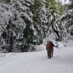
Enough snow had fallen on Cayada Creek Road (No. 7810) that we were not able to drive to the trailhead at 4,443 feet. Even our friend’s four-speed rig couldn’t handle the slippery snow-covered road where other vehicles had wisely turned around, so we found a wide space beside the road and parked (3,666 feet). In summer it’s about a 6.9-mile drive to the trailhead and the hike from the trailhead to Summit Lake is about a mile, one way.
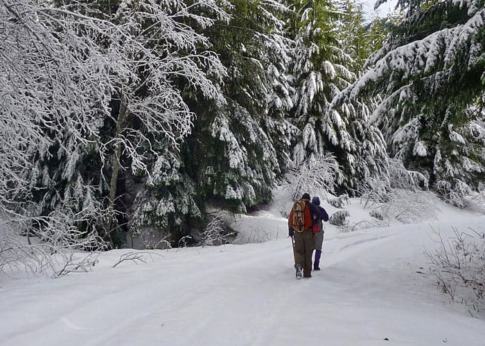
We were not undeterred as we enjoy snowshoeing roads as well as trails. In winter there are no vehicles to contend with, the road is wide enough you can walk abreast and chat, and views improve every step of the way. We started out toting our snowshoes, enjoying the gentle incline of the quiet road. As we gained elevation the forest gave way to views of lenticular clouds settling over Mount Rainier – today there were more clouds than mountain.
Soon the snow became deep enough we put on snowshoes for easier going and to avoid post-holing. Though we saw no other people we were not alone – small critter tracks crossed the road along with elk and deer tracks; small tributaries tumbled from steep hillsides above, still too warm to freeze over. To the south we enjoyed views of Mount Rainier’s subsidiary peaks and forested ridges as white clouds laden with snow boiled around the spot where Mount Rainier can be seen on a clear day.
Coplay Lake soon came into view (right); a large, forested lake not far from the road. The lake was completely snow-covered and tall, dark shadows cast from the trees on the far side stretched across the lake like giant fingers. Coplay Lake is especially popular with families in summer as it is easy to access and the lake large enough that visitors can find solitude.
We found the winter sky intriguing as the weather changes quickly; bands of clouds stack up in the sky, each layer a different color ranging from dark blue to white. Where the sky was clear colors ranged from gun-metal gray to peach.
The road ends at the trailhead (4,443 feet) with a snow-covered picnic table and signboards partially obscured by wind-driven snow. Soon after leaving the road the snow grew deeper and the gradient steeper though the trail was still discernible. There were a few bare patches though the trail was lined with whipped-cream like mounds of snow and the branches of evergreens drooped with the weight of snow. At 4,716 feet we entered the Clearwater Wilderness; designated with a hard-to-miss sign on a tree. The Clearwater Wilderness was designated in 1984 and is managed by the Forest Service). The Clearwater Wilderness is bordered by the Mount Rainier Wilderness (to the south).
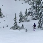
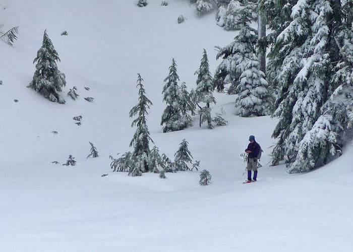
There we paused to consult the GPS to calculate how much more elevation we needed to gain to reach Summit Lake. The number was discouraging given the shortness of the day: another 800 feet to go! Plus, a member of our party had already turned around and started back to the car (with car keys, of course!). We don’t like to keep anyone waiting any length of time so we revisited our options and settled for Twin Lakes (only another 200 feet to go). In summer Twin Lake is little more than a bog, but in winter it is a fine consolation prize or turnaround if you run out of daylight, energy, or time to snowshoe further.
Twin Lake was mostly covered in snow except near the outlet stream, a good setting for a break. Though the shoreline is mostly forested there is a good view of Bearhead Mountain above the lake. Bearhead Mountain at 6,089 feet is the highest peak in the Clearwater Wilderness. The rocky peak is a scramble in summer but on this wintry day it looked formidable covered with ice and snow.
It was too cold to linger but a hasty snack was in order before heading back down. Though we were disappointed we didn’t have time to get to Summit Lake, we would have turned around anyway as it is generally unwise to separate a party, especially in winter.
We made quick work of following our tracks back to the road and took delight at the colors of the sky as they had changed again. At one point Mount Rainier almost completely emerged before going under again.
Road No. 7810 makes a fine snowshoe (or cross-country ski) trip though you might not have time to venture as far as you’d like. Where you start out will depend on conditions and how close you can park to the trailhead.(We started our trip here: N 47° 01′ 17, W 121° 50′ 53) As more snow accumulates you will need navigational skills for Twin Lake and certainly for Summit Lake. Be prepared to turn around as conditions warrant.
From Enumclaw drive west on SR 410 about five miles to SR 165 just west of Buckley. Continue on SR 165 through Wilkeson to the Carbon River Road/Mowich Lake Road junction. Continue on the Carbon River Road to Cayada Creek (Forest Service Road No. 7810). Cross the river on the bridge, continue as far as conditions allow. If you get all the way to the trailhead (unlikely!) you will need a Northwest Forest Pass. Map: Green Trails Map No. 237 Enumclaw.
Keep in mind: Depending on the amount of snow you may be able to drive to a higher elevation than we did. Doing so puts Summit Lake within the reach of strong snowshoers with route-finding skills. On this trip, we ended up starting our snowshoe trip well below the trailhead.
For additional information on road/trail conditions call the Mount Baker Snoqualmie Forest District (Enumclaw) at 360-825-6585.
– Karen Sykes, Visit Rainier Hiking Expert
| Waypoints:
Trailhead: N 47° 01′ 53, W 121° 49′ 36 |