| Area: Longmire |
Hike Type: historic wagon road, impressive waterfalls, kid-friendly | Pass: National Park Pass |
| Distance: 7.6 mi RT | Duration: 3.5 hrs | Difficulty Level: Moderate |
| Snow-Free: June – Nov | High point: 3,800 feet | Elevation Gain: 1000 feet |
-

- DSC07789
-

- 102
-

- 107

-
- DSC03466
-
- DSC07797
-

- 105

-

- DSC03464
Features: historic wagon road, impressive waterfalls, kid-friendly
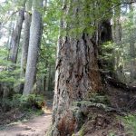
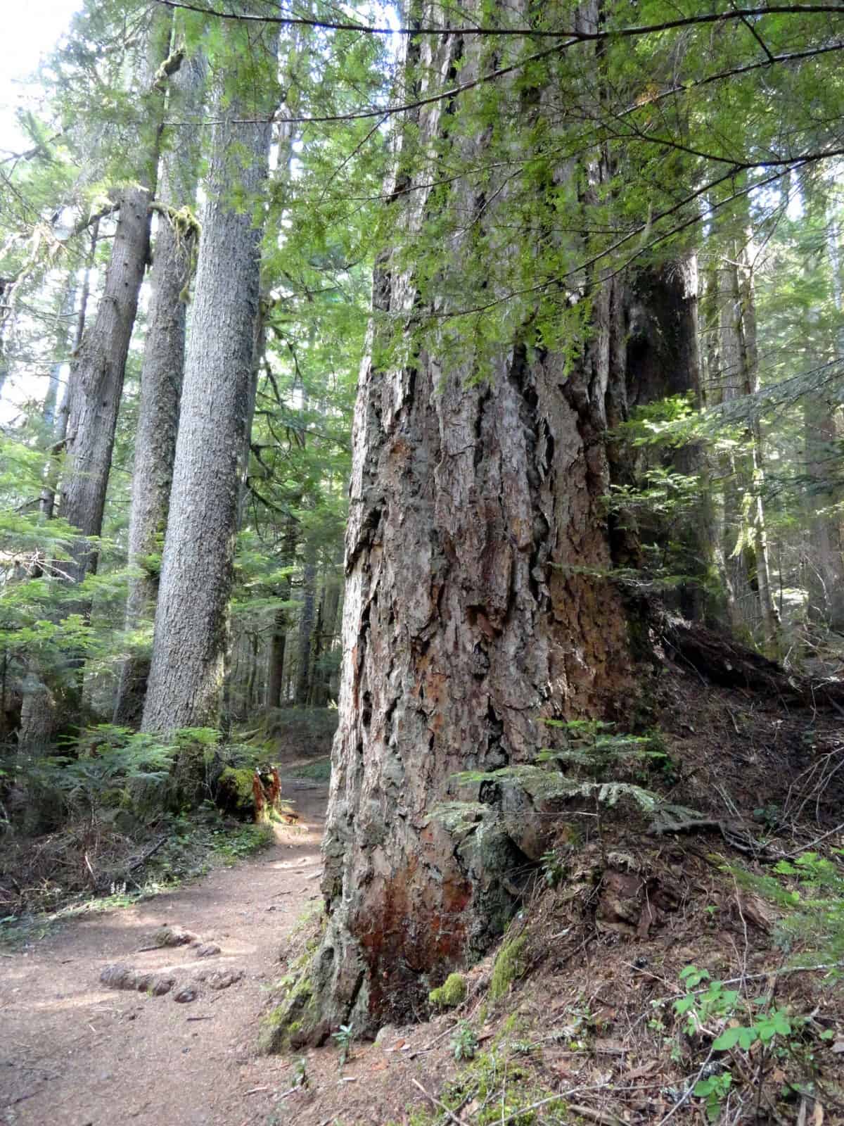
Hike a section of the round-the-mountain Wonderland Trail to a deep forested valley reverberating with crashing waterfalls. En route make an exciting crossing of the snow and ice fueled Nisqually River. Stare in disbelief of the snaking Nisqually Glacier above while frothy thundering water passes beneath your hiking shoes. And pass big old trees and remnants of the national park from its nascent days.
Hit the Trail
This is a great section of the Wonderland Trail to sample early in the summer and late into the fall while much of the 93-mile circuitous trail is buried in snow. It’s also a good route for overcast days and hot days as much of the way is in old-growth forest which will either shelter you from the rain or cool you from the sun.
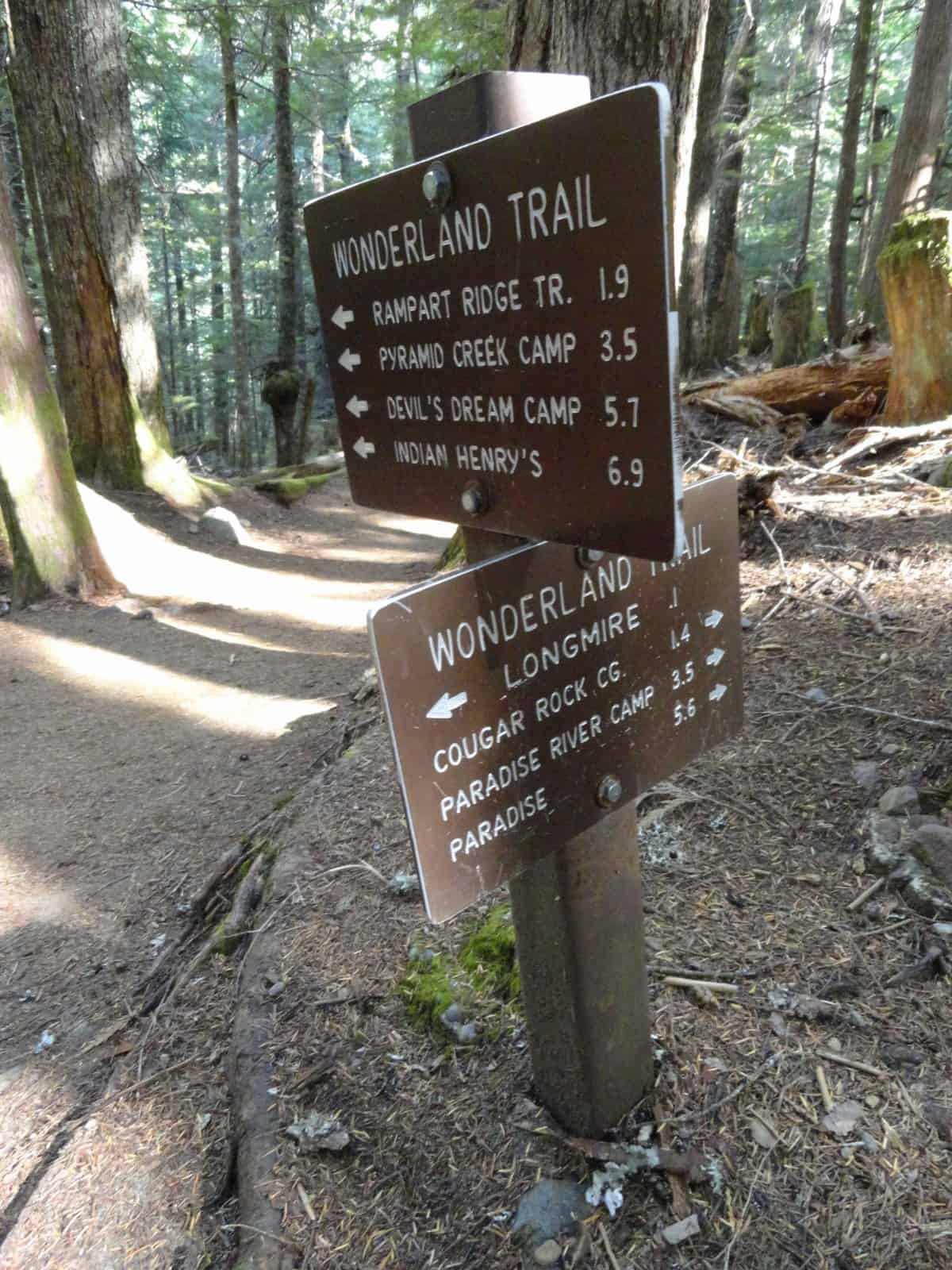
From the historic Longmire District, pick up the Wonderland Trail and immediately enter a grove of towering ancient firs, cedars, and hemlocks. At 0.2 mile come to a junction. Left heads to Rampart Ridge and beyond. Most Wonderland Trail through-hikers beginning their journey in Longmire will be heading that way, preferring to do their epic hike clockwise. You want to head right.
The trail soon follows an old carriage road that once brought park visitors to Paradise. Shortly after the turn of the 20th Century, a road was completed to the park. In 1907, Mount Rainier became the first national park in the country to permit cars. It cost a hefty amount to get a permit to drive into the park, and the road was horrible. By 1910 the road had been built all the way to Paradise. One year later, President William Howard Taft rode in a car to Paradise, but mules were needed to help pull his vehicle up the steep, rough, and muddy grades.
By the mid-1920s the Nisqually Road was realigned in places and greatly improved. As you hike up this old section of carriage road, try to imagine how slow and arduous travel by vehicle must have been more than a century ago. With the road now farther away from the Nisqually River bank, enjoy this stretch of tumbling waterway sans the hum of passing motorists. Enjoy lots of good views of the roaring river as well as Eagle Peak above it.
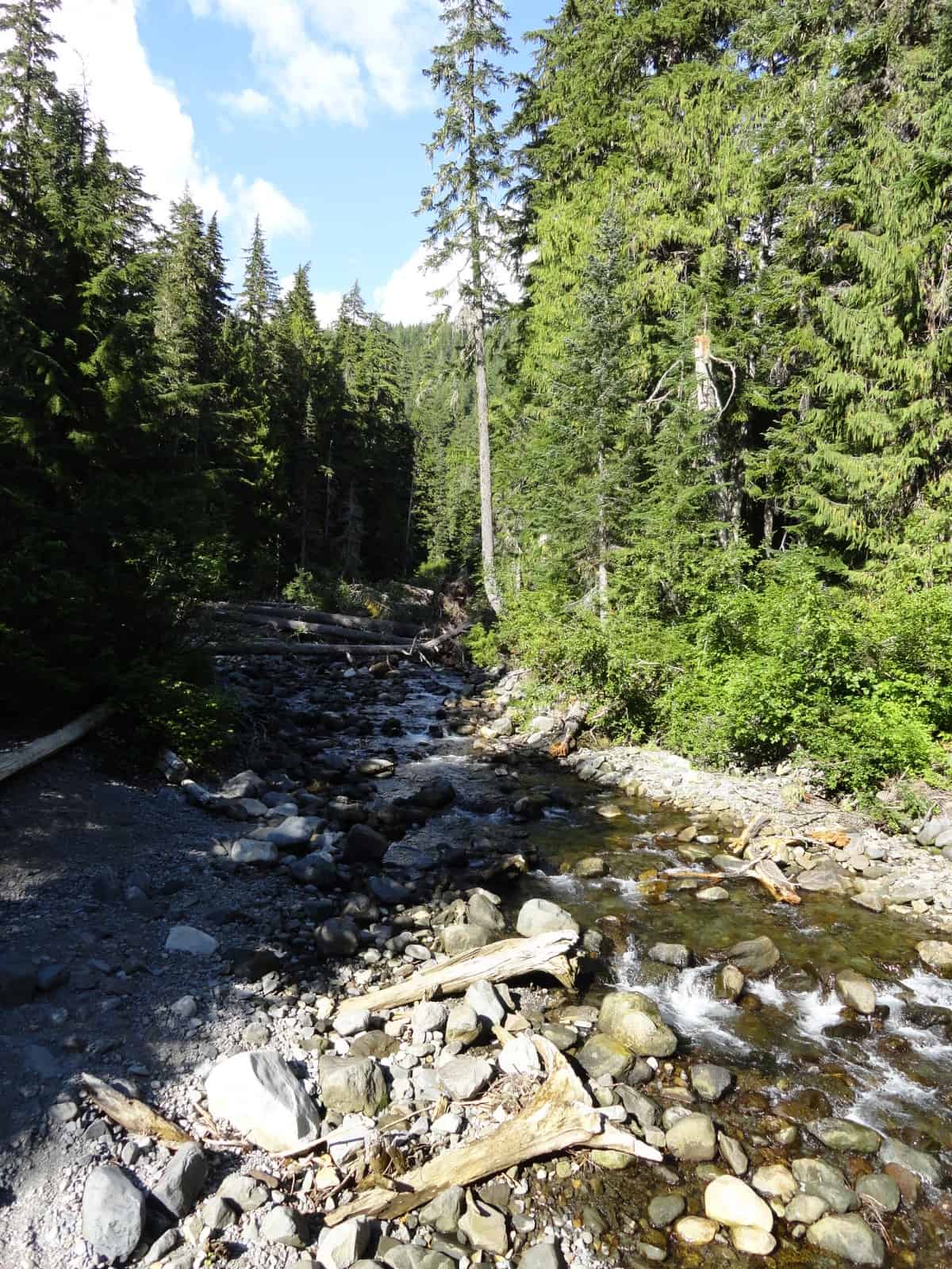
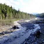
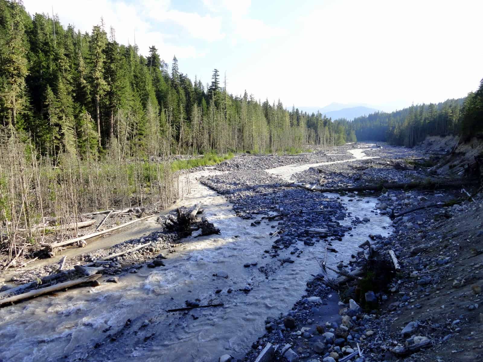
Gradually ascending and following along the river bank eventually pass a couple of short spurs leading left to the large Cougar Rock Car Campground. You’ll probably start encountering more folks on the trail now—as many a camper wanders down these paths to get a better view of the river making all that racket. At 1.8 miles, come to the Nisqually Road (el. 3200 feet). You’ve gained just slightly over 400 feet in a little less than 2.0 miles. An easy stretch of trail indeed. Now continue on the Wonderland Trail dropping down to the wide rocky moraine lining the crashing waterway. The route through this jumbled mess get moved around year to year as flooding has a habit of reshaping the moraine and moving some big rocks and downed trees around.
Cross the silty tumbling Nisqually River on a firm-in-place log bridge. The glacier-fed river is impressive, especially on a warm day when snow and ice melt fuels its fury. If it’s a clear day, the view of Mount Rainier up valley is breathtaking. If the mountain is partially or fully obscured, the view of the raging river and steep surrounding slopes is still quite a sight. The view down river to Eagle Peak, westernmost of the Tatoosh Range peaks isn’t too bad either.
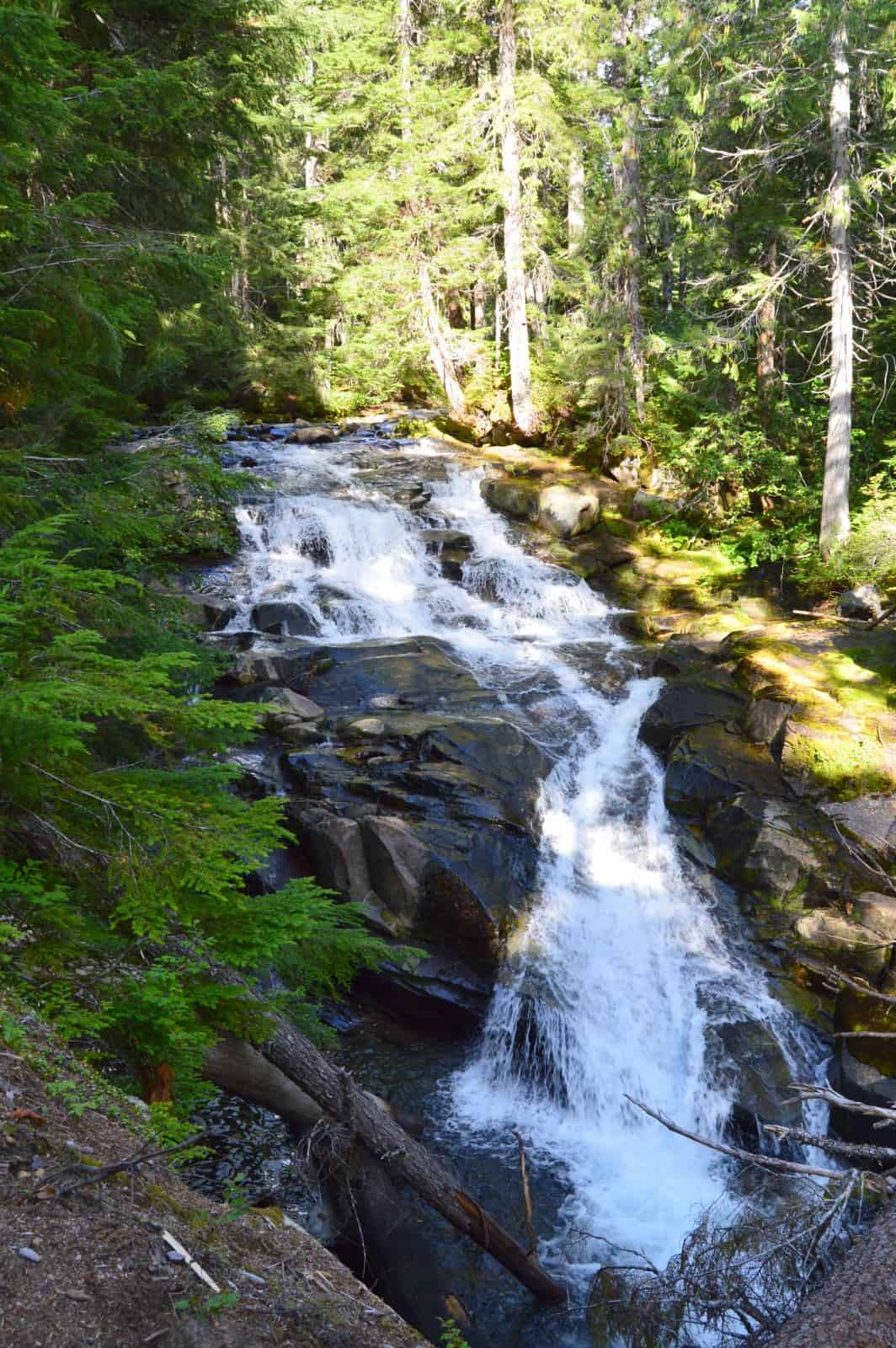
This is a good spot to turn around if you desire a shorter hike—otherwise continue. The way now climbs above the river and crosses a small talus slope. It then heads up the Paradise River valley following that tumbling snow and ice fed waterway. The trail briefly follows alongside the remnants of an old penstock once used for a park power plant. At 2.9 miles reach Carter Falls. It’s difficult to photograph due to trees inhibiting clear viewing. Try to enjoy the 50-plus foot falls through the greenery. They were named after Henry Carter, a guide who built the first trail to Paradise.
Continue hiking, steadily ascending and soon coming to Madcap Falls. Smaller than Carter Falls, they are still quite pretty and much easier to observe. Beyond, the Wonderland Trail eventually crosses the Paradise River on a bridge. Shortly afterward, reach the Paradise backcountry camps (el. 3800 feet) at 3.8 miles. If you were planning on spending the night, you would have needed to secure a permit prior to your hike. If you’re out for the day, take a break, have a snack, and then make your return. If you’re up for more hiking and you’re feeling energetic, continue up the Wonderland Trail through gorgeous old-growth forest reaching a junction after 0.7 mile. Here you can hike left to Narada Falls, one of the prettiest cataracts in the park; or continue right on the Wonderland Trail reaching the Reflection Lakes (el. 4900 feet) in 1.2 miles. If you can arrange for a car shuttle, this hike makes for a great one way. However, you’ll want to do it downhill from the lakes!
Notes: Dogs prohibited. Be sure that the log bridge is in place over the Nisqually River before attempting this hike.
Contact: Mount Rainier National Park; https://www.nps.gov/mora/index.htm; (360) 569-2211
Maps: Green Trails Mount Rainier National Park 269S
Trailhead directions: From Elbe at the junction of SR 7 and SR 706, head east on SR 706 passing through Ashford and reaching Mount Rainier National Park at 14 miles. Continue west on park road for 6.5 miles to Longmire and trailhead parking near the Wilderness Information Center.
Trailhead facilities: privy, water, visitor center, park concession
– Craig Romano, is an author of more than a dozen hiking guidebooks including the newly released 100 Classic Hikes Washington (Mountaineers Books) which includes several hikes in and around Mount Rainier National Park.
Waypoints
| Starting Point: N46 45.011 W121 48.746 | |
| Notable Waypoints:
Nisqually River Bridge: N46 46.003 W121 47.381 Paradise River Campsite: N46 46.164 W121 45.373 |
|