| Area: Ohanapecosh |
Hike Type: Woodland | Pass: Natl. Park Pass |
| Distance: 9 miles one way | Duration: 4 hrs | Difficulty Level: Moderate |
| Snow-Free: Late-May – November | High Point: 2,200 ft | Elevation Loss: 2,200 |
-
- IMG 2472
-
- IMG 2547
-
- IMG 2542
-
- IMG 2457
-
- IMG 2518
-
- IMG 2495
-
- IMG 2486
Features: kid-friendly, exemplary old-growth, impressive waterfalls, solitude
One of the longest trails within Mount Rainier National Park, the Eastside Trail is also one of the park’s quieter trails. Spanning the park’s eastern reaches from Chinook Pass to the Ohanapecosh Campground, the Eastside Trail traverses alpine meadows, primeval forest and a valley that thunders from catapulting creeks and crashing cascades. With several trailheads and access points, the 13.4-mile trail can be hiked in sections. The lower two-thirds of this trail makes for an excellent early and late season hike when the numerous waterfalls along the way are at their finest. If you can arrange a shuttle, do this hike as a downhill one-way.
Hit the Trail:
While this hike is best done as a one-way point to point, don’t shun it if you can’t arrange for a shuttle. Doing this hike out and back to the Ohanapecosh River crossing and waterfall from either direction makes for a great day hike as well. And if you want to spend the night, there is a small backcountry campsite (permits required—attain at White River or Ohanapecosh ranger stations) at the confluence of Deer Creek and Chinook Creek.
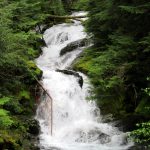
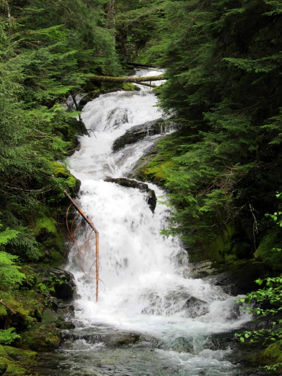
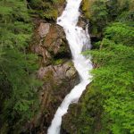
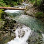
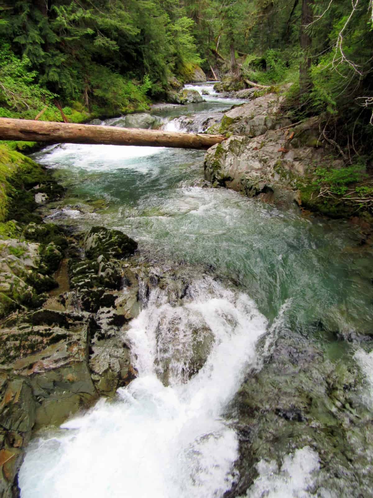
Starting from the eastern trailhead for the Owyhigh Lakes, enter the thick forest and immediately begin descending. Via tight switchbacks the trail steeply loses elevation. At .2 mile reach the first of several impressive waterfalls. From a precipitous (use caution) overlook, peer down on 60-plus foot Deer Creek Falls crashing down a tight rocky cleft. Deer Creek originates from three tiny lakes along the Cascade Crest, including little Anderson Lake reached by hiking the Pacific Crest Trail.
Now continue hiking, losing more elevation (400 feet in all) and coming to a junction at .4 mile. Here the lower Eastside Trail heads left down the valley—your route. The Owyhigh Lakes Trail continues straight, crossing Chinook Creek near its confluence with Deer Creek. The upper Eastside Trail diverges from this trail 0.1 mile west. Definitely walk upon the bridge spanning the crashing waterway before beginning your hike down the valley.
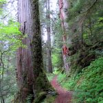
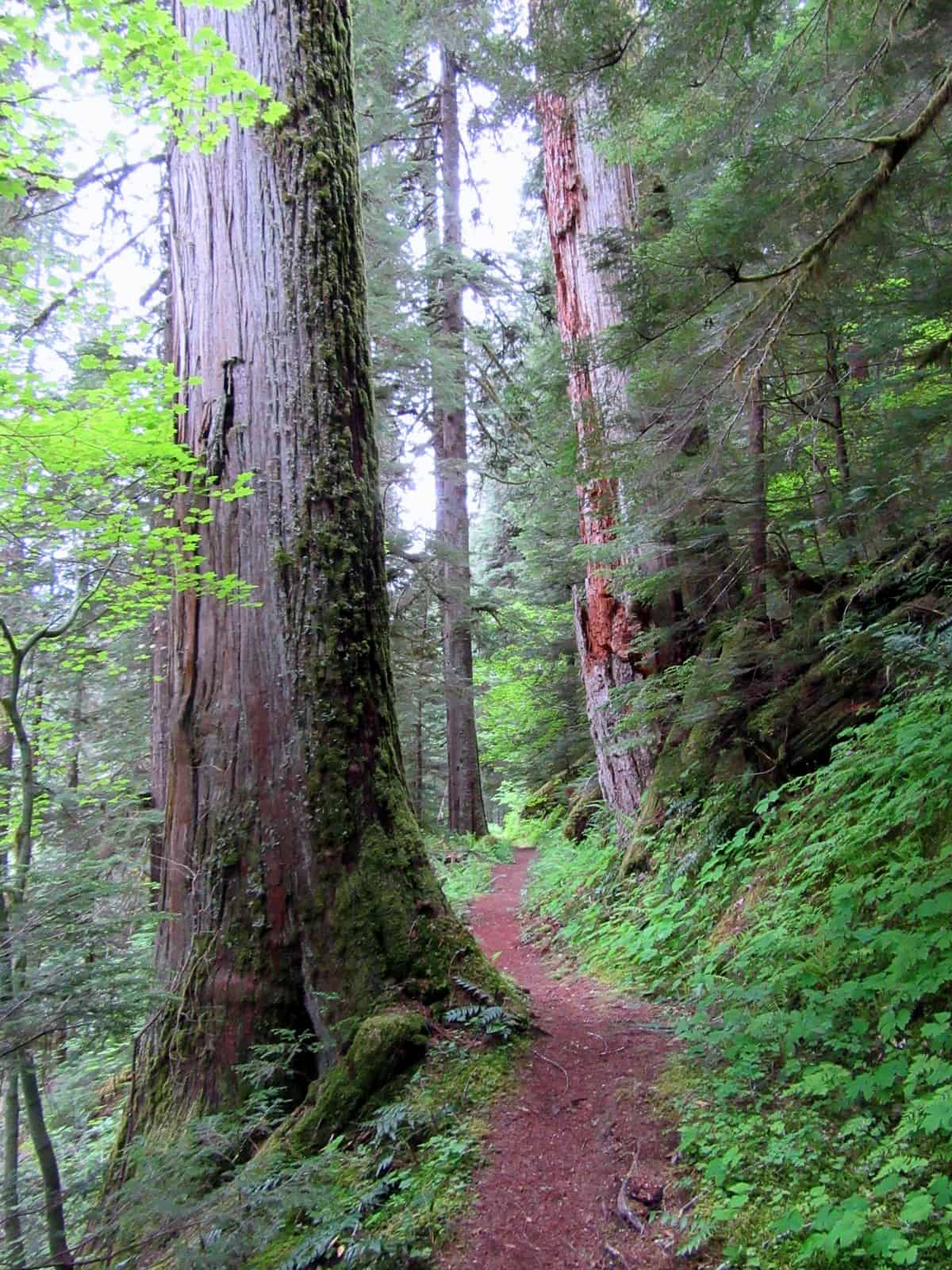
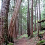
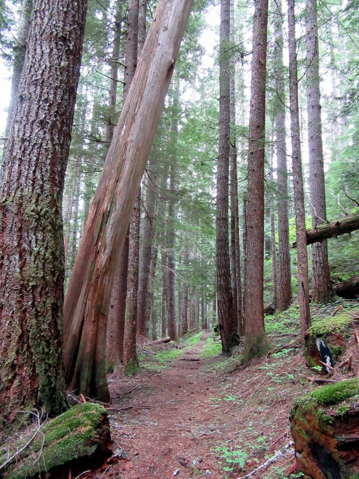
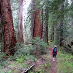
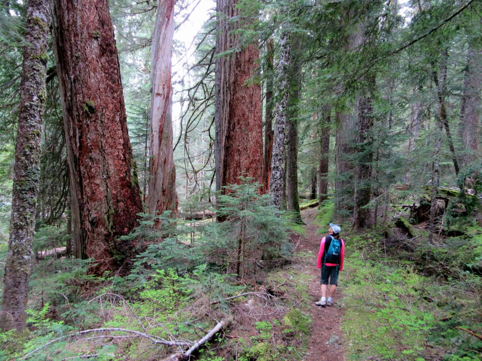
Then begin sauntering down miles of rarely hiked trail passing groves of towering ancient firs, hemlocks and cedars. Pass the Deer Creek backcountry campground—a great place to let the sound of crashing water serenade you to sleep. The Eastside Trail winds gently down the valley following alongside Chinook Creek. The creek is often visible and always audible. The trail is a pure delight. Most of the way is a gentle descent—but there are a few little uphill sections here and there.
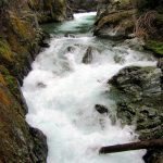
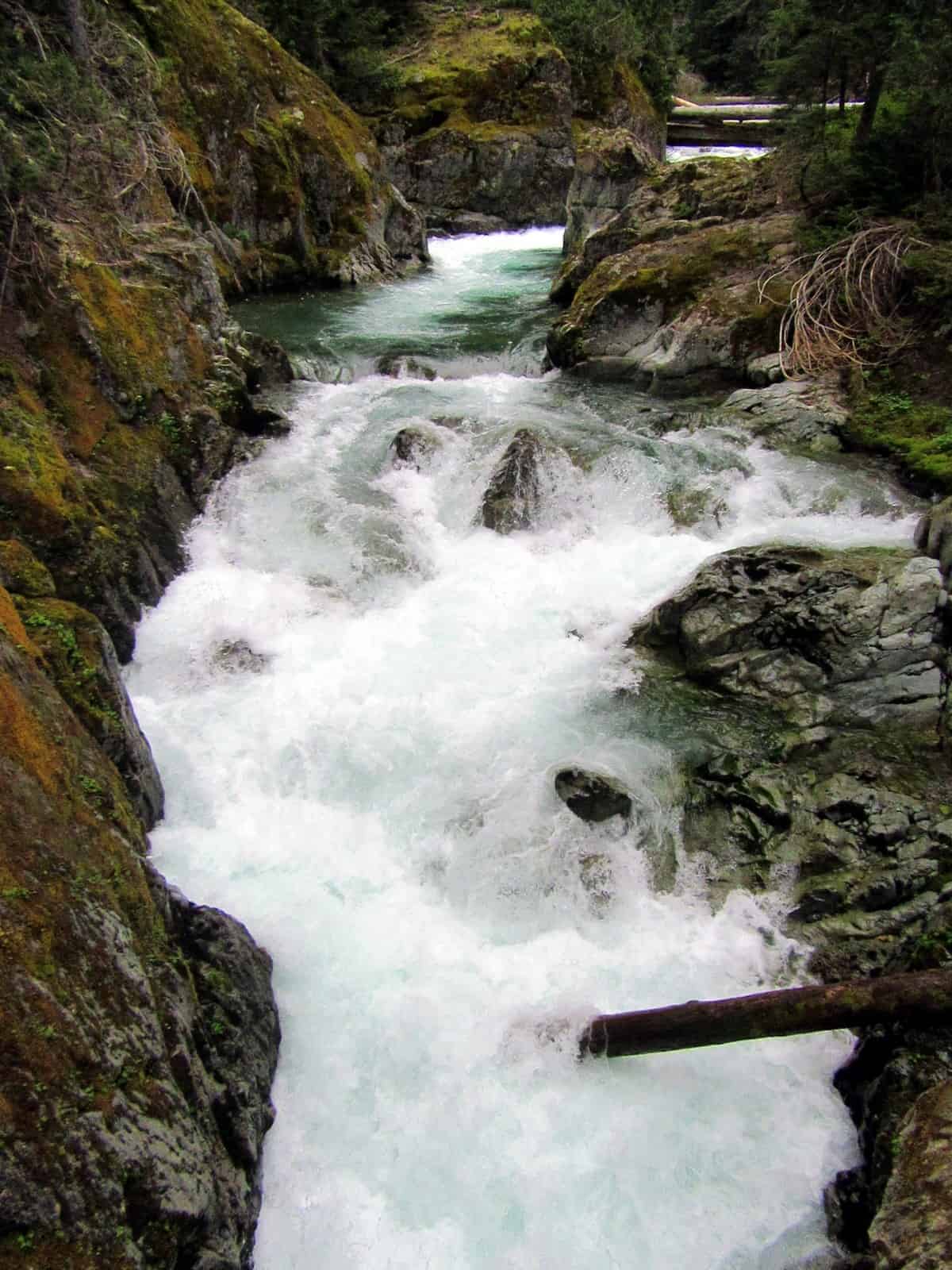
At about 1.4 miles come to the next big attraction. Here the trail reaches a high bridge spanning Chinook Creek at a thundering chasm. From the bridge stare down at roiling and swirling waters in rocky potholes and flumes. Then continue hiking through the breathtaking primeval forest. At 1.8 miles keep your attention left so you don’t miss Stafford Falls. While only 25 feet tall, these falls roar. The plunge pool below is also stunning with its glacial blue tint.
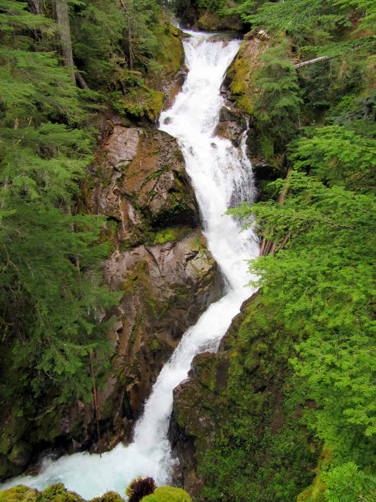
Keep hiking passing impressive cathedral groves of towering timber. At 3.3 miles reach yet another highlight—Ohanapecosh Falls. Here walk across another sturdy bridge spanning high above a crashing waterway. Look right up an impressive chasm and catch cool breezes riding above the glacier-fed river. Then look left at the lip of a double tier waterfall. Here the river plunges 50 feet over a shelved ledge. A little farther down the trail, you can get a sneak peek frontal view of this pretty cascade. This is a good spot to turn around if you couldn’t arrange a shuttle. Otherwise, keep following the trail downriver.
The trail now follows the Ohanapecosh River, often high above its floodplain which is prone to autumn flooding. While the river is often out of sight, it is always heard. And while the trail remains away from the river, it continues to cross numerous tumbling creeks. Pass a few overlooks of the valleys shortly after crossing Olallie Creek which also harbors a few waterfalls—but unfortunately well away from the trail. At 6.7 miles reach a junction—and lots of fellow hikers. Your lonely roaming is now over. Here a trail leaves left for a suspension bridge to the Grove of the Patriarchs; one of the most impressive old-growth forest groves in the park—and one of the park’s most visited attractions.
Now follow a well-beaten path coming to the Grove of the Patriarchs trailhead parking on the Stevens Canyon Road at 7.1 miles. If you have a car waiting for you here-you’re done! Otherwise, carefully cross the road and continue on the Eastside Trail soon crossing a creek and passing the Cowlitz Divide Trail. Then come up to a series of ledges hemming in a furious Ohanapecosh River. It’s quite a dramatic scene—only to be topped by Silver Falls just down river.
At 7.6 miles come to a junction. You can go left for an up-close and personal view of Silver Falls. Then continue on a busy path passing the historic Ohanapecosh Hot Springs returning to the Ohanapecosh Campground. Your other option is to go right on a quieter path returning to the Ohanapecosh Campground at 9.0 miles. Cross the river one more time for one last satisfying view of this beautiful waterway before heading home.
Notes: Keep children nearby around waterfalls and creek sides as a slip or fall can lead to injury or worse.
Contact: Mount Rainier National Park; (360) 569-2211
Maps: Green Trails Mount Rainier National Park 269S
Trailhead directions: For Hike Start at Owyhigh Lakes East Trailhead: From Enumclaw, follow SR 410 east for 41 miles to Cayuse Pass. Turn right and continue south on SR 123 for 4.9 miles to trailhead on right—parking availble at small turnout on the left. From Packwood follow US 12 east for 7.5 miles. Turn left onto SR 123 and continue 11.2 miles to trailhead.
For Hike Finish at Ohanapecosh Campground: From Packwood, follow US 12 east for 7.5 miles. Turn left onto SR 123 and continue 3.6 miles. Turn left and proceed to Ohanapecosh Visitor Center and day use parking. From Enumclaw, follow SR 410 east for 41 miles to Cayuse Pass. Turn right and continue south on SR 123 for 13 miles turning right for the Ohanapecosh Visitor Center and day use parking.
Trailhead facilities: Upper Trailhead: none. Lower Trailhead: privy, water, visitor center, campground
– Craig Romano, is an author of more than a dozen hiking guidebooks including the newly released 100 Classic Hikes Washington (Mountaineers Books) which includes several hikes in and around Mount Rainier National Park.
Waypoints
| East Owyhigh Trailhead: N46 50.012 W121 32.094 | |
| Notable Waypoints:
Ohanapecosh River Falls: N46 48.267 W121 33.912 Stevens Canyon Road Trailhead: N46 45.490 W121 33.467 Ohanapecosh Campground Trailhead: N46 44.226 W121 33.987 |
|