Distance: 12.7 miles one way
Elevation Gain: 2,300 feet
High Point: 4,850 feet
Snow free: July — October
Introduction
The Wonderland Trail travels for 93 miles around Mount Rainier. Constructed in 1915, it is one of the most beautiful, challenging, and popular hiking trails in America. The trail can be hiked in its entirety as a through hike usually typically taking 8-14 days to complete; or in shorter sections. Most people begin from Longmire and hike clockwise. This series of Wonderland Trail articles is meant as an introduction of what you can expect on this amazing trail. Be sure to consult with park officials for complete rules, permitting information and trail conditions before setting out. Consider too, these two excellent resources for more details: Green Trail Maps Mount Rainier Wonderland Trail Map 269S and Hiking the Wonderland Trail by Tami Asars (Mountaineers Books).
Special Information
Overnight permits required and can be acquired by making a reservation in advance; or at the Longmire Wilderness Information Center (360) 569-445; Carbon River Ranger Station; or White River Wilderness Information Center. View complete permit information and park and trail rules and regulations.
Special rules: No Fires—use a camp stove. Dogs prohibited.
Notes and special concerns: Small section of trail in Stevens Canyon prone to washouts and may be sketchy to negotiate.
Trailhead directions: (Box Canyon) From Stevens Canyon Park Entrance, follow Stevens Canyon Road 10.3 miles west to Box Canyon Picnic Area. (Longmire) From Elbe at the junction of SR 7 and SR 706, head east on SR 706 passing through Ashford and reaching Mount Rainier National Park at 14 miles. Continue west on park road for 6.5 miles to Longmire and trailhead parking near the Wilderness Information Center.
the hike
From the Box Canyon Picnic Area (water and restrooms available) Trailhead (el. 3050 feet), follow the Wonderland Trail (briefly paved here) a short distance to the Box Canyon. Joining scores of tourists, reach a bridge spanning the 115-foot deep, 13-foot-wide slot canyon cut by the turbulent glacier-fed waters of the Muddy Fork Cowlitz River. It’s a fascinating site to see—and hear.
After admiring this popular geological landmark, leave the tourists at the bridge and keep hiking—now following a quieter and unpaved trail. The trail crosses over the Stevens Canyon Road at a small tunnel. It then slowly descends along a forested slope above the Muddy Fork Cowlitz River. The forest is pretty young here in an area known as The Burn. A huge wildfire swept through the Cowlitz Valley around 1800. Subsequent fires continued to scorch the landscape here and farther up Steven Canyon throughout the 19th century. Soon pass a big rock offering a good view out to the Tatoosh Range, before once again heading beneath an emerald canopy.
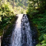
At 1.5 miles from the Box Canyon Trailhead (79.2 miles from Longmire) come to a junction with the Stevens Creek Trail which leads 0.8 mile back to the Stevens Canyon Road. Continue left soon coming to a bridged crossing (el. 2,600 feet) of cascading Stevens Creek. Admire a pretty waterfall, one of many you’ll pass along this stretch of the Wonderland Trail. Lacking alpine scenery, this section of the Wonderland Trail is known for its copious waterfalls.
The trail now bends west to begin its traverse of Stevens Canyon. Follow crashing Stevens Creek through young forest punctuated with charred snags and pockets of old growth that survived the past conflagrations. Across the creek, the canyon wall is absent of forest cover thanks to a procession of rocky ledges and avalanche chutes. The Stevens Canyon Road can be seen several hundred feet above the canyon floor hugging steep rocky walls.
At 2.3 miles from the Box Canyon Trailhead (80.0 miles from Longmire) come to the Maple Creek camp situated in a nice forested grove along Maple Creek. The Wonderland Trail continues west across the canyon floor soon coming to foot log crossing of Maple Creek. Look upstream to Maple Falls and the snow-blotched Tatoosh Range hovering above.
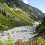
The way now hugs the rocky outwash of Stevens Creek. On sunny summer days, it can be quite warm on this stretch through brushy avalanche chutes and young forest. In autumn vine maples add brilliant colors to the valley. Traverse a big talus slope held back by a “great wall” thanks to past trail builders. Soon afterward come to pretty little Sylvia Falls. Here Stevens Creek plunges 45 feet into the rocky basin. It has been pretty easy going so far, but a short sketchy section of trail that may be a little intimidating soon changes the mood.
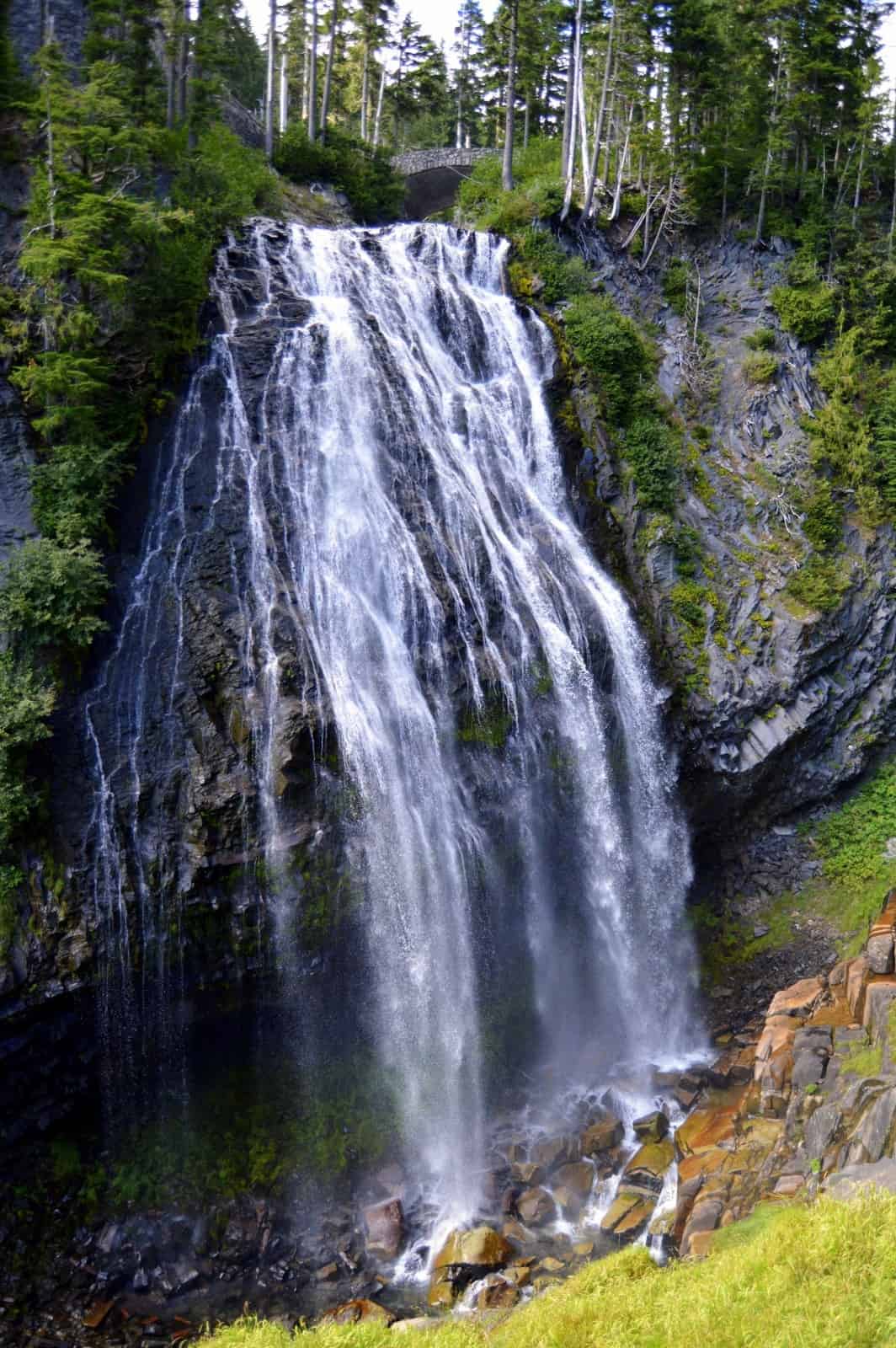
Carefully walk across an area that has slid out in the past. The tread is narrow here, but fairly stable. Enjoy good views downstream. Shortly afterward the way enters a cool hemlock forest and begins to more steadily climb. A nice scenic (and possibly spraying) surprise soon greets you at Martha Falls. Here the trail crosses Unicorn Creek at the base and above a couple of tiers of this rather large waterfall complex.
Beyond the falls, the trail climbs steeply reaching the Stevens Canyon Road (el. 4,200 feet) at 4.9 miles from the Box Canyon Trailhead (82.6 miles from Longmire). Carefully cross the road and continue to steadily climb. After passing through an alder tunnel, start enjoying expanding views of the Tatoosh Range and Stevens Ridge.
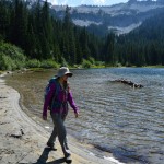
At 5.4 miles from the Box Canyon Trailhead (83.1 miles from Longmire), the way brushes up against the Stevens Canyon Road. Now paralleling the road, soon come to a spur trail leading a few hundred feet north to beautiful Louise Lake (el. 4600 feet). Louise makes for a great lunch spot offering good views, a respite from the tourists flocking nearby Reflection Lake, and good feet soaking—and perhaps even a dip.
The Wonderland Trail then traverses open slopes above the bowl cradling Louise Lake offering splendid views of the sparkling lake below. At 6.2 miles from the Box Canyon Trailhead (83.9 miles from Longmire) reach a junction with the popular Lakes Trail (el. 4,850 feet). Continue straight soon reaching the Stevens Canyon Road. Now follow a sidewalk along the road on this short and only section of the trail that follows the road.
Skirting the southern shore of Reflection Lake, pass scads of tourists and photographers trying to capture on memory and memory card majestic Mount Rainier reflecting on placid waters. The best views are in the evening, so you may want to plan your hike accordingly. At 6.8 miles from the Box Canyon Trailhead (84.5 miles from Longmire) come to the Lakes Trail again. Many a Wonderland-Thru hiker has diverted here to hike 1.5 miles to the Paradise Inn for a good meal and good night’s sleep. If that’s not in your plans, bear left and carefully cross the Stevens Canyon Road. Then lose the tourists and begin a long descent into the beautiful old-growth forest.
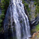
At 8.0 miles from the Box Canyon Trailhead (85.7 miles from Longmire) come to a junction. The trail right is a mandatory side trip leading 0.2 miles to Narada Falls, one of the prettiest cataracts in the park. Admire the Paradise River fanning nearly 75 feet wide and plummeting almost 160 feet over a hanging basalt ledge. On a hot day embrace the spray!
The Wonderland Trail continues downhill through the gorgeous ancient forest. At 8.7 miles from the Box Canyon Trailhead (86.3 miles from Longmire) reach the Paradise River backcountry camps. A little farther the trail crosses Paradise River on a bridge. Now follow the Paradise River down valley first passing Madcap Falls and then a short distance beyond, the more impressive Carter Falls; which is challenging to photograph due to trees inhibiting clear viewing.
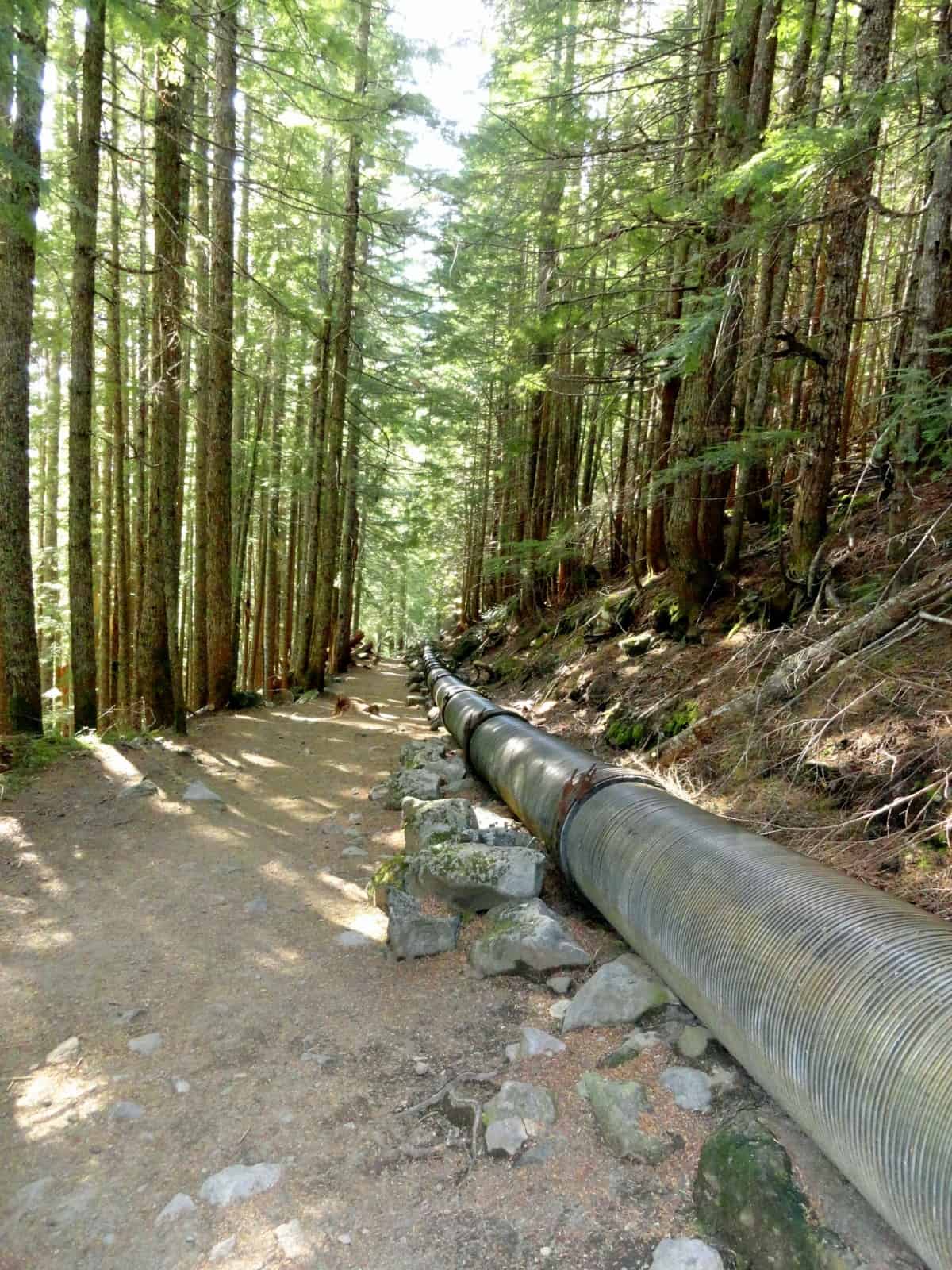
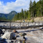
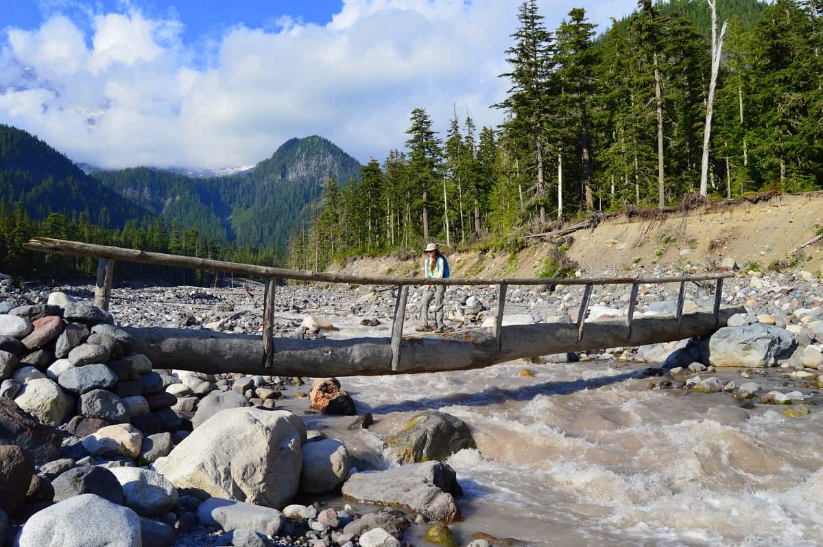
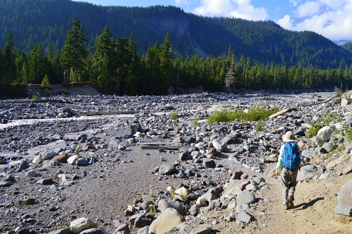
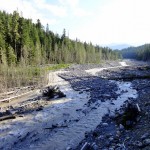
The trail continues in primeval forest soon sharing the right-of-way for a short distance with the remnants of an old penstock once used for a park power plant. After crossing a talus slope emerge upon the wide and gravelly Nisqually River valley bottom. The glacier-fed river is impressive, especially on a warm day when snow and ice melt fuel its fury. The view upstream to Mount Rainier and large moraine deposits is stunning as well as the view downstream to Eagle Peak.
Shortly after crossing the thundering river on a log bridge reach the Nisqually Longmire Road (el. 3200 feet) at 10.7 miles from the Box Canyon Trailhead (88.3 miles from Longmire). Now on a bank above the Nisqually River, follow the crashing river downstream. Pass a couple of spurs leading right to the Cougar Rock Car Campground. While this large campground does not have hiker-only sites, you certainly can camp here and many through hikers do, usually meeting friends or family who help replenish supplies.
The Wonderland Trail continues west following along an old carriage road. The way is enjoyable with good views of the river and Eagle Peak. This last stretch of trail is pure joy to hike as you move in closer to Longmire to finish your incredible journey around Mount Rainier. At 12.5 miles from the Box Canyon Trailhead (90.1 miles from Longmire) come to a familiar junction where the Wonderland Trail takes off right to climb the Rampart Ridge. You have already done that, so continue straight reaching Longmire in just over 0.2 miles. Entertain the prospects of a hot meal, cold drink, hot shower, and a comfortable bed at the Longmire Inn before returning home.
And if you’re wondering why the trail was only a little more than 90 miles and not the 93 miles the park claims—there is much debate about the official distance of this beloved trail. Green Trails Maps and Asar’s book have the journey just shy of 91 miles. The trail is frequently rerouted changing distances. And depending on where you start and where you camp, spurs will add mileage to your hike pretty much assuring you at least 93 miles. Whatever the actual distance, however, your hike will be challenging, rewarding, and giving you quite a feeling of accomplishment.
GPS waypoints:
Trailhead at Box Canyon Picnic Area: N46 45.932 W121 38.077
Maple Creek Camps: N46 45.446 W121 39.430
Paradise River Camps: N46 46.164 W121 45.373
Cougar Rock Campground: N46 45.932 W121 47.500
Trailhead at Longmire: N46 45.011 W121 48.746
-
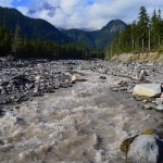
- Nisqually River crossing looking toward Mount Rainier

-
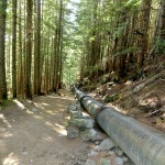
- historic penstock
-
- Louise Lake 4

-
- Narada Falls 2
-
- Martha Falls 3

-
- Nisqually River Crossing
-
- A hiker admires the great talus wall

-
- Hiker on Wonderland Trail approaching the Nisqually River
-
- Nisqually River

-
- gravely Stevens Creek 2
