Distance: 22.2 miles one way
Elevation Gain: 4,350 feet
High Point: 6,775 feet
Snow free: mid-July — October
introduction
The Wonderland Trail travels for 93 miles around Mount Rainier. Constructed in 1915, it is one of the most beautiful, challenging, and popular hiking trails in America. The trail can be hiked in its entirety as a through hike usually typically taking 8-14 days to complete; or in shorter sections. Most people begin from Longmire and hike clockwise. This series of Wonderland Trail articles is meant as an introduction of what you can expect on this amazing trail. Be sure to consult with park officials for complete rules, permitting information and trail conditions before setting out. Consider too, these two excellent resources for more details: Green Trail Maps Mount Rainier Wonderland Trail Map 269S and Hiking the Wonderland Trail by Tami Asars (Mountaineers Books).
special information
Overnight permits required and can be acquired by making reservation in advance; or at the Longmire Wilderness Information Center (360) 569-445; Carbon River Ranger Station; or White River Wilderness Information Center. View complete permit information and park and trail rules and regulations.
Special rules: No Fires—use camp stove. Dogs prohibited.
Notes and special concerns: Trail to Summerland sees heavy day hiker use. At Fryingpan Gap the trail crosses permanent snowfields that at times can be treacherous. It is best to cross the gap later in the day when snow softens and avoid crossing in bad weather. An ice ax is advisable early in the season.
Trailhead directions: (Sunrise) From Enumclaw follow SR 410 east for 37.5 miles to Mount Rainier National Park turning right onto the White River Road. Continue for 15.4 miles to Sunrise. (Box Canyon) From Stevens Canyon Park Entrance follow Stevens Canyon Road 10.3 miles west to Box Canyon Picnic Area.
the hike
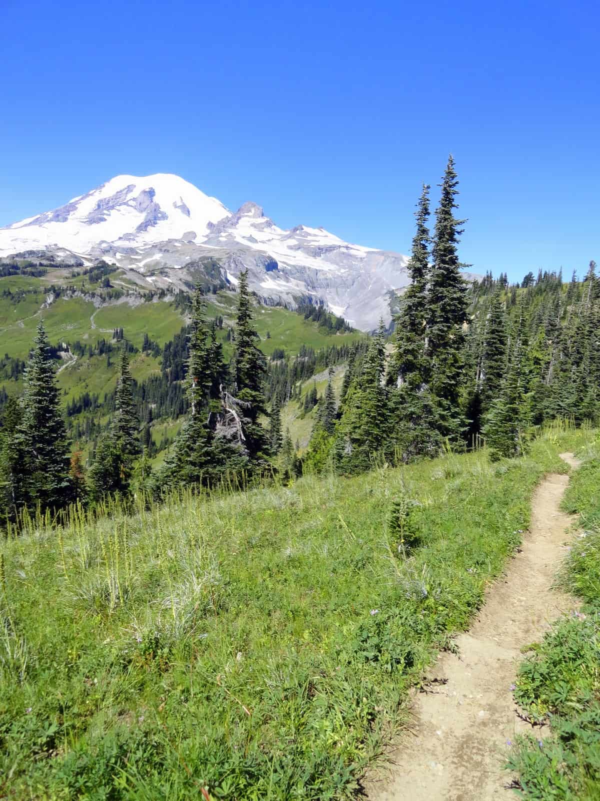
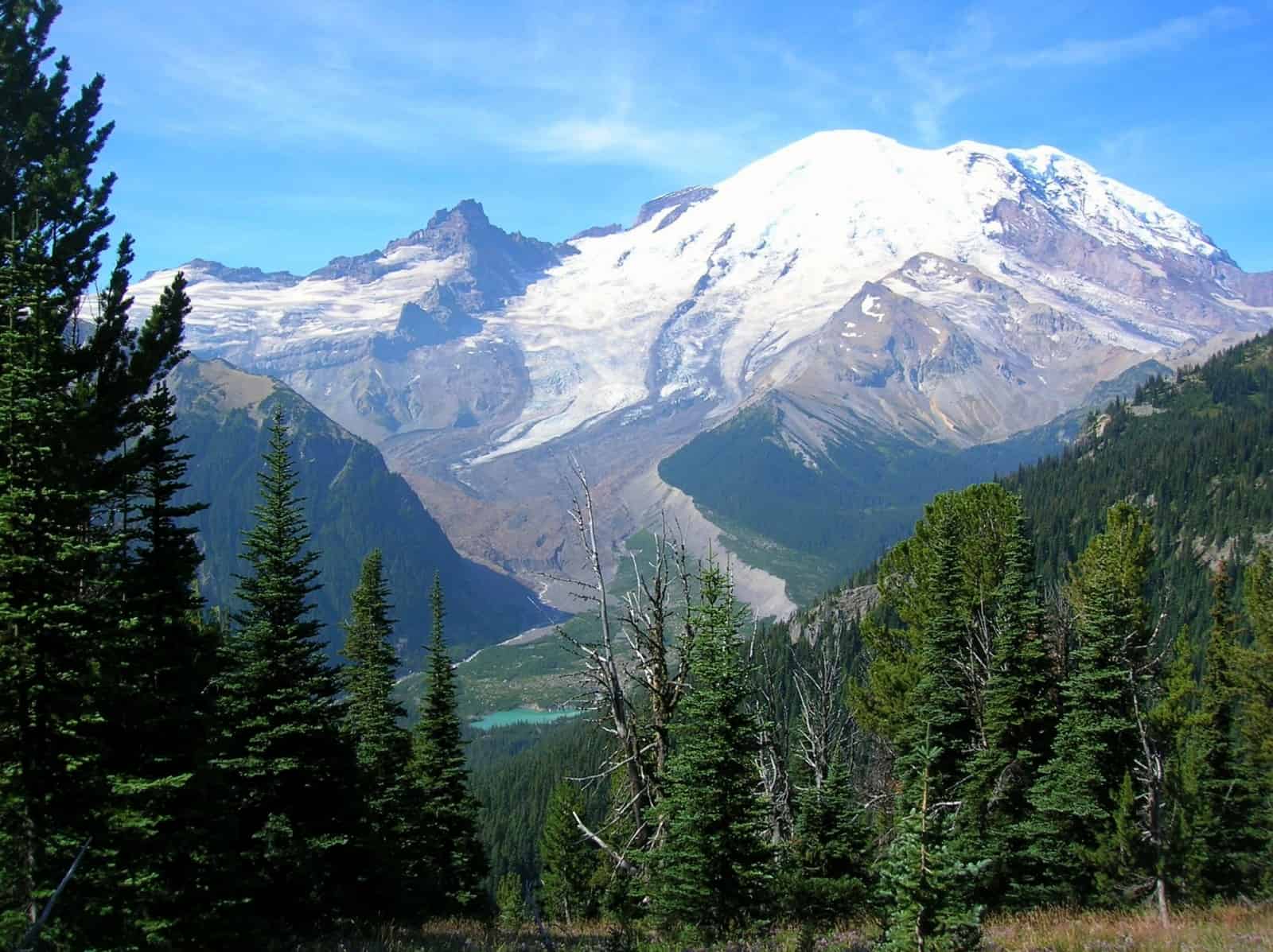
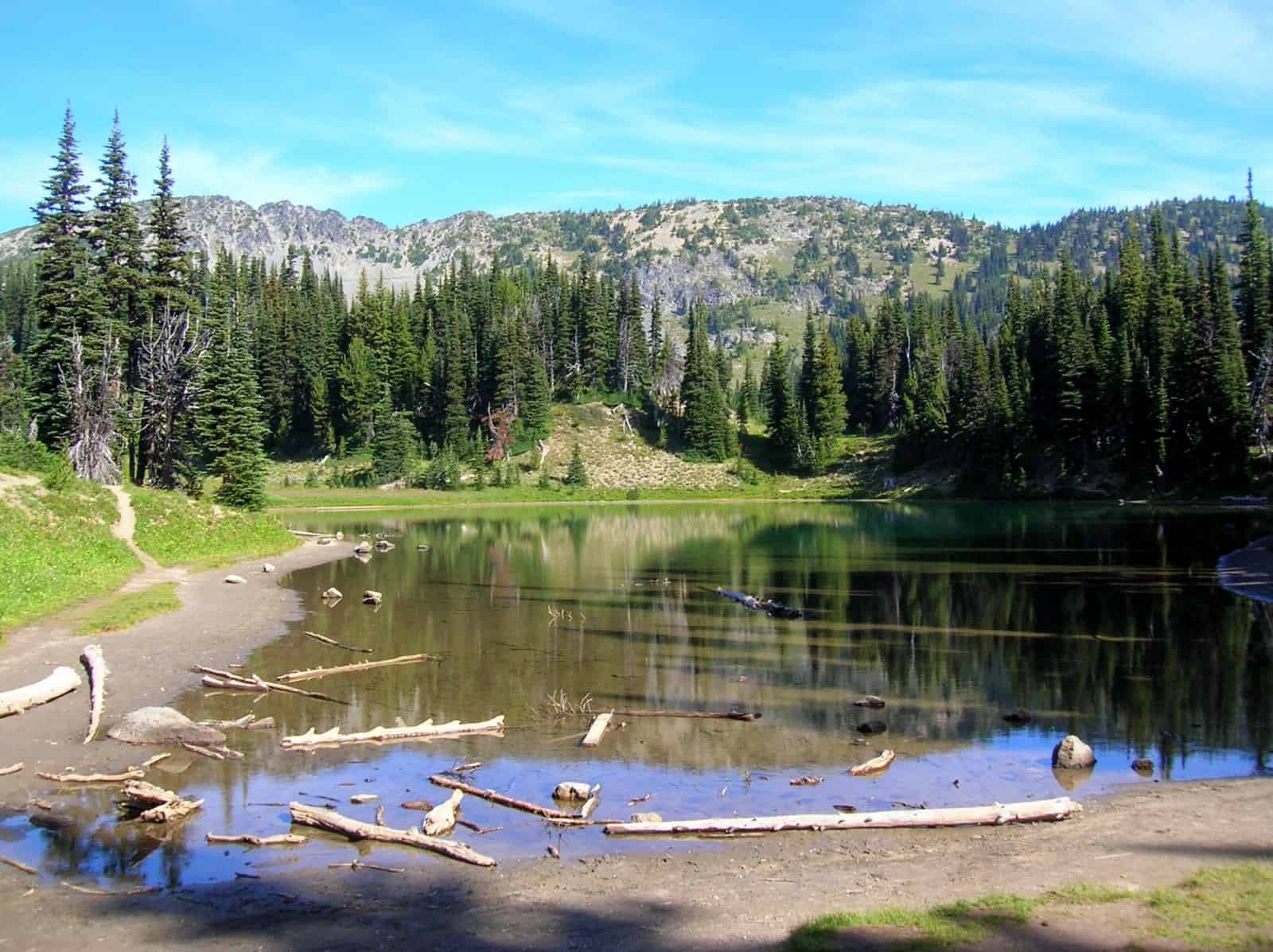
From the Sunrise Camp (el. 6,250 feet) follow the Wonderland Trail east skirting the southern shore of little Shadow Lake set in attractive open forest. At 0.8 mile (56.3 miles from Longmire) come to a junction. The trail left leads 0.5 mile to Sunrise. This popular spot within the national park is a great place to grab a snack or use as an alternative starting point for your Wonderland circuit.
The Wonderland Trail continues right beginning a rapid descent of over 2,000 vertical feet within 2.6 miles. Switchbacks help soften the downward journey to the White River Valley, but it’s a steep drop and a set of trekking poles will definitely come in handy. At 3.4 miles from Sunrise Camp (58.9 miles from Longmire) reach the car-accessible White River Campground. The ranger station here is a good place to cache food and fuel. There are some hiker-only sites within this popular campground (permits required); or you can stay in one of the car campsites (fee required) if you prefer.
From the campground, the trail crosses the deafening White River on a bridge and then follows the glacier-fed river downstream for a short distance. One of the newer sections of the Wonderland Trail; before its construction, through hikers had to walk pavement for a couple of miles. At 6.0 miles from Sunrise Camp (61.5 miles from Longmire) come to a junction. Left leads a short way to a trailhead on the White River Road. You want to continue right, now on wide and smooth tread following Fryingpan Creek through groves upon groves of majestic old-growth forest. You’ll no doubt have lots of company on this stretch of trail—plenty of day hikers heading to Summerland, one of the prettiest spots on the Wonderland Trail.
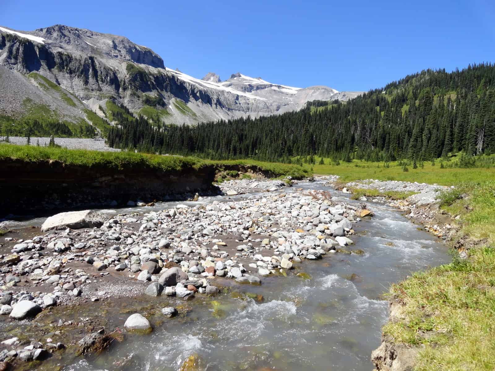
After some easy going, the trail steadily climbs breaking out of forest in a high basin beneath Goat Island Mountain. The way then bends left crossing a cascading creek and entering the sprawling alpine meadows of Summerland. It was Major Edward S. Ingraham (add link) who bestowed the name Summerland to this lovely spot where bountiful blossoms burst throughout the summer. Views are exhilarating here too, especially of the Mountain, Little Tahoma Peak and the impressive Fryingpan Glacier feeding several cascading creeks.
At 10.3 miles from Sunrise Camp (65.8 miles from Longmire) come to the beautiful but busy Summerland Camp (elev. 5,900 feet). The campsites are set near a Civilian Conservation Corp (CCC) built stone shelter. The shelter is used as a group site—but if there is no one staying there, feel free to check it out. Beyond Summerland, the Wonderland Trail traverses some of the most dramatic, rugged and highest terrain on its 93 mile journey. The trail winds through a barren basin beneath glaciers feeding cavalcades of cascades. Watch for marmots and mountain goats—especially, mountain goats. It is not uncommon to see (and smell) herds encompassing more than 30 of these beautiful mammals.
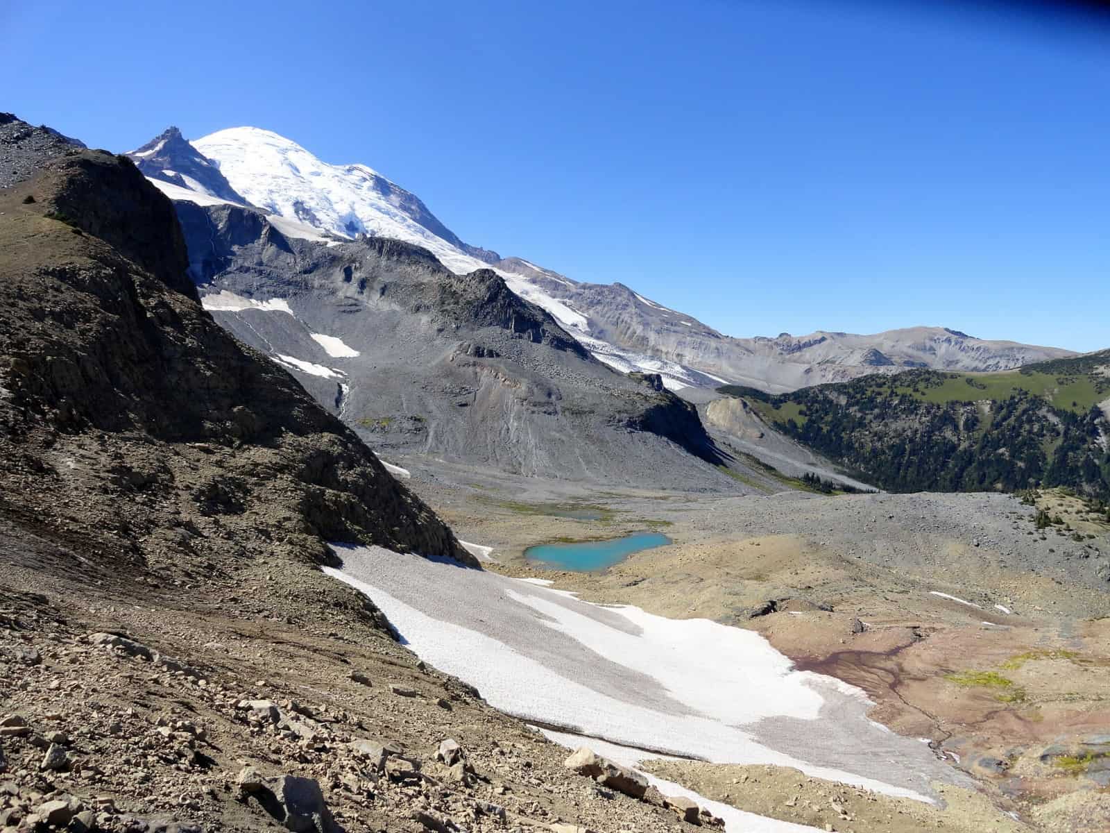
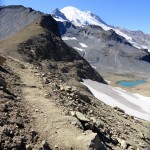
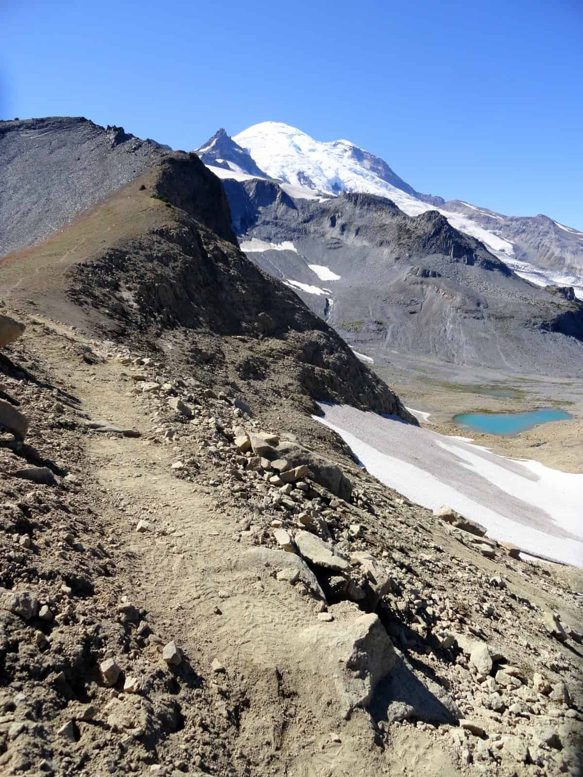
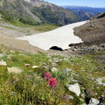
The trail continues to climb crossing rocky terrain oft covered in snow. Be sure to watch for cairns, snow wands and trail markers. As you climb higher toward Panhandle Gap you’ll need to negotiate traversing permanent snowfields. Some years they can be extremely dangerous to cross. Exercise sound judgment and avoid this area in bad weather and in early and late season. On clear and warm days, not only will passage be easier, but the views will be grand—particularly of a glacier-fed lake below and icy Mount Rainier hovering right above you. When sunlight makes contact with the icy lake, its waters shine a brilliant turquoise.
At 11.7 miles from Sunrise Camp (67.2 miles from Longmire) reach Panhandle Gap (el. 6,775 feet), one of the highest points on the Wonderland Trail. Take a break and take in the views west across alpine tundra and tarn-dotted slopes to the Cowlitz Chimneys, the Goat Rocks, Mount Adams and Oregon’s Mount Hood. The way then drops about 300 feet skirting snowfields and cliffs. Pass sparkling tarns and hop across braided cascading creeks while hiking above Ohanapecosh Park, a meadowy wonderland fed by a necklace of snowmelt fed tumbling creeks. Wildlife is profuse here. Look for deer, mountain goats, black bears and marmots.
After crossing a rocky stream bed, climb about 200 feet and crest a small open knob. Then steeply descend along the edge of deep and tight valley fed by crashing creeks emanating from the Ohanapecosh Glaciers. These ice fields clinging to stark rocky walls are quite a sight to behold. Your knees will be taxed on this stretch of rapid elevation loss. The trail makes a few futile switchback attempts before reentering forest. But the vegetative cover is brief as the trail soon breaks out onto a grassy valley floor cut by the rushing waters of the Ohanapecosh River.
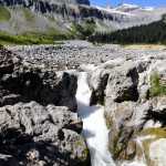
Follow the turbulent river for a short way to the famed Indian Bar, a large gravel once used by Native peoples as a camp for hunting and berry picking. Today, Indian Bar is favored by hikers for its sublime subalpine scenery and for its backcountry camps, considered by many to be the prettiest in the park. At 14.7 miles from Sunrise Camp (70.2 miles from Longmire) reach a junction (el. 5,100 feet). The spur left leads to the beautiful Indian Bar Camp. The Wonderland Trail continues right crossing the Ohanapecosh River on a bridge above Wauhaukaupauken Falls, which thunder down a narrow chasm. A mouthful of a name, the falls’ native origin name simply means spouting water.
Sitting in meadows above the river is the CCC-built stone Indian Bar shelter. You probably first noticed it from Ohanapecosh Park. Like the Summerland Shelter it is used as a group camp. If vacant, definitely check it out. Then begin the steep climb out of Indian Bar to the Cowlitz Divide, a meadow and old-growth forest draped rolling wedge separating the Ohanapecosh and Muddy Fork Cowlitz river drainages.
Crest an open knoll, descend a little and steeply climb once more reaching the Divide’s 5,930-foot high point. The views along the way are stunning. Be sure to keep looking back as Rainier makes quite a snowy showy presence towering over Indian Bar. Look east too to Shriner Peak, Nelson Ridge and the Goat Rocks; and south to Rainier’s giant snowy “twin” Mount Adams.
The way undulates along the ridge providing views into both drainages. Look north to a boggy basin where big critters can often be seen feeding. Stop and smell the flowers—millions of them—along the way. After dropping about 700 feet, the trail once again steeply climbs. This time however the grind is much shorter. After topping out on a 5500-foot knoll the way begins a long predominantly downhill stretch. The climbing reprieve will be much appreciated. Leaving the meadows behind, the trail enters ancient forest. While mountain views are now on hold, the divide’s primeval forest, one of the finest old-growth tracts in the park will impress you.
At 19.4 miles from Sunrise Camp (74.9 miles from Longmire) come to a junction with the Cowlitz Divide Trail (el. 4775 feet) which leads 4.3 miles to the Stevens Canyon Road near the Stevens Canyon Park Entrance. You want to continue right on the Wonderland Trail switchbacking downward through groves of towering old firs and hemlocks. At 21.4 miles from Sunrise Camp (76.9 miles from Longmire) come to the Nickel Creek backcountry camps (el. 3,450 feet). This camp was relocated a few years ago to allow the old camping area (which was much closer to the creek) to regenerate.
Continue hiking on the Wonderland Trail reaching Nickel Creek in just over 0.1 mile. Cross the waterway on a good bridge and briefly climb. Then continue descending, reaching the Box Canyon Picnic Area and Trailhead (el. 3050 feet) in another 0.7 mile. Water and restrooms can be found at this popular pull-out on the Stevens Canyon Road. The Box Canyon is geologically intriguing and you’ll be hiking past it in your next and final segment of the Wonderland Trail.
GPS waypoints:
Trailhead at Sunrise: N46 54.849, W121 38.514
Sunrise Camp: N46 54.635, W121 39.599
White River Campground: N46 54.156, W121 38.604
Summerland Camp: N46 54.156, W121 39.502
Indian Bar Camp: N46 49.574, W121 38.358
Nickel Creek Camp: N46 46.358, W121 37.425
Trailhead at Box Canyon Picnic Area: N46 45.932, W121 38.077
-
- Wauhaukaupauken Falls 2
-

- meadows and marvelous Mount Rainier views from along the Cowlitz Divide 2
-
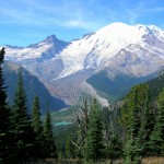
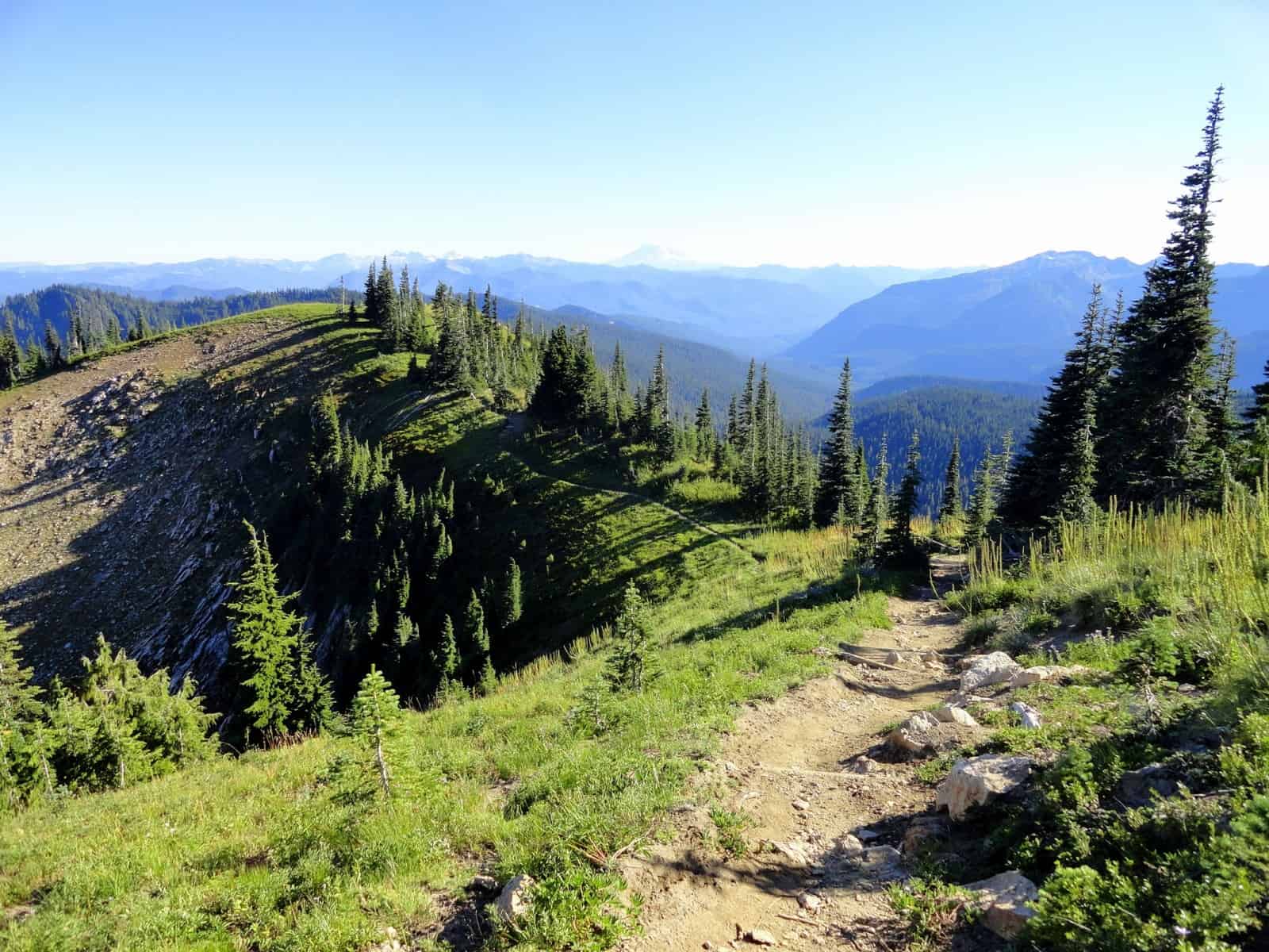
- Beautiful views of Mount Rainier and the White River Valley from the Wonderland Trail at Sunrise 2
-
- The Wonderland Trail at Fryingpan Gap
-

- peaceful shallow Shadow Lake
-
- Indian bar
-
- The Cowlitz Chimneys from Ohanapecosh Park

-

- Cowlitz Divide
-
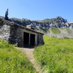
- historic Indian Bar shelter

-
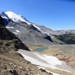
- Awesome view of Rainier Summerland the Sarvent Glacier and glacier fed tarns from Fryingpan Gap