Distance: 19.5 miles one way
Elevation Gain: 5900 feet
High Point: 6,000 feet
Snow free: mid-July — October
introduction
The Wonderland Trail travels for 93 miles around Mount Rainier. Constructed in 1915, it is one of the most beautiful, challenging, and popular hiking trails in America. The trail can be hiked in its entirety as a through hike usually typically taking 8-14 days to complete; or in shorter sections. Most people begin from Longmire and hike clockwise. This series of Wonderland Trail articles is meant as an introduction of what you can expect on this amazing trail. Be sure to consult with park officials for complete rules, permitting information and trail conditions before setting out. Consider too, these two excellent resources for more details: Green Trail Maps Mount Rainier Wonderland Trail Map 269S and Hiking the Wonderland Trail by Tami Asars (Mountaineers Books).
special information
Overnight permits required and can be acquired by making reservation in advance or at the Longmire Wilderness Information Center (360) 569-4453; www.nps.gov/mora. Find complete permit information and park and trail rules and regulations.
Special rules: No Fires—use camp stove. Dogs prohibited
Notes and special concerns: In early season mosquitoes can be dreadful at Devils Dream Camp and Indian Henry’s Hunting Ground. This is the remotest section of the Wonderland Trail. Side trails from closed-to-traffic Westside Road allow for shorter loop options.
Trailhead directions: From Elbe at the junction of SR 7 and SR 706, head east on SR 706 passing through Ashford and reaching Mount Rainier National Park at 14 miles. Continue west on park road for 6.5 miles to Longmire and trailhead parking near the Wilderness Information Center.
the hike
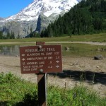
Find the trailhead (elev. 2,775 feet) near the Wilderness Information Center. Immediately enter beautiful old growth forest and soon come to a junction. You’ll be returning on the right several days later. You want to go left carefully crossing the Longmire-Paradise Park Road and continuing on the Wonderland Trail north. On wide and well maintained trail, traverse beautiful groves of monstrous ancient firs and cedars. After walking across a series of boardwalks spanning a marshy area, begin climbing.
It’s a stiff little climb up Rampart Ridge. Occasional breaks in the forest canopy reveal views to Eagle Peak across the roaring Nisqually River. Eventually crest Rampart Ridge reaching at 1.8 miles the junction with the Van Trump Park Trail; and at 2.1 miles the junction (elev. 3,900 feet) with the Rampart Ridge Trail. Most day hikers will veer left here and you probably won’t see too many day hikers now until Mowich Lake.
The way now descends reaching Kautz Creek at 3.2 miles. The creek is named for Army Lieutenant August V. Kautz who in 1857 made the first attempt to summit Mount Rainier. He was unsuccessful at reaching the summit, but the creek that bears his name has been pretty successful carrying debris and mudflows down the valley floor including two massive flows in 1947 and 2006. The trail traverses the creek’s unstable banks to make a log-bridge crossing of the fierce creek (elev. 3680 feet) and its rocky outwash area.
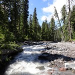
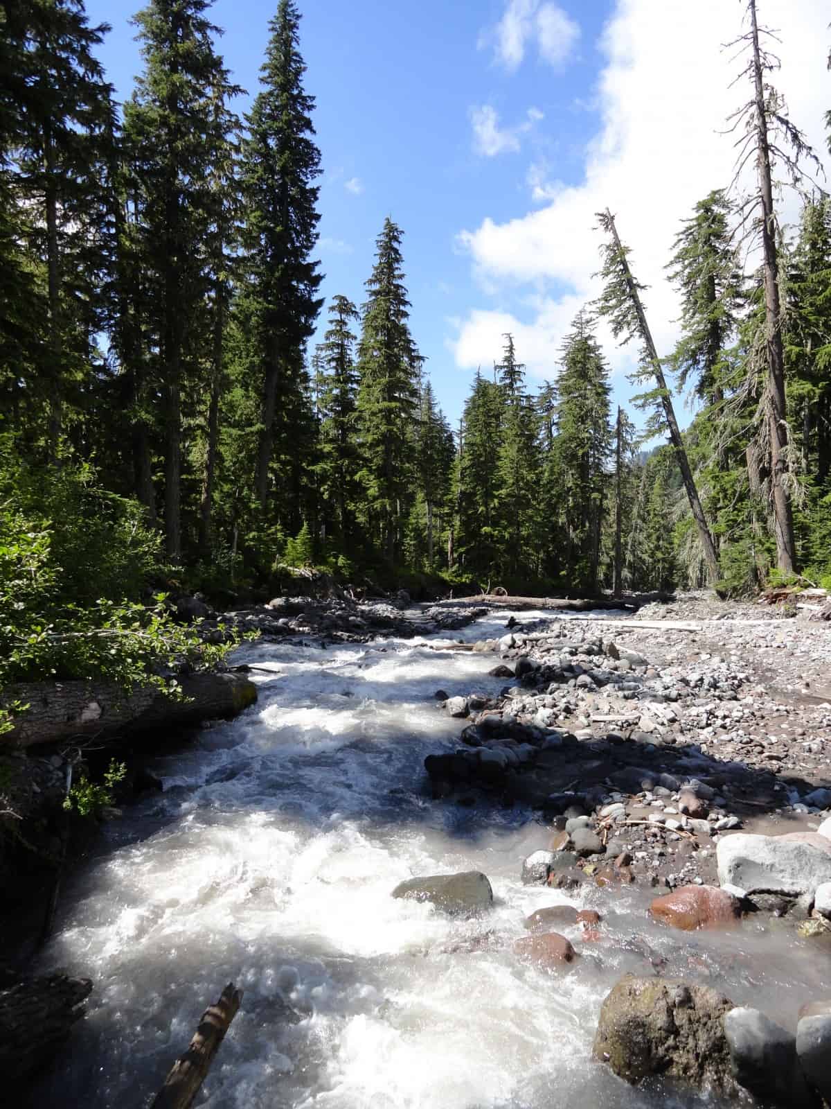
Now enter attractive old-growth hemlock forest and come to the Pyramid Creek Camp at 3.5 miles. Just beyond is a log bridged crossing of torrential Pyramid Creek. Then begin another long climb aided by incessant switchbacks. Traverse more attractive old-growth forest and cross Fishers Hornpipe Creek and Devils Dream Creek, both spots offering good water and a nice place to take a break.
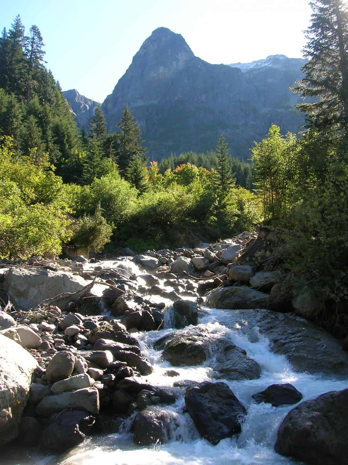
The trail then steeply climbs again paralleling Pyramid Creek which cascades and tumbles through a tight rocky chasm. At 5.5 miles reach the large, complete with fancy privy Devils Dream Camp (elev. 4900 feet). A seasonal stream flows nearby, otherwise you’ll need to hike a way to get water. The camp is forested and among the buggiest on the trail.
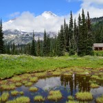
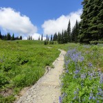
Beyond, the Wonderland Trail leaves deep forest for pocket meadows and groves of subalpine forest dotted with wetland pools and tarns. Keep hiking entering Indian Henry’s Hunting Ground with its sprawling wildflower meadows and breathtaking views of Mount Rainier. It is one of the prettiest and unfortunately (blame it on the flowers and wetlands) buggiest stretches of the trail.
At 6.6 miles reach a junction (elev. 5350 feet) with the Kautz Creek Trail and the short spur leading to the 1915-built patrol cabin. The patrol cabin is the oldest remaining in the park and it warrants a looksee. The Wonderland Trail continues north passing reflective pools and fields of flowers. At 6.8 miles, come to a junction with Mirror Lakes Trail. This 0.7 mile trail to a series of small ponds that reflect Mount Rainier is worth the side trip. The view from the small lakes was used on the three cent Mount Rainier stamp in the US Postal Service’s 1934-1935 national park series.
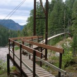
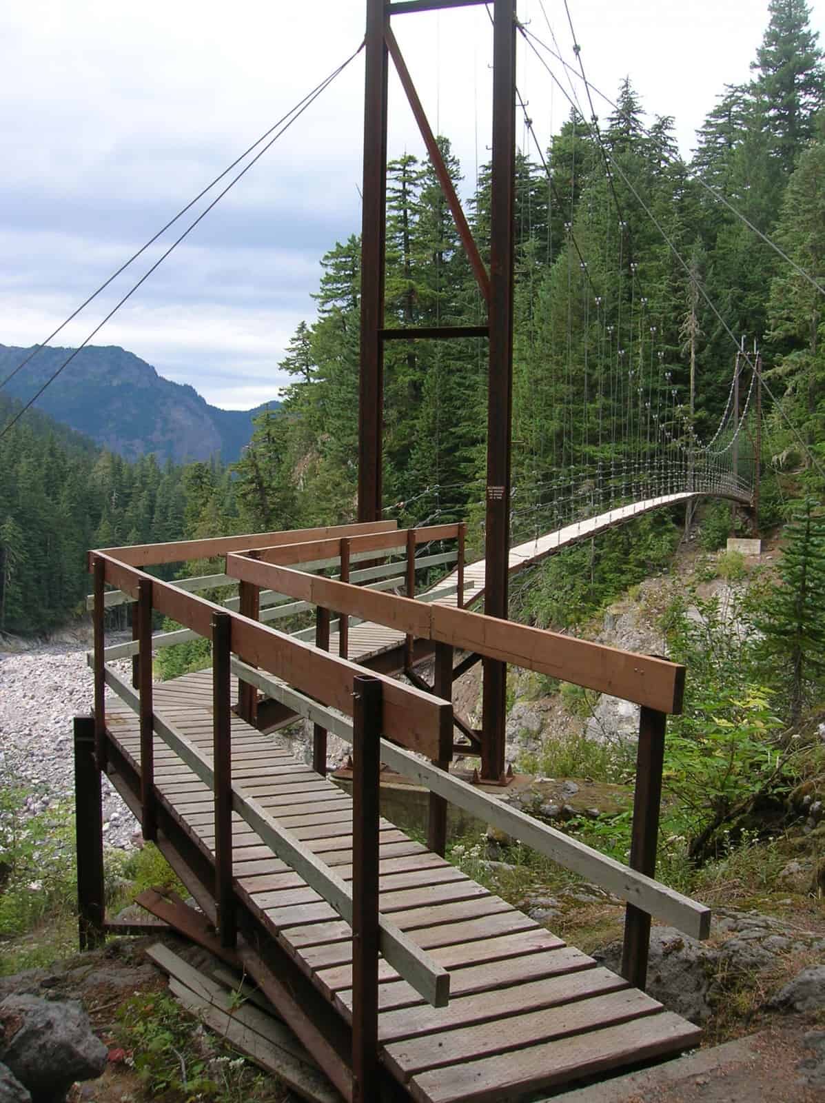
The Wonderland Trail continues north reentering forest and steeply descending reaching Tahoma Creek and its airy suspension bridge (elev. 4300 feet) at 8.2 miles. The rickety but safe suspension bridge is 150 feet long and dangles 200 feet above the chasm cradling roaring Tahoma Creek. The bridge may be intimidating to some hikers, but it is perfectly safe. Be sure to only cross one hiker at a time and walk gently across it. The views from it are as impressive as the bridge.
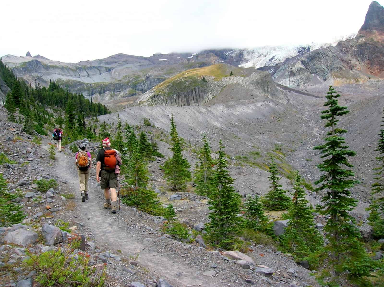
On the far side of the bridge reach the Tahoma Creek Trail which travels 2.1 miles west to the closed-to-traffic Westside Road where it is another 1.8 miles to the trailhead. You want to continue straight on the Wonderland Trail to start climbing once again. Be sure to pause to take in views of the suspension bridge and Tahoma Creek gorge. After a couple of switchbacks the way leaves forest and marches up the lateral moraine of the receding Tahoma Glacier. Enjoy excellent views of Pyramid Peak to the right, the Tukaloo Spire to the left and Glacier Island above; a barren wedge of a ridge that not too long ago was surrounded by snow and ice.
Across rock and glacial till the trail crests a gap on Emerald Ridge (el. 5,600 feet) at 10.4 miles. Now standing just above the snout of the Tahoma Glacier, enjoy fascinating views of blue ice, dirty moraine and deep crevasses. Be sure to scan Glacier Island too for moving clumps of white—mountain goats are often easily spotted along this ridge.
Then continue hiking along the ridge across flowered slopes on the edge of a deep canyon carved by the glacier. Reentering forest, the trail drops reaching the South Puyallup Trail (el. 4,200 feet) at 11.9 miles. Campsites and good non-glacier fed water are located just a short distance down this trail. The Wonderland Trail continues north crossing the glacier-fed silted South Puyallup River on a high bridge. Then once again steadily climb gaining nearly 2,000 feet of elevation. Views open up to peaks and valleys west and the Emerald Ridge east. Forest yields to meadows where flowers flourish in summer and berries are bountiful in autumn.
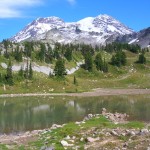
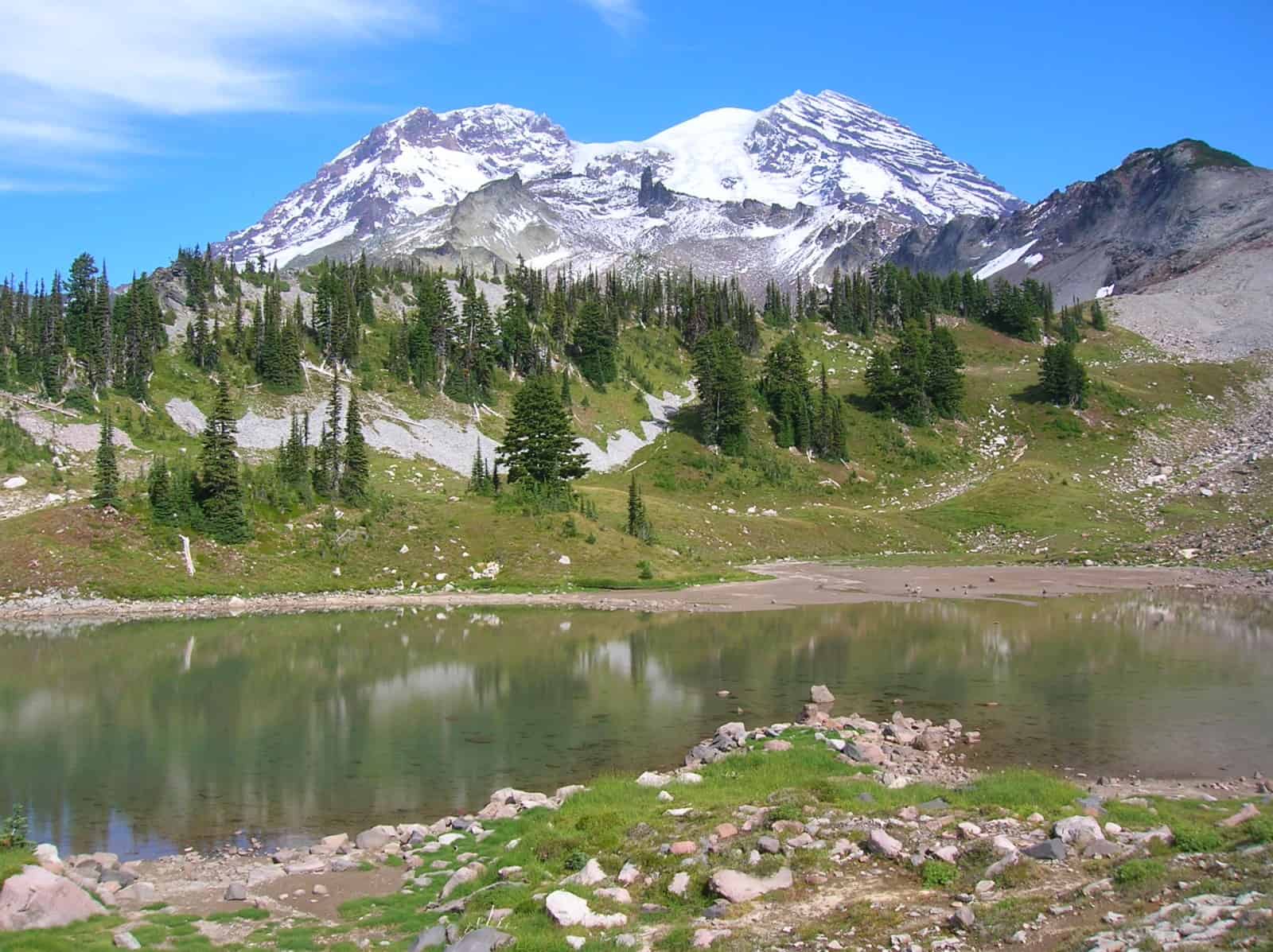
Reach a high notch (el. 5,950 feet) on a radiating ridge, and then slowly descend into a rocky basin. After crossing a small creek, begin climbing once more to soon reach gorgeous St Andrews Park. Here, sparkling St Andrews Lake invites lingering and lounging. Don sunglasses to take in the view of glistening Mount Rainier rising behind the sparking lake. Awe too at the impressive Tokaloo Spire. Near the lake’s outlet, an unmarked trail heads right to a smaller, higher lake tucked in a remote basin. Feel free to explore.
Continue north on the Wonderland Trail making a short climb before reaching a small saddle beneath Aurora Peak. Here another unmarked trail veers rights—this one a very steep scramble trail to the 6,076-foot summit of Aurora Peak. Klapatche Park is just ahead reached by gently descending through flowering meadows. At 16.6 miles reach a junction with the St Andrews Creek Trail (an alternative approach from the West Side Road) at the shallow meadow-surrounded Aurora Lake in gorgeous Klapatche Park (elev. 5500 feet).
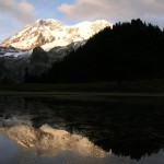
Named for one of the greatest Puyallup chiefs of all time, Klapatche Park is one of the greatest and most beautiful spots to spend the night along the Wonderland Trail. The inviting Klapatche Park campsites are located on a small wooded knoll just above the lake. From your snug campsite you can not only watch the evening and morning sunlight dance off of the mountain’s glaciers perfectly mirrored in Aurora Lake below—but also stand witness to bears, mountain goats, and deer frolicking in the surrounding high parkland meadows. A spring just to the east of the lake (which sometimes runs dry by late season) provides good drinking water. Set up camp and await the light show on Mount Rainier.
From Klapatche Park the Wonderland Trail steeply descends to the North Puyallup River Valley. The massive Puyallup Glacier hovers above. At 19.5 miles reach a junction with the lightly traveled North Puyallup Trail, which at one time was an extension of the Westside Road. Construction of that road which was once envisioned to go all the way to Mowich Lake ceased here.
Cross the North Puyallup River on new bridge (built to replace the one destroyed in 2006 flooding) and come to the North Puyallup River Camp (elev. 3750 feet). Rest well for the next leg of your journey.
GPS waypoints:
Trailhead at Longmire: N46 45.011 W121 48.746
Pyramid Creek Camp: N46 46.691 W121 48.599
Devils Dream Camp: N46 46.913 W121 49.928
Historic Indian Heaven Patrol Cabin: N46 47.651 W121 50.424
South Puyallup River Camp: N46 48.818 W121 51.868
Klapatche Park Camp: N46 50.139 W121 52.642
North Puyallup River Camp: N46 50.821 W121 52.159
-
- St Andrews Lake at St Andrews Park 2
-
- The intimidating to some Tahoma Creek Suspension Bridge
-
- Historic Patrol Cabin at Indian Henrys Hunting Ground 2

-
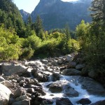
- Tumbling Pyramid Creek
-
- Klapatche Park

-
- North Fork Puyallup River
-

- Ascending Emerald Ridge
-
- evening at Aurora Lake at Klapatche Park

-
- flowers line the way through Indian Henrys Hunting Ground
