| Area: Chinook Pass |
High Point: 3000 feet | Pass: Northwest Forest Pass or Interagency Pass |
| Distance: 8.4 miles out and back | Snow-Free: mid-April — November | Elevation Gain: 700 feet |
| GPS Waypoints: Camp Sheppard Trailhead: N47 02.153 W121 33.599 Ranger Creek Trail Junction: N47 01.430 W121 31.938 Trail’s Terminus on FR 7174: N47 00.119 W121 31.150 |
||
-
- running through an ancient cedar grove on the Moss Lake Loop

-
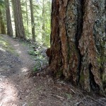
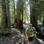
- Big old trees line the White River Trail

-
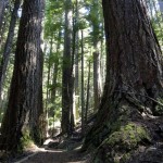
- giant firs on the Moss Lake Loop

-
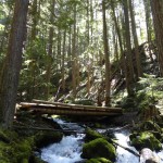
- Bridge over Deep Creek

-
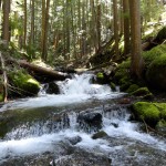
- Cascading Deep Creek

-
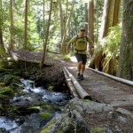
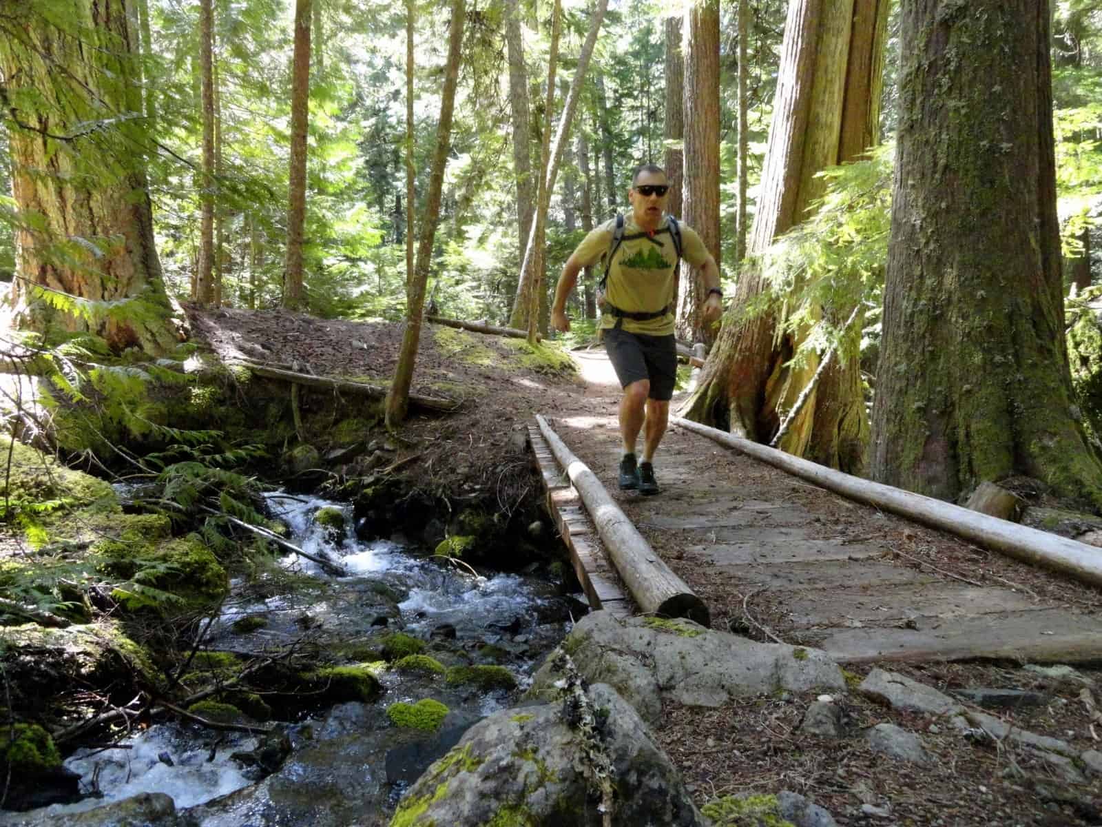
- running across the Dry Creek Bridge
This gentle valley bottom trail is ideal for beginning trail runners. Traveling up the White River Valley for over five miles, it traverses mature forest groves and spans cascading creeks while maintaining easy and moderate grades. Experienced trail runners shouldn’t shun this trail though, as it offers a great training route in spring and late fall when many of the nearby more challenging trails are buried in snow.
The White River Trail parallels SR 410 and has several easy access points, but surprisingly it’s not that busy. Some mountain bikers use it as a connector to area trails to form large loops, but hikers are often absent on it. Other than a stretch used to form a loop with the Snoquera Falls Trail, expect to see very few people while out running this trail. And, while you’re never that far from SR 410, the trail is set far enough back in the forest that you don’t see the road. While the roaring White River does a good job making sure you can’t hear the road noises.
Starting from the Camp Sheppard Trailhead head east immediately coming to an outdoor amphitheater used by the adjacent Boy Scout Camp. Here the beautifully built Moss Lake Loop Nature Trail circles around for 0.6 mile. You definitely want to warm up on it, but be mindful of contemplative hikers and nature observers that may be out on this delightful path. A good portion of this trail traverses an impressive grove of ancient cedars via boardwalks. Moss Lake is actually a large wetland fed by several tumbling creeks.
Once you get your warm up in, turn right and spring up a small incline reaching a four-way junction. Straight ahead is the Snoquera Falls Trail, a popular hike and a good choice for extending your run. Left, the White River Trail travels 1.2 miles skirting Camp Sheppard and connecting with the Snoquera Falls Loop and Palisade Trail.
You want to go right on the White River Trail leaving the falls bound hikers behind. Soon reach yet another junction, this one with an alternative trail used to access the falls loop; and the Buck Creek Trail leading to SR 410. Note that the suspension bridge spanning the White River has been washed out for years, so this trail can no longer be used as a connector to the Skookum Flats Trail.
Continue straight on fairly light tread occasionally carpeted with mosses. The way is lined with salal. It’s a much drier climate here on the northeast side of Mount Rainier than at Longmire and the Carbon River Valley thanks to the Mountain’s rainshadow effect. But while the forest is dry, there are lots of creeks tumbling down from the steep slopes hemming you in. Most are bridged or easy to hop over, but in the early season and during rainy periods you might get your running shoes wet.
After a short steep drop, reach a junction with a short spur heading right to SR 410 and FR 7160 which can be used to access Skookum Flats. You want to continue straight negotiating a short steep section of trail through towering big trees. At about 1.9 miles from the trailhead, come to a junction with the Ranger Creek Trail which climbs steeply toward Dalles Ridge offering a challenging run.
The White River Trail continues straight dropping into a gully to make a pretty bridged crossing of Ranger Creek before traversing steep side slopes. Pass a small scree slope offering glimpses across the valley before resuming traveling through deep timber. The way makes another pretty bridged creek crossing—this time over Dry Creek, which usually isn’t too dry.
At around 3.2 miles, skirt some cabins and a spur coming up from a Forest Service Road. The way then heads into a damp glen cut by cascading Deep Creek. You may want to slow your pace here to enjoy all of the tumbling water. Bear right at the Deep Creek Trail and make a bridged crossing of Deep Creek. Then steeply climb beneath a canopy of tall timber coming to a junction with a short side trail leading right to a nice view of the White River Valley.
You can turn around hear or continue to the trail’s southern terminus located just another 0.1 mile away on FR 7174. Now enjoy a mostly downhill 3.9 miles back to your start.
Notes: Green Trails Map Greenwater, WA no. 238 shows this trail
Contact Snoqualmie Ranger District, Enumclaw office (360) 825-6585 or www.fs.usda.gov/mbs for more information
Getting to the White River Trail (Camp Sheppard Trailhead):From Enumclaw, follow SR 410 east for 28 miles. Turn left onto Camp Sheppard access road and reach trailhead in 0.1 mile.
– Craig Romano, Hiking guidebook author and co-author of twelve books