| Area: White River Area | Starting Point: SR410 | |
| Distance: up to 10.0 miles RT | Duration: 2 to 7 hrs | Difficulty Level: Moderate |
| Elevation Start: 2,300 ft | Elevation End: 3,000 ft | Elevation Gain: 700 ft |
-
- WhiteRiverTrail 04
-
- WhiteRiverTrail 03

-
- WhiteRiverTrail 02

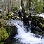
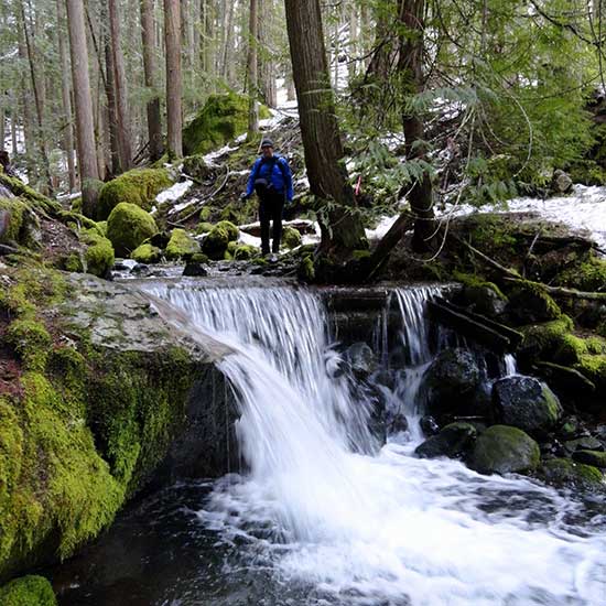
The White River Trail makes for a great kid-friendly snowshoeing route when snow levels are low. You can enjoy miles of easy wanderings through thick old-growth forests and by crashing mountain streams. The trail connects to many other trails too, offering lots of exploring possibilities.
Starting near The Dalles, the White River Trail parallels SR 410 and the White River for nearly 5 miles terminating at the Corral Pass (FR 7174) Road. It’s used primarily by mountain bikers and trail runners as a connector to form loops with the Palisades, Ranger Creek, and Deep Creek trails. The trail makes an excellent early season hiking destination; and when snow descends upon the valley floor, a great and safe snowshoeing route.
There are a half dozen access points to the trail, but the Camp Sheppard trailhead is the best for its ease of parking. From this access point, you can head north one mile on fairly level terrain through dark forest beneath the steep and formidable Palisades. The trail then drops 200 feet reaching SR 410 in .4 mile. Experienced snowshoers however, can opt to head right and attempt the Palisades Trail which climbs steeply up a dank ravine before cresting the ridge of the Palisades. It then meanders along the high ridge, passing a series of breathtaking viewpoints of the White River Valley and SR 410 over 1,000 feet directly below. Experienced snowshoers can also follow another trail from White River, hiking up to Snoquera Falls. This loop traverses along the Palisades to the falls before dropping steeply back to the White River Trail.
However, if you are looking for fairly gentle terrain and a much easier winter adventure, head south on the White River Trail from Camp Sheppard (el. 2,450 feet). In about .5 mile you’ll come to a junction with the Buck Creek Trail which leads .2 mile back to SR 410. Keep hiking south gradually ascending and staying above the highway and below the steep slopes of Little Ranger Peak.
The forest is fairly attractive with pockets of big old growth giants. And while the highway noise is a constant, eventually the sound of humming vehicles is drowned out by crashing water. At 1.8 miles from Camp Sheppard reach Little Ranger Creek and the Little Ranger Creek Trail which winds almost 5 miles to the Palisades Trail. Feel free to wander a mile or two up this trail if you’d like traversing beautiful old-growth forest and enjoying the crash of the creek. After about two miles the trail climbs steeply and becomes much more challenging.
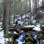
The White River Trail keeps going and it gets much more interesting rounding steep slopes and winding through gorgeous tracts of ancient forest. At 3.2 miles from Camp Sheppard you’ll pass an easy-to-miss trail right that leads to the Alta Crystal Resort. Shortly afterwards come to a junction with the Deep Creek Trail. This trail too, like the others radiating from the White River Trail offers a challenging route for experienced snowshoers, leading high above the valley to Dalles Ridge.
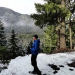
The White River Trail continues farther crossing Deep Creek on a sturdy bridge and then rounding another steep slope. Look for a side trail veering right at this point and be sure to take it. The short spur leads to a nice view of the valley below. Notice the sun loving manzanitas growing along this south facing slope. And notice all of the elk droppings-this area sports a large herd of wintering elk, so keep your camera at the ready.
The White River Trail continues from the viewing spot for a short distance to terminate at the Corral Pass Road (el. 3,000 feet) about 3.8 miles from Camp Sheppard. Now either turn around and enjoy the long slow descent back to your start-or if you still have some energy you can either extend your trip one mile by hiking to Goat Falls or heading up the closed to traffic in winter Corral Pass Road .4 mile to an excellent viewpoint.
During mild winters the White River Trail remains snow free making for a good off season hike. But when snow levels drop to below 3,000 feet, this trail is an excellent choice for a fairly gentle snowshoeing adventure.
Craig Romano, Guidebook Author, Outdoors Writer and Photographer.
| Waypoints:
N. Trailhead (SR 410): N 47 02.953 W 121 34.222 |