| Area: White River Area | Starting Point: Hwy 410 | |
| Distance: 11 miles RT | Duration: 9 hrs | Difficulty Level: Strenuous |
| Elevation Start: 2,200 ft | Elevation End: 5,271 ft | Elevation Gain: 3,050 ft |
-
- suntop snowshoe 02
-
- suntop snowshoe 05
-

- suntop snowshoe 01
-
- suntop snowshoe 04

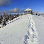
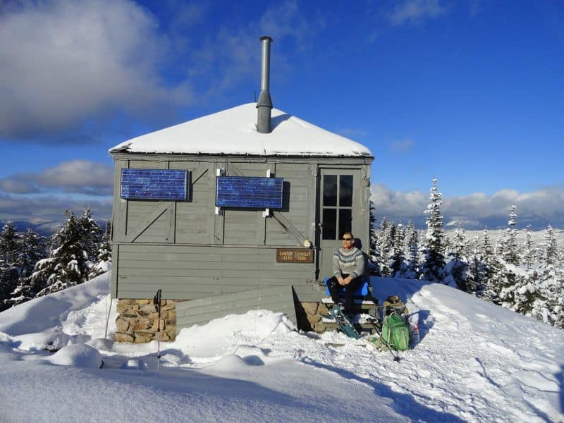
A challenging and invigorating snowshoeing destination; stand atop this 5,271-foot peak just north of Mount Rainier and bask in sweeping jaw-dropping views of deep emerald valleys and craggy frosty summits. Mount Rainier steals the scenic show here. But once you wrestle your eyes from its spellbound grip, you can also savor the beauty of the nearby Norse Peak Wilderness and Clearwater Wilderness peaks, the Olympic Mountains, Mount Stuart, and even Mount Baker on the northern horizon. Sun Top’s 1933-built fire lookout will no doubt captivate you as well.
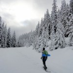
In the summer and autumn months, Sun Top’s summit is easily accessible by a graveled Forest Service road. Mountain bikers, hikers, and trail runners can also reach the historic and scenic lookout via a long trail that traverses the rugged ridge to the south of the mountain. When winter casts its snowy blanket upon Sun Top, the road is gated in the valley below allowing skiers and snowshoers a crack at this mountain. By way of the road, the trip is long and a good challenge but it’s not overly arduous thanks to a moderate incline.
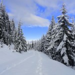
From the Sno-Park, pass the gate and soon come to a junction. The road straight is a near level route through old-growth forests along Huckleberry Creek. It makes for a good family-friendly cross-country skiing trip. You however want a better workout and some serious views, so head left up FR 7315. The way winds around a Forest Service nursery undulating between old cuts and patches of mature timber.
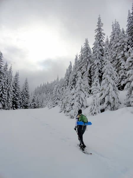
The route steadily climbs, never too steeply, but never letting up either. A few good but limited views north and east over growing-in old cuts tease along the way. At 2.2 miles, come to a gate (el. 3,300 feet) and a spur road leading right which may tempt you to explore. But unless the weather is bad with no promise of views from above-save this spur for another day and save your energy and keep marching forward and upward.
After making a sharp turn the route begins wrapping around the peak heading for a saddle on its southern ridge. Occasionally look back and catch a glimpse of the semi-open summit. At 5.0 miles, come to the 4,750-foot saddle. Here the road dissects the Sun Top Trail and a spur continues west to a broad shoulder. If avalanche warnings are in place, do not continue toward the summit and consider instead snowshoeing on the spur for limited views.
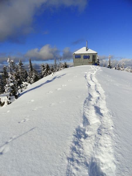
If the snow is stable continue a short distance on the Sun Top road soon coming to yet another gate. Do not continue straight on the road as it crosses a steep open slope prone to avalanches. Instead, locate the hiking trail and follow its route switch-backing up the southern slopes of the peak. The forest soon thins and views grow. Reach the summit road at a sharp bend near a solar panel and head right a short distance across the broad open summit.
At 5.5 miles your journey comes to an end at a fire lookout cabin (one of the few remaining in this region) perched on the 5,271-foot summit. Now, turn around and face south. Wow! Mount Rainier is right in your face-its icy facade nearly blinding. Look west too across the deep White River Valley to Crystal Mountain, Castle Mountain, Norse Peak, Pyramid Peak and Kelly Butte. Then face the west admiring views over the Huckleberry Creek Valley. Beyond its patchwork of logged hillsides are a series of mountains draped in virgin forests protected within the Clearwater Wilderness. Look northward now and sweep the horizon from left to right locating the Olympic Mountains, Mount Stuart and Mount Baker. Finally, if the sun is out, savor it on this summit whose name is solar inspired.
| Waypoints: Trailhead at Sno-Park: 47.066677, -121.583516 Upper Gate Summer Trail Junction: 47.033398, -121.583555 Summit Fire Lookout: 47.033461, -121.583552 |