| Area: Chinook Pass |
Hike Type: Family-friendly | Pass: Northwest Forest Pass |
| Distance: 6.0 mi RT | Duration: 4 hrs | Difficulty Level: Moderate |
| Snow-Free: mid-July – October | High Point: 6,400 ft | Elevation Gain: 1,100 ft |
* Make sure Chinook Pass is still open before you go.
-
- IMG 4716
-
- DSC 3095
-
- IMG 4722

-
- IMG 4712
-

- IMG 4727

-
- IMG 4689

-
- IMG 4706

-
- DSC 3269

-
- IMG 4698

-
- DSC 3242

Features: kid-friendly, dog-friendly, wildflowers, backcountry lake, sweeping views
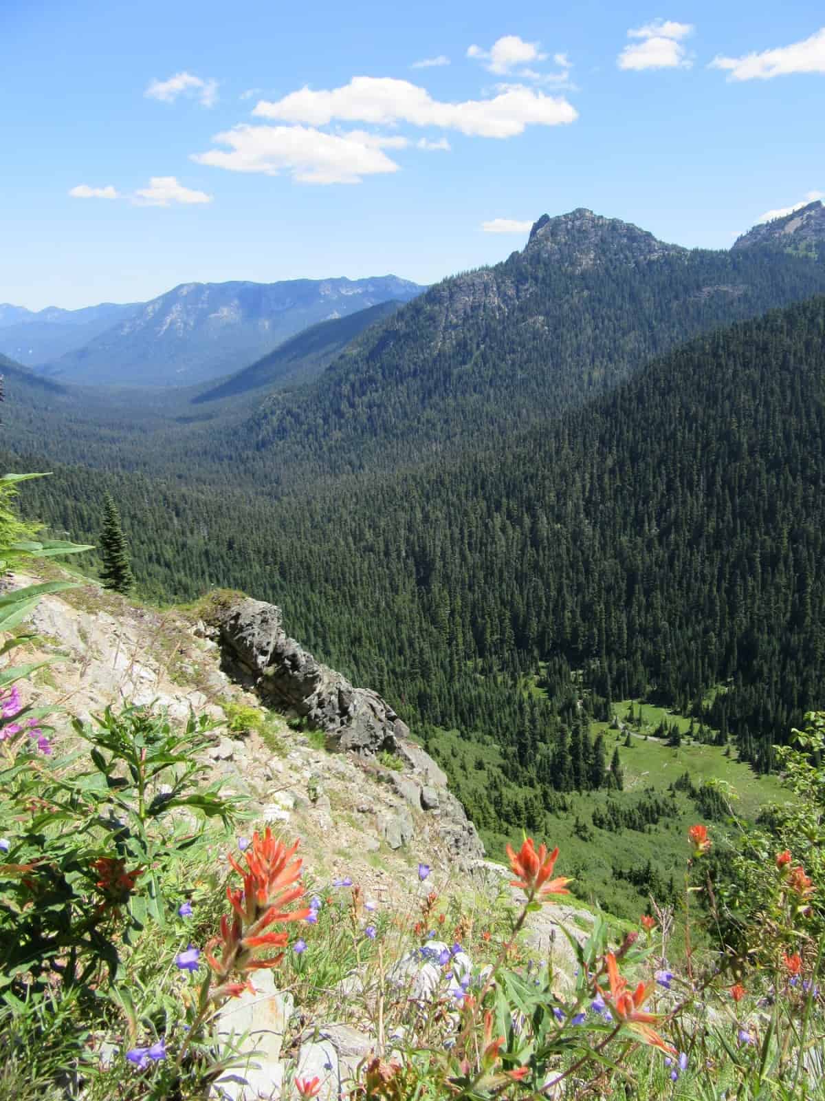
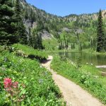
Head out on an easy two mile stretch of the Pacific Crest National Scenic Trail (PCT) relishing in sweeping views and dazzling wildflowers. Then take a break at a pretty little subalpine lake in a basin flush with meadows and wildlife. Soak your feet, go for a dip or take a nap. If wanderlust still persists, continue on the PCT for another mile climbing to a high gap on a rocky ridge. Then feast on views from Mount Adams and Mount St Helens to Fifes Peak and the Nelson Ridge. Rainier, while just a couple miles away is pretty much blocked from view thanks to a western flank of impressive craggy summits.
Hit the Trail
Chinook Pass can be a busy place. In the few months that it is open, many a motorist passing through this high pass makes a stop here. Some merely peer from an overlook or two and hastily snap some photos. Others make a pit stop, have a picnic lunch, or meander on the short trails circling Tipsoo Lake. And if you’re a hiker, Chinook Pass is the starting point for several great adventures.
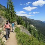
Here the long-distance PCT crosses over SR 410 on an attractive wooded park gateway bridge. From a large parking lot here that is usually close to full throughout the summer, you can head south or north on this famous trail—and you don’t need to go far to have an incredible hiking experience. Little Sheep Lake lies just two miles north along the trail. Sourdough Gap is a mere mile farther. The way to the lake gains very little elevation making it ideal for children and hikers-getting up there. The whole way is outside of Mount Rainier National Park too, meaning you can bring along any four-legged hikers in your family.
Start your journey on the well-trodden trail traversing steep eastern slopes. The way is through open forest cleared by past fires and annual avalanches. During mid-day in the summer, it can be downright hot on this stretch—so plan for a morning or evening jaunt. Wildflowers are profuse—so stop and smell them—but don’t pick them, leaving them for others to enjoy.
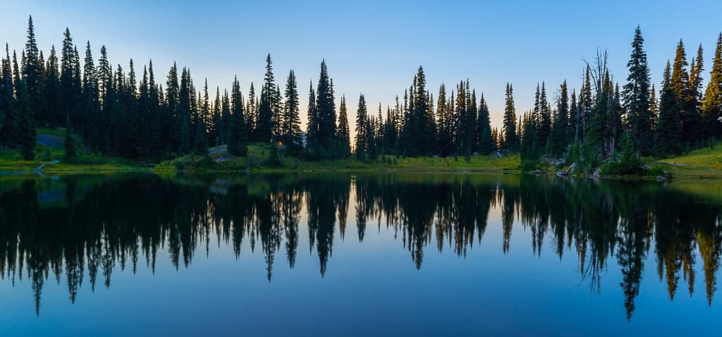
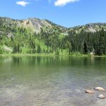
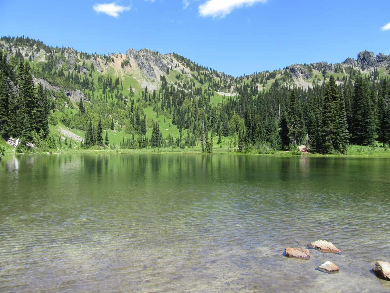
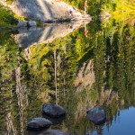
The trail parallels above SR 410 for more than a mile. The highway slowly descends into the American River Valley, while the trail stays high above it offering great views of this wide-U shaped glacial-caved valley. Eventually the trail turns away from the road onto a bench along the ridge. Pass through clusters of firs and verdant patches of meadows. At 2.0 miles come to Sheep Lake (elev. 5,760 feet).
A popular spot, try to tread lightly around its shores while exploring. There are some great spots for picnicking and wading. The lake is fairly shallow and warms up nicely in the summer. In autumn when things quiet down here, check the shores and neighboring meadows for elk, deer and mountain goats. Bear are common too once the crowds dissipate. If you’re satisfied with the hike so far—lounge for a while and then head back along the easy stretch of trail you followed here. Otherwise, keep hiking!
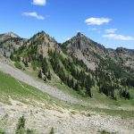
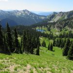
Continue north on the PCT winding through meadows and forest groves and steadily climbing. The trail was built for horses, so the grade is never steep. The way winds high above the basin cradling Sheep Lake. At 3.0 miles reach 6,400-foot Sourdough Gap, a rocky little notch on a rugged ridge. Now look south over the lake basin and all of the terrain you have just hiked over. Look beyond to Yakima and Naches peaks guarding Chinook Pass. Beyond those familiar peaks see the snowy Tatoosh Range and Goat Rocks peaks. Mount St Helens can be seen to the southwest. Mount Adams to the southeast.
Hike around a little and you’ll be able to see a snowy sliver of Rainier’s summit hovering over the rocky peaks to the west. Behind those peaks are the Crystal lakes. Look east over American Ridge to Nelson Ridge. Then look north along the PCT to Crystal Mountain, Threeway Peak, Bear Gap, and Crown Point. Look down into the Morse Creek valley and see if you can locate Placer Lake. All of this terrain was abuzz with miners and mining activity a century ago. There are still some active claims and plenty of mining relics scattered about. Miners named this gap after one of their staples in camp. Savor the specular sweeping views and then make the scenic return hike back to the trailhead.
Notes: Chinook Pass is usually closed from late November—late June.
No camping within 100 feet of Sheep Lake
Contact: Naches Ranger District, Okanogan-Wenatchee National Forest (509) 653-1401, http://www.fs.usda.gov/main/okawen
Maps: Green Trails Mount Rainier Wonderland Map 269S
Trailhead directions: From Enumclaw, head east on SR 410 for 40 miles bearing left at Cayuse Pass. Continue east on SR 410 for another 4.0 miles to large parking lot (just beyond national park arch) at Chinook Pass. From Yakima, follow SR 12 west for 16 miles bearing right onto SR 410. Then continue 47 miles to trailhead at Chinook Pass.
Trailhead facilities: privy
– Craig Romano, is an author of more than a dozen hiking guidebooks including the newly released 100 Classic Hikes Washington (Mountaineers Books) which includes several hikes in and around Mount Rainier National Park.
Waypoints
| Starting Point: N46 52.352 W 121 30.952 | |
|
Notable Waypoints: Sheep Lake: N46 53.651 W 121 30.114Sourdough Gap: N46 54.091 W 121 30.041 Sourdough Gap: N46 54.091 W 121 30.041 |
|
Q: Do I need a pass to hike the Sheep Lake/Sourdough Gap area?
A: Yes, you’ll want a Northwest Forest Pass. For additional information on this hike click here.
Q: Where is the nearest lodging to Sheep Lake and the Sourdough Gap trail?
A: The nearest resorts, cabins, and vacation rentals are in the Crystal Mountain area. Click here for accommodations.