| Area: Chinook Pass |
Hike Type: Off the Beaten Track | Pass: Natl. Forest Pass |
| Distance: 8 mi RT | Duration: 4 hrs | Difficulty Level: Moderate |
| Elevation Start: 3,480 | Elevation End: 5,380 | Elevation Gain: 1,900 |
| Snow-Free: Late-June – Oct |
-
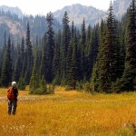
- a meadow near Placer Lake

-
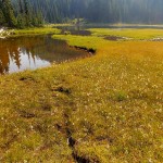
- e outlet Placer Lake
-
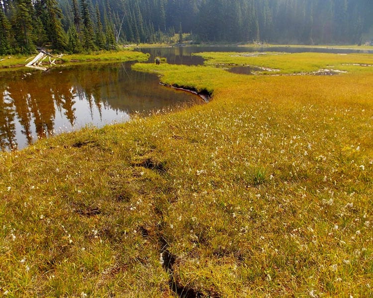
- d back to the gap
-
- b Heading back crosscountry toward the gap
-
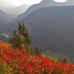
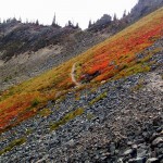
- z view from PCT north of Chinook Pass

Looking for information on hiking to Placer Lake is like looking for gold; your chances of success are not too likely. It does take some “digging” to find out more about the route – but well worth it both for the solitude and immense scenery along this remote trail.
The Morse Creek Road itself (Forest Service Road No. 462) was easy to find; it’s on the left-hand side of SR 410 (east of Chinook Pass) and is signed “Bear Gap”. Then you’ll need to drive or walk the road to get to the trailhead. It’s a primitive road used by property owners and Forest Service personnel who maintain a nearby cabin.
We parked our passenger car about miles from SR 410 as the road is best-suited for vehicles with high clearance and started hiking. A little further a well-placed sign warns drivers the road ahead is not suitable for passenger cars and trailers. To the right is a parking area with plenty of space to park or turn around.
As we continued we found signs of private property and mining claims (the road is still used by vehicles with high clearance and there are several places to tuck a vehicle off the road).
We did find the road/trail system baffling at times – spurs are not designated so when in doubt stay on the “best” road. At about 2 miles we came to a sign for “Bear Gap” though part of the sign is missing. The sign tells users to follow the road mile to the trail. At another switchback in the road; a turn is designated with a sign reading “Trail.” Here the road becomes more trail-like, bordered by forest with a few views to high country at its fall-color peak.
At an unsigned trail junction take the right-hand trail which we’ve opted to call Blue Bin trail (the blue trail markers are created from the kind of rubber storage bins you buy at stores). The markers are placed high in the trees indicating this has been used as a cross-country ski route (some may still use it).
The Blue Bin trail started out at a gentle grade, crossed a couple of seasonal creeks and then grew stern. This steep, rubbly stretch leveled off in about .5 miles and Placer Lake came into view set within meadows dotted with white tufts of cotton-grass. It is a pretty lake in a pretty setting. Nearby in surrounding meadows is a Sno-tel site. According to research on The Internet the Sno-tel site calls the lake “Morse Lake.”
Since we were running low on time we did not check out the trail that crosses the outlet of the lake to see where it went (we believe it leads to the Pacific Crest Trail below Sourdough Gap) but is probably not used often.
For solitude, Placer Lake is the place to go; keep in mind hunting season is in full swing so wear orange and check with the Washington Department of Fish and Wildlife for information on dates as to where and what is being hunted.
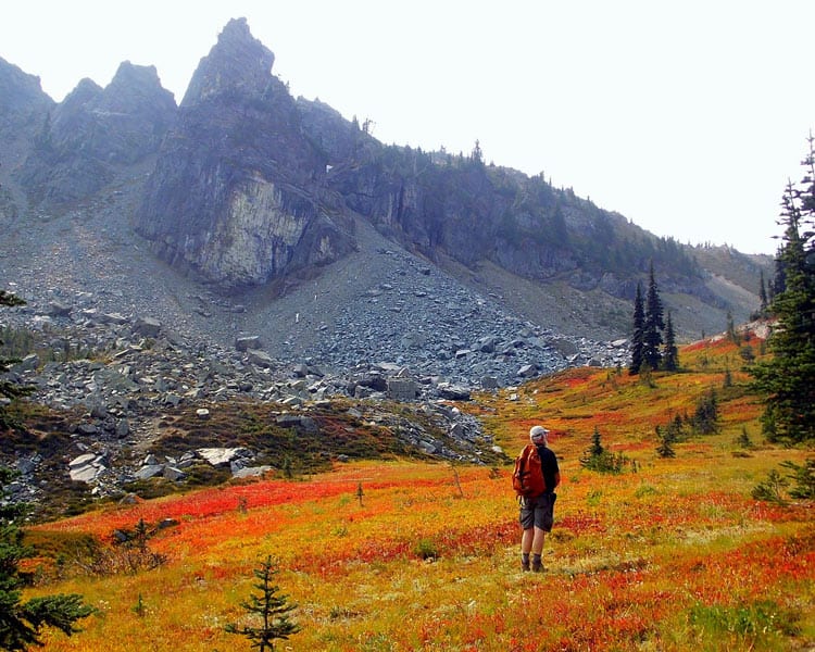
Placer Lake was so pretty we thought we’d see if we could get to the lake from Sourdough Gap on the Pacific Crest Trail. For hikers with route-finding skills who enjoy a challenge, this potential approach to the lake might tempt you to continue where we left off. A few days after our hike to Placer Lake via the Morse Creek Road we returned to Chinook Pass and the Pacific Crest Trail to see if the dream of a one-way hike could become a reality.
The fall color was raging at Chinook Pass – the PCT between Naches Peak and Sourdough Gap was bordered with mountain ash and false hellebore and flowers gone to seed. We stopped at favorite sites along the way, including quiet Sheep Lake where we saw more Halloween candy-colored mountain ash.
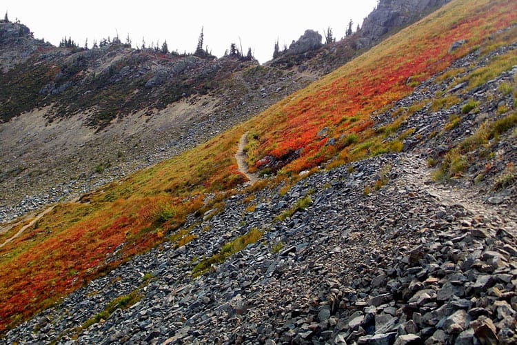
At Sourdough Gap we took a break, admiring an unusual cairn before descending into the basin just past the junction via the PCT where an unsigned path leads off (right) heading down a rocky bowl below the ridge. Here crimson blueberry-covered knolls were interspersed with boulders that had tumbled from the ridge above.
From there we kept to the “best” of what appeared to be ancient or game trails. Alas all too soon we lost sight of the “best” trail and proceeded cross-country looking for any kind of path that might lead to Placer Lake. We did get to a point where we could see the lake but it was further away than we’d anticipated and we were not able to pick up a trail that didn’t involve cross-country exploration.
However as far as we are concerned our second expedition to Placer Lake was not a waste of time – the boulder-strewn meadow below Sourdough Gap is itself a delightful place to idle a while before heading back to this popular stretch of the Pacific Crest Trail.
To get there (Morse Creek Road): From Chinook Pass on SR410 continue east about 4-5 miles to Morse Creek Road (left). Display your Northwest Forest Pass to be on the safe side (no signage requires it).
Maps: Green Trails No. 271 Bumping Lake or the Mount Rainier Wonderland Trail No. 269S.
For additional information call the Naches District of the Okanogan Wenatchee National Forest at 509-653-1401. For more information on hunting seasons call the Washington Department of Fish and Wildlife at 360-902-2200 or visit their website: www.wdfw.wa.gov
Waypoints
| Starting Point: 46.90807,-121.42025999999998 | |
| Notable Waypoints:
Junction with Highway 410: N 46° 54′ 29, W 121° 25′ 13 |
|
Alternate Hiking Route
Placer Lake: via the Pacific Crest Trail (Chinook Pass), Sourdough Gap |
|
| 8.5 miles round trip with 2,000 feet of gain Hiking time: 4 hours round-trip When hiked: October 5, 2012 High Point is Sourdough Gap at 6,420 feet |
|
| Notable Waypoints:
Chinook Pass: N 46° 52′ 30″, W 121° 31′ 04″ |
|
To get there: (Pacific Crest Trail): From Enumclaw via SR 410 drive to just below Chinook Pass, turn left on the first road into the Pacific Crest Trail trailhead. A Northwest Forest Pass is required.
– Karen Sykes, Visit Rainier Hiking Expert