| Area: Carbon River |
Hike Type: Dog-friendly | Pass: Northwest Forest Pass |
| Distance: 6.5 mi RT | Duration: 3 hrs | Difficulty Level: Moderate |
| Elevation Start: 4,369 | Elevation End: 5,709 | Elevation Gain: 1,340 |
| Snow-Free: Late-June – Early-Nov |
-
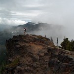
- 1 highpoint

-
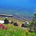
- t at summit Lake

-

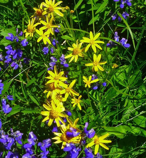
- w arnica and lupine
-
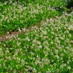
- trail to Summit Lake

-
- views from the ridge

-
- z above lake
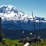
It may be hard to believe, but at Summit Lake you can experience a year’s worth of seasons in 4 or 5 months.
If you are lucky, by late June/early July, the narrow logging road is snow-free and you can drive to the trailhead. Even if that is the case, chances are good that you will end up in snow, and sometimes lots of it, before reaching the lake.
As the snow slowly retreats to higher elevations, it’s replaced by blankets of avalanche and glacier lilies covering meadows, large and small. By late July/early August, the fields of lilies are gone and the open areas are a pallet of color with Anemone, Heather, Paintbrush, Beargrass and Lupine. In August and September, Asters, Phlox, Bluebells and Mt. Bog Gentian start to flower. Early October brings wild huckleberries; a wonderful fall treat for us and the bears, they are everywhere. By late October/early November be prepared for early snows. There is nothing prettier than this lake surrounded by fresh, new snow.
Q: How do I get to Summit Lake?
To reach the Summit Lake hike, take Hwy 165 from Buckley, through Wilkeson, past Carbonado and across the Fairfax Bridge. In ¼ mile the road comes to a “Y”; up (right) goes to Mowich Lake, while down (left) goes to the Carbon River. Go left. Follow this road for 7.7 miles to a one-lane bridge on the left. (Keep an eye out for it when you drop down to the river level as there is no sign.) If you reach the Carbon River Entrance to Mt. Rainier National Park, you have gone too far.
The first obstacle you must deal with when hiking this trail is the road to get there. After crossing the one-lane bridge, it is a mostly narrow, single-lane logging road with few turnouts and therefore few places to turn around if the snow gets deeper. It’s a constant uphill climb for 6 miles to the trailhead at the end of the road. There are a few spur roads, but keep to the most traveled one and you should be fine. Always check with the Forest Service for road conditions; landslides, washouts, and late snowpack can wreck your day.
The first part of this hike is mostly level through the dense second-growth forest with some old trees and lots of thick underbrush. The trail crosses numerous small creeks, while the sounds of a larger creek keep you company most of the way. At .9 miles from the trailhead, you come to the Twin Lakes junction. The trail to the right takes you to Bearhead Mtn. (3+ miles). The trail to the left is the one to Summit Lake, 2.5 miles from the trailhead. The old-growth forest takes over here and the trail becomes a constant, but gentle uphill climb. As you reach the crest of a ridge the trail levels out again all the way to the lake.
Short of the lake, there is a fork in the trail, each way taking you to the opposite side of the lake. To the left, (west) the trail passes by a small pond and comes to a large meadow on a gentle slope. Here the view of Mt. Rainier is spectacular and it’s a great place to sit in the sun and have lunch and/or take a short snooze. After leaving this beautiful spot, it’s time to check out the lake. A maze of trails cut through the woods, a campsite, and along the shoreline. Try to find a well-traveled one, and veer to the right wherever you can.
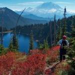
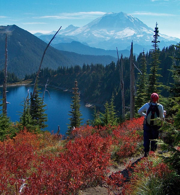
You may want to spend all your time at the lake itself or you can venture on to the trail that travels around the lake. The east end is the easier way to the rocky ridge above the lake where there are breathtaking views of both Mt. Rainier and the deep blue water below. In late September, this is where you will find lots of wild huckleberries. (This is also another good lunch spot.) Across the lake to the SE is Bearhead Mtn, the other hike with the same trailhead. There was once a fire lookout at the top of that mountain.
As you continue on the trail around the lake it heads north to the high point on the ridge. The rock formations at the top are incredible and you can see much of the Carbon River Valley spread out 3000 ft. below. From the farthest point, you can also see the parking lot where you began this hike. (The small lake below is Coplay Lake.)
To continue around the lake, things get a little tricky. You must find the trail on a steep rock face and it’s not very obvious. The narrow trail continues on a steep descent; it may be the shorter way back, but certainly not the easier way. There are some nice photo opportunities from this end of the lake and the fall colors are amazing, but the downhill is steep. Most of the time, we go back down to the lake the way we came up on the east end of the lake. Then you can catch the other trail back to the fork where you made your east/west choice.
Remember your camera when doing this hike; you cannot take a bad picture here. Summit Lake is a wonderful place to spend a day in summer, amongst abundant flowers, or in fall, delighting in the brilliant colors and feasting on huckleberries. Even hiking through the first snows of winter before the road is closed for the season is memorable.
– Mary Janosik, Visit Rainier Hiking Expert
Waypoints
| Starting Point: 47.031367,-121.826700 | |
|
Notable Waypoints: Trailhead: N 47° 01.882, W 121° 49.602 |
|
Q: How long does it take to drive from Seattle to Summit Lake?
A: Depending on your route it’s approximately 69 miles / 2-hour drive.
Q: Can I hike the Summit Lake trail with my dog?
A: Yes, you can. This trail is part of the Mt. Baker-Snoqualmie National Forest, Snoqualmie Ranger District, and dogs on a leash are allowed. Please remember to dispose of pet waste responsibly.
Q: Is there a campground on, or near the Summit Lake trail?
A: Mowich Campground is 30 miles. Ipsut Creek is approximately 28 miles please note the road to Ipsut Creek is closed to vehicles. This area requires a wilderness permit from Mount Rainier National Park and dogs are prohibited at Mowich and Ipsut Creek.
Q: Who can I contact if I have more questions about this area?
A: The Summit Lake area is managed by the Mt. Baker-Snoqualmie National Forest. (425) 888-1421