| Area: Paradise |
Hike Type: Mountain views | Pass: Natl. Park Pass |
| Distance: 2.6 mi RT | Duration: 2 hrs | Difficulty Level: Moderate |
| Snow-Free: July – October | Hight Point: 4,700 ft | Elevation Gain: 700 ft |
-
- IMG 5673 2
-
- IMG 5685
-
- IMG 5628
-
- IMG 5631

-
- IMG 5639 2

-
- IMG 5632
-
- IMG 5660

Features: kid-friendly, wildflowers, alpine views, backcountry camping
Hike to two little subalpine lakes tucked within the craggy and spired Tatoosh Range. One sits at the edge of a shelf offering breathtaking views of Mount Rainier—the other lies in a talus-strewn cirque beneath the highest point in the Tatoosh Range. A short hike, it’s not a cakewalk however with its numerous ups and downs. But in addition to the two sparkling lakes and stunning views, are waterfalls, wildlife and a dazzling array of wildflowers.
Hit the Trail:
Don’t let the short distance deceive you into thinking this will be a quick and easy hike. You’ll climb and drop three times en route for a cumulative elevation gain of 700 feet. The trail is well built and maintained and you’ll be getting quite a little step workout. But even if this trail was level, you still wouldn’t want to do it in a hurry. There are so many delights along the way. Take your time—seek surprises—and try to capture the beauty of this corner of Mount Rainier National Park on memory cards and in your heart.
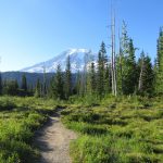
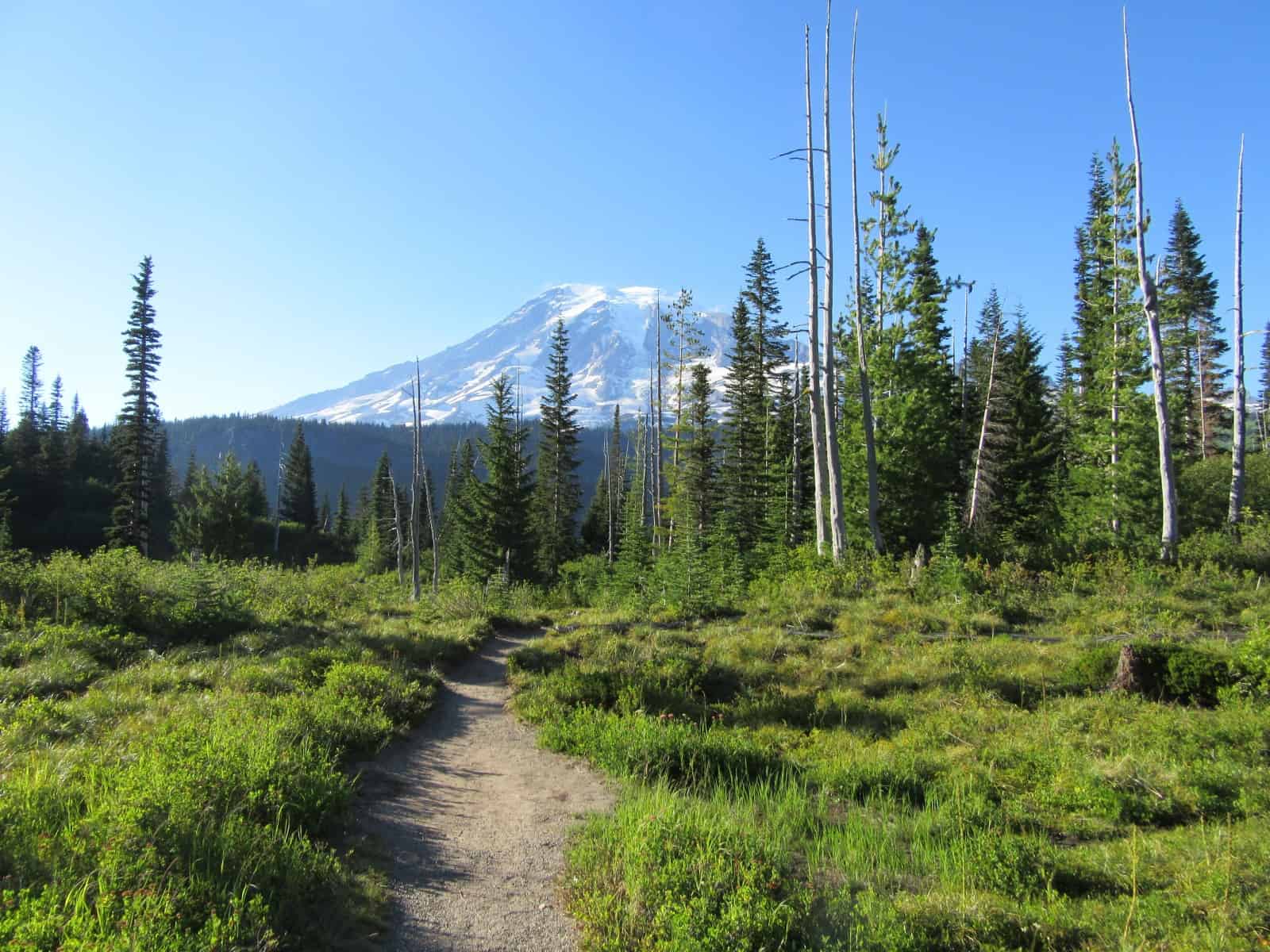
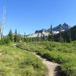
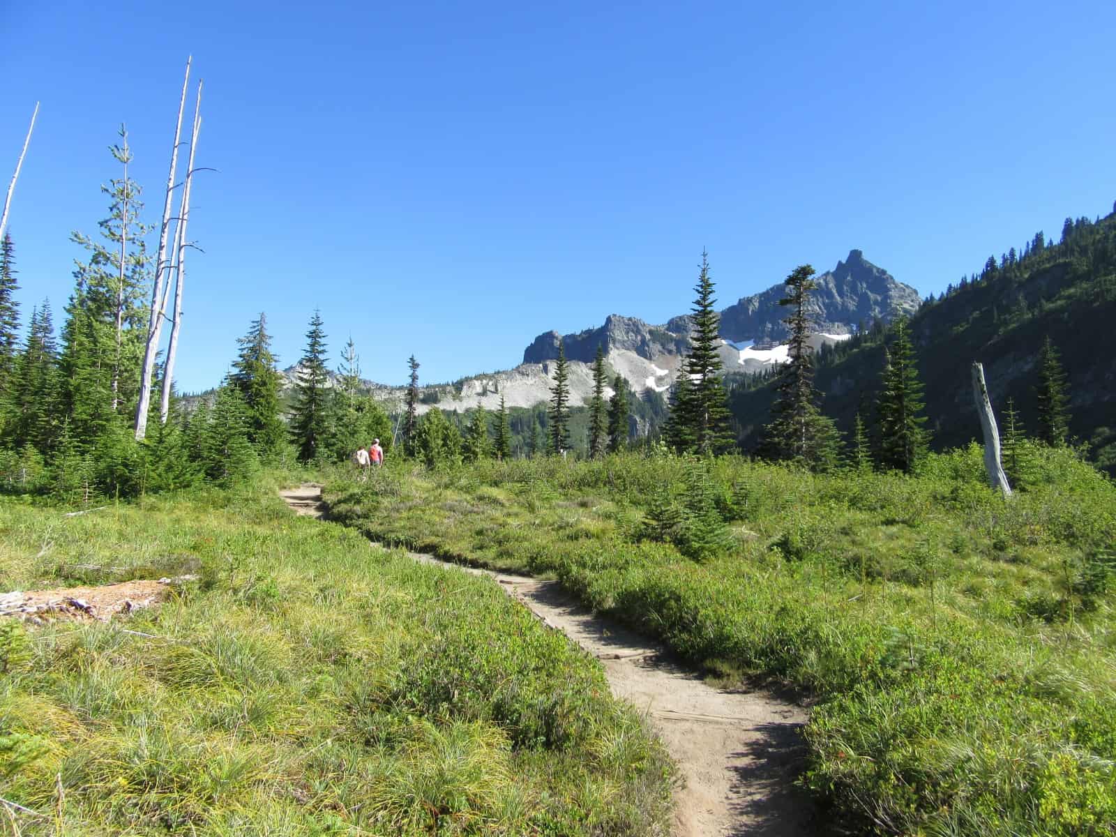
The way starts off climbing but soon grants a reprieve at a flat area known as The Bench. Here skirt a meadow and meander through thin clusters of trees and shrubs—the result of a long-ago fire. In summer The Bench is radiant thanks to copious wildflowers. In autumn The Bench is alive in color too thanks to berry bushes and mountain ashes. Be sure as you plod ahead, that you take a few glances back over your shoulder. Yep—Rainier is right there in all its beautiful snowy glory.
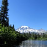
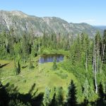
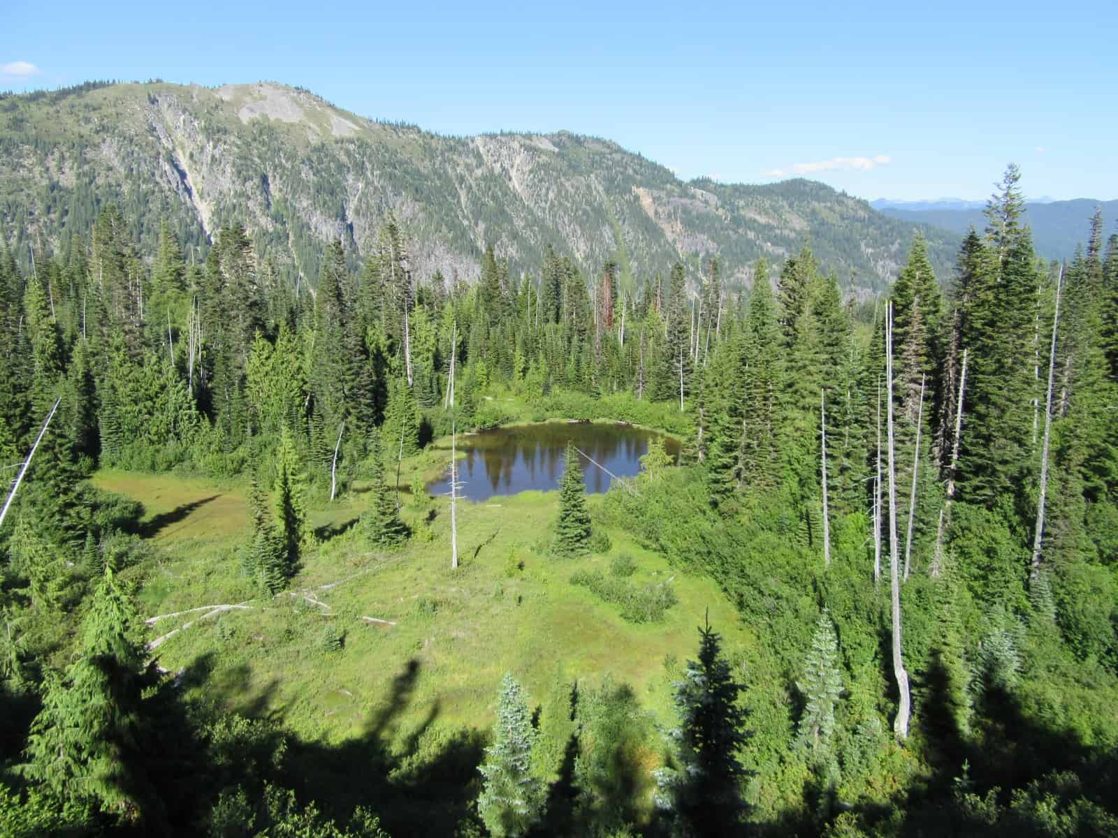
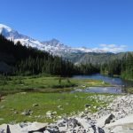
After a gradual ascent come to a ledge granting a view of a small pond below and a partial but good view of Rainier. Then continue hiking, steeply descending and reaching a junction at .6 mile. The short trail left drops some more soon coming to a fork. Ignore the one left and head right through a jungle of alders coming to the sandy shoreline of Bench Lake. Then cast your eyes across the lake and savor a spectacular backdrop of the mountain! When it’s calm, Washington’s iconic peak reflects beautifully on Bench’s waters.
After spending some time at Bench, head back to the main trail and continue hiking. The way descends a little to a small creek. Rock hop across it and then begin a steep climb. As you toil up a small ridge, be sure to look back over your shoulder at big beautiful Rainier. After cresting the ridge—guess what—yep, time to descend again. Then it’s one more uphill bout and you’re on a rib cradling Snow Lake.
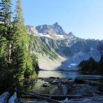
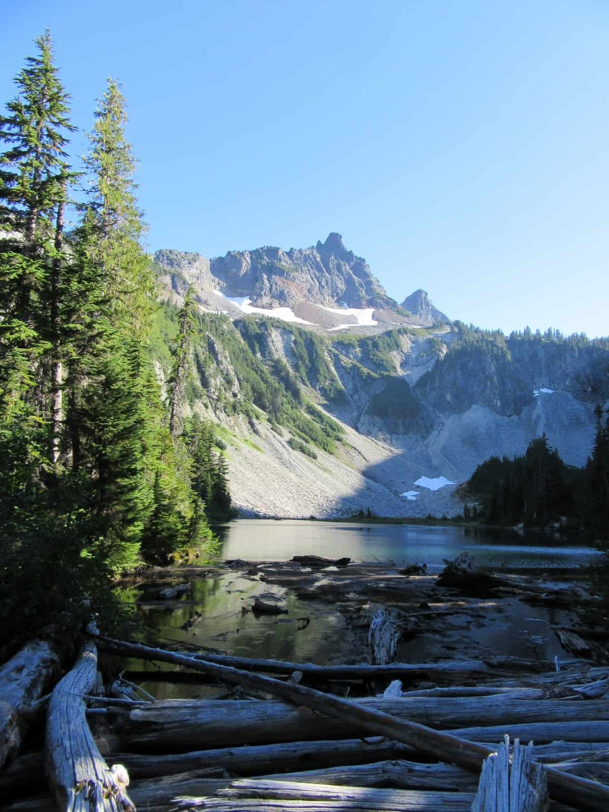
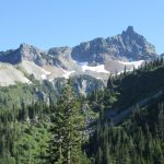
Come to a junction indicating backcountry camps to the left. Definitely, walk this trail left for 0.1 mile to a bridge spanning the log littered outlet of Snow Lake. Here you’ll be treated with a jaw-dropping view of the small lake with the appropriately named Unicorn Peak rising behind it. At 6,871-feet, Unicorn Peak is the highest summit in the Tatoosh Range. Its tall chimney-like rock pinnacle reminded some early park officials of the mythical horned-horse—hence its name. A small retreating glacier sits below the summit feeding Unicorn Creek which cascades down a rocky façade of ledge and talus. And as the lake’s name implies, snow usually hangs around the lake and basin well into summer.
Enjoy the view, but don’t go beyond the bridge unless you’re camping (permits required). Return to the junction and continue hiking. The trail soon comes to a ledge along the lake providing no stunning view but a good spot to take a lunch break. The trail continues a little farther reaching a small shallow upper lake where you can take in excellent close-up views of Unicorn Peak. The path officially ends at a small creek bubbling from a talus slope, but experienced hikers can go a little farther following a primitive path to the base of the large talus heap beneath Unicorn Peak.
If you decide to check this out—be sure to practice Leave No Trace Principles by staying on the established path and rocks. Travel on the talus is not encouraged as the loose rocks can be extremely dangerous. Enjoy the close-up views of the Unicorn and listen to tumbling water and to resident marmots and pikas. When you’re ready to return to the trailhead, prepare for an up and down journey taking solace that the downs are bigger than the ups!
Notes: Dogs-prohibited
Contact: Mount Rainier National Park; https://www.nps.gov/mora/index.htm; (360) 569-2211
Maps: Green Trails Mount Rainier National Park 269S
Trailhead directions: From Elbe, follow SR 706 east (passing through Ashford) for 14 miles to the Nisqually Entrance of Mount Rainier National Park. Then continue east on the park’s Paradise-Longmire Road for 17 miles bearing right onto the Stevens Canyon Road. Continue another 3.0 miles to the trailhead on your right.
Trailhead facilities: None (privies located at nearby Reflection Lakes Trailhead).
– Craig Romano is an author of more than a dozen hiking guidebooks including the newly released 100 Classic Hikes Washington (Mountaineers Books) which includes several hikes in and around Mount Rainier National Park.
Waypoints
| Starting Point: N46 46.065 W121 42.419 | |
| Notable Waypoints:
Bench Lake: N46 45.745 W121 41.946 Snow Lake: N46 45.443 W121 41.942 |
|
Q: Is swimming allowed at Bench and Snow Lakes?
A: Technically yes, Bench and Snow Lakes are not on the “closed water” list at Mount Rainier National Park. To see a list of the closed waters click here. Please keep in mind that swimming at alpine and subalpine lakes means cold water and inherent risk. There are no lifeguards on duty. Please exercise caution when recreating near and in water.