| Area: Carbon River |
Hike Type: Historic | Pass: Natl. Park Pass |
| Distance: 3 mi RT | Duration: 2 hrs | Difficulty Level: Moderate |
| Snow-Free: year-round | High Point: 2,150 ft | Elevation Gain: 350 ft |
-
- IMG 3050
-
- IMG 3031
-
- IMG 3045

Features: kid-friendly, exceptional old growth forest, bike-hike possibility, historic, year round
The Old Mine Trail is perhaps one of the least known trails within the national park. Yet, this short path is easily accessible and can be explored year round. Walk a short distance up the old Carbon River Road beneath a thick emerald canopy held together by primeval giants. Then steeply climb to a fern and moss shrouded ledge within the surrounding ancient forest for a peek into an old mine and a glimpse back into time.
Hit the Trail:
Before 2007 the hike to the old Washington Milling and Mining Company Mine in the Carbon River Valley was a mere .6 mile roundtrip. But in the autumn of 2006, heavy rainfall caused the Carbon River to flood and washout large sections of the Carbon River Road. Rather than reopen this prone-to-washouts road, park officials decided to permanently convert it to a trail. The road-trail is a pleasure to walk and can be done by just about any hiker young and old alike. The road-trail is also open to bicycles—so you can easily bike to the old trailhead and then do a short hike to the mine.
The Carbon River Trailhead has limited parking, so plan to possibly park on the side of the road leading to it if you’re visiting on a busy weekend. Be sure to have your park pass clearly displayed in your parked vehicle. At the trailhead you’ll find a privy and the old Carbon River Ranger Station. A newer ranger station was opened a couple of years ago on a new park land addition just to the west. You passed it on the way to the trailhead.
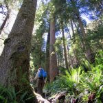
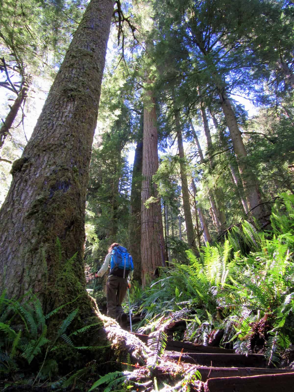
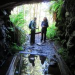
Now start walking up the old Carbon River Road. The road-trail pulls away from the roaring glacier-fed river, but remains in earshot of its constant roaring. The walking is easy with very little elevation gain. The surrounding forest is stunning—an emerald cathedral of towering ancient conifers. On sunny days, the thick canopy will do its best to keep you well shaded. And on overcast days the layered tree crowns will spare you from a soaking. When sunlight filters through the misty understory it creates an ethereal setting.
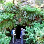
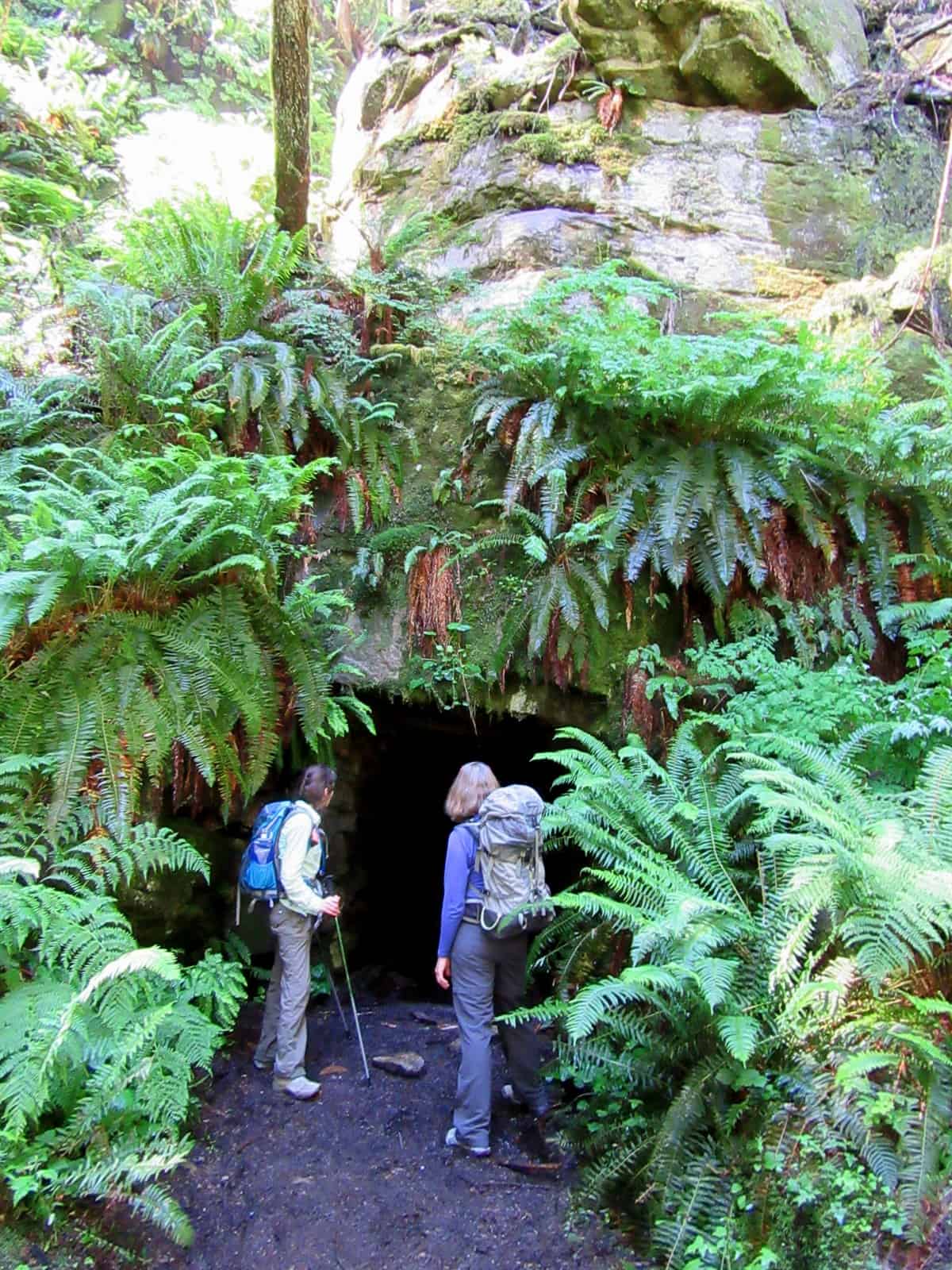
At about 1.2 miles you’ll come to what looks like it once was a road pullout. It’s the old indiscreet Washington Mine Trail. Take it leaving the nice and easy road grade behind. After a very short flat section, the trail climbs steeply. Insanely steep actually, but it’s a lot easier than it used to be. Trail crews recently upgraded this lightly traveled trail giving it a few tight switchbacks and lots of steps. You’re sure to get your heart rate up tackling this short but down-to-business trail.
Keep your mind off of the grunt by admiring the towering old trees lining the way. Your neck is sure to get as much strain as your quads. Primeval monstrous Douglas-firs. Western hemlocks, and Western red cedars here hold up the sky letting very little sunlight filter through the thick and elevated canopy. Enough light touches the forest floor however to allow for a thick groundcover of bushy ferns and thick mosses. Vine maples, salal, and salmonberry add to the dense vegetation creating a jungle-like understory.
After about 300 feet of climbing in .3 mile reach the old mine shaft nearly hidden by big boughs of ferns. You can peek a few feet in where a gate prohibits any deep probing. It’s pretty dark and you won’t see much of this more than 150 foot long bore. A short stretch of tracks for the mine carts survives, but nothing else. A funicular (incline railway) once ran from here to the valley floor to transport workers and supplies up to mine; and ore and workers back to the valley. A half dozen buildings once stood in this locale as well. You can see in the immediate area stumps and new growth where old growth trees were cleared and utilized in the construction of the mine buildings.
Unlike the nearby and copious old mines just outside of the national park boundary a little farther down the Carbon River Valley—coal was not mined here. In 1899, the same year that Mount Rainier National Park was established, the Washington Mining and Milling Company began looking for gold, silver and copper in the region. The company soon afterward made almost 40 claims, but never made any significant finds here. The company was responsible however for helping the park service build the original Carbon River Road more than a century ago. More than likely this mine was used for copper exploration. The Carbon River Valley downstream became a significant coal mining region and some successful mining operations also took place in Glacier Basin in the White River Valley within the park. But here in the park’s Carbon River Valley, the riches always were and remain, natural ones harvested by hikers in the form of incredible outdoors experiences and memories.
Contact: Mount Rainier National Park; https://www.nps.gov/mora/index.htm; (360) 569-2211
Maps: Green Trails Mount Rainier National Park 269S
Trailhead directions: From Buckley, follow SR 165 south. At 10.4 miles (just beyond Fairfax Bridge) bear left onto the Carbon River Road and continue for 7.7 miles to trailhead.
Trailhead facilities: Privy
– Craig Romano, is an author of more than a dozen hiking guidebooks including the newly released 100 Classic Hikes Washington (Mountaineers Books) which includes several hikes in and around Mount Rainier National Park.
Waypoints
| Starting Point: N46 59.704, W121 54.908 | |
|
Notable Waypoints: Mine Trail junction: N46 59.713, W121 53.470 |
|