| Area: Longmire | Starting Point: Longmire | |
| Distance: 6.5 miles RT | Duration: 6 hrs | Difficulty Level: Strenuous |
| Elevation Start: 2,687 ft | Elevation End: 4,437 ft | Elevation Gain: 1,750 ft |
-

- mildredpoint snowshoe02

-
- mildredpoint snowshoe01

Mildred Point offers one of the best views in the park, and no matter how far you snowshoe, this trail will not disappoint you – even on a foggy day the forest is mystical and the trail provides a good work-out. In summer Mildred Point is especially stunning with views of the heavily crevassed Kautz Glacier, the cubistic rubble of moraines, seldom-seen Pearl Falls, mountain goats and wildflower-dappled meadows. On a clear day Mildred Point can rival Paradise for its views and if you seek solitude you are more likely to find it there.
Be sure to have a hearty breakfast before you hit this trail! This is a demanding hike/snowshoe any time of the year (in summer it’s about 10 miles round-trip to Mildred Point with an elevation gain of 3,750 feet). We also recommend an early start or waiting until days grow longer and more snow has accumulated in the mountains. However, even snowshoeing part way as we did recently is an enjoyable and scenic experience.
Start from Longmire on The Wonderland Trail and ramble through old-growth forest near the Nisqually River. After a lazy half-mile or so through the sun-dappled forest you’ll cross the Nisqually-Paradise road (watch for traffic); where The Wonderland Trail continues. There a sign provides mileages for Mildred Point, Rampart Ridge and other destinations. As you gain elevation there are occasional views of Eagle Peak.
Much of the hike is in the trees and on a foggy day snowshoeing through the forest is like walking into an etching or a lithograph. Though the snowfall has been modest thus far this winter creating less than ideal conditions for snowshoeing it does make it easier to follow the trail. You may find as we did that you’ll need both traction devices and snowshoes depending on the condition of the snow.
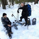
After finding a patch of sunlight we stopped for lunch; our lunches tend to be short in winter and we were soon ready to carry on. After a bit of a grind we reached the well-signed Wonderland Trail junction where Rampart Ridge and The Wonderland Trail continues (left). Here we turned right onto the designated trail to Mildred Point
As you proceed you’ll reach a signed junction for Comet Falls (the summer approach to Mildred Point via Van Trump Park). In winter the sign is likely buried by snow so if you don’t see it; continue along the ridge. There is little avalanche danger on this route that leads to Mildred Point but you should always be prepared for the unexpected. Park rangers will rightly discourage anyone from attempting the Comet Falls/Van Trump Park approach as that route is hazardous in the winter.
As the snow grew deeper we switched from traction devices to snowshoes. It had apparently been a while since anyone else had snowshoed to Mildred Point. There were no other snowshoe tracks though we could see the indentation of the trail in the snow and it was easy to follow.
The forest was so quiet that we ourselves grew silent in kind, not wanting to shatter the magical spell of the silver beauty surrounding us. Shafts of cascaded through the canopy of evergreens and as afternoon shadows deepened they cast intricate patterns on the snow.
As the snow grew deep and the trail grew steeper a couple members of our four-party group turned around; two of us carried on in a valiant attempt willing to gamble with Time, though constantly checking our watches. We ended up fudging our designated turnaround time in our eagerness to break out of the forest for those views of Mount Rainier and the Kautz Glacier. We were so close! Our push to reach the viewpoint conflicted with the need to get back to Longmire before darkness set in. This type of conflict is where snowshoers, hikers, and climbers can get into trouble. Common sense prevailed so we turned around short of the viewpoint and headed back. We turned around about a mile short and a couple hundred feet of elevation below the prow of Mildred Point.We were equipped withheadlamps but knew the snow would get icy on the way down as temperatures dropped and the sun went down.
If you get further than we did, you’ll enjoy expanding views of Mount Rainier as the trail breaks out of the trees. The view of Mount Rainier is guaranteed to incite awe; on a clear day you may also see Mount Adams, Eagle Peak, Copper Mountain, Pyramid Peak and Iron Mountain.
Stay well back from the edge of the trail at the viewpoint in winter; watch for cornices. A cornice is an overhanging edge of snow along a ridge-crest (or a peak). They are formed as wind deposits snow over breaks in the terrain (like a ridge-line) where it attaches and extends out horizontally.
Whether or not you get to Mildred Point in winter come back in summer as the deep forest transitions to a colorful chain of meadows; in late summer look for wildflowers. Then you can take time to revel in this setting; don’t be surprised if a mountain goat pops its head over the edge of Mildred Point curious to see what kind of creature you are.
For additional information on fees, rules and regulations, current trail and road conditions (including information about tire chain requirements in winter) and weather, call Mount Rainier National Park (360-569-2211) or visit their website at www.nps.gov/mora/ . The recommended map for Mount Rainier National Park is Green Trails (Mount Rainier Wonderland Map 269S).
– Karen Sykes
| Waypoints:
Longmire Starting Point: N 46-44-56, W 121-48-43 (2,745 feet) |