| Area: White River Area | Starting Point: Silver Creek Snow Park | |
| Distance: 10.4 mi RT | Duration: 7 hrs | Difficulty Level: Strenuous |
| Elevation Start: 1,750 ft | Elevation End: 3,825 ft | Elevation Gain: 1,075 ft |
-
- photo whiteriver 07
-
- photo whiteriver 04

-
- photo whiteriver 02
-
- photo whiteriver 05
-
- photo whiteriver 06
-
- photo whiteriver 03
Trailhead directions: From Enumclaw follow SR 410 for 33 miles turning left (just before Mount Rainier National Park entrance) onto the Crystal Mountain Boulevard. Then immediately turn right into Silver Creek Sno-Park.
If you ever wanted to play in the middle of a state highway, here’s your chance! Every winter, the Washington Department of Transportation closes State Route 410 (Mather Memorial Parkway) through Mount Rainier National Park. When the closure to traffic begins and when the road opens again fluctuates year to year dependent upon the snowfall. Except for the mildest of winters, it is a pretty sure bet that the road will be buried in snow from December through April.
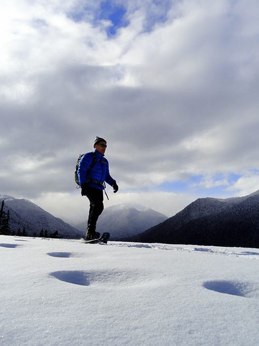
While that puts off any plans to drive through the northern reaches of the park during the winter months, it opens up a couple of other exciting recreational opportunities. Snowmobilers are allowed to use the road; but due to severe avalanche danger farther up the highway, the trip is too short and not worth it for most of them. That leaves the way for snowshoers and cross country skiers, with the latter often continuing onto Sunrise Road for longer and multi-night treks. For snowshoers, the road is just right for a day outing. The trip to the first viewpoint just beyond the Sunrise Road junction is a safe and easy family-friendly route mostly along the glacier-fed White River.
Folks who have regularly driven this stretch of highway will be pleasantly surprised at how much they miss when buzzing by at 55 mph. There are lots of big trees, and scenic river overlooks along the way. And wildlife observation opportunities are exceptional in the winter. Elk herds winter in the White River Valley and they can often be sighted on this trip. It’s not unusual too to have more hoof tracks in the snow than snowshoe and ski tracks. And where there are elk, there are cougars. The valley supports a large number of them. But don’t worry, chances are low you’ll actually see one of the big and secretive cats-you will however probably see their paw prints all over the valley.
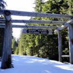
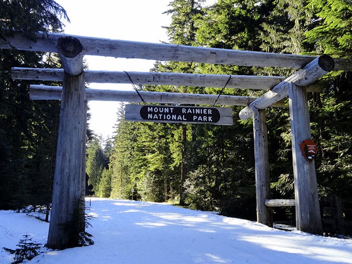
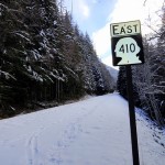
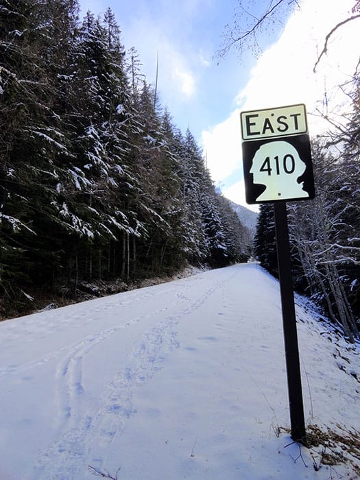
Starting from the Silver Creek Sno-Park, follow ski and snowshoe tracks to SR 410. Then turn left and snowshoe beneath the Mount Rainier National Park Entrance Arch. You’ll find some winter-relevant information posted here as well as permits which you can assign to yourself if you are planning on spending a night in the park.
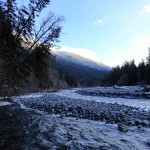
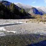
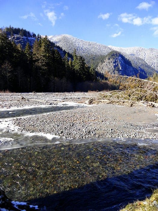
Now walk up the snow covered roadway beneath a canopy of ancient forest, enjoying a mile of near level easy going. Walk this way after a new snowfall and note a myriad of tracks attesting to all of the forest denizens who beat you to the path this morning. After a mile of very pleasant walking the way brushes right up alongside the crashing glacier-fed White River. Enjoy the scenery-views you miss in the summer when you are cruising down the highway.
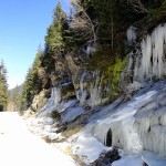
Admire frosty cliffs on the steep sloped Sourdough Mountains forming a formidable wall along the river’s west banks. Mount Rainier is hidden here, so you’ll have to keep snowshoeing if you want to see it. When you get a gap in the overhanging forest canopy, look left and up to admire the emerald wall of Crystal Mountain to the east.
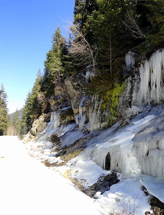
At about 2.0 miles you’ll reach a dark river flat graced with beautiful stands of ancient cedars. Shortly afterward the way begins to climb leaving the valley floor. Pass a series of springs bubbling out of Crystal’s steep slopes. In winter they create beautiful icy stalactites along road cut ledges. Now leaving the river behind, it fades from view but its roar is continuously heard in the background.
Soon after passing Crystal Creek and the trailhead for the popular Crystal Lakes you’ll reach a junction with the Sunrise Road at 4.8 miles. While you certainly can snowshoe up this road too, it’s more popular with skiers who are accustomed to traveling greater distances than snowshoers. Never-the-less, this isn’t the end of the road for your trip.
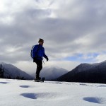
If avalanche danger is low, continue up the Mather Memorial Parkway another .4 mile to the edge of an old avalanche chute for an excellent view of Mount Rainier hovering over Goat Island Mountain and the White River Valley. One of the best views of The Mountain from along the highway, you’ll have it all to yourself-no motorcyclists, RVers and cars loaded with campers to share it with.
After you are through marveling at The Mountain, begin your march back to your vehicle. Under no circumstances should you continue farther up SR 410 as it crosses one dangerous avalanche chute after another beyond this point. Enjoy instead a nice leisurely return to the trailhead. Chances are good that you may see some elk.
| Waypoints:Trailhead at Sno-Park: N 46 58.746 W 121 32.082 Sunrise Road Junction N46 54.947 W121 32.136 Viewpoint over White River Valley: N46 54.624 W121 32.206 |