| Area: Crystal Mountain |
Hike Type: Mountain ridge | Pass: NW Forest Pass |
| Distance: 12.7 mi RT | Duration: 8 hrs | Difficulty Level: Difficult |
| Snow-Free: mid July – Oct | High Point: 6,872 | Elevation Gain: 2,900 |
-

- IMG 3578
-

- IMG 3640
-
- IMG 3644
-
- IMG 3612

-

- IMG 3605

-
- IMG 3626

-

- IMG 3628

Features: sweeping alpine views, wildflowers, dog-friendly, alpine meadows
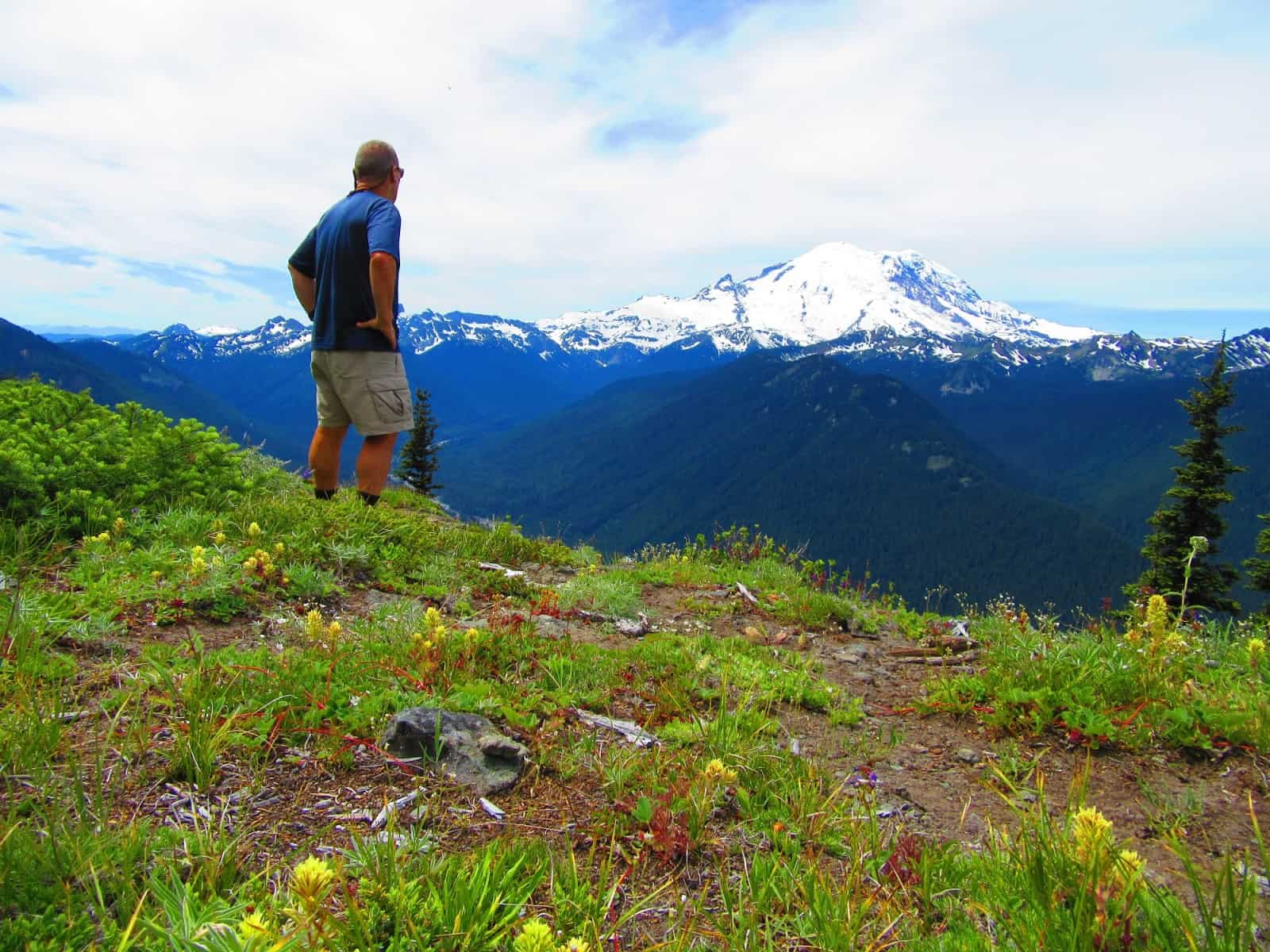
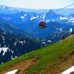
Most folks know Crystal Mountain as a top-notch ski resort. But ambitious hikers can enjoy this long broad multi-summited mountain, too. Follow an adventurous trail through forests, meadows, and across ski slopes to a ridgeline traverse of the lofty mountain. In summer, admire a dazzling array of blossoming wildflowers. Throughout hiking season feast on sweeping horizon-spanning views. And stand mouth agape at the many close-up views of majestic Mount Rainier along the way.
Hit the Trail:
There are several ways you can approach this hike. Strong hikers can do the entire Crystal Mountain Trail—up and over the mountain—and then following the Silver Creek Trail to Forest Road 410 for a long and challenging all-day 12.7-mile hike. If this is too much, consider the following options. You can do a 6.4-mile out-and-back to the first viewpoint—or take the gondola to the summit and hike one-way downhill 6.0 miles or 6.7 miles—depending on which direction you choose to take.
To do the entire loop, start from the Sand Flats Horse Camp. Locate the trailhead south of the camp and immediately cross Silver Creek on a wide bridge. Come to a ski area service road and turn right walking a short distance on it. Now come to the official trailhead (unsigned) —a rather unimpressive start along a utility line. The trail follows the line for a short way before entering young forest. On rocky tread, the way works its way upward. Stick with it—it gets better—much better!
The transition from hemlock forest to fir forest. Climbing higher the trail skirts below impressive cliffs. Soon afterward window views to the north begin opening up. Pass a small wetland cupped in a rocky fold. Then start gaining elevation more steadily. Views expand northward to Castle Mountain and Norse Peak. At about 3.2 miles crest Crystal Mountain’s long summit ridge and come to a meadow (el. 5500 feet) granting a good view of Mount Rainier. This is a good spot to have lunch and turn around if the full loop is too much.
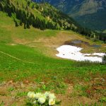
Otherwise, keep hiking winding up and along the summit ridge. The way brushes up along the national park boundary undulating between forest groves and meadows. Climbing higher the trail traverses along a clifftop. Catch your breath here as the views will knock the wind out of you. Stare straight down to the White River Valley and then across it to big bold Rainier. Admire also the pyramidal peaks of the Sourdough Mountains stretching north from the mountain. And locate the Buck Creek Air Strip and Sun Top Mountain to the north. In early season this rocky stretch is adorned with dazzling wildflowers.
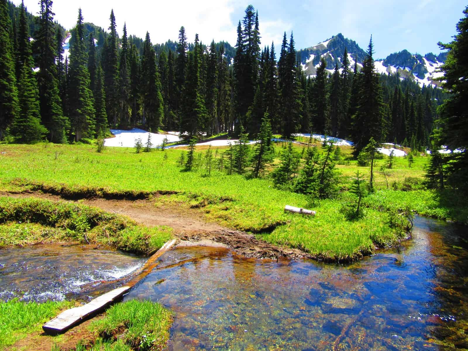
The way continues to climb passing meadows often sporting big game. Next negotiate a steep slope that often retains a potentially dangerous snowfield crossing until mid-July. Climbing higher and traversing more meadows—the views expand now including Glacier Peak, the Olympics and the jagged summits surrounding Snoqualmie Pass.
At about 5.3 miles the trail emerges on a ridgeline ski service road. Follow it soon coming to a junction just beneath 6,776-foot Northway Peak. By all means hike the short distance left to this Crystal Mountain summit sorting a chairlift. Enjoy the excellent views of the ski area basin and Silver Creek Valley. Admire a small sparkling tarn below. Then continue hiking now following the ridgeline service road. By this point, don’t be surprised if you start running into other hikers. Many folks who take the gondola up Crystal stretch their legs with a short hike to Northway.
At 6.0 miles reach another road junction. Here you can walk a short distance to the Summit House at 6,872-feet. When the gondola is in operation, you’ll have lots of company. Many folks come for the scenic ride and then just mosey around the summit. The Summit House is usually open from late-May to mid-September outside of its ski season schedule. You may want to consider having lunch there—the food is superb—as well as the ambiance!
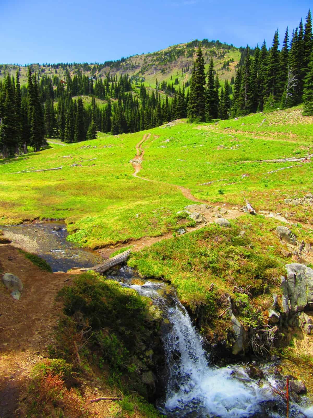
To continue the loop, hike south still on a ski service road with mouth-gaping views of Mount Rainier. Now descending the road heads for a saddle between the knoll housing the Summit House and 7,002-foot Silver Queen, highest peak of Silver Mountain’s many summits. The road eventually ends at a wide-open slope. Here pick up the trail once more and make a few sweeping switchbacks down into an open basin. The views are superb, and so are the wildflower displays throughout most of the summer.
Skirt a small tarn and a disc golf course (be alert for flying discs). Then enter the forest and make a traverse across steep slopes. The way ducks beneath a chairlift line and crosses a couple of service roads before coming to a beautiful cascading creek. Cross the creek and enter the old-growth forest. The way then eases its descent eventually coming to another cascading creek. Cross this one too—which may get your feet wet in the early season. Here a short path leads right to Elizabeth Lake—a peaceful spot tucked in a valley between The Throne and Silver King, two more of Crystal’s summits.
The trail continues southeast crossing a series of small creeks. At 8.4 miles come to a junction. Here a trail heads right to the Pacific Crest Trail at Bear Gap. You want to go left soon coming to pretty littler Henskin Lake. Pass the lake and continue descending passing through the site of Jim Town, an old mining settlement. At 8.9 miles come to a junction with the Silver Creek Trail. Take a left here and make a long descent. After passing a mine shaft and cascading creek—traverse a wide grassy ski slope and reach Forest Road 410 (Gold Hill Road) at 10.6 miles. To finish the loop follow the road left—a long and uneventful—but generally peaceful walk for 1.9 miles. Just past the Norse Peak Trail, locate the horse trail leading left leading back to Sand Flats. Take it—crossing Crystal Mountain Boulevard and returning to your start in .2 mile for a grand total journey of 12.7 miles. Well done! Now get some rest and reflect on this incredible hike.
Notes: Trails open to horse and bikes. Stay out of mines and leave all artifacts for others to enjoy as well.
Contact: Snoqualmie Ranger District, Enumclaw office (360) 825-6585 or www.fs.usda.gov/mbs
Maps: Green Trails Mount Rainier National Park 269S
Trailhead directions: From Enumclaw head east on SR 410 for 32 miles turning left on the Crystal Mountain Road (just before the Mount Rainier National Park entrance). Continue for 4.5 miles turning right on the access road to Sand Flats Horse Camp. Proceed 0.1 miles to the trailhead at camp. Park away from campsites.
Trailhead facilities: Privy.
– Craig Romano, is an author of more than a dozen hiking guidebooks including the newly released 100 Classic Hikes Washington (Mountaineers Books) which includes several hikes in and around Mount Rainier National Park.
Waypoints
| Starting Point: Trailhead at Sand Flats: N46 57.645 W121 28.844 | |
| Notable Waypoints:
Northway Peak junction: N46 56.613 W121 30.007 Summit House: N46 56.097 W121 30.033 Henskin Lake Trail junction: N46 55.059 W121 29.087 |
|