| Area: Randle | Pass: No Pass Required | |
| Distance: 7 miles, RT or 14.5 mile loop | Duration: | Difficulty Level: Intermediate |
| Elevation Start: | Elevation End: | Elevation Gain: 1,600 ft |
| Prime Season: July – October | ||
-
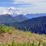
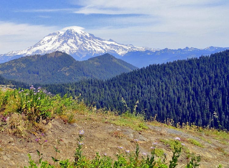
- a views of Mt Rainier and the Sawtooth Ridge from old cuts along the way
-
- c allen Mountain from Greenwood Lake Trail
-
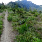
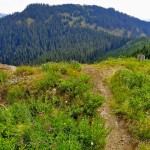
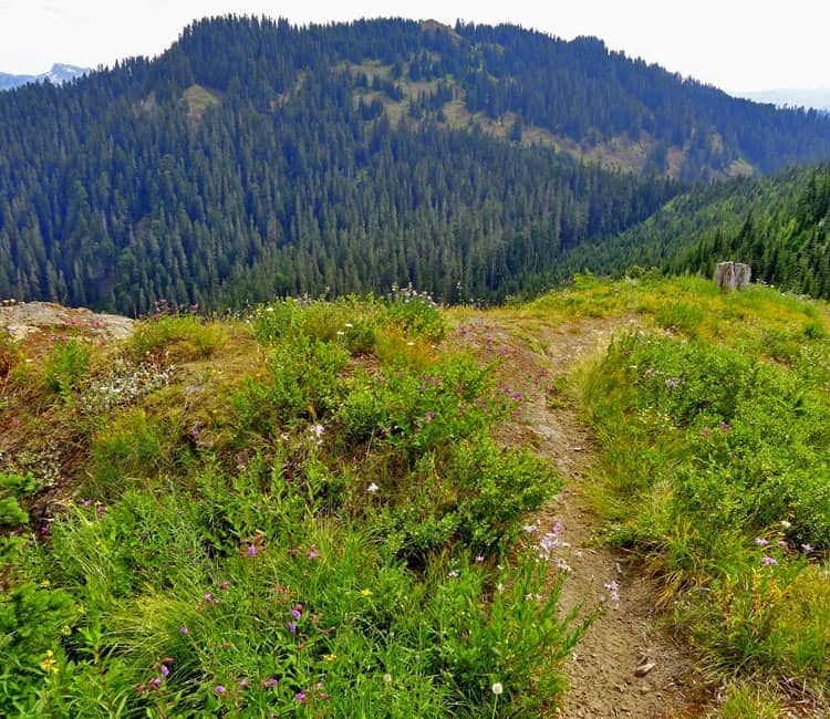
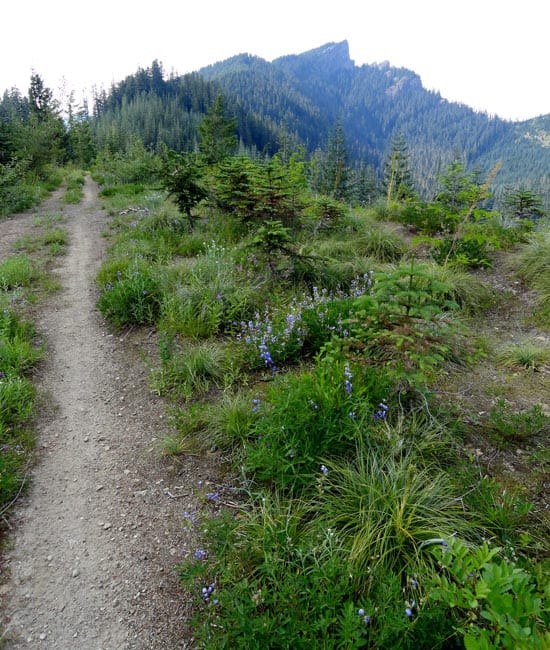
- beargrass lined trail and High Rock hovering in background
-
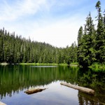
- b greenwood Lake set among ancient trees

One of the region’s least traveled trails, a handful of surprises awaits those who venture upon it. Cruise along a high ridge admiring big trees, showy wildflowers, and far reaching views. Good chance too, you’ll have it all to yourself.
Lying just to the south of the fairly popular High Rock Trail, very few people hike or bike the Greenwood Lake Trail. For one thing, most folks don’t even it exists. There are no signs and the approach isn’t obvious. Secondly, the area surrounding the lake was intensely logged in the 1980s and 90s. But pockets of old growth and mature timber still grace the way. And the areas that were cutover a couple of decades ago-they now sport brilliant wildflowers come mid-summer and excellent views from Mount Rainier to Mount Adams any time of the year.
The approach is easy enough too. From across the road from the High Rock Trailhead, locate a closed to vehicles spur road taking off south. Follow it. On a double track lined with bear grass admire a nice view of Mount Rainier and the Tatoosh Range to your left. Stop for a minute too to cock your head back and enjoy a good view of High Rock with its historic lookout teetering on its precipitous summit.
After about .25 mile the double track ends and the real trail begins. Old growth forest too. Now start descending. The tread is good but be aware of face-whackers; vine maple branches creeping over the trail. The trail is a little brushy in spots too, so that’ll keep you concentrating on the way as well. Skirt beneath some ledges and a large fallen fir before crossing a small creek (el. 4,000 feet). Then begin grinding upward beneath a canopy of big hemlocks.
The way steepens in spots, but that’s the worst of it-the rest of the trip to the lake is pretty enjoyable. At 1.5 miles reach an old logging road (FR 8518-036) at Cougar Gap (el. 4,460 feet). The Allen Mountain Trail takes off from the road a short distance to the left. The Greenwood Lake Trail continues right staying just below a ridge crest and traversing an old cut. Enjoy excellent views north of High Rock, Sawtooth Ridge, and Mount Rainier.
At .4 mile from Cougar Gap pop up on an old logging road spur. Turn right and pick up the trail again shortly afterward. Continue to climb traversing an old cut draped in bear grass and gorgeous wildflowers. Enjoy excellent views south of nearby Purcell Mountain and Whalehead Ridge and to Mount Adams, Mount St Helens and the Goat Rocks in the distance. Reach a small gap on the ridge crest (el. 4,800 feet) and once again enter a mature forest. Now on smooth tread begin a downward journey.
A few brushy spots will keep your speed in check as you wind downward into cool old growth forest. At 1.8 miles from the trailhead note, a spur left dropping to a nice camping area and great access to the forest flanked Greenwood Lake (el. 4,460 feet). Small and placid, the lake’s waters reflect the surrounding primeval evergreens. Take a break or continue riding.
The trail continues west crossing the lake’s outlet on a slanted bridge that’s close to collapsing for good. It then slowly ascends and traverses a steep side slope before ending at 3.5 miles at FR 8511 (el. 4,600 feet) at the edge of an old cut. Retrace your route or consider a loop back to the trailhead by utilizing a series of old logging roads.
For the loop, bike west on FR 8511 along a cut-over ridge. Enjoy good views south before descending. The lightly used road ends in about 3.2 miles at FR 85. Turn right on this road and pedal about 3.3 miles to FR 8440. Then turn right and slowly pedal uphill along Catt Creek returning to the trailhead in 5.0 miles.
Directions to Trailhead: From Elbe, follow SR 706 east (passing through Ashford) for 10.1 miles. Turn right (south) onto Skate Creek Road (FR 52) and follow for 4.7 miles. Turn right (south) onto graveled FR 84 and follow for 6.8 miles bearing right onto FR 8440. Continue 2.7 miles to the trailhead for High Rock. Park here; Greenwood Lake Trail begins on old road spur south of the High Rock Trailhead.
Miscellaneous information: Greenwood Lake Trail No. 253 is also open to motorcycles, but motorized use on this trail is extremely light. Actually, all uses on this trail are fairly light, except for the western end of the trail which sees a handful of fishermen and women taking the short way to the lake. As of the summer of 2012, the trail was in decent shape with just a few brushy spots and a couple of fallen trees. The fallen trees will require a bike hoist up and over. No other major obstacles along the way except for some rocky tread between the trailhead and Cougar Gap.
If you consider the loop, note that FR 8511, and FR 85 see little (if any) maintenance and while they are rough for vehicle passage (high clearance suggested), they shouldn’t pose too many problems for biking. FR 8440 is in fine shape for bikes. While some sources suggest extending your trip by biking the Allen Mountain Trail (no. 269), I caution against it. That trail is overgrown in spots, has fading and very rough tread and lots of obstacles. It is okay to hike (although difficult in spots and not recommended for all but experienced hikers) and any bikers who consider it should be extremely experienced with riding difficult terrain.
Green Trails Map Randle, WA no. 301 shows this trail and the nearby Osborne Mountain Trail which also offers good mountain biking. Contact Cowlitz Valley Ranger Station (Randle), Gifford Pinchot National Forest for updated information on this trail and access roads; (360) 497-1100; http://www.fs.usda.gov/giffordpinchot
– Craig Romano, Hiking guidebook author of nine books
Waypoints
| Starting Point: 46.6665,-121.89139999999998 | |
| Notable Waypoints:
Trailhead: N 46° 39.988′, W 121° 53.493′ |
|