| Area: Carbon River |
Hike Type: Glacier views |
Pass: Natl. Park Pass |
| Distance: 17.5 mi RT | Duration: 6 hrs | Difficulty Level: Strenuous |
| Elevation Start: 2,300 | Elevation End: 3,600 | Elevation Gain: 1,300 |
| Snow-Free: Early-May – Late-Nov |
-
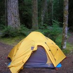
- Campsite at Ipsut Creek Campground

-
- Carbon Glacier from Suspension Bridge

-
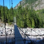
- Suspension Bridge over Carbon Glacier

-

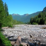
- Cataract Creek

-
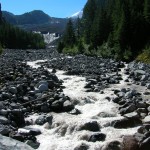
- Carbon River with Carbon Ridge in background

-
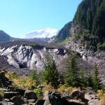
- Snout of Carbon Glacier with Mount Rainier rising in the background

-
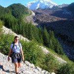
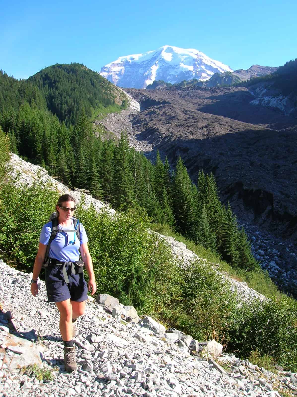
- A hiker on the Wonderland Trail at the Carbon Glacier
EDITOR’S NOTE: The Carbon River Road is now closed due to the Flood of 2006. This trail now begins 0.5 miles after the Carbon River Ranger Station. The five miles of the former Carbon River Road to the Ipsut Creek Campground is now included in the hiking mileage. Be prepared to cross washouts. Wear sturdy shoes and carry the ten essentials. For another option, bring a mountain bike, carry a bike lock, and bike this five miles to the trailhead at Ipsut Creek Campground.
What chance do you ever have of seeing a river being born? Here’s a great opportunity right in Mount Rainier National Park. That’s right. You can get up close to the Carbon Glacier in one of the most popular hikes on the northwest side of Mount Rainier National Park. When you get to the terminus of the Carbon Glacier, you’ll see huge chunks of ice and flowing water — breaking out of an ice cave — the headwaters of the Carbon River.
For an early spring hike, in May, this is one of the places to tune up those hiking muscles.
How to get there: From Puyallup, travel 13 miles east on Highway 410 to Buckley, turn right (south) onto Highway 165, and proceed through Carbonado. Continue to the Carbon River Entrance of Mt. Rainier National Park.
Start your hike on the former Carbon River Road. Devastating flooding in 2006 washed out the Carbon River Road in multiple places. Some sections of this three-mile stretch are on the wide gravel surface of the former roadbed. In several places, cross new pedestrian bridges and follow recently constructed trails. Walk through this lush river valley and take in the surroundings of the temperate rainforest. View areas where the river now flows along the former roadbed. This walk provides an excellent example of nature’s extreme power.
Upon reaching Ipsut Creek Campground, find the trailhead just past the campground at the end of the road. The trail heads upstream. You can hear the rushing Carbon River, flowing nearby. The sound will recur throughout the hike, reminding you of the prize at trail’s end. For the first 1/10 of a mile, you’ll leave boot prints in sandy deposits left on the path by the glacier before arriving at the junction of a side trail to Ipsut Falls.
Go left at the junction and proceed to climb through the forest for another 1/10 of a mile to the junction of the Ipsut Pass Trail, where another left is in order. The trail climbs further through the forest above the river, eventually turning back toward the river, and rejoining the old roadbed. Now, you’re above the roaring river, its powerful force pushing big, clunking boulders downstream.
Rounding a ridge, the trail offers you a first view of the glacier, still 1.5 miles upstream. Then, the trail re-enters the forest and heads back uphill away from the main course of the river. It winds below cliffs and rock debris from the ridge above. Spring floods waters on the forest below have forced the Park Service to reconstruct the trail on this higher ground.
At 2 miles from the trailhead, you’ll reach a junction with the Northern Loop Trail. Veer right and keep on climbing past Carbon River Camp at 2.8 miles. Past the camp, the trail drops to a footlog that stretches across Cataract Creek, just below one of the low falls of the same name. This is one of the most dramatic falls in the park. n
After crossing a log bridge, at the far side of the creek, you’ll find a junction with the Seattle Park Trail. Stay left here, and go up a short hill to a suspension bridge over the Carbon River, 3 miles from the trailhead. The bridge will generate some adrenaline. It’s high over the river and sways and bounces slightly as you navigate its planks.
Once across the river, go right on the trail. It begins to climb steeply under cliffs wiped smooth by glacial action. This is the steepest part of the trail, and it gets you to the viewpoint of the glacier’s frozen snout at 3.6 miles from the trailhead.
Take time to appreciate the sight of the glacier, which contains the mountain’s thickest ice (700 ft thick). The glacier is over 4.5 miles long to this the lowest elevation of any glacier in the lower 48 states. It is named because of its atypical black appearance indicative of the protective mantle of dark rock debris that protects the glacier from retreating more than it has.
Stay back! Don’t be tempted to approach the glacier face. Boulders frequently melt out and come bouncing down. You’re already closer than anyone except the professional geologists who have experience working near the glacier.
Take pictures to capture this moment. Return to your car content that you had a scientific adventure of a lifetime.
– Karen Sykes
Waypoints
| Starting Point: 46.97755861841651, -121.8314266204834 | |
| Notable Waypoints:
Carbon Glacier: N 46° 56.744 W 121° 47.441 |
|
Q: Can I camp at Mowich campground and do the Carbon Glacier Trail?
A: Yes, you could but it’s a bit of a drive from the campground to the trailhead. It’s approximately 30.5 miles, the typical drive time is 90 minutes.