| Area: Ashford / Skate Creek Rd |
Hike Type: Off the Beaten Track | Pass: No Pass Req |
| Distance: 10 mi RT | Duration: 6 hrs | Difficulty Level: Moderate |
| Elevation Start: 2,475 | Elevation End: 4,825 | Elevation Gain: 2,350 |
| Snow-Free: July – October |
-
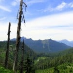
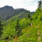
- views northwest to High Rock and the Sawtooth Ridge

-
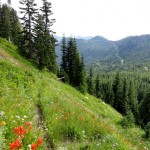
- The trail traverses slopes of wildflowers 2

-
- High Rock seen from beginning of hike
-
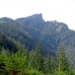
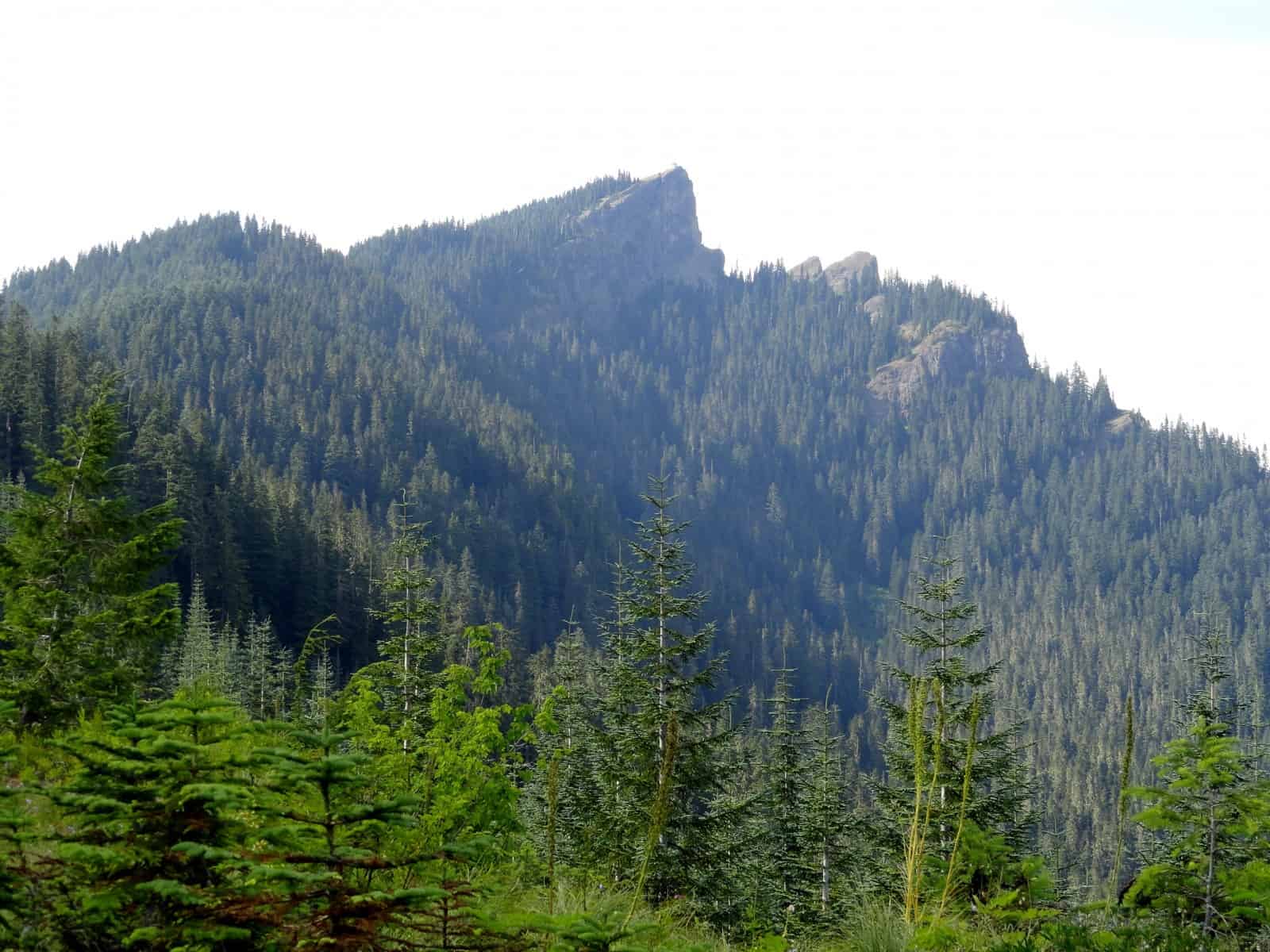
- trail skirts beneath Allen Mountains summit

-
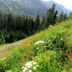
- The trail traverses slopes of wildflowers

Little-known and little visited, Allen Mountain’s allure is its solitude. Deer and other wild critters are prolific on this 5,095-foot mountain. Hikers are not.
A fairly nondescript peak located just south of the precipitous and prominent High Rock, Allen Mountain sees very few boot prints. Hoof and paw prints, however, are another story. Located in an oft-forgotten corner of the Gifford Pinchot National Forest, much of the surrounding landscape was intensively logged in the past. But, groves of old-growth forest still cover the mountain and its high ridges are carpeted with wildflower meadows. The going can be a little rough-the tread fading in places-but experienced hikers seeking good views, chance wildlife encounters and a backcountry all to themselves will be satisfied.
The Allen Mountain Trail begins at Cougar Gap and travels east to FR 8460. It doesn’t lead to the mountain’s summit-although experienced off-trail travelers can easily bag it-but instead runs along the peak’s south-facing slopes. En route the trail traverses sprawling meadows, skirts ledges and makes a few steep drops and ascents. Views are excellent to Mount St Helens and rows of emerald ridges and peaks south; and there are some good views north too, to the Sawtooth Ridge and Mount Rainier.
The eastern approach via FR 8460 can be rough and not recommended for most vehicles. The preferred route is from the west via the Greenwood Lake Trail. Locate this trail across the road from the High Rock Trailhead. It begins on a closed to vehicles spur road taking off south. Hike the old jeep track along an open ridge lined with bear grass. Look back to admire High Rock with its historic lookout. And look northeast at Mount Rainier dominating the landscape.
After about .25 mile the jeep track ends and the trail begins. The way descends about 400 feet into old growth forest before crossing a small creek. It then steeply climbs reaching a logging road at the edge of an old cut at Cougar Gap (el. 4,460 feet). Walk on the road a few steps to the left and locate the Allen Mountain Trail marked with a bent post denoting Trail no. 269.
The trail takes off northeast through brushy meadows. Route finding may be a little tricky here, so pay close attention to the tread. Watch for burrows too in the trail, lest you twist an ankle. The way then begins to steeply climb up Allen’s west face via a series of tight switchbacks. The tread is sketchy over rocky sections and through overgrown meadows, but you should be able to follow the way with minimal navigational complications. The trail gets much better so don’t get discouraged. Showy wildflowers and emerging views of Mount St Helens should help ease any frustration along the way.
The grade eventually eases, as the trail now traverses groves of old trees. At about 1.2 miles from Cougar Gap emerge upon sprawling herbaceous flowering meadows. The tread disappears here. Carefully contour across the slope to once again pick up the trail. The way becomes more defined as you continue hiking east. After reaching a high point of about 4,825-feet, the trail gently dips and climbs to round a shoulder. It then steeply switchbacks downward passing below some ledges. Pause to take in some good views of Mount Adams and the Goat Rocks.
At about 2.2 miles from Cougar Gap the way enters a grove of towering trees before coming to the edge of an old clear-cut. Now traversing the cut, slowly descend to a 4,270-foot gap providing excellent views of lush wetlands below and Mount Rainier towering above in the background. Then begin climbing again to round a knoll (el. 4,590 feet) and skirt some cliffs. From here the trail continues across a brushy slope, but the views out to Rainier and the Sawtooth Ridge warrant hiking across it. At 3.5 miles from Cougar Gap the trail terminates at FR 8450 (el. 4, 470 feet). Turn around and enjoy the views once more. Perhaps on your return now later in the day you may be fortunate to witness some wildlife. The chance of seeing fellow hikers however are pretty slim.
Notes: The Allen Mountain and Greenwood Lake Trails are also open to mountain bikes and motorcycles. Motorized use is light on the Greenwood Lake Trail and practically non-existent on the Allen Mountain Trail. This hike is lightly used and is recommended for experienced hikers with some navigational skills. The Allen Mountain Trail sees some use during autumn hunting season, so be sure to don orange. Beyond the small creek crossing on the Greenwood Lake Trail this hike is dry-pack adequate water. Trail receives minimal maintenance, so expect downed trees and brushy sections. FR 84 and FR 8420 were graded in the summer of 2012 and are both in good shape and drivable for passenger cars. Green Trails Map Randle, WA no. 301 shows this trail and the adjacent Greenwood Lake Trail. Contact Cowlitz Valley Ranger Station (Randle), Gifford Pinchot National Forest for updated information on this trail and access roads; (360) 497-1100; http://www.fs.usda.gov/giffordpinchot
Getting to Allen Mountain (via Greenwood Lake Trail): From Elbe, follow SR 706 east (passing through Ashford) for 10.1 miles. Turn right (south) onto Skate Creek Road (FR 52) and follow for 4.7 miles. Turn right (south) onto graveled FR 84 and follow for 6.8 miles bearing right onto FR 8440. Continue 2.7 miles to the trailhead for High Rock. Park here; Greenwood Lake Trail begins on old road spur south of the High Rock Trailhead.
– Craig Romano, Hiking guidebook author of nine books
Waypoints
| Starting Point: 46.6665,-121.89150000000001 | |
| Notable Waypoints:
Trailhead: N 46° 39.988′, W 121° 53.493′ |
|