Distance: 21.5 miles one way
Elevation Gain: 6,300 feet
High Point: 6,700 feet
Snow free: mid-July — October
introduction
The Wonderland Trail travels for 93 miles around Mount Rainier. Constructed in 1915, it is one of the most beautiful, challenging, and popular hiking trails in America. The trail can be hiked in its entirety as a through hike usually typically taking 8-14 days to complete; or in shorter sections. Most people begin from Longmire and hike clockwise. This series of Wonderland Trail articles is meant as an introduction of what you can expect on this amazing trail. Be sure to consult with park officials for complete rules, permitting information and trail conditions before setting out. Consider too, these two excellent resources for more details: Green Trail Maps Mount Rainier Wonderland Trail Map 269S and Hiking the Wonderland Trail by Tami Asars (Mountaineers Books).
special information
Overnight permits required and can be acquired by making reservation in advance; or at the Longmire Wilderness Information Center (360) 569-445; Carbon River Ranger Station; or White River Wilderness Information Center. View complete permit information and park and trail rules and regulations.
Special rules: No Fires—use camp stove. Dogs prohibited.
Notes and special concerns: Spray Park Trail can be used as an alternative route to the Carbon River. However, this highly scenic route crosses permanent snowfields and can be treacherous in early season and inclement weather.
Trailhead directions: (South) From Buckley, follow SR 165 south for 10.3 miles bearing right on road to Mowich Lake. Continue another 16.8 miles (pavement ends at 1.6 miles) to road end at Mowich Lake. (North) From Enumclaw follow SR 410 east for 37.5 miles to Mount Rainier National Park, turning right onto the White River Road. Continue for 15.4 miles to Sunrise.
the hike
Mowich Lake (el. 4950 feet) is the largest and deepest in the park and shares its name with the Mowich River and Mowich Glaciers. Mowich means deer in the Chinook Jargon. Early Native Americans spotted within the glaciers and rock on Mount Rainier’s northwest side the figure of a deer. See if you can spot it—although it is most discernible from Spray Park. An easier site to spot is the Mowich Lake Patrol Cabin. Located a short distance from the camping area via a side trail, this 1922-built structure overlooks the lake and is still used by park personnel.
From the campground, the Wonderland Trail heads north crossing the lake’s outlet on a bridge and then hugging the pretty lake’s western shoreline. While the mowich figure on Mount Rainier might be elusive to decipher, you should have no problems sighting the real thing along the lake’s shores. Deer are profuse here. The trail rounds small coves and skirts lakeside ledges providing nice glimpses across placid waters to Fay and Castle Peaks and massive Mount Rainer. Beyond the lake, the trail commences a gentle climb through cool old growth forest to 5,150-foot Ipsut Pass.
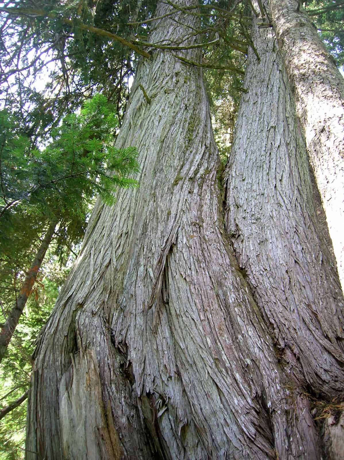
Here, a scenic 1.7 mile side trail leads left to Eunice Lake and the Tolmie Peak Lookout. The sweeping views and gorgeous lake make this trail a worthy diversion from the Wonderland Trail. The Wonderland Trail continues north dropping steeply through brushy avalanche slopes to the Carbon River. En route take time to admire a massive Alaska Yellow Cedar, one of the largest in the state. The trail soon passes more massive trees traversing impressive groves of old-growth hemlocks. At 5.1 miles from Mowich Lake (39.1 miles from Longmire) you’ll reach a junction. Here at an elevation of 2,500 feet in the dank interior rainforest of the Carbon Valley is the lowest point on the Wonderland Trail.
The trail left leads 0.3 mile past Ipsut Falls to Ipsut Creek Campground, once accessible by automobiles before flooding warranted conversion of the Carbon River Road into trail. This trail continues west 5.1 miles to the Carbon River Ranger Station and can be used as an alternative starting point for your Wonderland Trail adventure.
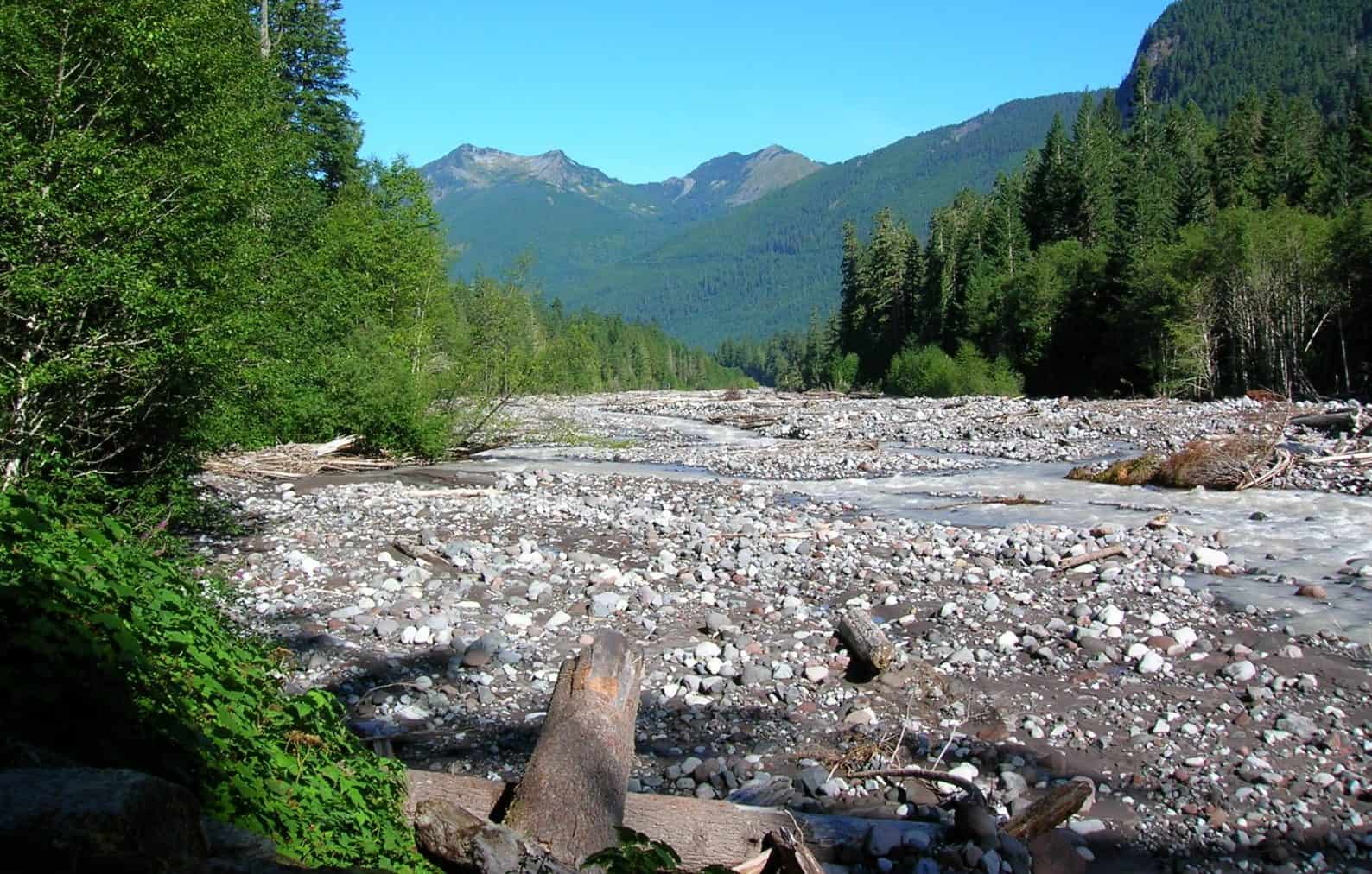
From this junction, the Wonderland Trail now heads east following the wide and channeled glacier-fed silted Carbon River through an interior-rainforest. At 6.8 miles from Mowich (40.8 miles from Longmire) a side trail veers left to cross the Carbon River linking to the lonely and spectacular Northern Loop. It may be necessary to head this way as a detour as the one mile stretch of Wonderland Trail beyond is prone to washing out and in need of rehabilitation. If trail is open, continue straight along the roaring river reaching the Carbon River Camp in another mile. The thundering river should lull you to sleep at this camp.
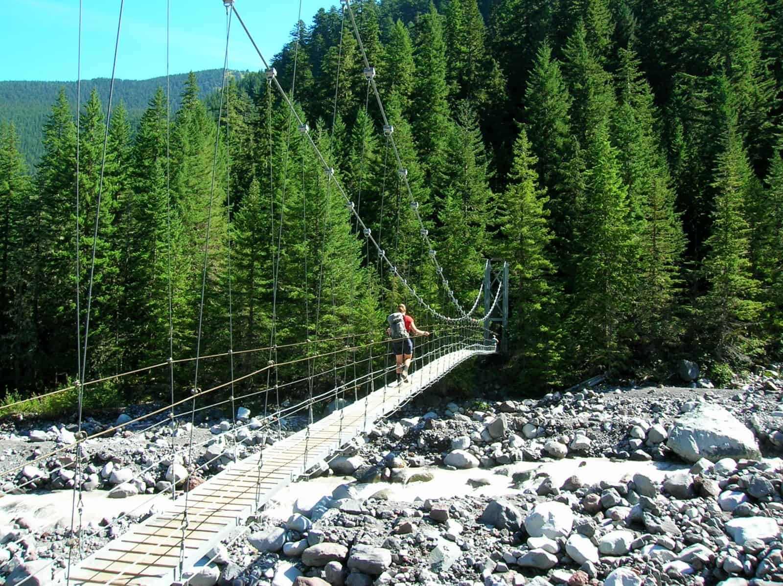
Just beyond Carbon Camp, the trail crosses Cataract Creek and reaches a junction with the Spray Park Trail (alternative route from Mowich Lake). Now turn left continuing on the Wonderland Trail and cross the Carbon River on a 200-plus foot long suspension bridge. From the bridge you’ll get your first of the Carbon Glacier, the lowest (and one of the largest) glaciers in the Continental US.
Once across the bridge reach yet another junction (el. 3200 feet). Here the Northern Loop (insert link to Northern Loop Trail) (and the current one mile detour) leaves left heading down river before beginning its long climb to Windy Gap. You want to go right where you will begin a long climb to Mystic Lake. Following alongside the crashing Carbon River, leave forest and begin hiking up and alongside lateral glacial moraine. At 9.0 miles from Mowich Lake (43.0 miles from Longmire) reach the Dick Creek Camp (el. 4200 feet) with its two sites located just above cascading Dick Creek.
The trail now steeply climbs offering excellent views of the Carbon Glacier, largest of the radiating icy fingers emanating down from the mountain. Approaching Moraine Park, the climb eases. One of the prettiest spots along the Wonderland Trail, Moraine Park is punctuated with jumbled boulders and patches of brilliant wildflowers all under the watchful snowy eyes of Rainier. It’s also the home to scads of marmots often observed sunning on boulders and scurrying through lupine patches.
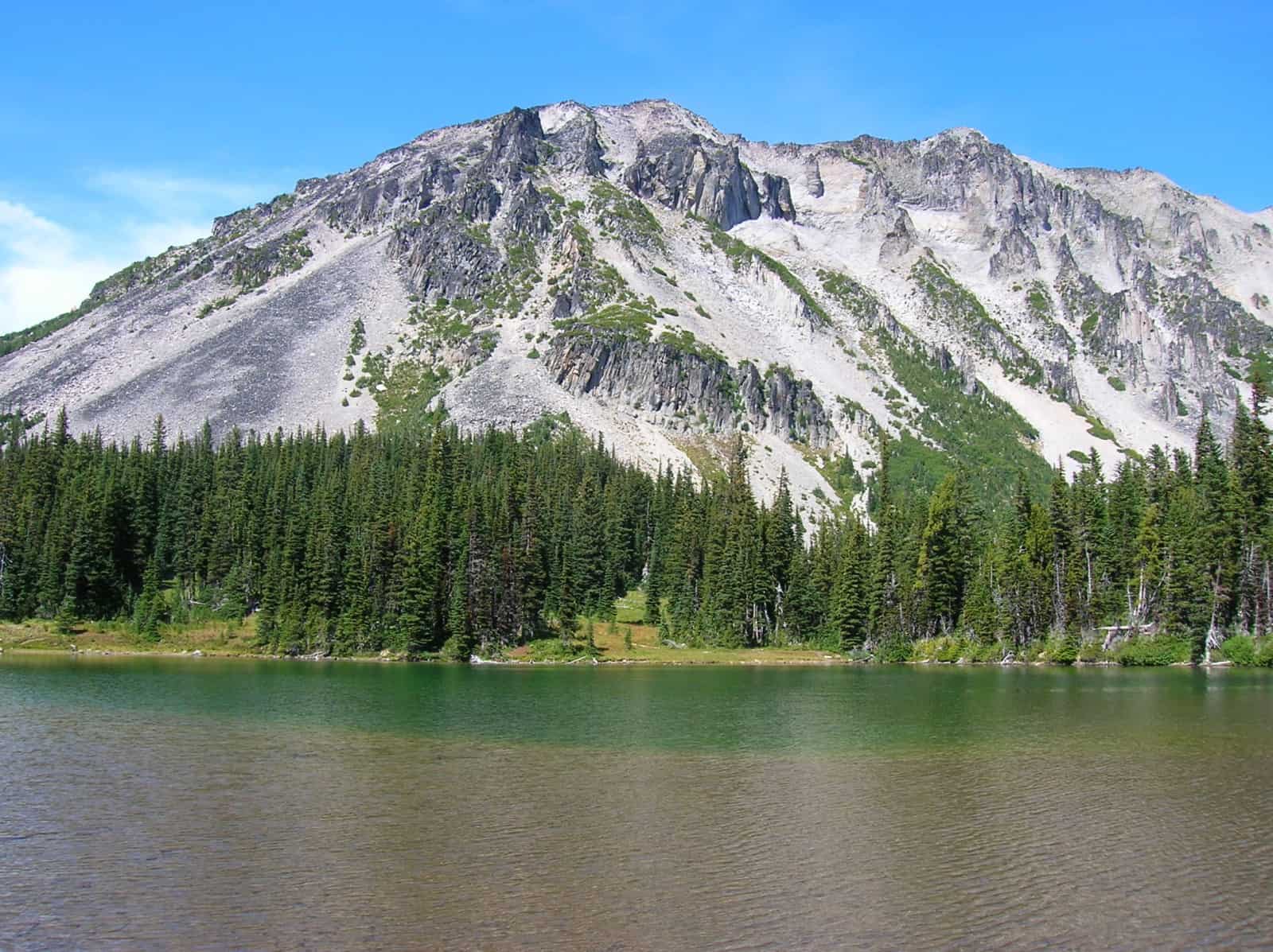
Climb once again reaching a 6,060-foot gap. Stop to admire the mountain before descending to Mystic Lake (el. 5,700 feet) set in a basin beneath craggy Mineral Mountain. The trail hugs the sparkling lake’s grassy shoreline crossing a few flowering bogs before reaching a junction. The trail left leads to another one of the park’s historic (and still in use) patrol cabins and to a great day use area on the lake perfect for picnicking, napping and wading.
The Wonderland Trail continues east descending into thick forest. At 12.8 miles from Mowich Lake (46.8 miles from Longmire) reach the Mystic Lake camps, one of the less attractive campsites along the trail. The Wonderland Trail continues a long descent reaching the terminal moraine of the massive Winthrop Glacier. Here Winthrop Creek streams from the glacier’s snout. On hot days it thunders from it.
Cross this milky, silted creek (el. 4,600 feet) on a foot log and begin yet another steep climb. Cross Granite Creek and pause to admire its tumbling Garda Falls. Then continue your ascent in cool forest eventually paralleling Granite Creek. At 17.2 miles from Mowich (51.2 miles from Longmire) come to Granite Creek Camp (el. 5,800 feet). The camp is well sheltered from the elements and located close to its cascading namesake.
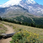
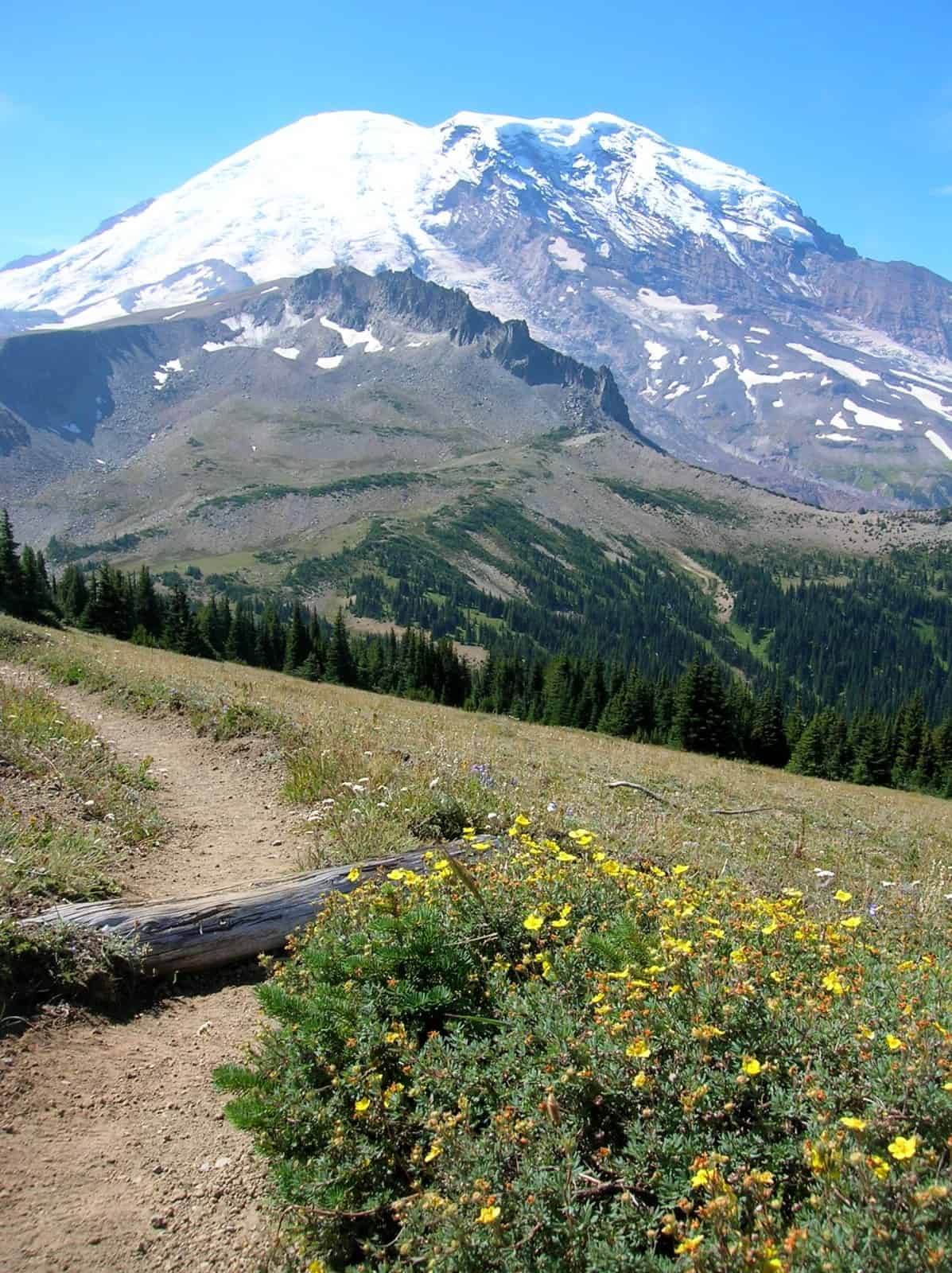
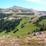
Climb once again. A couple of sweeping switchbacks help lessen the pain. At 18.5 miles from Mowich (52.5 miles from Longmire) reach a 6,700-foot pass beneath Skyscraper Mountain. Views from the pass are sweeping, but they’re even better from Skyscraper’s 7,078-foot summit reached via a scramble path. Make the side trip or keep going traversing a barren and open cirque cradling Berkeley Park below. This section of trail is breathtaking across alpine tundra within the shadows of massive Mount Rainier. Views north to the Clearwater Wilderness peaks and beyond are impressive. After a slight descent and short ascent, reach at 19.7 miles from Mowich (53.7 from Longmire) the eastern terminus of the Northern Loop Trail.
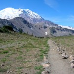
Continue another 0.8 mile across rocky and open terrain reaching a five-way trail junction in a barren windswept gap (el. 6700 feet) above Frozen Lake. There are lots of options here for side trips. Left to Mount Fremont and Sourdough Ridge or right to Burroughs Mountain. The Wonderland Trail continues straight to Yakima Park. Located within the mountains’ rainshadow, the vegetation here is not as lush as Paradise. You’ll also notice different plant species combinations too, including the presence of whitebark pine which favors the high slopes east of the Cascade Crest.
At 21.1 miles from Mowich (55.1 miles from Longmire) reach a junction with the old Sunrise Camp Road since converted to trail. The old road continues straight about 0.6 mile to Sunrise where you can pick up cached supplies (or alternatively begin or end your Wonderland Trail hike). The Wonderland Trail turns right following the old road reaching in 0.4 mile Sunrise Camp (el, 6250 feet). Formerly a car campground, this nice but busy camp allows for excellent star gazing and serves as a great base to check out the aforementioned side trips from the gap. Rest up for the next section of trail, considered by many a Wonderland Trail hiker as the most visually stunning.
GPS waypoints:
Mowich Lake Camp: N46 55.976 W121 51.802
Ipsut Creek Camp: N46 58.654 W121 49.822
Carbon River Camp: N46 56.988 W121 47.692
Dick Creek Camp: N46 56.459 W121 47.049
Mystic Camp: N46 54.932 W121 45.026
Granite Creek Camp: N46 55.190 W121 42.461
Sunrise Camp: N46 54.635 W121 39.599
-
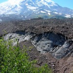
- Winthrop Glacier

-
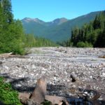
- Carbon River e1524519767612
-
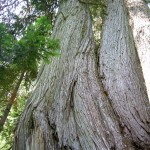
- monstrous old growth Alaska yellow cedars
-
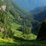
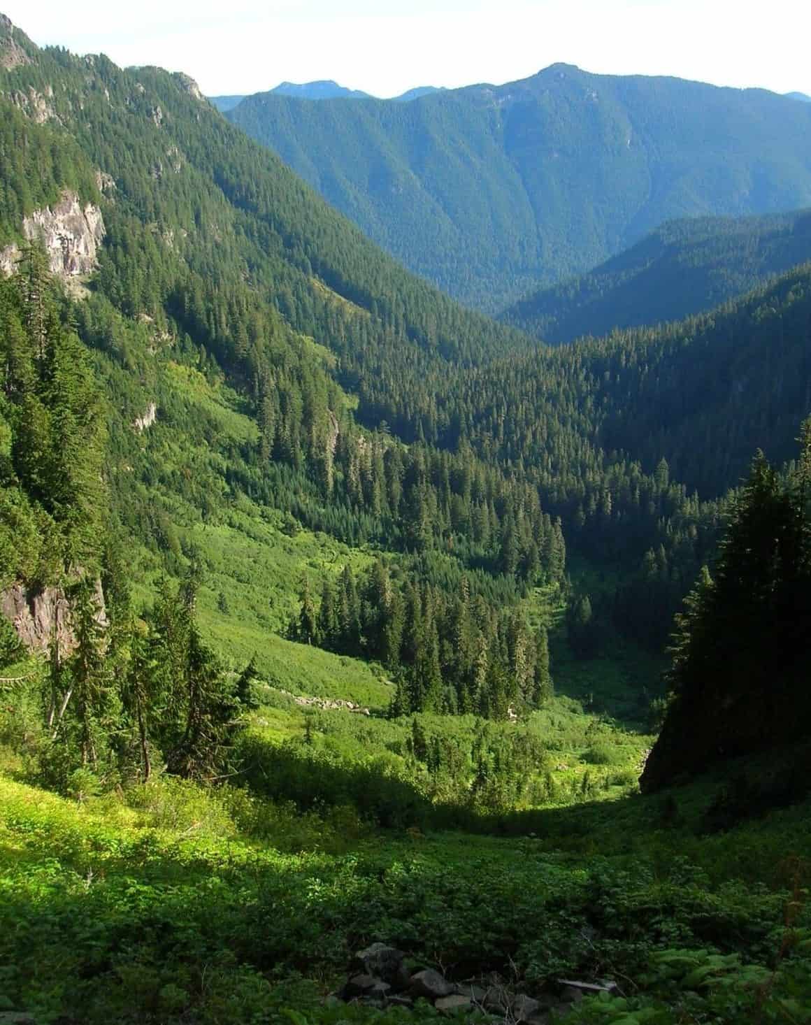
- Ipsut Creek Valley from Ipsut Pass e1529972265578
-
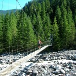
- Suspension bridge over the Carbon River
-
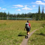
- A hiker approaching Mystic Lake

-
- Mount Rainier from Skyscraper Pass
-
- Mount Fremont above Berkeley Park

-
- Wonderland Trail near the five trail junction

-
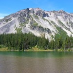
- Mineral Mountain hovers over Mystic Lake
By Craig Romano