| Area: Tieton River Valley US 12 | Hike Type: Dog-friendly, family-friendly | Pass: Discover Pass |
| Distance: 3.8 mi. RT | Duration: 2 hour | Difficulty Level: Easy |
| High Point: 1,825 feet | Elevation Gain: 220 | Snow free: Mar—Nov |
-
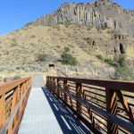
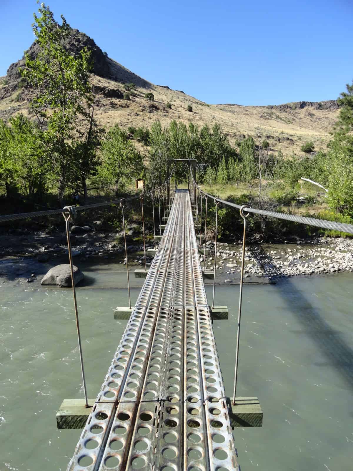
- Looking down the Tieton River from the suspension bridge
-
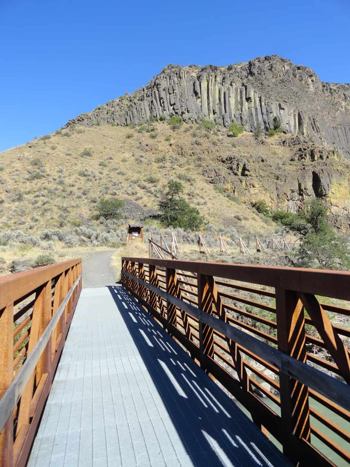
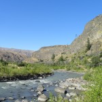
- First bridge crossing of the Tieton River
-

- DSC04393
-
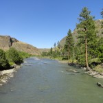
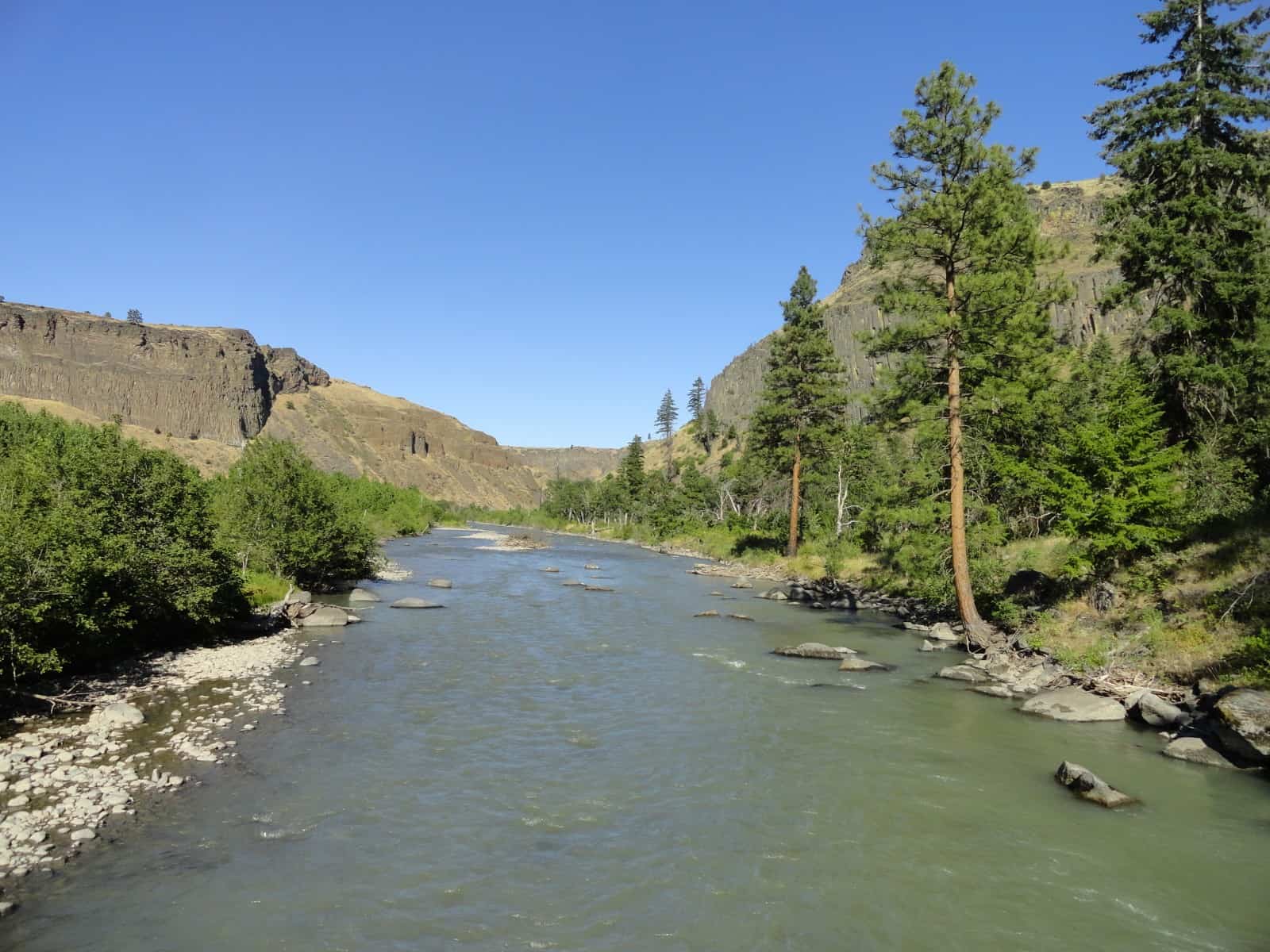
- Tieton River and Royal Columns

-
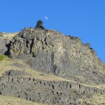
- Moon rising over the Royal Columns basalt cliffs

-
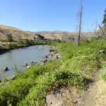
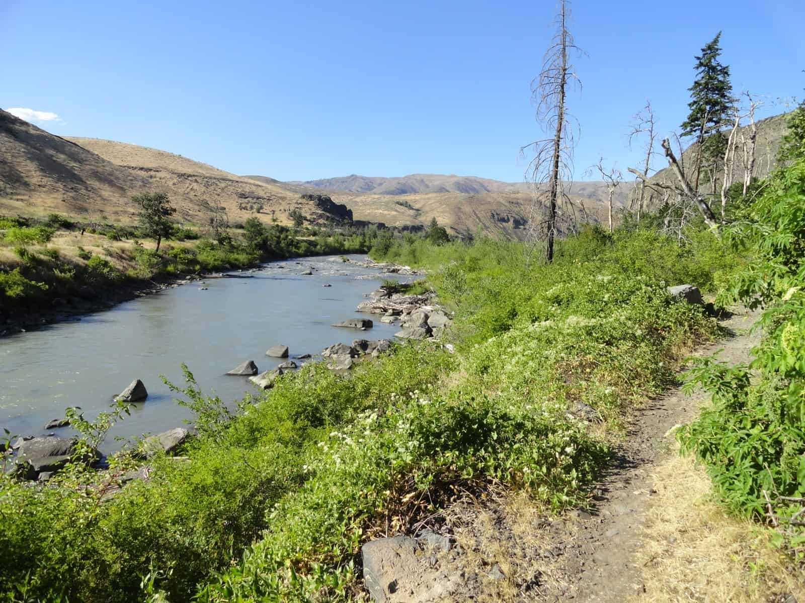
- The Nature Trail runs along the river for most of its way
The Tieton Nature Trail offers a slew of surprises in a stunning setting. Follow this fairly easy family-friendly trail alongside the crashing glacier-fed Tieton River through an impressive wide canyon. Dart beneath stark walls of columnar basalt. Mosey through groves of stately oaks proving homes to melodious songbirds and industrious woodpeckers. Watch for eagles and bighorn sheep. And enjoy the thrill of crossing the river’s turbulent whitewater on a springy suspension bridge. And the biggest surprise of all may just be realizing how few other hikers will be sharing this landscape with you.
Located within the Oak Creek Wildlife Area, most folks know this spot along the Tieton River for its winter elk feeding program. Here at the wildlife area headquarters people come from throughout the region to get up close and personal views of hundreds of elk congregating for feedings. The Washington Department of Fish and Wildlife conducts the feedings here throughout the winter to draw the elk away from local farms and reduce conflict. While the elk are fun to watch—consider going for a nice little hike here. Start by walking down the parking lot access road. Then carefully cross US 12 to find the start of the Tieton Nature Trail.
Immediately the scenic rewards begin. On a sturdy metal bridge, hike cross the roiling waters of the Tieton River. Taking its name from a corruption of Taitnapam (an Upper Cowlitz Tribe); Tieton means milky water—apropos for its glacial origins. Cross the river and come to a junction. You can walk left along an old rail grade if you’d like—but the nature trail continues right. Pass through a gate meant to keep the elk either in or out—you figure it out!
Then follow a double track through tall grasses beneath stunning canyon walls of columnar basalt known as the Royal Columns. Popular with rock climbers, these walls are also well trodden by bands of California bighorn sheep. Look for them. And look too for golden eagles and their large nests. These beautiful and large birds of prey are not as common as their bald eagle cousins—and here in this canyon a few are nesting. Please respect the eagle nesting closure areas by not veering off of the trail.
Continue upriver through a grassy flat that bursts with wildflowers in spring and summer. Soon pass some old apple trees, evidence of past homesteading and farming in the valley. There’s still plenty of native vegetation here though despite early farming. Note sagebrush, bitterbrush, rabbitbrush and bluebunch wheatgrass. And wildlife is prolific here. In addition to elk and bighorns, mule deer are copious. Birds—especially songbirds nest throughout the valley. Look and listen for wrens and orioles. In the warmer months watch too for snakes—although they are pretty shy and tend to avoid hikers.
The way eventually becomes a single track and hugs the riverbank. Climb a small rise at a bend and enjoy sweeping views of the beautiful waterway up and down river. Enjoy sweeping views too of the magnificent canyon walls embracing you and the valley. Pass an old foundation the remnants of an irrigation project. Old canals and flumes can be seen high on the canyon walls to the south. Now continue hiking ascending a broad bench composed of old glacial till. Then cross an old irrigation ditch. Enjoy yet another sweeping overlook of the river before passing through an old burn. Here scan the silver snags for Lewis woodpeckers. Named for Meriwether Lewis, it is one of North America’s larger woodpeckers and they can usually be spotted—its red breast drawing it out—perched on snags and limbs.
The trail continues upriver now on an old road descending into a grove of aspens. In autumn this cluster of trees turns a glowing yellow. Look for evidence of beaver activity here too; aspen being one of their favorite trees for browse. Then enter a beautiful open grove of Oregon white oak. This tree is at its north-central Washington limits here. It is a favored tree for wildlife with its acorns for food and cavities for nests. Ground and tree squirrels are usually quite active in and around these pretty trees. Look too in the surrounding forest for grouse, quails, chukars, and turkeys.
The trail now comes to one of its highlights—especially for many children—a narrow suspension bridge spanning the Tieton River. Slowly walk across the bouncing bridge and be sure to pause and enjoy the gorgeous view downriver and down the canyon. The bridge may be unnerving to some—but it is perfectly safe. Once across you can either turn around here or walk a short distance to the trail’s western trailhead located near a Quonset hut—an old military surplus building now used by the highway department. Return the way you came and enjoy this wonderful riparian environment all over again.
Notes: Watch for rattlesnakes from late Spring to early Fall.
Contact: Oak Creek Wildlife Area, Washington Department of Fish and Wildlife
Trailhead directions: From Yakima follow SR 12 west for 19 miles turning right into Oak Creek Wildlife Headquarters parking area (turnoff is 2.0 miles west of the junction with SR410).
From Packwood follow SR 12 East for 52 miles turning left into right into Oak Creek Wildlife Headquarters parking area
– Craig Romano, author and co-author of 14 hiking guidebooks
Waypoints
| Starting Point: N46 43.610 W120 48.715 |
Q: What is a nearby campground that’s close to the Tieton River Nature Trail?
A: Windy Point Campground is 3.2 miles from the trailhead.