| Area: Sunrise |
Hike Type: Mountain views | Pass: Natl. Park Pass |
| Distance: 5 mi Loop | Duration: 3+ hrs | Difficulty Level: Strenuous |
| Elevation Start: 6,397 | Elevation End: 7,169 | Elevation Gain: 1,000 |
| Snow-Free: Mid-July – Sept |
-
- top 1st burroughs
-
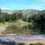
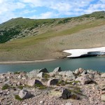
- Shadow Lake

-
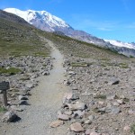
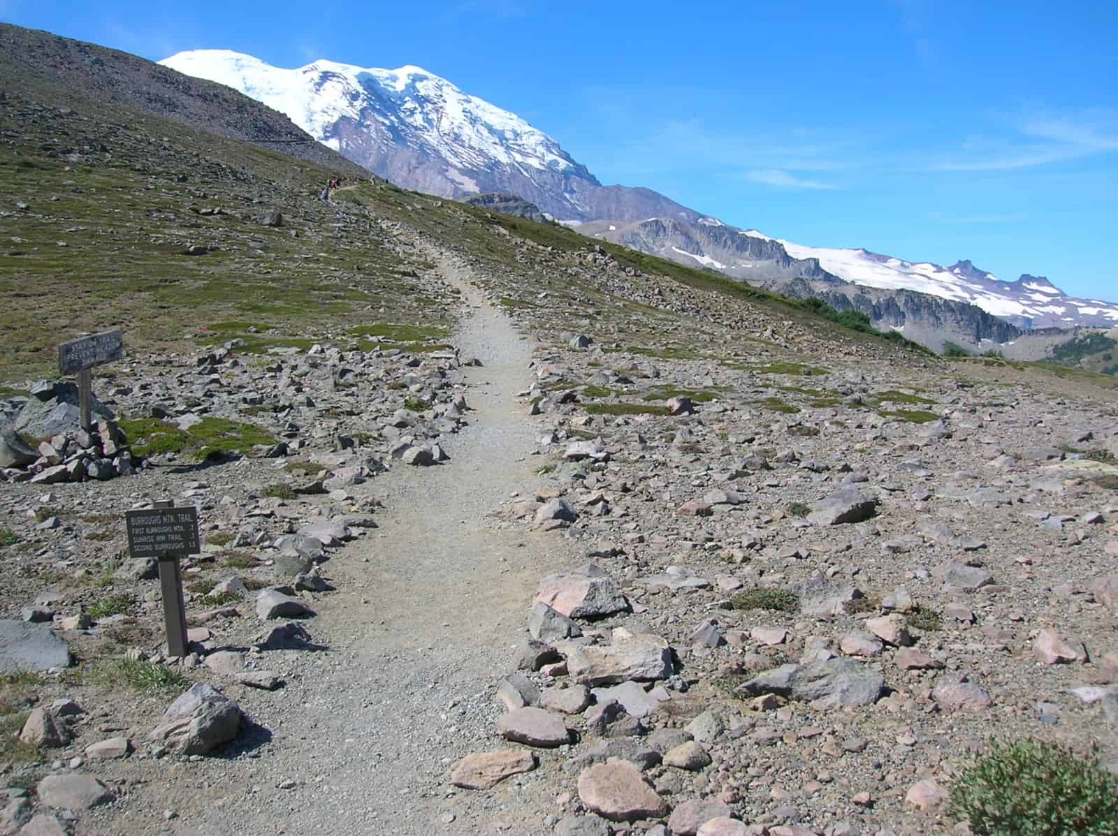
- Loop hike utilizes the Burroughs Mountain Trail across alpine tundra
-
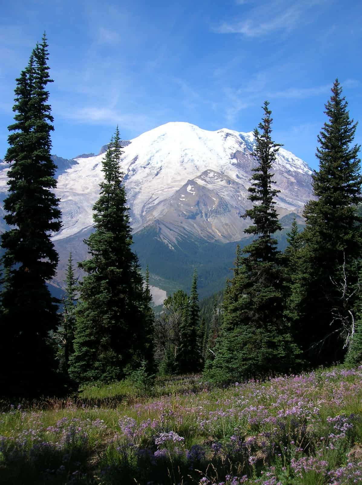
- Beautiful wildflowers and spellbinding views of Rainier on the Sunrise Rim Trail
-
- Frozen Lake along the loop hike

-
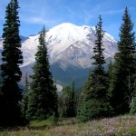
- tahoma

This trail offers something for just about everyone. You can choose to do a leisurely walk to Shadow Lake or a strenuous hike to the Burroughs Mountains… whatever suits your fancy at the time. This winding trail offers spectacular views of Mt. Rainier towering above and the Emmons Glacier Moraine 3,000 ft. below. In mid-summer, mountain flowers are everywhere along the path offering an array of colors. Occasionally, you can hear picas squeak or marmots whistle as you venture into their rugged territory and you may even catch a glimpse of them, if you are lucky. The farther you go, the greater the variety of terrain you will encounter.
The trail begins at the south side of the Sunrise parking lot.
Shortly after leaving you come to a junction… stay right. This hike starts out easy as the trail meanders through the sub-alpine trees and small meadows. At 1.3 miles you arrive at Shadow Lake (N 46° 54.626′, W 121° 39.443′), with Sunrise Camp (N 46° 54.638′, W 121° 39.597′) just beyond. This is a wonderful, small alpine lake with trails surrounding it – a delightful destination in itself. From here, if you look north, you can see the Sourdough Ridge and the trail that cuts across it.
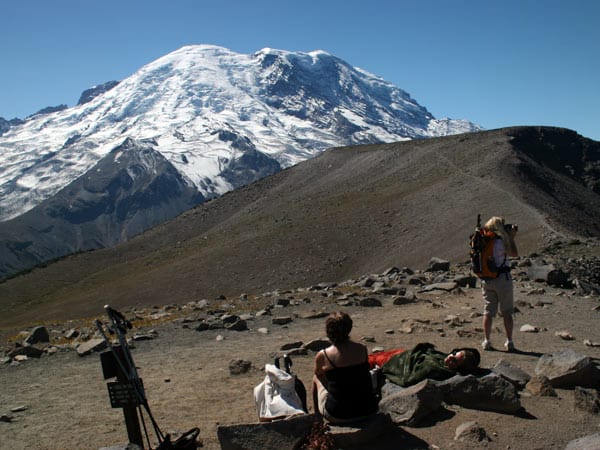
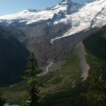
The trail continues on past Sunrise Camp on a moderate incline to a very scenic point of interest called Glacier Overlook.
This man-made platform is where many photos of Mt. Rainer are taken. The view is both breathtaking and awe-inspiring. The Emmons Glacier can be viewed in its entirety as it separates Little Tahoma Peak from the Mountain itself. The top half of the glacier is a huge field of giant ice towers and deep crevasses, while the bottom half of the glacier is covered in debris from a massive rock fall in 1963, originating from Little Tahoma Peak. Although it may look like only dirt, there are many giant boulders the size of a 1-car garage. This debris insulates the ice of the glacier beneath it, so as other glaciers here and around the world are retreating, this one is actually advancing, albeit at a slower rate than in the 1980’s. You also see the very beginnings of the White River, its birthplace, before making its way down the mountains, through the valleys, to Puget Sound. Scattered around the moraine are small lakes with the prettiest sea-foam green color. This is caused from the sun reflecting off glacial sediment suspended in the water. Even though the Mountain is the main attraction here, take the time to enjoy the splendid views ALL around you. Sometimes it’s really hard to leave this place but the trail continues on.
After traveling past the overlook, the trail becomes steeper. This is where the hike turns from moderate to strenuous, unless you are in pretty good shape. You will notice that your surroundings are beginning to change as you leave the tree line and enter the tundra-like terrain of the Burroughs Mountains. The path beneath your feet turns from silty sand to uneven rock. The trail is very impressive, as volunteers built amazing walls from this rock to hold back massive amounts of more rock. Even more amazing are the flowers that choose to live in this environment. Hike with care in this area to protect not only the fragile landscape but also your own well being.
Author’s Note: Before actually arriving at the top of 1st Burroughs, where the trail finally flattens out, there is a nice spot with small trees and big rocks. We like to stop here for lunch and the impressive view for several reasons. At the very top, the view of the Mt. Rainier is somewhat obstructed by 2nd Burroughs Mountain. It is also a VERY busy (crowded) place with competition for the few flat rocks on which to sit and rest. And, last of all, the winds can get a little gusty here which may add “sand” to your “sand”wich.
From the top of 1st Burroughs you can continue on to the top of 2nd Burroughs, an additional 400 ft in elevation (.6 miles). This gets you closer to the Mountain with a less obstructed view. If you have LOTS of energy left in your legs, you can continue on to 3rd Burroughs, a long distance and very strenuous as you get closer to that summit. The un-maintained trail consists of very soft sand that makes for difficult walking but the view of the Winthrop Glacier is beyond words!!!
There are other choices at 1st Burroughs: you can hike back to the parking lot the way you came, or make it a loop trail, via Frozen Lake (N 46° 55.054′, W 121° 40.107′) and Sourdough Ridge. The loop trail offers amazing views to the north of Skyscraper Mt. and Mt. Fremont Lookout with Berkeley Park nestled between those two peaks. In the far distance you can see the majestic Cascades and Mt. Baker. As you climb Sourdough Ridge you can enjoy the other side of it with its jagged cliffs and lush meadows far below. Looking to the south you can see Shadow Lake and the trail where you began this trek. The total distance of this loop trail is around 5 miles, give or take.
Regardless of how far you go on the Sunrise Rim Trail you will see things far removed from your everyday life. These experiences stay with you long after leaving this truly incredible place. If you are like me, being here only renews the urge to return for more adventure.
Author’s Note: It’s always good protocol to check with the park service (360-569-2211) for gate closures and road conditions in the spring and fall. Often, the snowpack is late in melting or the early snows are heavier than normal. The weather can change very quickly, especially in those seasons, so come prepared.
– Mary Janosik, Visit Rainier Hiking Expert
Waypoints
| Starting Point: 46.914050, -121.641817 | |
| Notable Waypoints:
Trailhead: N 46° 54.843′, W 121° 38.509′ |
|