| Area: Mowich Lake |
Hike Type: Waterfall views |
Pass: Natl. Park Pass |
| Distance: 6 mi RT | Duration: 3 hrs | Difficulty Level: Moderate |
| Elevation Start: 3,600 | Elevation End: 5,800 | Elevation Gain: 2,200 |
| Snow-Free: Mid-July – Mid-Oct |
-
- t falls
-
- spray falls
-
- spray park

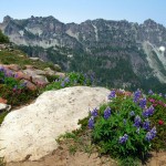
If you love the flowered meadows so well known at Paradise on Mt. Rainier’s south side, you’ll be ecstatic upon discovering Spray Park, on the mountain’s northwest side.
Dazzling with midsummer explosions of avalanche lilies and other alpine flowers, Spray Park also offers splendid close-up views of Mt. Rainier and exposed rock. While it requires a bit of effort, the hike has a marvelous payoff in dividends of spectacular scenery.
You begin your hike at Mowich Lake campground (4,900 ft) after enduring an eventful 16-mile drive on a potholed gravel road.
To get to the gravel road, the drive is more routine: From Puyallup, travel 13 miles east on Highway 410 to Buckley, turn right (south) onto Highway 165, and proceed through Carbonado. Just beyond the Carbon River Gorge bridge, veer right onto Mowich Lake Road, the sometimes bone-jarring gravel adventure previously mentioned.
You’ll find the start of the trail at the end of the road and parking lot, near the outlet of Mowich Lake (southeast side of lake). The trail descends 1/4 of a mile to a junction with the Wonderland Trail. Go left (east) on the Spray Park trail. You don’t want to go right or you’ll be going around the mountain toward Paradise, a hike for another day.
The Spray Park trail winds its way up and down through forested terrain. Notice the trees cloaked with long stringy moss and the relative absence of sound other than your own breathing and footsteps.
The trail loses, perhaps, a hundred or two hundred ft of elevation as it rounds Fay Peak, Hessong Rock, and what appears to be a number of avalanche chutes. After attaining the low point of the entire hike at about one-half hour or so into the journey, you start to climb.
Eagle Cliff, at 1 1/2 miles into the hike, is a nice spot to rest momentarily and enjoy the wonder of Mt. Rainier, especially taking in the Mowich Glacier.
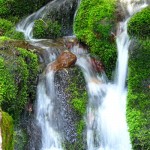
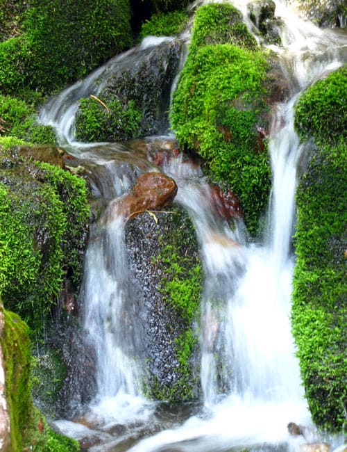
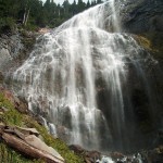
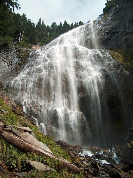
Onward and upward, you’ll pass Eagle Roost backcountry camp. Look for a side trail (not well marked) to Spray Falls 1/4 of a mile away.
Take the diversion, either now or on the way back. You’ll appreciate the wide splash of water 80 ft high and 50 ft wide even though this is only a fraction of the falls.
The main part is uphill and out of sight. What you can see, however, has enough beauty to please. Drink in the fall’s splendor, then back track to the main trail and keep heading up. From the falls, you’ll be on switchbacks, climbing 600 ft in 1/2 mile, arriving at Spray Park’s lower meadows. This is a good choice for a lunch break.
Depending upon how you feel and the time of day, you can turn around and head back content over the glorious flowered meadows and Rainier’s impressive backdrop to 7,800-foot Echo Rock and 8,300-foot Observation Rock.
If you’re not ready to leave just yet, a few minutes away is the first broad meadow in this vast virtual garden, under aptly named Mount Pleasant. The farther you go, the better the views. Staying on the trail, you will make it to a 6,400-foot ridge above Seattle Park.
On a clear day, your view stretches from the lower flanks of Mount Rainier to the North Cascades. This is a logical turn-around spot.
When you get back to Mowich Lake, soak your hot, tired ft in the cool water, before heading home refreshed and rewarded by the day at Spray Park.
– Mary Janosik
Waypoints
| Starting Point: 46.932800, -121.8637337 |
Q: Is there a water fountain at Mowich Lake Campground?
A: No. There is no potable water at the campground.