| Area: Packwood / Randle |
Hike Type: Dog-friendly | Pass: No Pass Req |
| Distance: 9.4 mi RT | Duration: 5-6 hrs | Difficulty Level: Moderate |
| Elevation Start: 4,310 | Elevation End: 5,960 | Elevation Gain: 1,650 |
| Snow-Free: Mid-July – Mid-Oct |
-
- lunch
-
- a crossing Goat Creek
-

- wildflowers2
-
- t old Snowy

-

- wildflowers21
-

- n throw a stick
-
- snowgrass Flats

-
- m throw the stick river

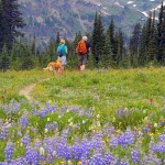
The Snowgrass Flats (Trail No. 96) in the Goat Rocks Wilderness outside of Randle is a favorite of wildflower enthusiasts who prefer their wildflower displays served with solitude. It is also a dog-friendly trail.
Hiking to Snowgrass Flats is like the first chapter in a compelling book that is so good you don’t want it to end and once you get to Snowgrass Flats you won’t want to leave.
Though in August, days are growing shorter the wildflower season is making up for lost time not only at Mount Rainier National Park but other settings in the South Cascades. Summers seem shorter and sweeter with each passing year; some hikers may experience a sense of quiet desperation as summer winds down and green meadows turn to gold. Wildflower displays seem especially poignant this year since flowers got off to a late start due to the late melt-out. The good news is that summer may linger into fall and we can hope for a late winter. With the late snow-melt the flowers are all in a hurry to bloom and reseed. Hence you’ll see odd combinations of flowers blooming together; early season avalanche lilies share space with late season asters, for example. n
Other than being dusty, the forest service roads to the Snowgrass Flats trailhead are in good condition though it was a good thing we got an early start because parking is limited. However, hikers who camp or find lodging in nearby Randle, Morton or Packwood can get a more leisurely start and perhaps even hike or backpack beyond Snowgrass Flats into Lily Basin or scramble Old Snowy, a non-technical summit (no climbing gear or skills needed).
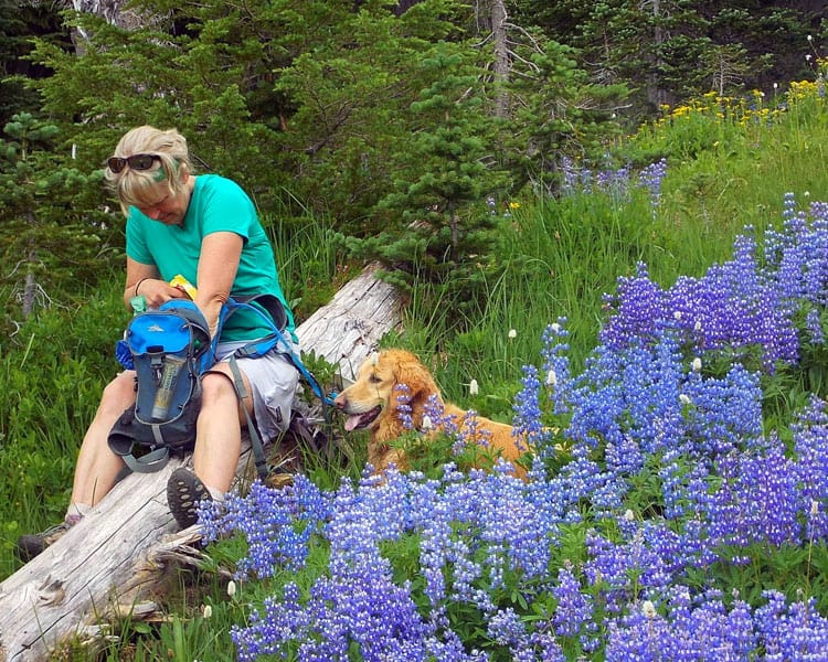
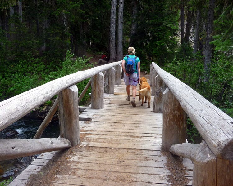
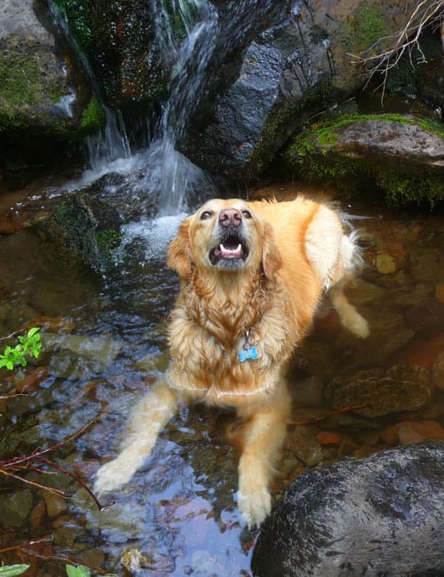
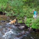
The trail begins with a short descent through forest, crossing minor tributaries before crossing Goat Creek on a robust bridge suitable for equestrians (the Pacific Crest Trail can also be accessed from this trailhead). This is also a dog-friendly trail so we hiked with a friend and her golden retriever, Tika. Tika took advantage of every tributary on the trail – it was a joy to watch her cooling down and retrieving sticks where the streams created ponds.
After the initial descent, the trail stays mostly level with minor ups and downs. Not far from the trailhead there is a clearing in the trees where you can get a view of Old Snowy (an easy scramble for strong day-hikers but probably preferable as part of a 2-3 day backpack).
As we hiked, we couldn’t help but notice that trees were often growing in clumps of threes; especially Alaska cedars with their ragged bark. We also spotted an old-growth Douglas fir with the thickest bark we’ve ever seen, 8 to 10 inches thick. Most of the early season lowland flowers such as trilliums had passed; we did see a bit of arnica and asters here and there along with glimpses of green, grassy meadows where one might expect to see elk or at least a grazing horse and its rider dozing in a Rip Van Winkle sleep. At the end of a switchback, there is also a good view of Goat Ridge before the trail returned to the forest.
As we continued uphill we noticed that climbing was sapping our energy more than usual – a week-long heat wave had ended though the humidity was high and temperatures too warm for comfort without a breeze.
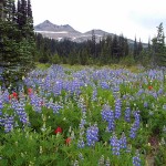
At 5,960 feet we came to the signed junction for Lily Basin/Snowgrass Flats. This is where Snowgrass Flats begins – the flats are a vast, billowing meadow filled with wildflowers with campsites nearby in sheltering trees. Backpackers can continue on to Lily Basin and Goat Lake (a strenuous hike); one party coming out from Goat Lake said the lake was still mostly frozen though the trail was snow-free.
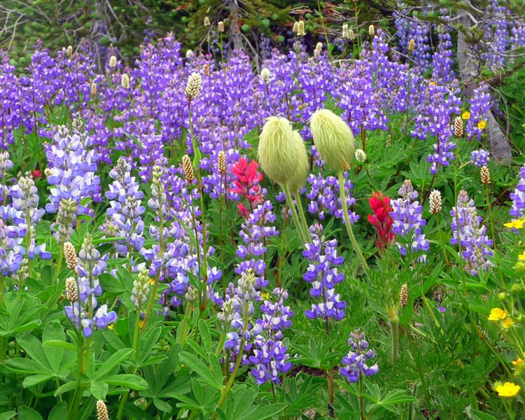
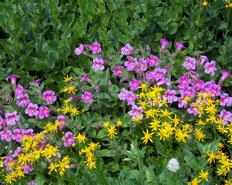
We lost track of time as we paused in a sea of wildflowers to take photos before settling down to lunch. After watching a pack string go by like a scene in a Western movie, we hiked a little further on a secondary trail that led to a steep meadow with even more prolific wildflower displays; masses of purple monkey flower mixed in with yellow asters amidst fat cushions of lime-green moss sparkling with beads of moisture where the meadows were boggy. We also spotted lupine in an array of hues ranging from white to purple, monkey flower, western pasqueflowers, bistort, rosy spirea, valerian, magenta Indian paintbrush, and bracted lousewort. We even spotted a few avalanche lilies though most had gone to seed.
Then in what seemed an idyllic setting, I was suddenly stricken with such painful leg cramps that I couldn’t move, and since my companions had moved on a little ahead they couldn’t hear me as I called out to them. It took several moments before I could rise to my feet and continue walking. Though I’d drunk plenty of water apparently that wasn’t enough to compensate for the accumulative effects of that week-long heat wave.
If this should happen to you – fluids, shade, water, rest, salt are the solution (hikers lose electrolytes when sweating a lot). It’s also not a bad idea to carry salty treats – one suggestion from a friend, pack a small package of salty potato chips. Remember, even if you are not thirsty you need to keep replacing fluids. Fortunately, I did recover after resting and was able to hike out.
Despite the heat and humidity, we envied the Washington Trails Association (WTA) volunteers we’d met who were camping for the week; yes, they do get days off for hiking and exploration. As for us the memory of the wildflowers and views of Old Snowy will last much longer than the effects of muscle cramps or the fatigue of a long drive.
Getting there: From US 12 between Randle and Packwood take Forest Service Road No. 21 and continue about 15 miles to Forest Service Road No. 2150 and turn left. Drive about three miles to Spur Road 2150-040. The route is well signed for both Snowgrass Flats and nearby Chambers Lake. A Northwest Forest Pass is not required at this trailhead.
For additional information or trail conditions on this trail and others in the region contact the Cowlitz Ranger District (360-497-1100).
Maps: Green Trails No. 335 Walupt Lake and Green Trails No. 334 Blue Lake
– Karen Sykes, Visit Rainier Hiking Expert
Waypoints
| Starting Point: 46.4639, -121.51887999999997 | |
| Notable Waypoints:
Trailhead: N 46° 27′ 50, W 121° 31′ 08 |
|