| Area: Ashford |
Pass: No Pass Required | |
| Distance: 8 – 11.5 miles | Duration: | Difficulty Level: Intermediate |
| Elevation Start: | Elevation End: | Elevation Gain: 1,300 ft |
| Prime Season: Late-June – November | ||
-
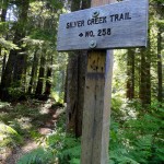
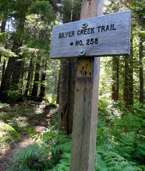
- signs point the way through forest
-
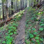
- smooth tread through forest

-
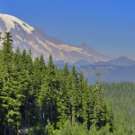
- b Rainier hovers in the background

-
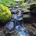
- many bubbling creeks the trail crosses

8 miles out and back on the trail; or 11.5-mile loop combined with FR 5240 and FR 84
The Silver Creek Trail is perhaps the best-kept biking secret in the Nisqually Valley. While nearby Osborne Mountain and the Mount Tahoma Trail System see a fair share of bikers cruising up and down their trails and roads, Silver Creek usually remains void of activity; except perhaps for an elk or two in transit.
Located just off of the Skate Creek Road (FR 52) between Ashford and Packwood, Silver Creek is easily accessible. The trail’s gentle grade, good tread and lack of exposure also make it a nice intermediate ride suitable for mountain bikers both young and old and everyone in between!
If you’re intent on just riding the trail as an out and back, start at the lower trailhead (el. 2,800 feet) for a long gradual climb. After just .4 mile reach an open grassy old cut. Be sure to look over your shoulder at a meadowy ridge of Lookout Mountain rising above and Mount Rainier too. The views of The Mountain, however, get much better farther into the ride.
The trail is a little bumpy here but soon smoothens as it enters the cool forest and parallels a small creek. Cross the creek on a good bridge and skirt around a large wetland. In early season, birdsong, frog song, and buzzing insects fill the air. Mosquitoes too, so you may want to keep on biking at a good clip.
At 1.1 miles cross FR spur 016. Side trip possibilities here include veering off on this road right passing some small ponds and heading back to FR 52. From there you can turn right and follow the paved road past the wildlife-rich Bear Prairie back to FR 5240 and your start.
The trail crosses the road, parallels it for a short while and skirts more wetlands before reaching the spur’s terminus at 1.5 miles. The way then heads into mature timber for a nice stretch of easy cruising before beginning to climb in earnest at 2.2 miles. Continue through a nice green swath among old cuts crossing a few small creeks en route-none posing any problems or major mud splashing.
At 3.6 miles push up along a cut lined with huckleberries and behold majestic Mount Rainier to the north. Admire some big Doug-firs too along the way. The climb eases as the smooth trail meanders through old growth forest. At 4.0 miles reach trail’s end (el. 4,100 feet) at FR 84. Now consider your options.
Turn around and enjoy a joyous downhill ride back to the trailhead or follow FR 84 to FR 8460 to the Allen Mountain Trail. While this trail is open to bikes, it is brushy, steep, has lots of obstacles in the forms of blowdown and rocks and fading tread and is best for only expert bikers and hikers. The better option is to follow FR 84 to Fr 8440 to the Big Creek Trail and the beginning of an epic ride across the Sawtooth Ridge.
If you’re interested in the loop route back to your start via FR 84 and FR 5240, do it in reverse biking the roads first. From the trailhead ride .5 mile on the 015 spur to FR 5240 and turn right for a long but gentle climb out of the Skate Creek Valley. Enjoy occasional views of Skate Mountain with its inviting alpine meadows, and some ridge glimpses from Silver Creek Pass. At this pass, turn right onto FR 84 enjoying Mount Rainier views as you ride across a side slope to the upper trailhead of the Silver Creek Trail. Now collect your reward for your uphill toil with a nice smooth descent through an attractive forest, over and by bubbling creeks, and though a few good viewpoints of Mount Rainier, as well. Best of all about this ride-you will probably be the only one out enjoying it!
Directions to Trailhead: From Elbe, follow SR 706 east (passing through Ashford) for 10.1 miles. Turn right (south) onto Skate Creek Road (FR 52) and follow it for 11.2 miles. Turn right (south) onto graveled FR 5240 and follow for .5 mile to a junction near an old gravel pit. Park here (and cycle to the trailhead) or turn right and proceed on FR Spur 015 for .5 mile to trailhead.
Miscellaneous information: Silver Creek Trail is also open to motorcycles, but motorized use on this trail is extremely light. As of autumn of 2012, the trail was in excellent shape with just a few brushy spots. No major obstacles-just a few small holes and the usual smattering of twigs and branches. FR Spur 015 is a little rough, in which case you may want to park at the gravel pit at the junction of Spur 015 and FR 5240 and bike an easy half-mile on road to the trailhead. Green Trails Map Randle, WA no. 301 shows this trail and the nearby Osborne Mountain and Greenwood Lake Trails which also offer good mountain biking. Contact Cowlitz Valley Ranger Station (Randle), Gifford Pinchot National Forest for updated information on this trail and access roads; (360) 497-1100; http://www.fs.usda.gov/giffordpinchot
Waypoints
| Starting Point: 46.7021,-121.81579999999997 | |
| Notable Waypoints:
Trailhead: N 46° 42.124′, W 121° 48.950′ |
|