| Area: Enumclaw | Hike Type: Dog-friendly, family-friendly | Pass: Discover Pass |
| Distance: 2.5 mi. RT | Duration: 1.5 hour | Difficulty Level: Easy |
| Elevation Start: 850 | Snow-Free: Year-round | Elevation Gain: 175 |
-
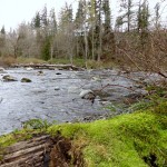
- Mossy overlook of the Green River
-
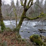
- Mossy maples overhang the Green River

-
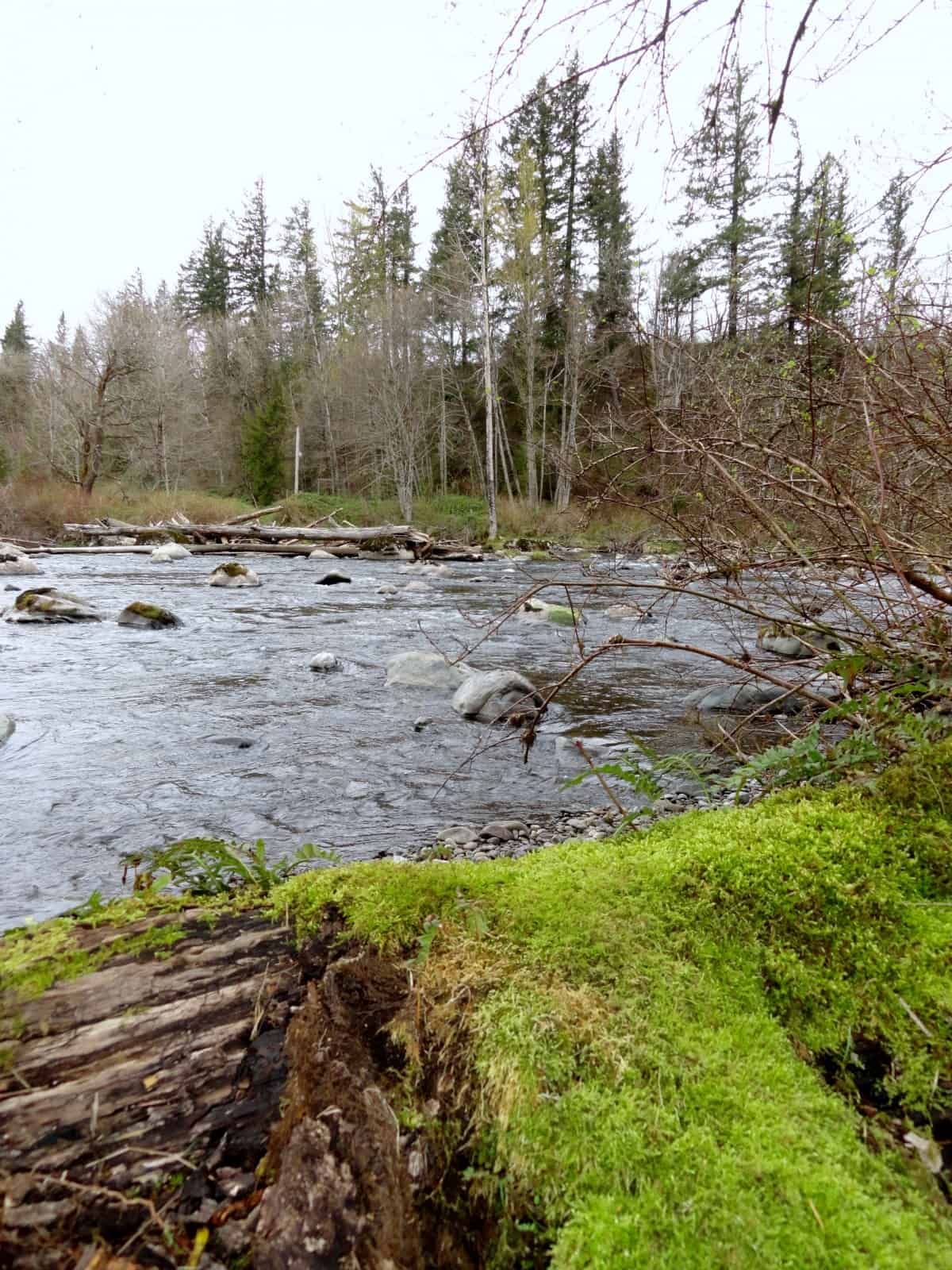
- Boulders and deciduous trees give the Green River a Southern Appalachian feel here at the park 2

-
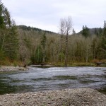
- A much gentler river can be found upstream in the park than downstream near the gorge

-
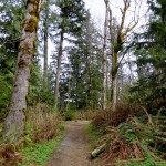
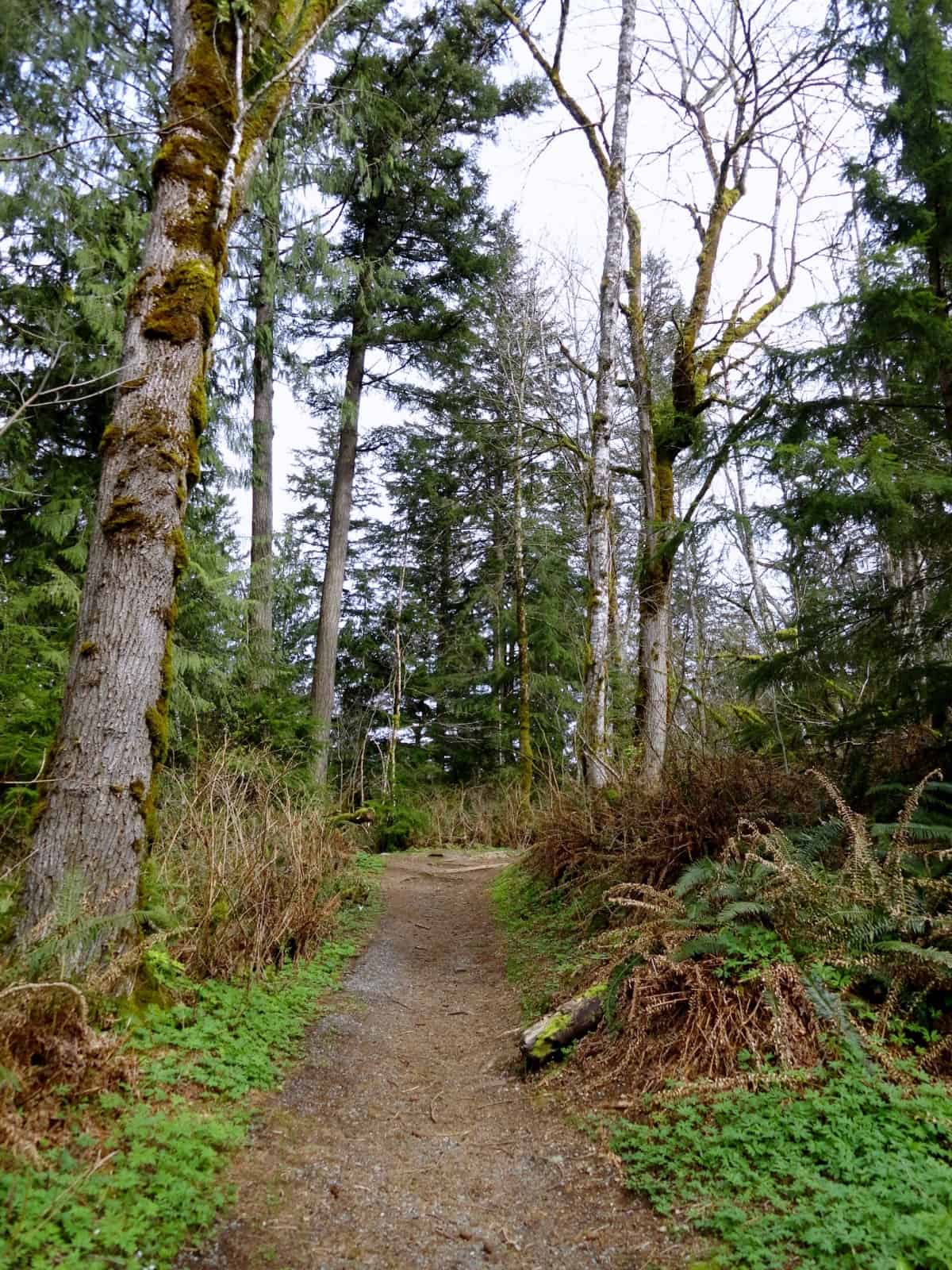
- Well maintained trail through an attractive forest
-
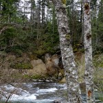
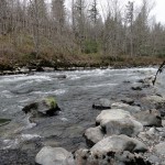
- A pair of alders frame some rapids near the mouth of the Green River Gorge

Named for two tiny communities on the Northern Pacific Railway in the heart of a once thriving coal mining district—Kanaskat-Palmer State Park is rife with history. But it’s the Green River which forms a big bend here at the mouth of a dramatic gorge that is the park’s main feature.
River kayakers and rafters have been coming to this spot long before it became a state park in 1983. It was some of these river rats and rapids riders who first recognized the ecological importance, natural beauty, and historical significance of the Green River Gorge calling for its preservation. In the 1970s Washington state Parks began acquiring lands along the 12 mile stretch of the Green River Gorge for protection and recreation. Today a near contiguous stretch of protected land embraces the gorge from its mouth to its outlet.
Kanasket-Palmer consists of 320 acres at the gorge’s mouth. Here the river progresses from class II to Class IV rapids offering some of the most challenging river running on the Green. While the park is well known for its river running, hikers will be pleased with the park’s River Trail which forms a pleasant kid-friendly loop around the park. Aside from offering excellent views of the river, this well-maintained trail leads to some pretty quiet spots along the river and traverses a few groves of big old trees along the way.
Starting from the main Day Use Area, locate the signed trailhead near the Upper take-out and put-in site. Now begin hiking on a wide trail gently climbing to a junction in .1 mile. The spur right leads to the park’s lovely campground with its 44 wooded sites and 6 yurts. Head left along a bluff high above the river. While much of the surrounding forest has been logged in the past, many mature trees can still be found along the way. The forest floor is carpeted in ferns. In spring, wildflowers—particularly trilliums and bleeding hearts (dicentra) add dabs of white and purple to the emerald shroud.
At .3 mile the trail switchbacks off of the bluff traversing a grove of big cottonwoods, hemlocks, spruces and cedars reaching river level and some good river views. Aside from looking for kayakers in the rapids, watch for mergansers and dippers in the frothy waters too. The trail now hugs the river bank coming to a junction at .8 mile. The spur right leads to the group campground. The spur left leads .1 mile to a deep pool graced with a sandy shore and a big cottonwood.
The River Trail continues straight through a lush alder flat before reaching a grove of big cedars. The way then bends right passing through a grove of Sitka spruce, a tree rare this far inland from the coast. Now on an old road bed climb 100 feet up a bluff coming to the park road near the ranger station at 1.3 miles. Turn right and walk the road a short distance picking up trail again (signed) at a gate. Here too the way follows an old roadbed traversing a quiet forest away from the river.
Bear right at a junction. Eventually, the roar of the river once again fills the forest as the trail reaches a bluff top above the waterway. Now slowly descend reaching the park road once again at 1.9 miles. Turn left here and walk along the short road leading to the Lower take-out and put in site. Locate the River Trail once again and soon come to the Lower take-out spot located at a shaded cove at the mouth of the gorge.
Here the river cuts through 300-foot tall bluffs and overhanging ledges of shale and sandstone. It is a very difficult place to explore—and you can catch glimpses of the deep gorge from various bridges and overlooks along the greenbelt protecting it. The River Trail heads upriver here passing riverside ledges and boulders and roaring rapids. The rocky river is lined with deciduous trees and hemlocks giving this area a Southern Appalachian feel.
Continue upriver passing excellent viewing spots. The trail eventually reaches the park picnic area, where a paved path left leads you back to your start. But before calling it a hike, walk the wide path left .1 mile to the Upper take-out and put-in site for an excellent river view at a rocky bend.
Consider spending a night at the state park and exploring some of the gorge’s other protected areas and trails on a future visit.
Notes: Discover Pass required. The trail is dog (on-leash) and kid-friendly. Green River contains strong currents—exercise caution along river’s edge. Camping and yurts are available in park year round.
Contact: Kanaskat-Palmer State Park (360) 902-8844; visit website.
Getting to Kanaskat Palmer State Park
From Enumclaw travel east on SR 410 for 0.8 mile. Turn left onto Farman Street (284th Ave) and follow this county road which eventually becomes the Veazie-Cumberland Road; then Cumberland-Kanaskat Road for 8.8 miles. Turn left into the Kanaskat-Palmer State Park and follow park road 0.9 mile to Day Use and Picnic Area.
– Craig Romano, Hiking guidebook author and co-author of eleven books
Waypoints
| Trailhead: N 47 19.320 W 121 54.427 Group Camp Spur: N 47 19.096 W 121 53.859 Road junction: N 47 18.839 W 121 54.04 Lower Takeout/ put-in site: N 47 18.982 W 121 54.492 |
Written by Craig Romano