| Area: Chinook Pass |
Hike Type: Dog-friendly | Pass: Northwest Forest Pass |
| Distance: 11.6 mi RT | Duration: 8 hrs | Difficulty Level: Moderate |
| Elevation Start: 2,800 | Elevation End: 5,520 | Elevation Gain: 2,720 |
| Snow-Free: Mid-May – Oct |
-
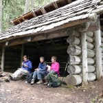
- cabin shelter

-
- P1050849

-

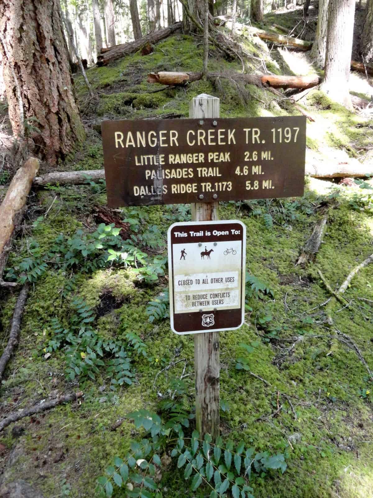
- Trailhead sign
-
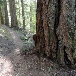
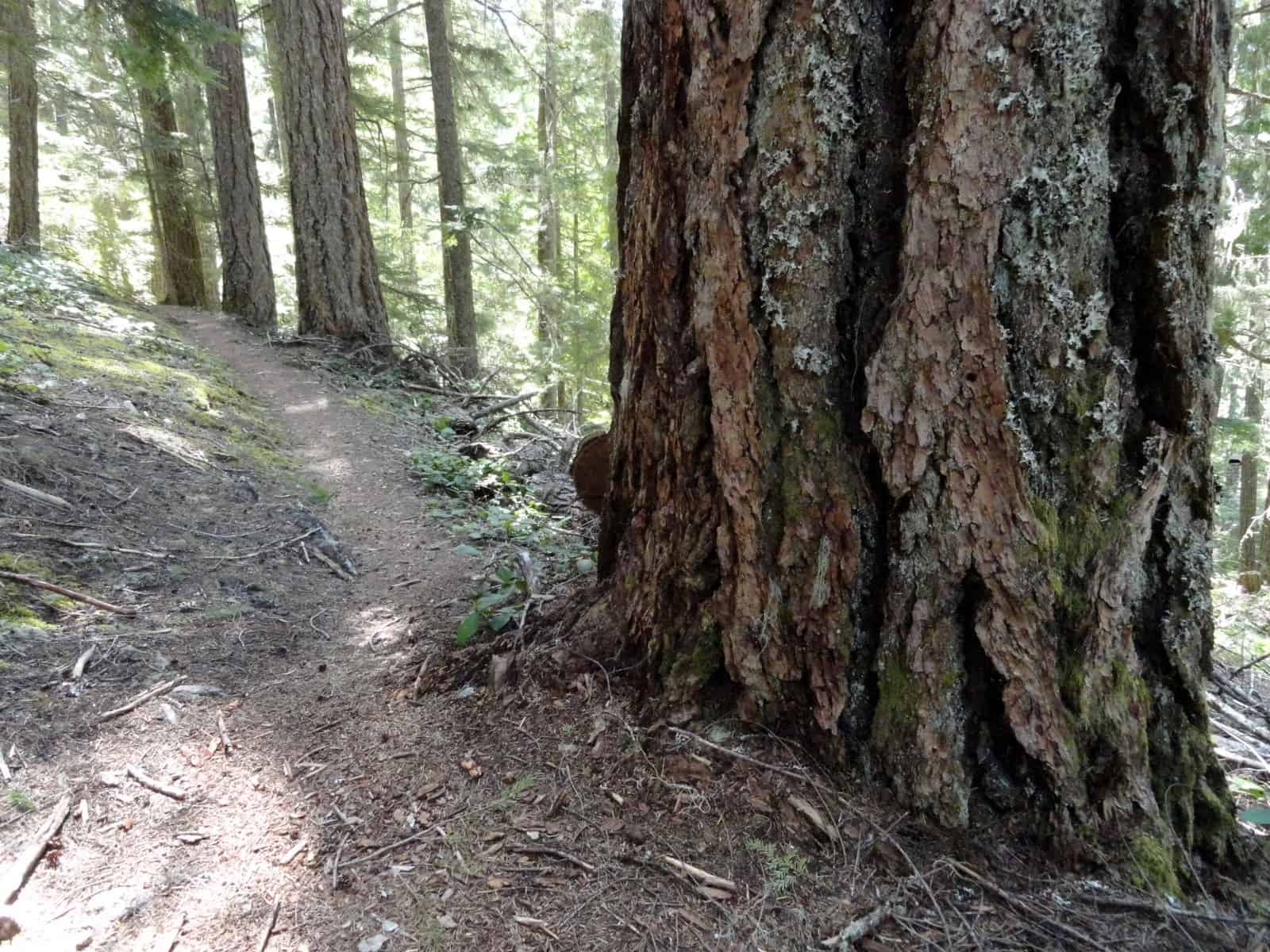
- Lots of big old Douglas firs along the way
-

- penstemon

-
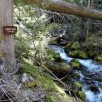
- Ranger Creek crashes along and below the trail for a couple of miles

Summary of hiking distances and times
Round trip to Little Ranger overlook: 5.2 miles; 1,200-foot gain; hiking time: 4 hrs
Round trip to Ranger Creek shelter: 9.2 miles; hiking time: 5-1/2 hours
Round trip to Dalles Ridge Trail: 11.6 miles; 2,720-foot gain; hiking time: 8 hours
The Ranger Creek trail is a quiet, forested trail that doesn’t get much attention from hikers. Perhaps that’s because the trail is seldom featured in guidebooks or hiking-related websites. You’re more apt to run into mountain bikers than hikers; this trail is one of their favorites.
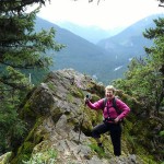
For a leg-stretching hike with views it’s only 2.6 miles (one-way) to the Little Ranger Peak viewpoint. Though the trail is steep, the elevation gain is gradual thanks to long, lazy switchbacks. A short spur leads (left) to an overlook with views of Suntop Mountain and surrounding foothills. A moss-covered outcropping may tempt you to crawl out onto it for a closer look don’t try it! A fall from the rock could be fatal.
From the Little Ranger Peak viewpoint hikers can continue another two miles to the Ranger Creek shelter. The trail is steep but in good condition; no snow on the trail and blow-downs have been removed.
As you gain elevation the trail begins a gradual transition to more open terrain – rock outcroppings can be glimpsed through the trees and so can the sky; a small stream is crossed two or three times, pocket meadows begin to appear.
Though this hike couldn’t be considered a wildflower hike there are flowers along the trail. In May find Calypso orchids like tiny ballerinas gracing the dark forest duff. By June vanilla leaf predominates; pioneer women used vanilla leaf to freshen their linens. . Vine maple appears at low to mid elevations, it’s cheerful fresh foliage adding a bright green contrast to the darker shades of conifers. Incidentally, the presence of vine maple suggests this is also a splendid fall-color hike.
In June look for marsh marigolds beside small streams and boggy areas near the Ranger Creek shelter. The shelter was built by the Boy Scouts of America (BSA) and is in good condition. The shelter provides an ideal setting for lunch or a turnaround, especially on a rainy day. There is also a water source nearby.
From the shelter hikers can continue to the end of the Ranger Creek trail if so inclined (find the trail behind the shelter). The Ranger Creek trail ends at the 1.8-mile Dalles Ridge trail (No. 1173), elevation 5,520 feet. There are good views of Mount Rainier from the Dalles Ridge Trail.
An easier option for hikers is to follow a ¾-mile or so stretch of the 6.6-mile Palisades Trail (No. 1198). The upper end of the Palisades trail starts at the shelter (left) and is signed. In June there were a few trees across the trail near the shelter. Reports indicate the trees have since been cleared. Here the undulating trail takes on more of an alpine personality with rocky outcroppings and overlooks of the White River valley.
In June clumps of wildflowers hugged the edge of the cliffs, mainly penstemon and stonecrop. As summer rolls on the floral cast of characters will change but the scenery is gorgeous spring through fall.
Whether you hike during the week or on a weekend be on the alert for mountain bikers descending the trail. It’s easier for you to stop than it is for them.
For a detailed description of the Palisades Trail (No. 1198) from the lower trailhead from SR 410, click here.
To find the Ranger Creek Trailhead
From Enumclaw head east on SR 410 and between milepost 54 and the Buck Creek Recreation area, park on the shoulder of the road (left side), elevation 2,626 feet. A spur from the highway climbs to the White River trail (No. 1199) where our hike begins. At this junction turn right, continue 0.2 miles to the junction for the Ranger Creek Trail (No. 1197), elevation 2,800 feet at the end of a switchback (left). If you get to a stream crossing, you’ve gone a little too far.
– Karen Sykes, Visit Rainier Hiking Expert
Waypoints
| Starting Point: 47.02444538218626, -121.53777837753296 | |
|
Notable Waypoints: Trailhead: N 47° 01′ 28, W 121° 32′ 16 |
|
Q: What are nearby campgrounds to the Ranger Creek Trailhead?
Buck Creek Campground, Silver Springs Campground, and The Dalles Campgrounds are the three closest campgrounds to the Ranger Creek Trailhead.
Q: Who do I contact if I have a question about the Ranger Creek Trail?
This trail is managed by the Mt. Baker-Snoqualmie National Forest, Snoqualmie Ranger District. (425) 888-1421