| Area: Carbon River |
Hike Type: Waterfall views | Pass: Natl. Park Pass |
| Distance: 9.6 mi RT | Duration: 5 hrs | Difficulty Level: Moderate |
| Snow-Free: mid-May – Nov | High Point: 3,225 | Elevation Gain: 1,350 |
Please check with Mount Rainier National Park on current conditions in this area.
-
- IMG 3196

-
- IMG 3147

-
- IMG 3162
-
- MG 2867

-
- IMG 3063

-
- IMG 3125

-
- IMG 3207

-
- MG 2871
-
- IMG 3081

-
- IMG 3072

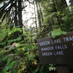
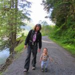
Features: kid-friendly, exceptional waterfall, exceptional old growth forest, bike-hike possibility
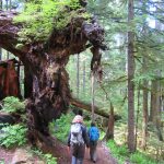
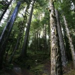
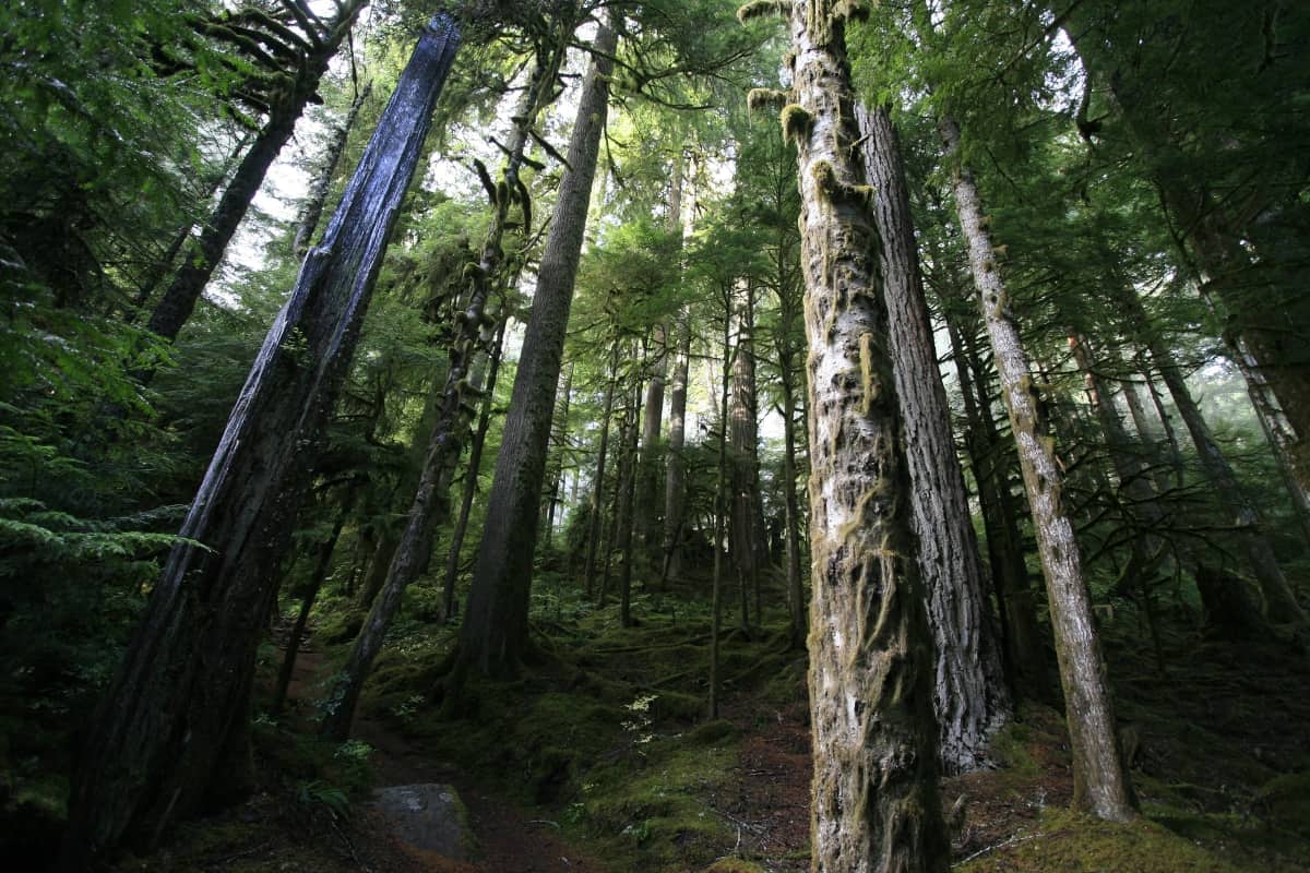
Roam through miles of some of the largest and oldest trees in Mount Rainier National Park to a placid lake and a stunning waterfall. While Green Lake is a pretty sight—it’s triple-tiered Ranger Falls and the surrounding primeval forest that are the real treats on this hike. Amble up the Carbon River Valley before briskly climbing to the small lake tucked beneath Tolmie Peak. And try to keep your neck from straining while constantly tilting your head upward admiring towering firs, cedars, and hemlocks.
Hit the Trail:
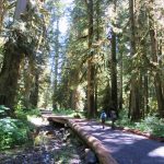
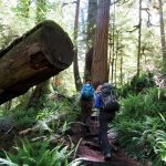
Before 2007 the hike to Green Lake was a mere 3.4 miles roundtrip. But late in the autumn of 2006, heavy rainfall caused the Carbon River to flood and washout large sections of the Carbon River Road. Rather than reopen this prone-to-washouts road, park officials decided to permanently convert it to a trail. The bad news—many popular short day hikes became much longer and the Ipsut Creek Campground was no longer car accessible. The good news is that the Carbon River road-trail makes for a pleasant hike year round and is also open to mountain bikes. Consider biking the first 3.1 miles of this hike to the old Green Lake Trailhead. Here you’ll find a bike rack and a much shorter hike to the lake.
The trailhead has limited parking, so plan to possibly park on the side of the road leading to it. Be sure to have your park pass clearly displayed in your parked vehicle. At the trailhead, you’ll find a privy and the old Carbon River Ranger Station. A newer ranger station was opened a couple of years ago on a new parkland addition just to the west. You passed it on the way to the trailhead.
Now start walking up the old Carbon River Road. The road-trail pulls away from the roaring glacier-fed river, but never far enough away that you lose the sound of it. The walking is easy with very little elevation gain. The surrounding forest is stunning—an emerald cathedral of towering ancient conifers. On sunny days, the thick canopy will do its best to keep you well shaded. And on overcast days the layered tree crowns will spare you from a soaking. At about 1.2 miles you’ll come to a junction with the indiscreet Washington Mine Trail. This path takes off south on a steep short jaunt to an old copper mine on the northern flanks of Florence Peak.
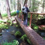
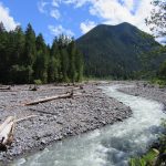
You want to continue east on the road-trail soon coming upon a channel of the Carbon River. Pass through more groves of impressive arboreal giants and cross Falls Creek on a wide bridge. Continue upriver eventually coming to a bank high above the raging river. Here enjoy excellent views of the cloudy silty pounding river below and of Tirzah Peak across the wild waterway. Just after leaving the open riverbank you’ll come to the Green Lake Trailhead. Now 3.1 miles into your hike, you’ve climbed a mere 350 feet. You’ll now subdue close to a 1,000 vertical feet in almost half the distance.
The well-built trail immediately climbs darting around massive old-growth giants. Some of the trees here are more than 800 years old—mere saplings when the Crusades were in full swing in Europe and Genghis Khan was sweeping across Asia. You’ll pass beneath a few fallen giants too—just as impressive as their vertical kindred. The trail marches up steep lush slopes undulating between short switchbacks and short traverses. It’s not overly difficult, but it should get your heart rate up a little.
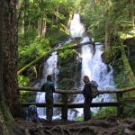
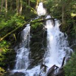
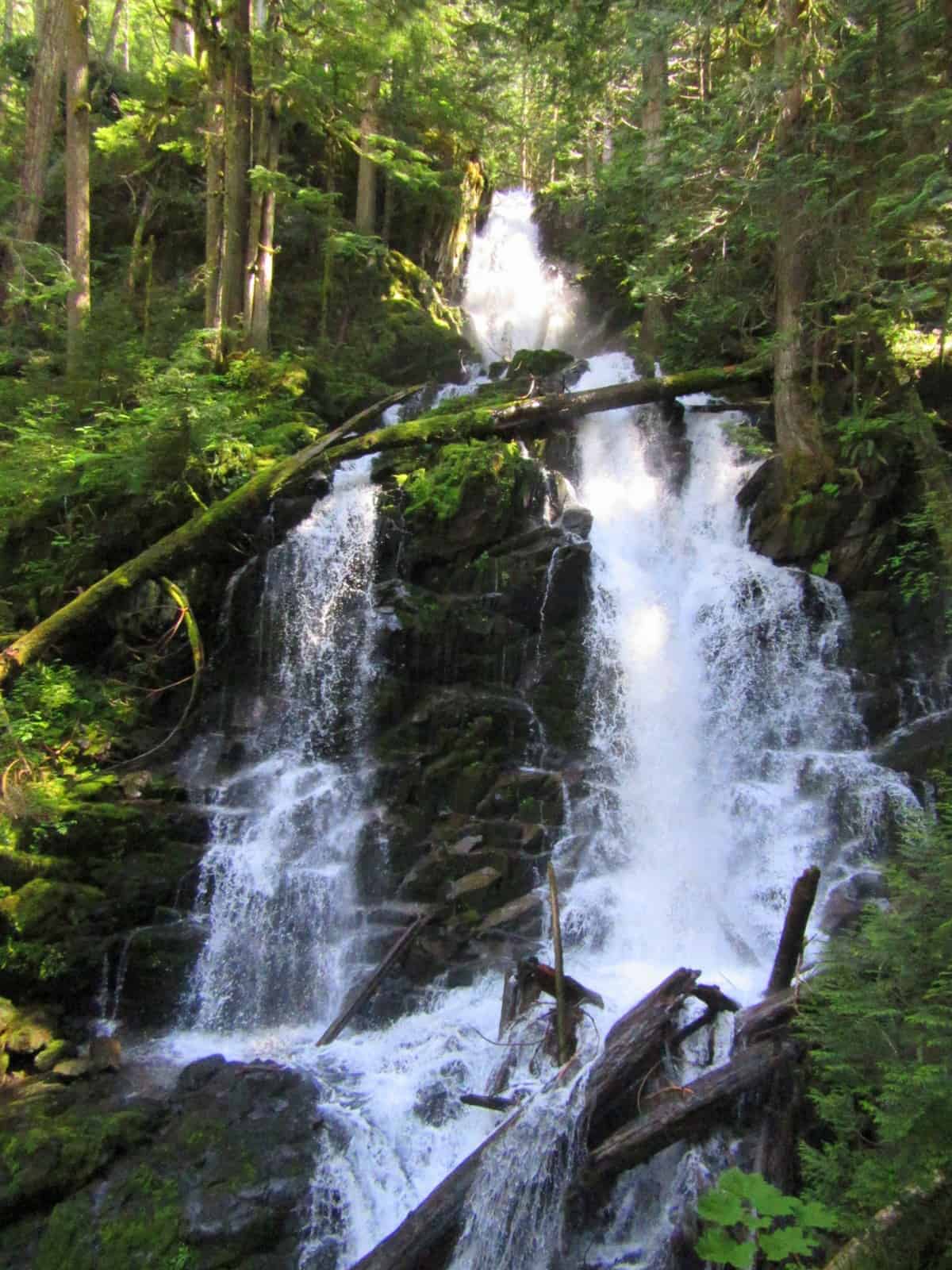
At 4.0 miles come to a junction. The way left is a short spur leading to an up-close and sure to get mist in your face viewpoint of Ranger Falls. By far the prettiest waterfalls in the Carbon River Valley, in early season they are mesmerizing. Here Ranger Creek plunges down mossy ledges for more than 170 feet. The falls are triple-tiered and fan into twin falls before converging back into one. Your view of them is unobstructed. Stay for a while—especially on a warm summer’s day.
Then continue hiking commencing up another stretch of switchbacks. The climb then eases followed by a slope traverse before coming to Ranger Creek. Cross the creek on a high log bridge—then make one last climb—before descending a tad and coming to Green Lake (elev. 3,185 feet). Here next to the placid lake’s outlet is a small opening graced with several large weather-bleached logs. Prop yourself up on one, grab some snacks, take a break and enjoy the view.
The lake sits in an emerald basin. Its green tinted waters reflecting the surrounding verdant forests. No surprise—though quite unimaginative where this lake got its name. Above the lake, you can catch a glimpse of Tolmie Peak, one of four summits in the park still sporting a fire lookout tower. The lake warms up enough late in the season that it might tempt you for a dip—or at least a foot soak.
A rough boot beaten path leaves left from trail’s end making its way along the lake’s eastern shoreline. It leads to a few limited viewing areas—but much of the lakeshore is lined with thick vegetation—so don’t expect to find a sandy beach or sunning area. Instead, hang out for a little while on one of the logs and watch for resident birds. Then make your return—with a mandatory second viewing of Ranger Falls.
Contact: Mount Rainier National Park; https://www.nps.gov/mora/index.htm; (360) 569-2211
Maps: Green Trails Mount Rainier National Park 269S
Trailhead directions: From Buckley, follow SR 165 south. At 10.4 miles (just beyond Fairfax Bridge) bear left onto the Carbon River Road and continue for 7.7 miles to the trailhead.
Trailhead facilities: Privy
– Craig Romano, is an author of more than a dozen hiking guidebooks including the newly released 100 Classic Hikes Washington (Mountaineers Books) which includes several hikes in and around Mount Rainier National Park.
Waypoints
| Starting Point: N46 59.704, W121 54.908 | |
|
Notable Waypoints: Green Lake Trail junction: N46 59.549 W121 51.037 Green Lake: N46 58.686 W121 51.491 |
|
Q: Can I go fishing at Green Lake?
Yes, Green Lake is reputed to have pretty good fishing, mostly non-native cutthroat trout. Click here for a PDF on fish regulations. Please visit the official Mount Rainier National Park website for details about fishing and boating in the national park.