| Area: Sunrise |
Hike Type: Mountain views | Pass: Natl. Park Pass |
| Distance: 5.4 mi RT | Duration: 3 hrs | Difficulty Level: Moderate |
| Snow-Free: Mid-July – Sept | High Point: 7,200 | Elevation Gain: 900 |
-
- IMG 4857

-
- 9174350565 9fd5168dfb b

-

- IMG 4890

-
- IMG 4886

-
- 9174386343 5206b2920c b

-

- 14451811279 632b41666f k

-
- IMG 4874
-

- 14413087438 de39fd0a66 k

-
- 14413069080 fe386db728 k
-
- IMG 4876
-
- IMG 4906

-
- IMG 4894

-
- 14413048560 7a24357128 k

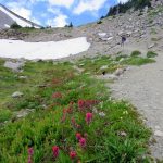
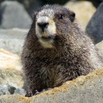
Features: kid-friendly, wildflowers, alpine views, historic fire lookout, wildlife watching
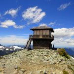
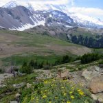
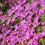
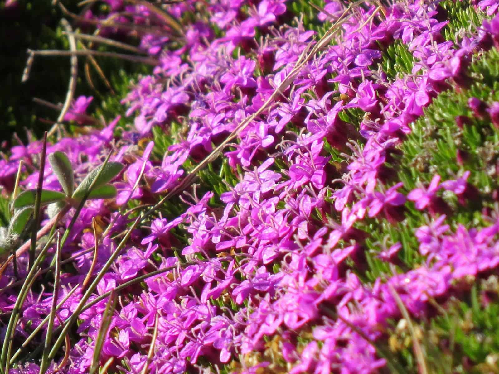
Hike to one of the four remaining fire lookouts in Mount Rainier National Park. Perched on an open 7,181-foot knoll on rocky Mount Fremont, this historic structure is the highest of the park’s lookouts. But don’t let Fremont’s lofty elevation intimidate you. You start your hike at Sunrise at 6,400-feet making this journey pretty manageable. Wildflowers along the way can be quite showy—but the real treat along this trail is catching a glimpse of the large herd of mountain goats that reside here.
Hit the Trail:
From Sunrise, there are three ways to get to Mount Fremont. The most direct way is to follow an old road—now a wide trail toward Sunrise Camp and then take the Wonderland Trail up a steep often snowy gully to Frozen Lake Junction (from where the Mount Fremont Trail departs). The longer quieter way is to follow the Sunrise Rim Trail to the Wonderland Trail. Then meander through meadows on your way to Shadow Lake before traversing Sunrise Camp and heading up that aforementioned gully to Frozen Lake Junction. The most scenic route and the one described here involves hiking to Frozen Lake Junction via the Sourdough Ridge Trail.
The direct way to Frozen Lake Junction is 1.3 miles. The long way is 1.8 miles. And the way described here is 1.4 miles. Consider one of the other routes for your return to add a little variety to your hike. Okay—start your hike by following a wide nature trail leaving the big parking lot north. Bear left at a fork and reach a junction along Sourdough Ridge (el. 6625 feet) in a little more than 0.3 mile. Now head left hiking on the packed-with-panoramic-views Sourdough Ridge Trail.
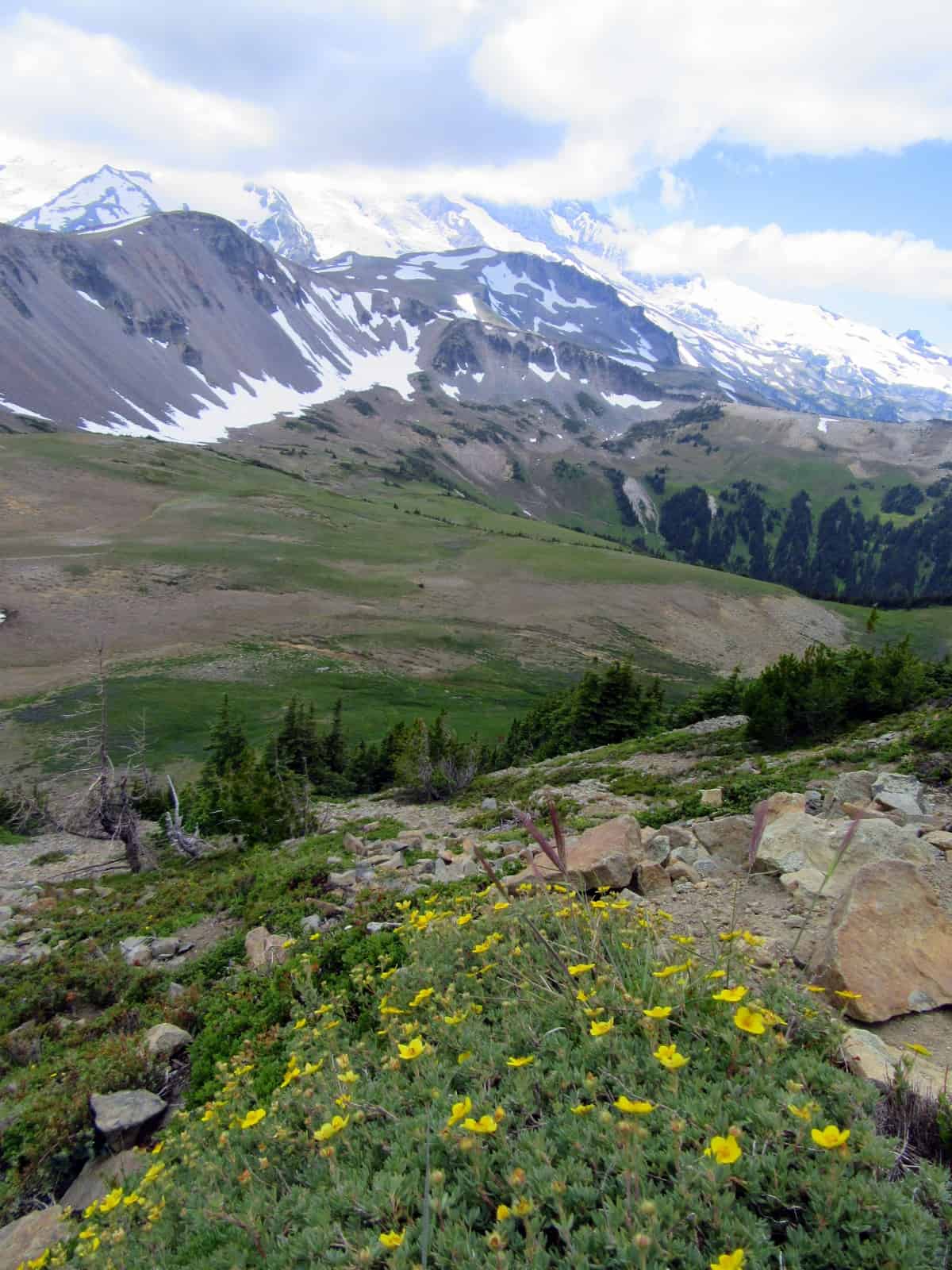
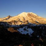
All along this trail enjoy sweeping in-your-face views of Mount Rainier and all of her glacial glory. Savor breathtaking views too of Yakima Park’s emerald lawn rolled out below you with its frolicking deer, marmots, and ground squirrels. Be sure to let your eyes roam east too to catch views of Crystal Mountain, Nelson Ridge, and scores of other peaks crowding Rainier and the Cascade Crest. At .6 mile pass the Huckleberry Creek Trail, one of the loneliest paths in the park. Beyond the junction enjoy a slight descent and non-stop views. Reach busy Frozen Lake Junction at 1.4 miles. Here four trails converge and many hikers loiter taking snack breaks and contemplating their hiking options.
Now head right on the Mount Fremont Lookout Trail descending a little across a plain of pumice and lichen-encrusted rocks. The way follows along a fence enclosing nearly perpetually snow filled Frozen Lake. This stark body of water is the water supply for Sunrise. It is imperative that you do not cross the fence line. A string of signs in many languages emphasizes this point. Enjoy viewing the lake from along the fence—your telephoto lens should work just fine for the close-up.
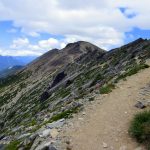
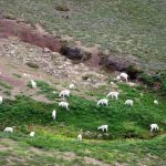
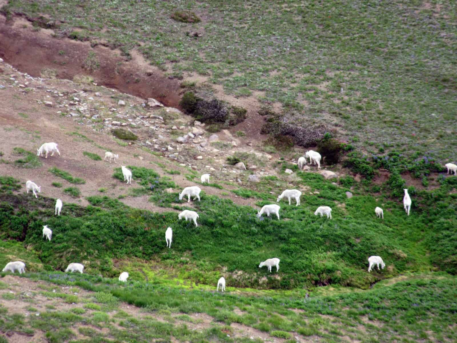
The trail eventually reaches a small saddle and begins to climb leaving the lake behind. With each step, views of the barren windswept alpine tundra surrounding you expand. To the south it’s big barren Burroughs Mountain and craggy Skyscraper Peak. Rainier looms above them. To the west Old Desolate and Sluiskin Mountain provide a rugged backdrop to emerald Berkeley Park. Keep your eyes fixed on the flats directly below for moving white patches. Yep—those aren’t snowfields but mountain goats. A rather large herd hangs out here on Fremont, Burroughs and Berkeley Park. It is not rare to see more than two score of these members of the Bovid family grazing, wallowing, napping, and skedaddling in the surrounding slopes, meadows and plain.
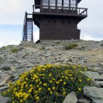
Continue climbing the open slopes punctuated by clusters of tenacious whitebark pines. The trail rounds a 7,291-knoll and then heads northward—the lookout now in view. Traverse steep open slopes and take in breathtaking views of the West Fork White River below. The way slightly descends before once again heading upward. The grade is gentle but the rocky terrain will have you watching your step. The trail skirts below Fremont’s summit before emerging on a 7,181-foot knoll housing the historic lookout.
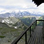
Definitely check out the lookout, still occasionally used by park personnel. Walk the catwalk and cherish the views. They’re jaw-dropping! Look north across the broad emerald plain of Grand Park. Beyond is a seemingly infinite wave of verdant ridges succumbing to Puget Sound. The Olympics rise above the fog and haze in the Puget Trough. Look northeast and trace the Cascade Crest all the way to Mount Baker. Then turn south and try to keep your senses from exploding as you savor an in-your-face view of Rainier’s impressive Willis Wall and sprawling Emmons Glacier. Stay for a while. Keep your lunch from being raided by ground squirrels. Make a friend or two. And cherish the natural beauty from this historic landmark.
Notes: Dogs-prohibited
Contact: Mount Rainier National Park; https://www.nps.gov/mora/index.htm; (360) 569-2211
Maps: Green Trails Mount Rainier National Park 269S
Trailhead directions: From Enumclaw follow SR 410 east for 37.5 miles to Mount Rainier National Park turning right onto the White River Road. Continue for 15.5 miles to Sunrise.
Trailhead facilities: Visitor Center, privies, water, picnic area.
– Craig Romano, is an author of more than a dozen hiking guidebooks including the newly released 100 Classic Hikes Washington (Mountaineers Books) which includes several hikes in and around Mount Rainier National Park.
Waypoints
| Starting Point: N46 54.874 W121 38.544 | |
|
Notable Waypoints: Frozen Lake Junction: N46 55.056 W121 40.127 Fire Lookout: N46 56.030 W121 40.516 |
|
Q: How do I place a reservation for staying overnight at the Mount Fremont Lookout Tower?
A: You can’t. Overnight camping at or in the lookout tower isn’t permitted. For overnight camping look to Mowich (open seasonally) or Silver Springs Campgrounds.