| Area: Paradise |
Hike Type: Wildflower views | Pass: Natl. Park Pass |
| Distance: 5.4 mi Loop | Duration: 4 hrs | Difficulty Level: Moderate |
| Elevation Start: 5,400 | Elevation End: 7,100 | Elevation Gain: 1,700 |
| Snow-Free: Mid-July – Mid-Oct |
-
- high Skyline Trail

-
- z moonwalk
-
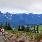
- views from skyline trail

-

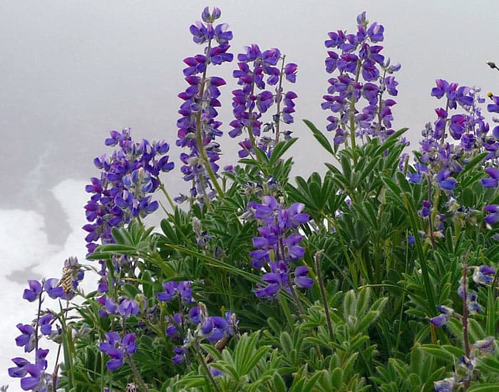
- bLupine in the fog Golden Gate trail
-
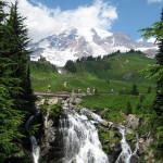
- myrtle falls mk

Q: I have time to hike one trail at Mount Rainier National Park this summer. Which trail should I hike?
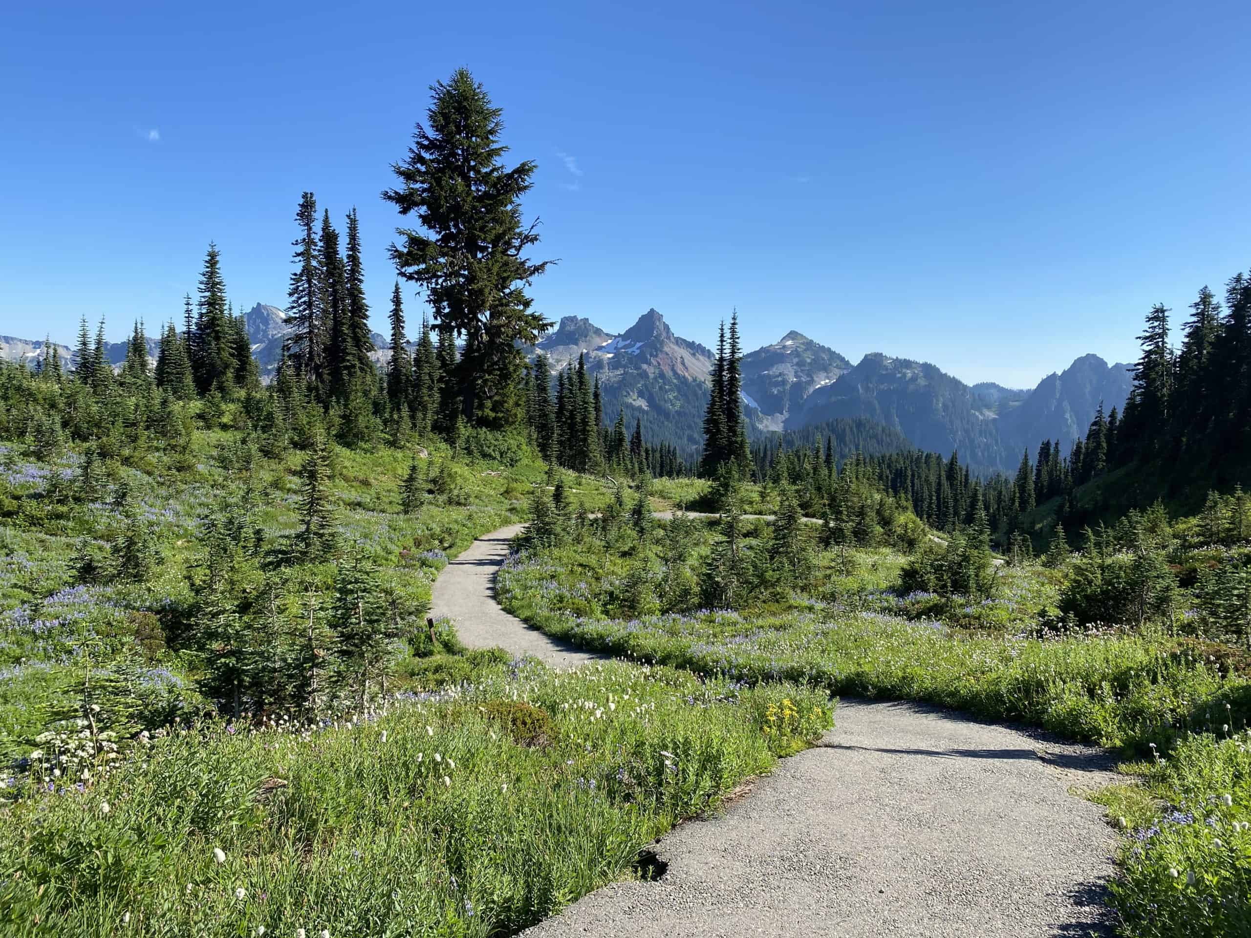
A: If your schedule allows you time to hike only one trail at Mount Rainier National Park, we recommend the Skyline Trail, especially on a sunny day. You’ll hike through a variety of terrain ranging from sweetly scented meadows with wildflower displays to snowfields and the rubble of glaciers.
The hike from Paradise to Panorama Point is world-class; tourists come from afar to experience the wildflower displays for which Paradise is famous. Not only are there views of Mount Rainier and the Nisqually glacier; on clear days there are views of the rugged Tatoosh Peaks, Mount Adams, Mount Saint Helens, and Mount Hood.
Be prepared for a variety of terrain on the Skyline Trail; sturdy boots are recommended. Forgot your boots? You can still safely experience the wonders of Paradise by strolling the shorter trails at Paradise with views accessible to all, including the Glacier Vista and Alta Vista Trails.
Pick up a trail map at the Henry M. Jackson Visitor Center so you can plan your route. A first-time visitor may find the intricate maze of trails near Paradise initially confusing but trail junctions are well signed and you can get advice from the visitor-friendly Wilderness Information Center at the Henry M. Jackson Visitor Center.
Be sure you stay on designated trails despite the temptation of avalanche lily-dotted meadows that invite one to stray. Park rangers and signs remind us that trampled flowers may not recover from human impact for decades, if at all. Luckily, the trail is so lavishly bordered with wildflowers you needn’t leave the trail at all.
The hike to Panorama Point via the Skyline Trail starts out on stone steps near the Visitor Center and climbs briefly uphill to a series of trail junctions. Turn right at the main junction; follow the signs to Panorama Point on the Skyline Trail. This main trail also provides access to Alta Vista, the Glacier Vista trail and other Paradise “flower” trails or viewpoints.
Our hike to Panorama Point fell on what we affectionately call a “transitional” day; where fog and clouds gradually give way to the sun (or sadly, vice versa). En route, we enjoyed graceful groves of subalpine trees placed in meadows sparkling with avalanche lilies and bright patches of pink heather. In late July, Western pasque flowers were in transition some still blooming, others gone to seed. Rosy spirea, lupine and bright yellow cinquefoil added splashes of color to the green meadows.
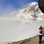
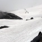
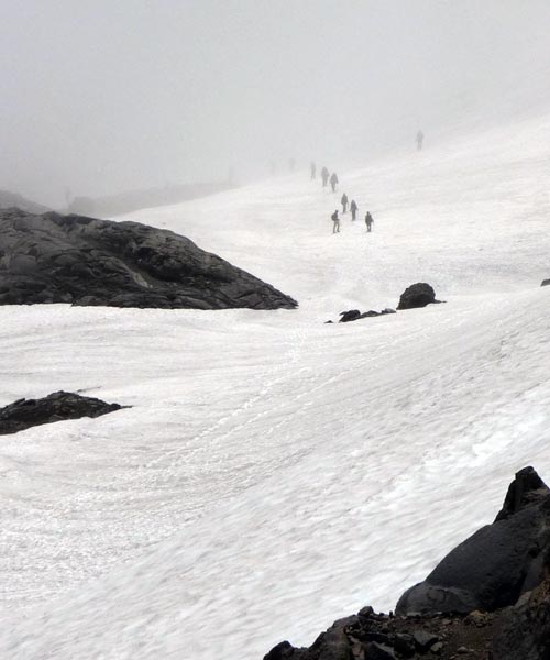
In mid-July, we found snow patches at higher elevations where park rangers had marked a safe route across the snow. We had planned to hike the Lower Skyline Trail back to Paradise. Instead, we found the Lower Skyline closed due to snow and ice; hikers were directed to take the High Skyline Trail instead.
The persistent fog began to lift as we approached Panorama Point; Mount Rainier materialized slowly through the mist. Crevasses and rocks on the flanks of Rainier appeared and dissolved again as mist teasingly rolled back and forth across the skyline.
We reached Panorama Point (6,227 feet). Turning away from Rainier the peaks of the Tatoosh range poked through like islands in a sea of clouds.
The High Skyline continues, climbing above Panorama Point to a high point (N 46° 48′ 20″, W 121° 43′ 39″; elevation 7,051 feet) where you can look down on the Point. At Panorama Point there are options: hike back the way you came or extend your hike by making a loop as we did.
We continued on the High Skyline Trail as the trail dropped down to the moonscape rubble of an ancient moraine interspersed with snow patches. As we descended the world of rock and snow gradually gave way to tender meadows and moss-bordered rivulets.
When you get to the junction (N 46° 47′ 56″, W 121° 43′ 22″; elevation 6,400 feet) for the Golden Gate trail, there are more options. For a shorter route follow the Golden Gate trail through Edith Basin back to Paradise. You can also continue on the Skyline Trail; this adds about a mile to your hike. The Skyline trail drops down to the Stevens Van Trump Memorial, continuing to Myrtle Falls (5,600 feet) before it descends to Paradise. Mileages are displayed on trail markers to help you decide which route you want to take.
As we approached Paradise the meadows blazed with magenta paintbrush, bistort, Jacobs ladder, lousewort, valerian, and cinquefoil. Marmots posted on sentry rocks shrilled warnings before scuttling out of sight as we passed.
About ½ mile from Paradise we crossed Myrtle Creek on a bridge; here you can also drop down to a dramatic viewpoint of Myrtle Falls, a favorite spot of professional photographers.
All too soon we left the trail and stepped into the parking lot, feeling slightly dazed as if we had just been awakened from a dream.
– Karen Sykes, Visit Rainier Hiking Expert
Waypoints
| Starting Point: 46.787056, -121.734167 | |
|
Notable Waypoints: Trailhead: N 46° 47′ 07, W 121° 44′ 06 |
|
How hard is the Skyline Trail?
Considered a moderately difficult hike. Hiking the trail counterclockwise offers hikers a lower initial elevation grade. Hiking clockwise quickly offers breathtaking views of Edith Creek and Myrtle Falls and a number of ancillary trails to explore.
How long does it take to hike the Skyline Trail?
The average hiker takes 4 hours on the main trail.
Where to read additional trip reports from the Skyline Trail?
The Washington Trails Association
What is the closest lodging to the Skyline Trail?
The Paradise Inn is located within walking distance of the trailhead however, the historic lodge is not open year-round. The Paradise Inn is usually open mid to late May through early October. The next closest option is the National Park Inn which is located an approximately 25-minute drive from the trailhead and is open year-round.