| Area: Paradise |
Hike Type: Mountain views | Pass: Natl. Park Pass |
| Distance: 5.6 mi RT | Duration: 3.5 hrs | Difficulty Level: Moderate |
| Snow-Free: mid-July –Oct | High Point: 6,400 | Elevation Gain: 1,000 |
-
- IMG 6811

-
- IMG 6765

-
- IMG 6752 1

-
- IMG 6783
-
- IMG 6794
-

- IMG 6822
-
- IMG 6792 1

Features: kid-friendly, wildflowers, alpine views, historical, wildlife viewing
The Paradise Ice Caves were one of the most popular features in Mount Rainier National Park. But that was decades ago, before a changing climate claimed this fascinating frozen feature. The trail that once lead to the caves however is still in place—and now it only sees a fraction of the number of hikers than from its heyday. So, hike this trail for solitude. But its breathtaking close-up views of the mountain and the Paradise Glacier are enticing too. There’s also a sparkling tarn along the way, and a slew of waterfalls to keep you mesmerized as well.
Hit the Trail:
The Paradise Glacier Trail branches off from the Skyline Trail at the Stevens-Van Trump Historical Monument. There are several ways you can do this hike, the shortest by taking the 4th Crossing Trail from the Paradise Valley Road to the Skyline Trail. My preferred route—and the one described here begins at Paradise.
From the Jackson Visitor Center, start off on the Skyline Trail heading northeast. Follow the paved path past the Paradise Inn and the Guide House and Waterfall trails. The way soon steepens cresting a bench just above Edith Creek. Here enjoy a sweeping close-up view of Mount Rainier, and if you’d like a close-up view of Myrtle Falls by following a short spur right.
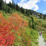
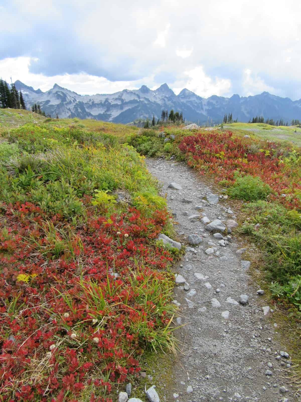
The Skyline Trail continues by crossing Edith Creek on a bridge and soon coming to a junction with the Golden Gate Trail. Continue right, now on a wide graveled path sporting plenty of impressive stone steps and stone drainage gullies. The trail traverses steep slopes across the Paradise Valley. Enjoy gorgeous views of the valley and its Tatoosh Range backdrop. In summer, the surrounding slopes are alive in a dazzling array of wildflower blossoms. In autumn, mountain ashes add oranges to the golden grasses while ground hugging blueberry bushes set the ground afire with patches of red.
The trail descends about 150 feet or so making a boot-wetting crossing of a cascading Paradise River tributary, before making a bridged crossing of another cascading tributary. Here the 4th Crossing Trail departs right. You want to continue left now climbing up Mazama Ridge. A few switchbacks help ease the grade. So too do the magnificent views of Mount Rainier hovering over Paradise.
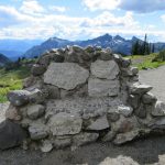
At 1.4 miles reach Mazama Ridge and the junction with the Lakes Trail. The Lakes Trail departs right for the Reflection Lakes offering another starting point for this hike. From here you want to continue left climbing up the open ridge. Views east to Stevens Canyon and beyond and south to the Tatoosh Range are inspiring. So too are the carpets of wildflowers that drape this ridge throughout most of the summer. At 1.8 miles come to the Stevens-Van Trump Memorial that commemorates the spot where General Hazard Stevens and Philemon Van Trump camped before making their famous 1870 ascent of Rainier. The memorial also commemorates their guide Sluiskin who waited for their return at this spot. The pretty waterfall just to your left is also named for Sluiskin. The canyon right was named for Stevens, and a beautiful park above Comet Falls is named for Van Trump. This memorial was placed here in 1921 by the Seattle Mountaineers and Portland based Mazamas.
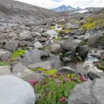
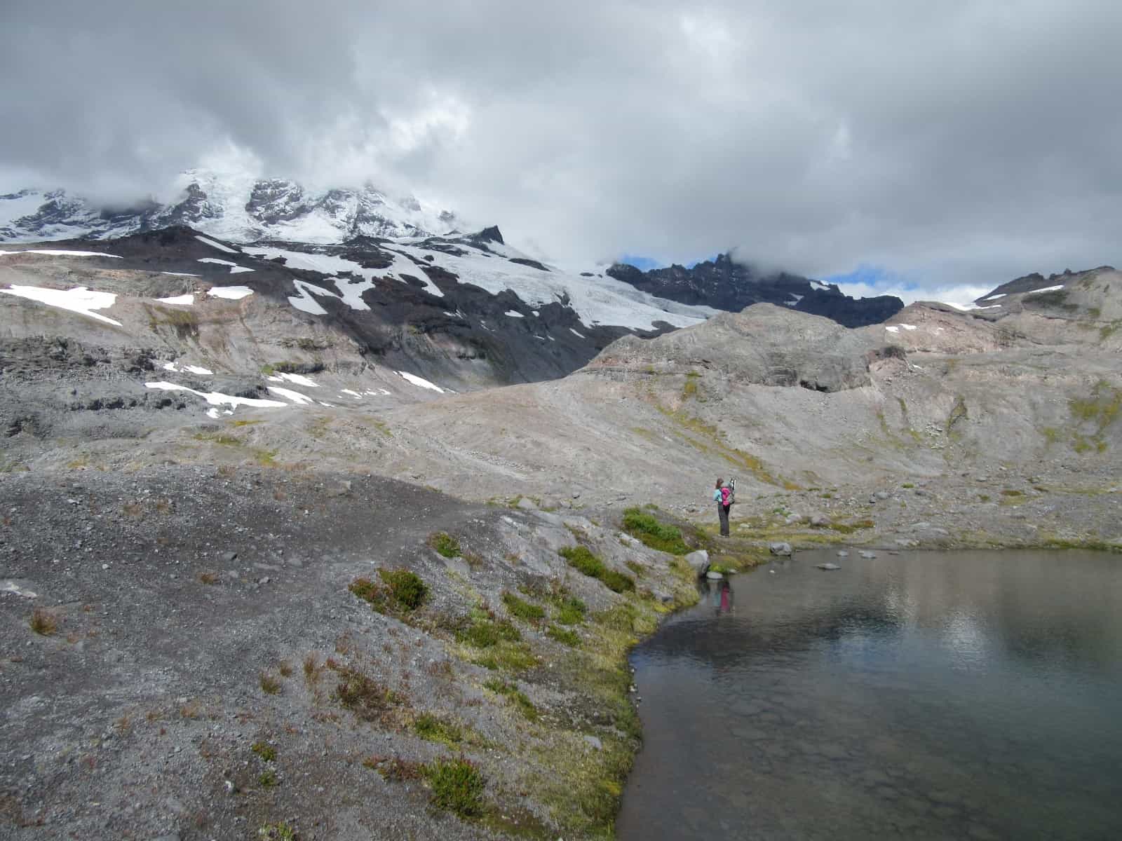
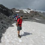
Now head right on the lightly traveled Paradise Glacier Trail ascending a ridge above cascading Stevens Creek. The way grows increasingly open, grasses and sedges giving way to glacial till. The trail is often covered with large snowfields and snow patches most of the summer. Snow-fed creeks and rivulets rush down and across the trail feeding small tarns and wetland depressions. A series of pretty tarns lie just to the right on the edge of the ridge. When lighting is just right, they capture beautiful reflections of clouds and peaks.
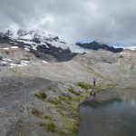
The trail marches north skirting below a small knob before brushing up against a sparkling little tarn that often reflects Rainier. You’ll want to spend some time here trying to capture a few choice photographs. Then continue hiking on a rockier path across and along polished ledge and glacial till. This entire area was under a sheet of glacial ice not that long ago. Look around for tenacious marmots scampering about colonizing plants in search of some good grazing. Look right at the plummeting glacier-fed Stevens Creek now just a couple of hundred feet away.
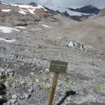
At 2.5 miles a sign announces the end of maintained trail. But when snow is absent, a well-defined path can still be followed beyond for a short distance. Take it hiking above and perhaps across a lingering snowfield reaching a barren bench in .3 mile. Here creeks run across the seemingly desolate plain feeding Stevens Creek. But look close at the ground and you’ll see mosses and sedges claiming this newly exposed ground. It was here not too long ago where a large network of ice caves and the snout of a glacier once reached. The caves are no more and the glacier has receded much higher up the surrounding stark slopes. It must have been quite the scene—check out some of the old photos of the caves at the museum in Longmire. The area is still quite beautiful and a testament of our changing climate and environment.
Experienced off-trail hikers may want to continue farther to check out distant waterfalls. But for most folks—this is a satisfying spot to turn around. Retrace your steps back to the Skyline Trail—and then return the way you came—or consider a longer return by either heading right on the Skyline Trail and following that wonderful trail back to Paradise—or by following the Golden Gate Trail back to Paradise—a shorter but just as beautiful return.
Notes: Dogs-prohibited
Contact: Mount Rainier National Park; https://www.nps.gov/mora/index.htm; (360) 569-2211
Maps: Green Trails Mount Rainier National Park 269S
Trailhead directions: From Elbe, follow SR 706 east (passing through Ashford) for 14 miles to the Nisqually Entrance of Mount Rainier National Park. Then continue east on the park’s Paradise-Longmire Road for 17 miles bearing left onto the Paradise Road. Continue another 2.1 miles to large parking areas and trailhead.
Trailhead facilities: restrooms, visitor center, guest services, ranger station, water.
– Craig Romano, is an author of more than a dozen hiking guidebooks including the newly released 100 Classic Hikes Washington (Mountaineers Books) which includes several hikes in and around Mount Rainier National Park.
Waypoints
| Starting Point: N46 47.173 W121 44.218 | |
| Notable Waypoints:
Junction at Stevens-Van Trump Memorial: N46 47.654 W121 42.965 Trail end at old ice caves site: N46 48.335 W121 42.965 |
|