| Area: Chinook Pass |
High Point: 4000 feet at North Snoquera Point | Pass: NW Forest Pass or Interagency Pass |
| Distance: 8.4 miles out and back to North Snoquera Point14.6 mile loop combined with Little Ranger and White River Trails | Snow-Free: July – November | Elevation Gain: 1500 feet out and back to North Snoquera Point or 2700 feet loop |
| GPS Waypoints:
Camp Sheppard Trailhead: N47 02.153 W121 33.599 Palisades Trail & White River Trail Junction: N47 02.949 W121 34.080 North Snoquera Point: N47 02.534 W121 33.311 Junction with Little Ranger Trail: N47 02.769 W121 31.420 |
-

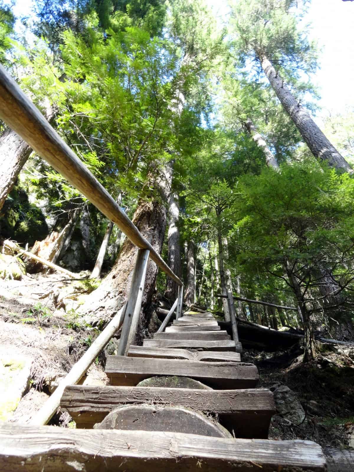
- Stairs help negotiate a steep section of trail within the ravine
-
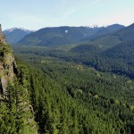
- Looking up the White River Valley from the first viewpoint

-
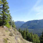
- Trail along the Palisades
-
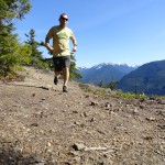
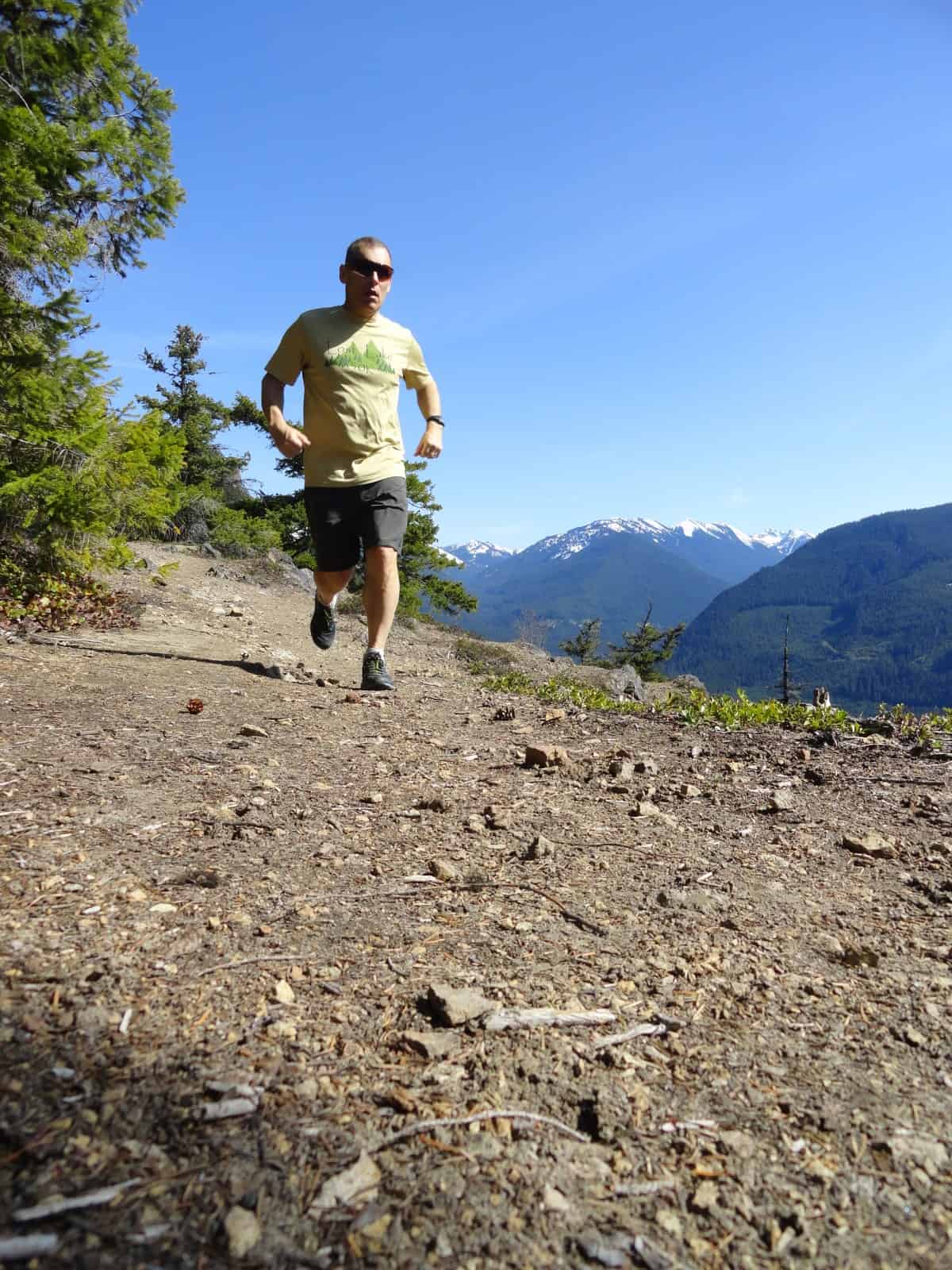
- Running along the Palisades
-
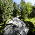
- Lower Dalles Creek Falls plummets down a rock face

-
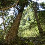
- Big Trees shade the trail through a tight ravine

Impressive waterfalls, stately big trees, and sweeping views of the White River Valley; the Palisades Trail packs quite a scenic punch. Often shunned by mountain bikers because of its steep inclines and stairs, the Palisades Trail is overlooked by many hikers too, as there are shorter and easier ways to get to the Dalles Ridge high country. With fairly light usage, good tread and south slopes that often melt-out early in the season, the Palisades Trail is a great destination for moderately-challenging trail running.
While this trail starts from a trailhead (easy-to-miss) on SR 410 (about 1.3 miles south of The Dalles Campground); I like to start my run from the Camp Sheppard Trailhead. Why? Besides offering plenty of parking and a privy—I get to warm up first on fairly level terrain by following a section of the gentle White River Trail before steeply climbing.
Starting from the Camp Sheppard Trailhead head east immediately coming to an outdoor amphitheatre used by the adjacent Boy Scout Camp. Continue straight passing the Moss Lake Loop Nature Trail and after a short climb reach a four-way junction. Straight ahead is the Snoquera Falls Trail, a popular hike and a good choice for extending your run. The White River Trail heads right upriver, and left downriver.
You want to go left skirting Camp Sheppard and passing the northern junction of the Snoquera Falls Loop. At 1.3 miles from the trailhead you’ll come to the Palisades Trail. The way left steeply drops about 300 feet to reach SR 410. You want to go right immediately entering a dark and pretty ravine. Cross Dalles Creek here on a series of rocks that may be submerged early in the season.
Then get ready to get your heart rate up! The trail works its way up the tight creek-cradling ravine via a series of short switchbacks. Dart under and around ledges and weave through impressive showy old-growth giants. By mid-spring the way is lined with blossoming wildflowers. After about 0.8 mile or so and over 400 feet of climbing come to the base of Lower Dalles Creek Falls. Plummeting nearly 300 feet down a steep tiered wall of the Palisades, these falls are definitely worth taking a break from your running to admire. They are most impressive in the spring when snow melt and rains fuel their volume.
Now continue on an even steeper course working your way up and out of the ravine. Come to a neat wooden staircase which will slow your run down—but help you negotiate a very steep slope. In early season, a small cascade fans down a steep adjacent rocky ledge. Hang in there as the grade finally eases! The way now heads south traversing steep and thickly forested slopes. Cross a small tributary where a seasonal waterfall may cool you down with its spray. Then soon afterward reach a bridged crossing of Dalles Creek where the small but attractive Upper Dalles Creek Falls can been seen upstream.
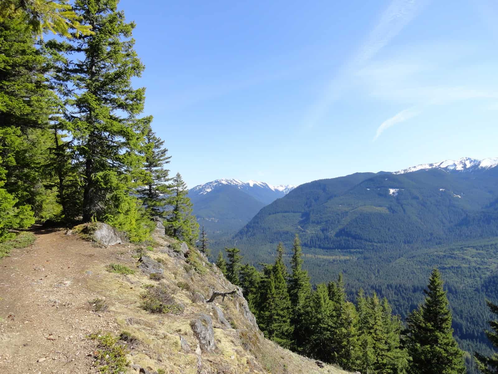
From here the trail becomes quite enjoyable to run as its meanders through an open forest on an easy grade. The way comes to a small viewpoint (el. 3375 feet) propped on the edge of the Palisades granting a decent view of the valley below. But, a much better viewpoint lies not too far ahead—so keep running. At 4.2 miles from your start reach North Snoquera Point (el. 4000 feet).
Time now for a snack and to feast on some sweeping views. Here directly above Snoquera Falls and 1500 feet above the White River, gaze down at Skookum Flats and the Buck Creek Airstrip. Then look out at Crystal Mountain, Norse Peak, Brown Peak, Slide Mountain, and Sun Top. Mount Rainier hovers over the green wall of peaks to the west.
This is a great turn around to what has so-far been an uphill and challenging run. Enjoy the downhill return. But, if you’re up for more miles, continue on the Palisades Trail steadily but sanely gaining elevation along the rim of the Palisades. The way temporarily bends away from the rim to cross Snoquera Creek before coming to South Snoquera Point (el. 4500 feet) offering an even more sweeping view.
Then follow the trail along a forested ridgeline climbing another 600 feet scooting around the summit of Little Ranger Peak before reaching the junction with the Ranger Creek Trail near an historic shelter at 7.9 miles. Now enjoy a 4.8 mile downhill run via long sweeping traverses interspersed with short switchback sections.
The Trail intersects the White River Trail where you’ll turn right and head north 1.9 easy miles back to your start. This loop is incorporated into the famous White River 50 Mile Endurance Run (add link here to White River Story) and offers a shaded respite to the sunnier and warmer sections of that challenging double loop course.
Notes: Green Trails Map Greenwater, WA no. 238 shows this trail
Contact Snoqualmie Ranger District, Enumclaw office (360) 825-6585 or www.fs.usda.gov/mbs for more information
Getting to the White River Trail (Camp Sheppard Trailhead):From Enumclaw, follow SR 410 east for 28 miles. Turn left onto Camp Sheppard access road and reach trailhead in 0.1 mile.
– Craig Romano, Hiking guidebook author and co-author of twelve books