| Area: Sunrise |
Hike Type: Mountain views | Pass: Natl. Park Pass |
| Distance: 7.5 mi RT | Duration: 4 hrs | Difficulty Level: Moderate |
| Elevation Start: 6,150 | Elevation End: 6,150 | Elevation Gain: 700 in / 900 out |
| Snow-Free: July – Oct |
-
- path hq
-
- hiker

-
- upper palisades lake

-
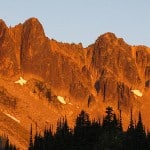
- palisades sunrise

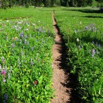
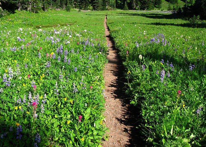
The Palisades Lake Trail, out of Sunrise Point, is one of those hikes where you can do as little or as much as you want. This trail passes by six pristine, alpine lakes, like jewels on a necklace. Each can be a destination in itself or a site for pictures before moving on. You will probably find picas in great numbers and a marmot or two in the rocks. You may even come upon a few deer or elk grazing in the giant meadows. This is a great fall hike… all the colors are brilliant, the air is cool and the bugs are few. (Although August is the perfect time to see the meadows carpeted with wildflowers, the bugs, especially the mosquitoes, are numerous.)
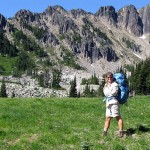
The trailhead to the Palisades Lakes begins at Sunrise Point, about 3 miles BEFORE the Sunrise Visitor’s Center. You can’t miss the large parking lot inside the hairpin turn in the road. There are always people walking around taking pictures from this ridge. From here, the view of Mt. Rainier is exceptional and you can even see Mt. Adams in the distance to the south. The trail goes east from the parking lot and follows the ridge for a short distance before dropping steeply down the north side. Remember at this point that if you drop down, you must be able to come up the same steep hillside.
As you hike down this hill you will see Sunrise Lake ahead of you. The total distance from the parking lot to this lake is .5 miles. This is a beautiful place for a picnic if that is as far as you would like to go. The trail is short enough for little ones… even if you have to carry them up the hill on the return. Along the way, you will hear the squeaks of many picas (small rodents), as they scurry into their little holes in the rocks. This trail ends at the lake.
If Sunrise Lake is NOT your destination you will need to hang a right BEFORE reaching the bottom of the hill. (There is a sign at this junction.) The trail continues on through forest alternating with meadow on fairly level ground to Clover Lake, 1.5 miles from the parking lot and the second and largest lake in the chain. Clover Lake, another great spot for a picnic lunch, is a good destination for a family outing with older children. Note: there are small trails along the banks… please don’t stray off of them, as the meadow is fragile and is easily damaged by hiking boots.
The main trail travels past Clover Lake, up the next hill and down the other side… another steep grade. Again, coming back on this part of the hike will get your heart-rate up. You cross another large meadow, with the rocky ridge to the west getting more impressive as you hike on. The definition of “Palisades” becomes more apparent.
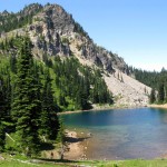
At 2.6 miles from the parking lot is the junction to Hidden Lake. The trail heads west, up and into the ridge on a fairly steep path. As you gain in elevation, you get a terrific view of the meadows and hills below. If you look south you can see a flat section on the far ridge… this is the parking lot where you began this hike. You will be surprised at how far you have come. As you crest this hill, .5 miles from the junction, you come upon Hidden Lake. The crystal clear waters allow you to see the sandy bottom of this crescent-shaped lake. The trail goes to the right and then to the left, just above the shoreline. As you round the second corner, the amazing rocky cliffs come into view and you realize that you are in a huge bowl. Above you, the cliff-face looks like vertical columns. Many of those columns have broken away and fallen down the hillside.
If your destination is still the Palisades Lakes, stay right at the Hidden Lake Junction. You will pass by Tom, Dick and Harry Lakes on the right side of the path. (Dick Camp is located on a short spur trail.) The trail continues on through rolling meadows and woods until you reach Upper Palisades Lake on the left (at 3.5 miles from the trailhead). After a relaxing rest and delicious lunch (and perhaps a quick swim), you will be ready for the 3.5-mile hike back to the parking lot.
– Mary Janosik, Visit Rainer Hiking Expert
Waypoints
| Starting Point: 46.9175, -121.587778 | |
| Notable Waypoints:
Trailhead: 46° 55′ 03 N & 121° 35′ 16 W |
|
Q: Can I go for a swim at Palisades Lake?
A: Yes, however, you do so at your own risk. There are no lifeguards on duty. There is an inherent risk when it comes to swimming in cold water. With regard to swimming, most park waters are open after a visitor’s own safety evaluation and risk assessment. There are some important exceptions, and they are exceptions for very good reasons. Permanent closures are usually made because the body of water receives high volume foot traffic, has a fragile shoreline, or is part of the water system that supplies the park. We ask that swimmers be aware that the quality and clarity of lakes are largely dependent on their respect for the continued health of the resources, to be aware that most park waters are very cold, and sometimes have hidden obstacles beneath the surface. The waters closed to swimming permanently are those that also apply to fishing and boating restrictions as well. Click here for more information about closed bodies of water at Mount Rainier National Park.