| Area: Enumclaw |
Hike Type: Family-friendly | Pass: Discover Pass |
| Distance: 1.4 mi Loop | Duration: 1 hr | Difficulty Level: Easy |
| Elevation Start: 785 | Elevation End: 825 | Elevation Gain: 12 |
| Snow-Free: January – Dec |
-
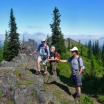
- summit1

-
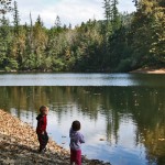
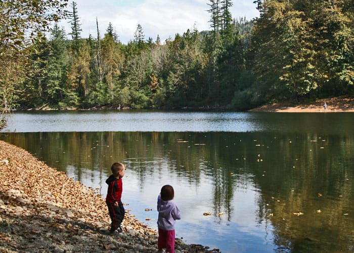
- 04329 kids
-
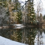
- 0879 winter

When the weather is cold, grey clouds fill the sky and it seems as if spring and summer will never arrive… When your hiking gear is collecting dust and you know a nice walk in the outdoors would do your body and soul some good…. Where can you go to breathe the fresh, fragrant, forest air for a short renewing walk? Might I suggest Nolte State Park. In the summertime, this park is alive with visitors enjoying the beautiful forest environment and taking a dip in the lake. Year-round this is a place to fulfill your need for the great outdoors.
Although the park officially closes for the winter season each year, visiting the park is allowed during the winter season. It’s a splendid option for getting outdoors in all seasons. In winter the restrooms are shut down, there are no garbage cans (Pack it in, pack it out!) and the parking lot is closed, so parking is on the road outside the park gates. However, in all kinds of weather, rain, sun or clouds, you will find people walking the loop trail, fishing off the dock or just enjoying a picnic… Just the sight of this serene lake is enough to remind you to slow down a bit and enjoy nature’s beauty.
If you live anywhere near Enumclaw, you probably have spent some time at Deep Lake. When I was growing up, Mrs. Nolte owned the property and charged 50 cents for a carload of kids to enjoy her lake. There were swimming docks with low diving boards, high dive platforms and a rope swing. There were large logs chained together that separated the shallows from the deep and we spent quite a bit of time rolling each other off of them. When she passed away, she willed the property to the state, who developed a large picnic area and created a beautiful trail around the lake.
This easy hike/walk, a 1.4 mile loop trail, travels around Deep Lake with many cut-outs dropping down to the water’s edge. It’s always fun to explore off the beaten path. There are 10 benches along the trail, each offering a scenic view to enjoy while resting or taking a little extra time to absorb your lush, green surroundings.
During the summer this is a very busy place, but away from the main picnic area, the crowds thin allowing one to become immersed in Nature’s embrace. In the off-season the crowds are sparse and you can enjoy the true peace of the park. It’s a great place to stretch your legs in a brisk walk or sit at a picnic table for lunch. There are even covered areas to get out of the rain. For those with four-footed friends, dogs are allowed on leash. The swimming area occasionally has a lifeguard on duty in the summer months. The docks are for fishing only, no swimming in these areas. You can fish anywhere on the lake, year-round, but with non-motorized boats only.
Directions to Nolte State Park
Traveling towards Enumclaw from Auburn (Hwy 164) or Black Diamond (Hwy 169) take a left on 400th St. (Krain/Wabash Rd) and travel east to 284th Ave. SE, (Veazie Cumberland Rd. SE). Go left and follow this road about 2 miles. There are good signs. The entrance to Nolte State Park is on the left, but during the off season, parking is only allowed on the right shoulder of the road. Traveling from Sumner/Buckley on Hwy 410, travel through Enumclaw to 284th Ave. SE (Farman St. N, becomes Veazie/Cumberland Rd. SE). Take a left and follow this road north thru Veazie Valley for 5.5 miles. Again, the park is on the left, with parking in the off-season on the right shoulder of the road.
Q: When is the best time of year to visit?
A: It doesn’t matter what time of year you visit this place… the beauty is beyond compare. Nolte State Park is one of those hidden gems to be enjoyed by people of all ages and physical abilities. No matter how many times visit, there is something new to experience while the landscape changes with the seasons.
– Mary Janosik, Visit Rainier Hiking Expert
Waypoints
| Starting Point: 47.2706, -121.94139999999999 | |
| Notable Waypoints:
Trailhead: N 47° 16′ 14, W 121° 56′ 29 |
|