| Area: Paradise |
Hike Type: Family-friendly | Pass: Natl. Park Pass |
| Distance: 2.2 mi Loop | Duration: 0.75 hr | Difficulty Level: Easy |
| Elevation Start: 5,383 | Elevation End: 5,840 | Elevation Gain: 400 |
| Snow-Free: Mid-July – Mid-Sept |
-
- nisqually
-
- hikers
-
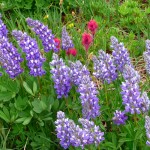
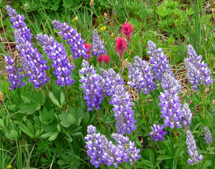
- lupine
-

- marmot

-
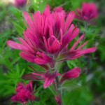
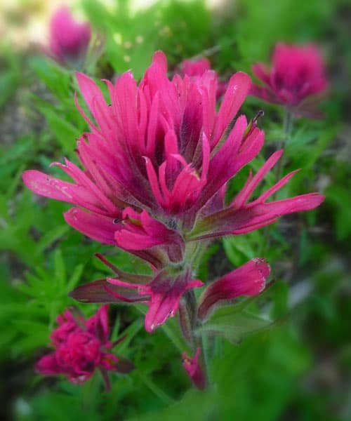
- paintbrush
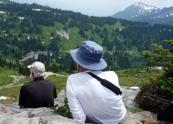
Words cannot adequately describe Paradise when its wildflowers are in bloom. Whether you are a tourist, seasoned hiker or mountain climber, the floral displays for which Paradise is famous never fail to saturate the senses. July through August is the best time to explore these “flower trails” at Paradise.
Be sure to pick up a handout at the Henry M. Jackson Visitor Center that details the trail system. You can also get up-to-date trail conditions and weather forecasts at the information desk on the first floor.
Since the Paradise flower trails are linked, you can hike any one of them or concoct any combination that suits your fancy; refer to the handout for options not described here. Though the trails described here are user-friendly, you are in the mountains and mountain weather is unpredictable; be prepared for sudden weather changes.
One can never pinpoint exactly when the wildflowers will show their colors. This depends largely on the timing of spring’s snowmelt. With seasons of late-melting snow, the line between early season wildflowers and later-season wildflowers can be rather indistinct. In fact, some flowers can seem confused. Early bloomers like the avalanche and glacier lilies may billow in rolling, green meadows while only a few feet away some Western pasqueflowers have gone to seed and a few Rosy Spirea look more rusty than rosy.
Time and time again I am moved by the beauty of the mountains. Classical symphonies often swirl inside my brain as I walk. Yet another great symphony is the sound of the breezes rustling the boughs of evergreens, a scattered birdsong, the whistle of marmots and the crackle of far-off avalanches and rock falls on ancient glaciers.
From the Paradise parking lot and Henry M. Jackson Visitor Center climb the stone steps to a trail junction where the Paradise flower trails begin. We started out on the Avalanche Lily trail, a spur that leads to the Nisqually Vista trail, a short loop with overlooks of the Nisqually Glacier.
During summer months, avalanche lilies and glacier lilies are at the early bloomers. Not far behind, see clumps of pink heather interspersed between evergreens and boulders. Mixed in with avalanche lilies and heather you will see magenta Indian paintbrush; so vivid they look digitally enhanced. On our recent trip we also saw valerian, marsh marigolds, Western pasqueflower, arnica, cinquefoil (they resemble buttercups), shooting stars, lupine and even a few asters (a purple late-summer flower that resembles daisies).
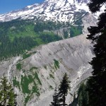
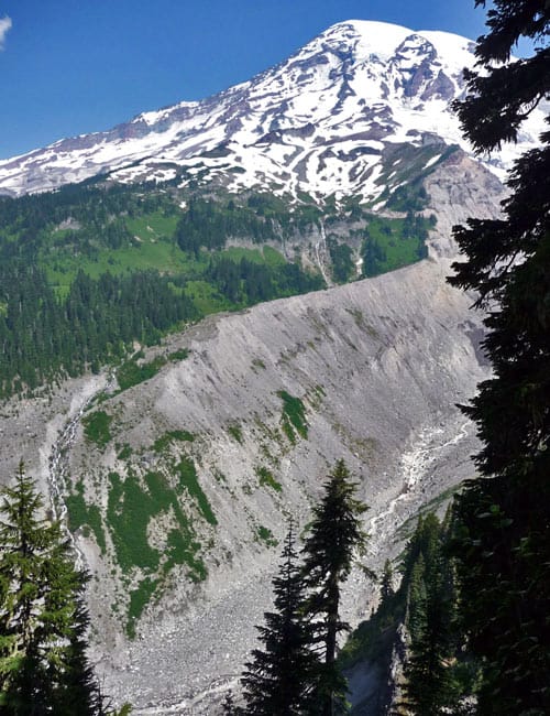
As you hike the Nisqually Vista loop (just follow the signs); take time to stop at the overlooks (5,165 feet) of the Nisqually Glacier to witness the grandeur of that living entity, the birthplace of the Nisqually River that runs all the way to Puget Sound. In August the river is a narrow ribbon trickling from the glacier. En route to the lowlands, the river grows as tributaries feed into it, as melting snow and ice feed into the tributaries. Though most glaciers are in a period of retreat, do not mistake this for indolence; glaciers are busy places and ever-changing as they shape and reshape the terrain.
After hiking the Nisqually Vista Trail we branched off onto the Deadhorse Creek trail to another trail junction (5,840 feet), turning off onto the Moraine Trail rather than climbing to Glacier Vista (another option if you continue on the Deadhorse Creek trail). The Moraine Trail is a more lonesome trail as it gradually descends to closer views of the Nisqually Glacier you saw from overlooks above. Here avalanche lilies literally blanketed the hillsides; we saw more avalanche lilies there than anywhere else at Paradise.
The Moraine Trail ends in less than half a mile ( N 46° 47′ 35″, W 121° 44′ 24″, 5,816 feet) and although a trail still continues, it is not maintained beyond this point. Beginning hikers and hikers with small children should not venture beyond the maintained trail. However experienced hikers can explore a little further as we did for closer views of the moraine as the trail weaves through rock gardens and hanging meadows.
Perhaps you’ve never met a moraine before; so what is a moraine? A moraine is defined as an accumulation of earth and gravel carried and deposited by a glacier. As the unmaintained trail continues its descent to the glacier, the path grows a little vague; if in doubt turn back and hike back the way you came. Do not hike along the exposed edge of the moraine above the glacier – the edge is unstable, under-cut and a fall could be hazardous. Please do not venture off the trails; if you must, step on rocks rather than the heather. Since the Moraine Trail is not maintained past the sign, remember you travel at your own risk when you leave established trails. Sturdy boots are recommended; for experienced hikers the views of the glacier are worth the effort.
Since these trails are connected, you can hike one of them or try any combination that suits your fancy. If you’d like a more challenging hike, refer to the handout or query a ranger at the information desk inside the visitor center.
Stats: The Nisqually Vista Trail: From the Henry M. Jackson Visitor Center upper parking lot: The .3-mile Avalanche Lily Trail and the .8-mile Nisqually Vista Trail is 2.2.miles round trip with 400 feet of elevation gain. 45 minutes to 1 hour.
Stats: Deadhorse Creek Trail and the Moraine Trail from the Visitor Center upper lot via the Avalanche Lily Trail: hike .3 miles to the Deadhorse Creek Trail junction – then hike .5 miles to the Moraine Trail junction – from there it is .3 miles to the end of the maintained trail. That comes to roughly 2.1 miles round trip with about 400 feet of elevation gain. 1 hour, 30 minutes approximately.
Note: Mileage will vary slightly depending on whether you refer to the printed trail handout or use a GPS.
If you visit on a weekend it may be difficult to find parking at Paradise. Plan to get an early start for parking.
To get there: From the Nisqually Entrance of the park, drive to Paradise via the Nisqually-Paradise Road to the Henry M. Jackson Visitor Center and parking at 5,383 feet elevation.
For additional information on fees, rules and regulations, conditions, reserving campsites call Mount Rainier National Park at 360-569-2211 or visit their website at www.nps.gov/mora. The recommended map for Mount Rainier National Park is Green Trails (Mount Rainier Wonderland Map 269S).
– Karen Sykes, Visit Rainier Hiking Expert
Waypoints
| Starting Point: 46.784444, -0121.740556 | |
| Notable Waypoints:
Trailhead: N 46° 47′ 04, W 121° 44′ 26 |
|