| Area: Wilkeson / Carbonado |
Hike Type: Dog-friendly | Pass: No Pass Req |
| Distance: 5 mi, one way | Duration: 4.5 hrs | Difficulty Level: Easy |
| Elevation Start: 1,328 | Elevation End: 1,357 | Elevation Gain: 29 |
| Snow-Free: January – Dec |
-

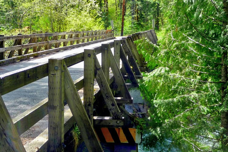
- a manley Moore Bridge
-
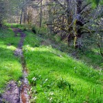
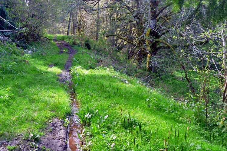
- b the trail
-
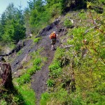
- c most of grade is level

Northern Pacific Railroad Grade from Fairfax Bridge to Manley Moore Road (an Easy Hike along an old railroad grade)
Most often, hiking is about getting out and away from civilization, however on this hike, it was an exciting adventure to be where civilization once was; long since taken back by nature. Manley Moore Road is named for the site of another long-gone settlement and Manley-Moore Mill, also obliterated by Time, blackberries and logging. Nothing remains of Manley Moore today except the road for which it is named (the site of the mill is further south along the Carbon River but has likely washed away).
The hike between the Fairfax Bridge and Manley-Moore Road is 10 miles round trip or 5 miles one way. A one-way hike on this old railroad grade is an easy possibility with a car shuttle or car-key exchange. Start this hike from either access point or hike as far as you like then hike back the way you came.
For our day’s journey, we parked at the Fairfax Bridge, dropped down to the railroad grade opting to hike south (left) until we reached Manley Moore Road or until turnaround time. Starting from this end at Fairfax also gives you the option of visiting the ghost town of Melmont and other points of interest.
From the Fairfax Bridge drop down to the railroad grade south of the bridge and head south (left). You will skirt an old retaining wall, a fern-splashed, brick powder house before coming to an unsigned junction. The left fork climbs to the foundations of the Melmont Schoolhouse (a worthy side-trip); otherwise continue on the railroad grade contours above the town-site of Melmont a little south of the junction; a large meadow the size of several football fields. We didn’t stop at the town-site since today’s goal was Manley Moore Road.
Other than a few muddy stretches, the railroad grade is in good condition. Wildflowers abound, much more prolific than on our previous hike this year to Melmont. In addition to skunk cabbage we saw yellow violets, forget-me-nots, Starry Solomon’s Seal, vanilla leaf and Western Corydalis. In addition to wildflowers, there are varieties of moss, lichen and ferns. Ancient pale stumps, still showing spring-board notches dating from logging days stand silently beside the railroad grade and small streams burst from water-saturated hillsides.
About a mile past Melmont we reached a junction (N 47° 01′ 03″, W 122° 01′ 33″); here a spur (right) leads down to river bars along the Carbon River (the railroad grade continues straight). When river levels are not high you can walk upstream on river bars and side-channels – you can also see Mount Rainier from the river-bars on a clear day. Depending on water levels you may need to hop across a side-channel or two to get to the river-bars. Look for animal tracks crisscrossing the damp sand; this is a busy place. Across the river, pale green layers of alder trees lined the river-bank, above were waves of forested ridges and foothills, some logged, others forested.
We returned to the railroad grade and continued south, hoping we might find signs of Lower Fairfax on our way. We soon came to another junction with no sense of which path to take but opted for the path that went “up,” especially since it was flagged with orange tape but the path soon dead-ended in brush. That path remains a mystery; the orange flags could be there for several reasons. Perhaps a site to be logged, perhaps an old trail to a mine, perhaps a trail to be cleared in the future as some property along the river is being diverted for recreational use and to protect habitat. The railroad grade is a multiple-use trail including bicycles and ATVs – incidentally, the railroad grade between the Fairfax Bridge and Manley-Moore Road is one leg of the Mountains to Sound Relay. It is also part of the Foothills Trail, an ongoing project of Pierce County Parks and Recreation.
The railroad grade continues, contouring above the river with minor ups and downs allowing more views of the river and Mount Rainier. After hiking up and over coal tailings we thought we might have found the site of Lower Fairfax though no artifacts were found (Upper Fairfax is on the other side of the river). Though vestiges of the old railroad bridge are said to remain at Fairfax we found no trace of them or the coke ovens that have been sighted over the years. Since the Carbon River often changes course, some artifacts may have washed away or overgrown with brush.
After an open stretch, the trail enters an almost rain-forest-like setting where a cool breeze from the river was welcome after hiking in the open. It wasn’t long before we recognized the terrain, including a small cairn artfully arranged on a log. After our first visit to Melmont a few weeks prior to this hike, we’d driven to the Carbon River Valley looking for other historical sites, and came to this same area after a short jaunt out of the car and down to the river.
We retraced our route and took our time; enjoying the scenery anew. When you hike to a destination and then hike back, it’s never the same hike. You’ll see what you missed as your perspective and the light changes. When we reached Melmont, we dropped down to the townsite to look for remnants of the wagon bridge that crossed the river (on our first visit to Melmont we didn’t find it). This time we found it; buried under grass and vegetation (there is no obvious path). It is so well-obscured by vegetation that we didn’t even recognize it as a bridge-abutment when we first stood on it. Though it’s always fun to look for historical artifacts this one is difficult to find and there’s isn’t much to photograph. If you do look for the bridge we recommend walking down to Melmont on the obvious old road rather than the steep footpaths. The road is easier and also closer to the wagon bridge. The wagon-bridge is slightly below a grassy area where the road dies out but well hidden by vegetation. It’s only a matter of time before it is completely obscured. A very steep path can be scrambled to the base of the structure or to the river but it’s not a place to lose your footing.
Getting to the Manley Moore trailhead: From Wilkeson/Carbonado continue on SR 165 (south), over the Fairfax Bridge and at the junction with the Mowich Lake Road continue on the Carbon River Road to Manley-Moore Road (about 3.64 miles from the Fairfax Bridge). From there it is .6 mile to the bridge. Cross the bridge and park in the obvious parking area above the bridge.
Getting to the Fairfax Bridge – From Wilkeson/Carbonado continue on route State Route 165 as if approaching the Carbon River entrance of Mount Rainier National Park (visit mid-week if possible, parking is limited). Drive across the Fairfax Bridge and note a small parking spot on the left side of the road. Park there, walk back across the bridge and look for a short, steep path on the north side of the bridge that descends to the railroad grade, turn left (south) onto the grade and start walking.
– Karen Sykes, Visit Rainier Hiking Expert
Waypoints
| Starting Point: 47.04091, -122.0419 | |
| Notable Waypoints:
Parking at Fairfax Bridge: N 47° 02′ 27, W 122° 02′ 31 |
|