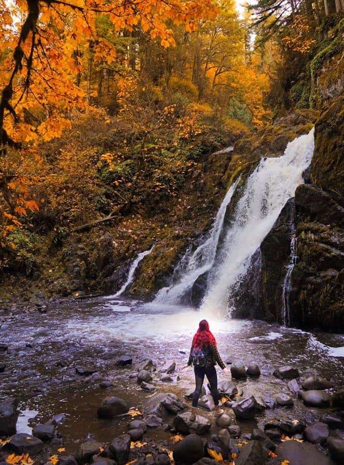
Nothing is little about this waterfall. A veiling horsetail falls of 120 feet, this is the highest of a series of three falls accessible via the University of Washington Pack Forests trail system near Eatonville in a spectacular setting. The waterfall is named for the Little Mashel River; words don’t even come close to describing the intense beauty of this powerful waterfall. Though it is possible to hike to an overlook near the foot of the falls, the trail is steep and potentially hazardous, especially for inexperienced hikers.
Height: 120 feet | Form: Veiling Horsetail | Number of Drops: 1
Source Stream: Little Mashel River | Access: Moderate Hike
Viewpoint: 46.849722, -122.273056
Directions: Follow SR 7 to the signed entrance of the University of Washington Pack Forest (left. Enter Pack Forest and continue to the lower parking lot or upper parking lot (903 feet elevation). From the parking lot, walk a few steps up the main road to Road 1000 (Lathrop Drive) and directional signs. Turn left. Bypass all numbered roads until you reach a Y about 1-1/2 miles from the trailhead and a metal signpost designating the hiker-only Falls Trail. Here turn left onto Road 1070. Shortly past the “Y” you’ll see a large boulder (left) with blue painted letters signed “Falls” with a directional arrow and another metal signpost. Note two trails (left), one is a rough path blocked off with branches and the other a wider track across a grassy area near a pond – this is the correct trail. Follow the grassy track as it skirts the pond followed by a brief descent to an obvious junction marked with three yellow diamonds. Turn right. Then turn left at the trail marker for Middle Falls and you’ll come to wooden steps that descend to an overlook of Little Mashel Falls.

