| Area: Packwood |
Hike Type: Mountain views | Pass: No Pass Req |
| Distance: 3.2 mi RT | Duration: 3 hrs | Difficulty Level: Moderate |
| Elevation Start: 4,308 | Elevation End: 5,685 | Elevation Gain: 1,350 |
| Snow-Free: Late-June – Oct |
-
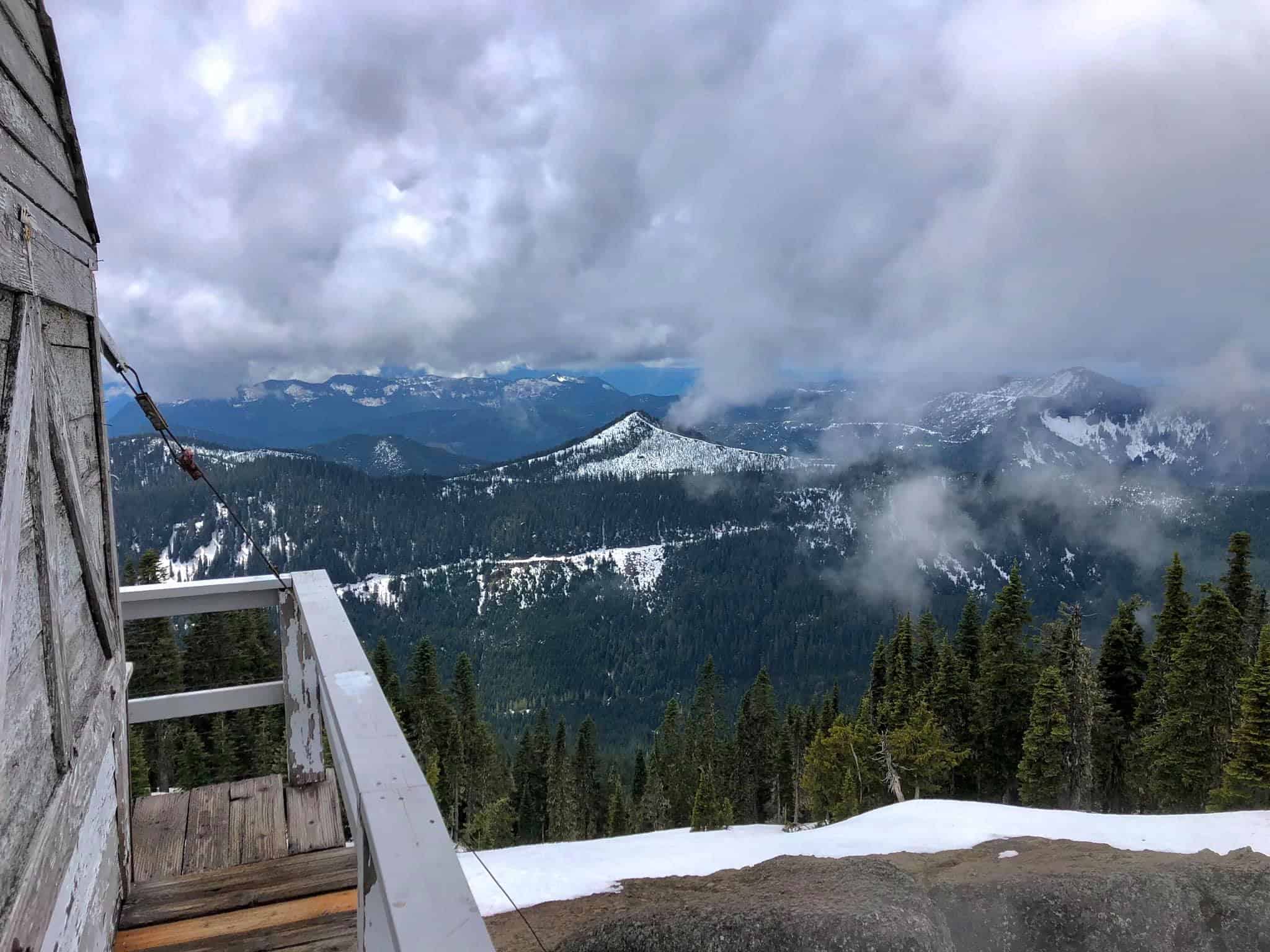
- r historic High Rock Lookout
-
- lookout
-
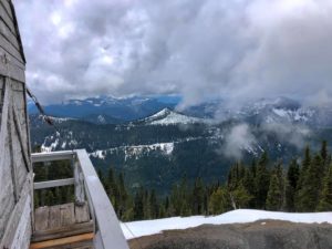
- t serrated Sawtooth Ridge from High Rock Lookout

-
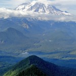
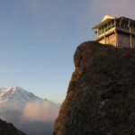
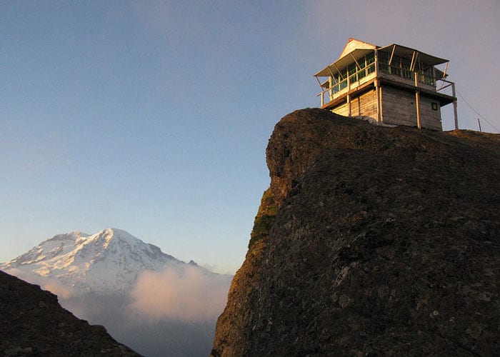
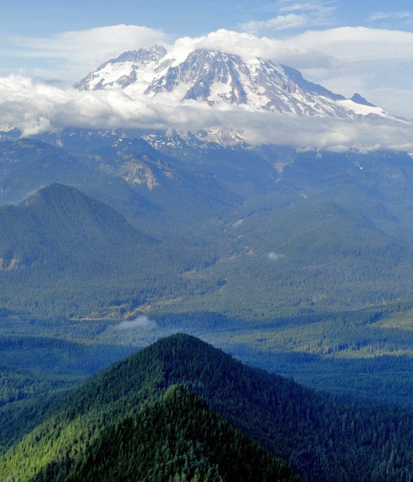
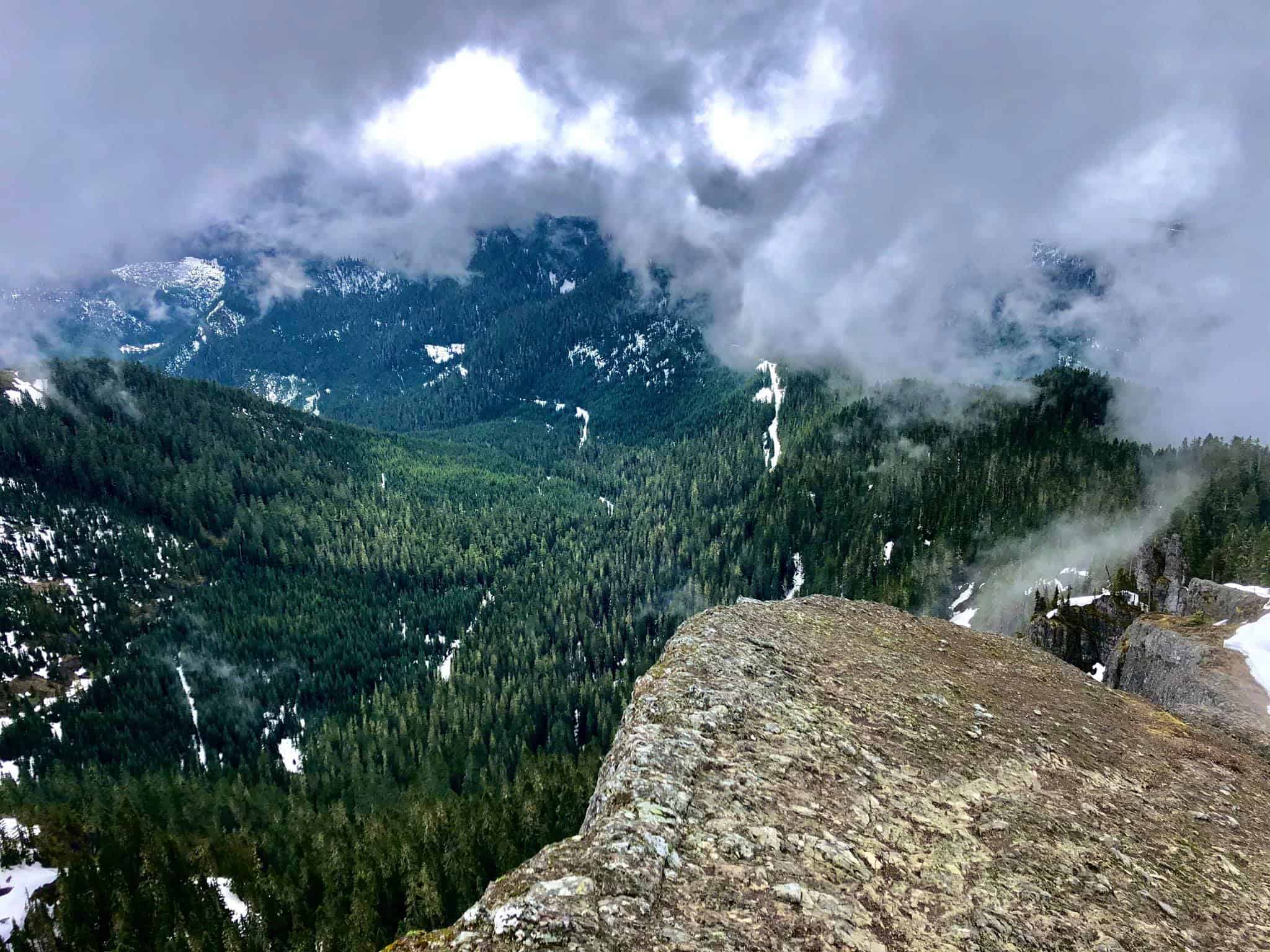
- u looking up the Nisqually Valley to Mount Rainier
-

- s lake Cora and the Nisqually Valley

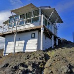
Teetering on a precipitous pinnacle, High Rock is one of Washington’s most stunning lookouts.
Effective June 24, 2021, the historic lookout tower will be removed from the trail to receive extensive repairs. The tower will be returned to the trail in 2023.
The hike to it is short but steep. And if the climb doesn’t take your breath away, the in-your-face view of Mount Rainier’s snowy face will!
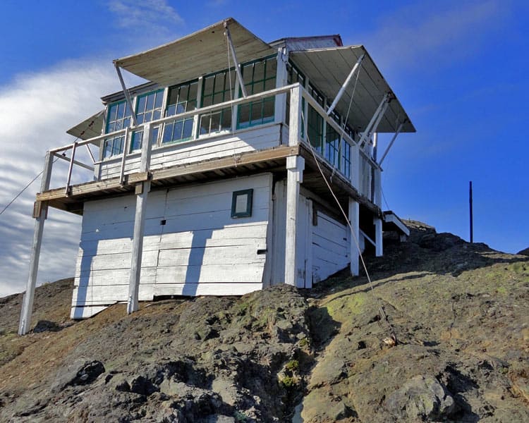
High Rock is the loftiest and most prominent point along the serrated Sawtooth Ridge which rises above the Nisqually River valley just south of Mount Rainier National Park. Graced with a fire lookout since 1930, it’s one of the few remaining in the Gifford Pinchot National Forest. No longer staffed and in need of some restoration, the historic structure is open for day use. It’s readily available to shelter snacking hikers and be the striking subject for scores of photographers.
Back when the lookout was constructed folks had to hike over 10 miles to reach this jagged summit. But over the decades roads were punched closer to this peak for timber extraction. The days of the big cut are over in the Gifford Pinchot National Forest, and the Sawtooth Ridge still retains some healthy stands of old-growth forest. But what hikers are most drawn to when they visit High Rock are its far-reaching and unsurpassed views.
Start your hike at the edge of an old cut and make your way up the southeast spine of the mountain. The forest composed mainly of mountain hemlock and silver fir is open and the way is lined with bear grass. In early summer, lupine, paintbrush, and other showy blossoms brush the trail in an array of dazzling colors.
The tread is built well and well-trodden. This is a popular trail despite its steepness, which soon becomes evident shortly into the hike. At .7 mile a trailside bench invites a quick respite from marching on. Shortly beyond, the trail veers off of the spine of the ridge before quickly regaining it again after reaching a small saddle.
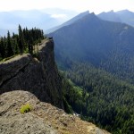
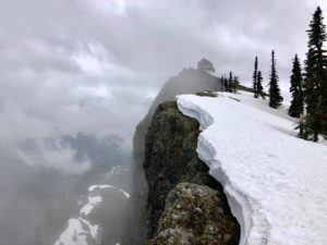
The way steepens as it approaches an open ledge. It’s quite a drop-off and just a small taste of what is about to come. Ambling over the ledge and passing by some rocky flower gardens, the trail continues upward. A final switchback has you cresting the narrow summit ridge. Just above the switchback notice a small plaque in the ledge. It’s a memorial for Johnnie T. Peters, who in 1930 packed materials on mules and drove them from the Ranger Station in Mineral to this mountain to construct the lookout. Mr. Peters constructed ten other lookouts in the area as well.
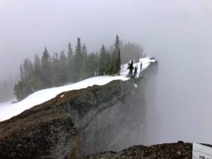
Now continue on the final stretch passing the dilapidated remains of a cabin before coming to the big block of exposed rock and ledge that gives High Rock its name. Head right up the ledge to the teetering white lookout standing out prominently against the gray rock. Use extreme caution as you approach the lookout. The guide cables are gone. Keep children close by and dog on leash. The cliffs drop over 600 feet inducing vertigo in many a High Rock hiker.
Once you’ve lifted your eyes away from the ground and have firmly planted yourself on the balcony of the lookout, soak in the views, and let your jaw drop. The panorama from this pinnacle packs a punch! Mount Rainier dominates the scene; its snowy icy presence can practically be felt breathing upon you. Admire the mountain’s craggy and meadow flanked neighbors too-the Tatoosh Range, Mount Wow, and the Glacier View Wilderness peaks.
Stare straight down to Cora Lake tucked in a forested valley 1,500 feet below. Look south and east to waves of emerald ridges with Mounts Adams and St Helens floating upon them. Be sure to stare east too, across the Sawtooth Ridge with its notched summits, stark north faces, and shadowed folds and drops. If it’s a warm sunny day, bask on the rocks like a content marmot. There’s no need to hurry back, for you’ll not tire of these views. In fact, they only grow more intense as late afternoon and evening light beautifully accents the surroundings as the sun lowers in the sky.
Notes: Trail is hiker only. Dogs are allowed but should be on a leash because of steep and dangerous drop-offs. Young children will find this trail difficult and they should be supervised at all times especially at and near the summit lookout. The trail receives regular maintenance and is in excellent shape. FR 84 and FR 8420 were graded in the summer of 2012 and are both in good shape and drivable for passenger cars. Green Trails Map Randle, WA no. 301 shows this trail as well nearby trails to Cora and Granite Lakes. Contact Cowlitz Valley Ranger Station (Randle), Gifford Pinchot National Forest for updated information on this trail and access roads; (360) 497-1100; http://www.fs.usda.gov/giffordpinchot
Getting to High Rock Trail: From Elbe, follow SR 706 east (passing through Ashford) for 10.1 miles. Turn right (south) onto Skate Creek Road (FR 52) and follow for 4.7 miles. Turn right (south) onto graveled FR 84 and follow for 6.8 miles bearing right onto FR 8440. Continue 2.7 miles to the trailhead at Towhead Gap (el. 4,330-feet).
– Craig Romano, author of nine hiking guidebooks
Waypoints
| Starting Point: 46.666433,-121.89134999999999 | |
|
Notable Waypoints: Trailhead: N 46° 39.992′, W 121° 53.499′ |
|
-
- 99269343 10223036390244669 2065307355825831936 o
-

- 100044885 10223036389964662 7742282015419924480 o

-
- 97996649 10223036585209543 7349705443171631104 o

-
- 99055663 10223036390844684 5188528133761925120 o

-

- 97071577 10223036388764632 3694110042828570624 o
-
- 98078360 10223036389244644 4193164064140034048 o

Q: Can I stay overnight in the lookout tower?
A: No, overnight camping in and at the lookout tower is not permitted. For nearby camping consider the Big Creek Campground located in Gifford Pinchot National Forest Service which is approximately 12 miles/30 minutes via NF-52/Skate Creek Rd. Another campground to consider is the Cougar Rock Campground in Mount Rainier National Park. Cougar Rock is approximately 20 miles/50 minutes from the lookout tower via NF-52/Skate Creek Rd S and NF-84.
Q: Are dogs allowed on the trail?
A: Yes. The hike to High Rock Lookout is part of the Gifford Pinchot National Forest, it is managed by the Cowlitz Valley Ranger District. This trail is not part of Mount Rainier National Park and dogs are allowed. You’ll want to keep your dog on a leash at all times and please dispose of pet waste responsibly. Leaving pet waste in a bag along the trail is not permitted. Please practice Leave No Trace principals.
Q: How far is High Rock from Paradise? Can I visit both locations in one day? Can I pay one fee to visit both locations?
A: It’s approximately 35 miles from the High Rock Lookout to Paradise which normally takes about an hour and 20 minutes to drive. It is possible to visit both locations in one day. You’ll only need to pay one fee because the High Rock Lookout is managed by the Gifford Pinchot National Forest and no parking or entrance fee is charged to visit the lookout. Paradise is managed by Mount Rainier National Park, an entry fee is required.
Q: Where can I go to learn more about what it’s like to hike this trail?
A: You may want to check out the trip reports posted by hikers who have been on the trail to High Rock. Here’s a link to the Washington Trails Association website to read trip reports.