| Area: Crystal Mountain |
Hike Type: Dog-friendly | Pass: None |
| Distance: 5 mi. RT | Duration: 4 hrs | Difficulty Level: Moderate |
| Snow-Free: mid-July – Oct | High Point: 5,500 ft | Elevation Gain: 1,100 ft |
-
- IMG 3685 1

-
- IMG 3657 1

-
- IMG 3678 1
-
- IMG 3681
-
- IMG 3679

-
- IMG 3653

-
- IMG 3650 1
Features: historic mining district, backcountry lake, kid-friendly, dog-friendly
Long before Crystal Mountain was a top notch ski resort, it was part of bustling mining area known as the Summit Mining District. Before lifts and ski trails traversed this high broad mountain bordering Mount Rainier National Park; pack trails and narrow gauge roads crisscrossed the mountain, valley below, and neighboring peaks, ridges and basins. Relics and remnants of this bygone era remain scattered among old trees and open slopes. And place names attest when Crystal was known for silver and gold and not powder. Hike to oddly-named Henskin Lake and catch a glimpse or two of the past.
Hit the Trail:
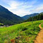
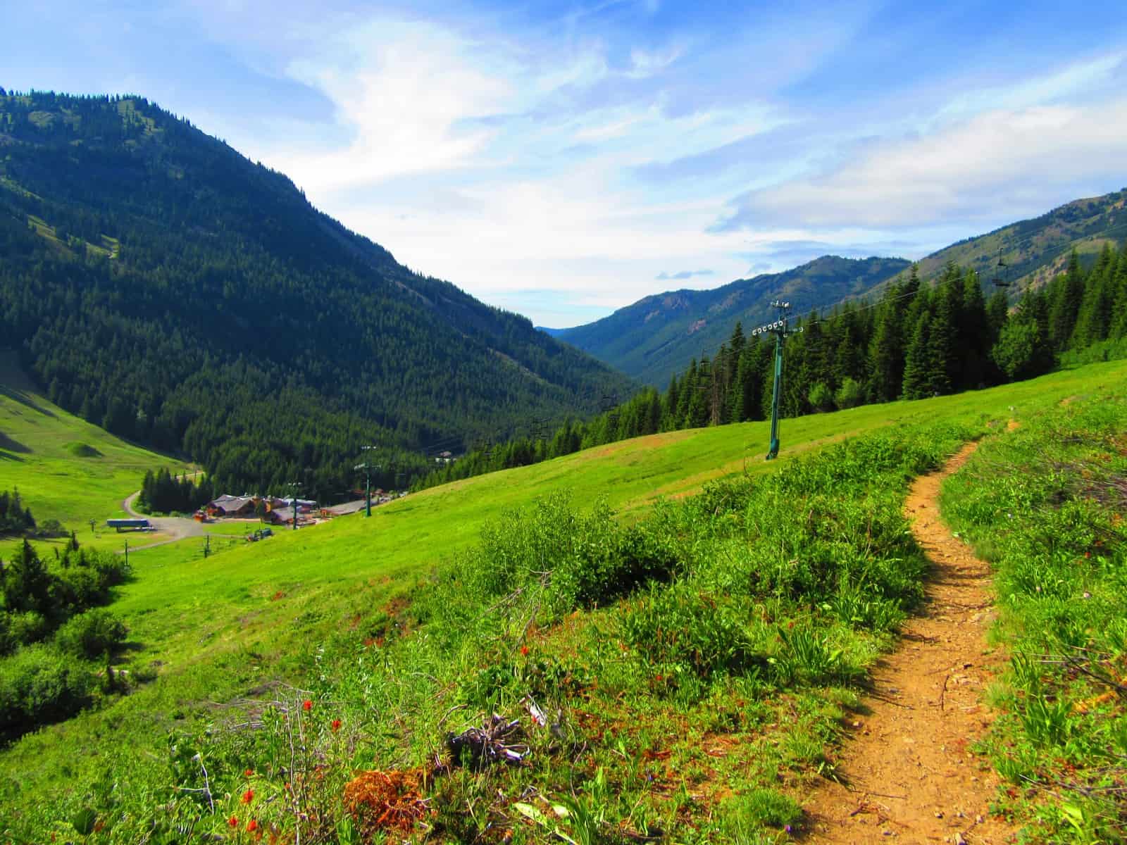
From the Crystal Mountain Ski Area, locate the service road taking off west to the Gold Hills part of the ski area. After a stiff climb of 350 feet in 0.3 mile reach FR 410 (Gold Hill Road). Here at a bend in the road locate the start of the Silver Creek Trail taking off right (south). Take it and enjoy fairly level walking—first on old road—then across a wide ski slope—and finally on bona fide trail. You may have some company in the form of equestrians or mountain bikers, but this trail usually isn’t too busy.
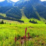
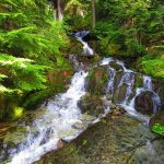
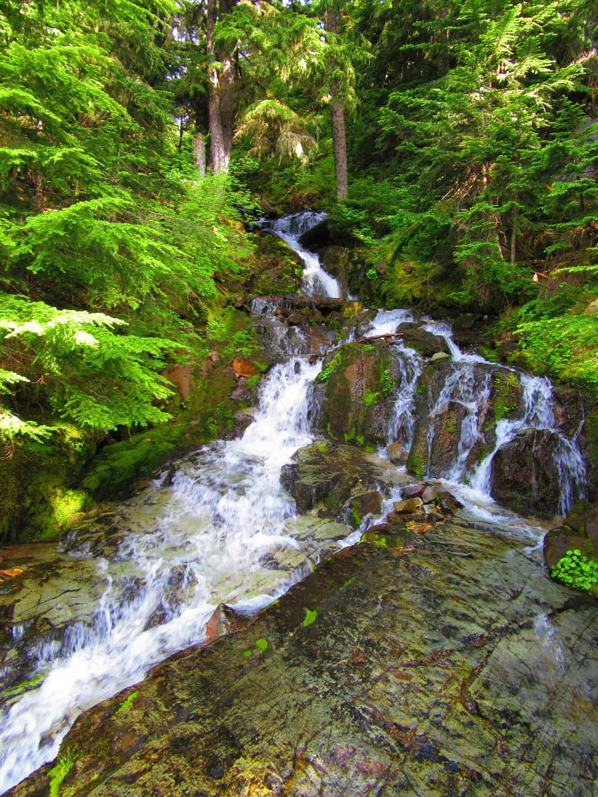
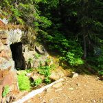
Traversing the ski slope, be sure to enjoy the good views west of Crystal Mountain. And look down too at the slope where a wide array of flowers including elephant’s head orchids grow in profusion. Once on the trail enter forest and immediately come to an old mine shaft near a cascading creek. Resist the temptation to enter the shaft (which is dangerous) and keep hiking, crossing the creek on a good bridge.
The trail traverses a long timbered slope and eventually steepens. Climbing higher come up alongside Silver Creek crashing down a tight ravine. Soon afterward at 2.0 miles reach a junction. The Silver Creek Trail continues left making a sweeping switchback reaching the Pacific Crest Trail in 0.7 mile. You want to go right on the Crystal Mountain Trail, an adventurous trail that goes up and over Crystal Mountain. No worries though for this trip, as you will only be venturing a short distance on this trail.
Prepare to get your feet wet hopping across Silver Creek. Later in the season however you should be able to cross this creek dry footed. The way then enters old forest and makes a short switchback gaining a little elevation. Soon notice old stumps and clearings. This is Jim Town, once an old mining camp named such because it was occupied by seven prospectors with the name of Jim!
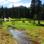
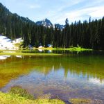
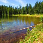
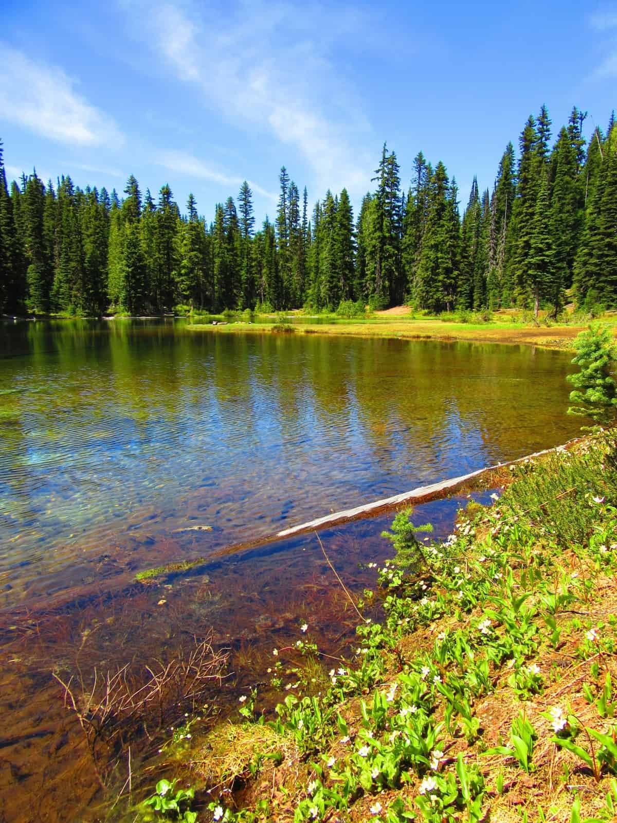
Beyond Jim Town the trail dips a little reaching an old road. Right heads to the ski slopes on the other side of Elizabeth Creek. You want to go left climbing just a bit before descending just a bit to the bowl cradling Henskin Lake. The lake is surrounded by tall timber and Three Way Peak can be seen in the distance. To the right a short trail leads to camps and lunch sites near the lake’s outlet. To the left the trail continues alongside the lake’s grassy shore. Find a nice spot to take a break and enjoy the surroundings of this placid little body of water.
Now about the lake’s odd name. According to the Tacoma Library place name data base, the lake received its name due to a prank. Many moons ago William and Edith Steffen decided to camp at the then unnamed lake. All they had for the night was a thin cotton blanket known as henskin. To “commemorate” the miserable night that Edith spent on the ground in the henskin, William made a sign for the lake calling it Henskin. Later travelers just assumed that was the name of the lake—and it stuck.
If this hike is too short for you, you can continue right on the Crystal Mountain Trail a short distance to where an unmarked spur takes off left near a creek crossing. If you take this spur it will lead you to the upper Henskin Lake, a small body of water at the head of Silver Basin. Your other option is to take the Henskin Trail left from the lake. This path leads .7 mile to the PCT at Bear Gap. From here you can follow the Silver Creek Trail 2.4 miles back to the Gold Hills Road.
Notes: Trails open to horse and bikes. Stay out of mines and leave all artifacts for others to enjoy as well.
Contact: Snoqualmie Ranger District, Enumclaw office (360) 825-6585 or www.fs.usda.gov/mbs
Maps: Green Trails Mount Rainier National Park 269S
Trailhead directions: From Enumclaw head east on SR 410 for 32 miles turning left on the Crystal Mountain Road (just before the Mount Rainier National Park entrance). Continue for 6.0 miles to parking at Crystal Mountain Ski Resort.
Trailhead facilities: Water and restrooms and visitors services at ski area buildings.
– Craig Romano, is an author of more than a dozen hiking guidebooks including the newly released 100 Classic Hikes Washington (Mountaineers Books) which includes several hikes in and around Mount Rainier National Park.
Waypoints
| Starting Point: N46 56.153 W121 28.447 | |
|
Notable Waypoints: Silver Creek Trail junction: N46 56.223 W121 28.1 Henskin Lake: N46 55.109 W121 29.018 |
|
Written by Craig Romano