| Area: Ohanapecosh | Hike Type: Family-friendly | Pass: Natl. Park Pass |
| Distance: 1.5 mi RT | Duration: 1 hr | Difficulty Level: Easy |
| Elevation Start: 2,200 | Elevation End: 2,200 | Elevation Gain: 0 |
| Snow-Free: June – Oct |
-
- Beautiful scenery at Grove of the Patriarchs scaled

-
- Grove of the Patriarchs with visitor

-
- 14022133737 cb33f920b5 b
-
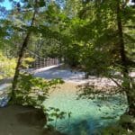
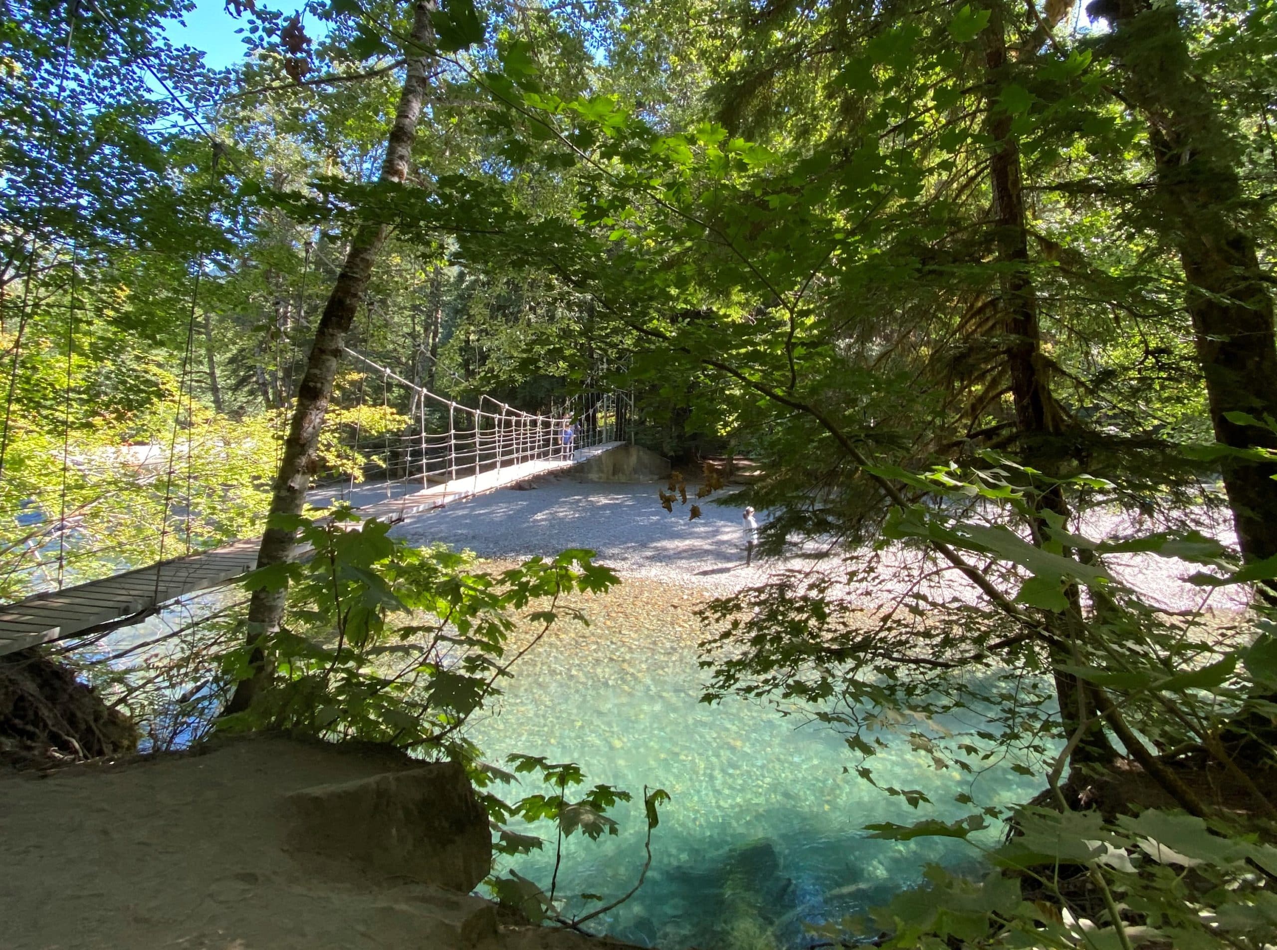
- Approaching the bridge at Grove of the Patriarchs scaled
This is, perhaps, one of the easiest hikes in Mount Rainier National Park, but one of the most memorable because it’s like entering a magical kingdom.
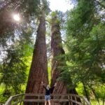
This is rare, even in a region with so many really big trees. Think about it. Doesn’t “the grove of the patriarchs” have that special ring to it? Like a Tolkien ring? You’ll walk through a forest of old-growth trees, some a thousand years old, onto an island in the middle of the Ohanapecosh River. Better than some new world created for a virtual reality game, it’s all there for you to enjoy again and again.
How do you get to this special place?
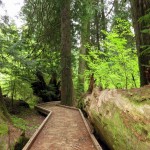
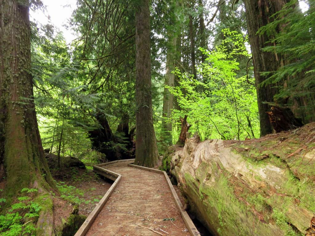
On the east side of Mt. Rainier, drive to the Stevens Canyon entrance on Highway 123. Proceed about 1/4 of a mile on the Stevens Canyon Road across the Ohanapecosh River bridge to the trailhead parking area on the right, elevation about 2,200 ft. The parking lot, which accommodates about two dozen cars, generally is full during the summer. The trail goes upstream through a stand of old, tall, exquisite red cedars, erect like guards, protecting what lies ahead. The path leads to a crossing of the Ohanapecosh River on a suspension bridge at just less than 1/2 of a mile. Go over the bridge in single file, following directions on a sign suggesting one person at a time. Upon crossing the bridge, you reach the island. After passing through smaller trees, the path forks. Go either way. It’s a loop.
Signs identify plants and describe features of this habitat. Isolated on the island, these regal giants have been protected from fire, thus, allowing them to grow to enormous size. So, in this small area, you have many trees that are more than 25 ft in circumference, at least one approaching 50 ft, and some over 1,000 years old.
One thing is clear. This is a sacred place. A place to be humble. These ancient Douglas firs, western hemlocks, and western red cedars deserve respect and reverence. After all, by human measure, many of these on the island were on earth when the Normans conquered England in the 11th century. Walk, don’t run, and show proper esteem. Take your time walking through this island paradise. You don’t have to worry about being voted off this island. The survivors are REALLY the massive trees that have literally stood the test of time. They’re timeless warriors. Admire them; take pictures of your family by them. Have someone take pictures of you by the trees and cherish the memory of your visit.
Waypoints
| Starting Point: 46.758056, -121.5575 | |
|
Notable Waypoints: Trailhead: N 46° 45′ 29, W 121° 33′ 27 Grove: N 46° 45′ 45, W 121° 33′ 11 |
|
Q: Are dogs allowed at Grove of the Patriarchs?
A: No. Dogs are not allowed on the trails at Mount Rainier National Park. Click here for more information on where dogs (on a leash) are allowed at Mount Rainier National Park.
Q: What’s the best entrance to use to get to the Grove of the Patriarchs?
A: You’ll want to use the Stevens Canyon: Southeast Entrance, it’s the closest entrance to the Grove of the Patriarchs trailhead. This entrance is open seasonally. Click here for more info.
Q: Can I camp overnight at the Grove of the Patriarchs?
A: Not at the Grove, no. The largest campground in the park is the one at Ohanaepcosh, it’s the nearest campground to the Grove of the Patriarchs. For more details on this campground click here.
Q: How far is the Grove of the Patriarchs from the Sunrise visitor center?
A: It’s approximately a 30-mile drive, typically takes about an hour to do the drive. Remember that these areas of the park are open seasonally.
Q: I have young kids. Is this trail stroller-friendly?
A: This is a great trail to walk with kids but it isn’t stroller friendly. It isn’t paved, there are tree roots in some sections of the travel and there’s a wooden suspension bridge to cross. This would be best experienced with young walkers or while “wearing babies” in a backpack or carrier.
Q: I have someone in my party that’s a “slow walker” with mobility challenges. Are there benches to stop and sit on along the path?
A: That’s a good question. Yes, there are a few benches at the halfway point on the path, but to get to the seating you’ll need to cross a wooden suspension bridge which may be problematic. Additionally, while there are no significant elevation changes on this path it isn’t always level. There are some sections of the path impacted by tree roots that can result in an uneven surface. There are also some sections of the path that dip up and down causing inclines and declines.
Q: Is there a restroom near the Grove of the Patriarchs?
A: Yes. There is a restroom near the trailhead and parking area.
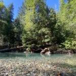
Q: Can I go swimming in the water near the suspension bridge along the trail?
A: The water near the suspension bridge isn’t deep enough to go swimming. Some people do choose to wade into the water. While that activity is legally is allowed we don’t encourage it because that trail is a highly traveled area, shoreline use increases can be concentrated, which can lead to future resource issues. It also disrupts the scenic pastoral view for people enjoying the natural elements of the hike. A better area would be a spot designed and much more conducive for swimming and wading like Alder Lake at Sunny Beach Point near Elbe.
Q: I’m a heavy hiker. Is there a weight limit for using the suspension bridge? I weigh over 300 pounds.
A: We checked with the park and asked, there is no published weight limit per person for the suspension bridge at Grove of the Patriarchs. The only restriction in place is the sign at the bridge that asks one person to go across the bridge at a time. As long as you follow that guideline, one pedestrian at a time you should be okay.
Q: How long of a walk from the trailhead to the farthest point on the trail?
A: The Grove of the Patriarchs is an “out-and-back” trail. It’s approximately a mile and a half in distance round-trip. From the trailhead to the farthest point it’s approximately .75 tenths of a mile from the trailhead to the farthest point of the trail.
Q: I sometimes get vertigo and am concerned about navigating the suspension bridge. Is there a way to complete the trail and avoid walking the suspension bridge?
A: No, there is no alternate route.