| Area: Ashford/Skate Creek Rd |
Hike Type: Off the Beaten Track | Pass: No Pass Req |
| Distance: 3.6 + mi RT | Duration: 2-5 hrs | Difficulty Level: Easy |
| Elevation Start: 3,700 | Elevation End: 4,200 | Elevation Gain: 500 |
| Snow-Free: July – November |
-
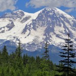
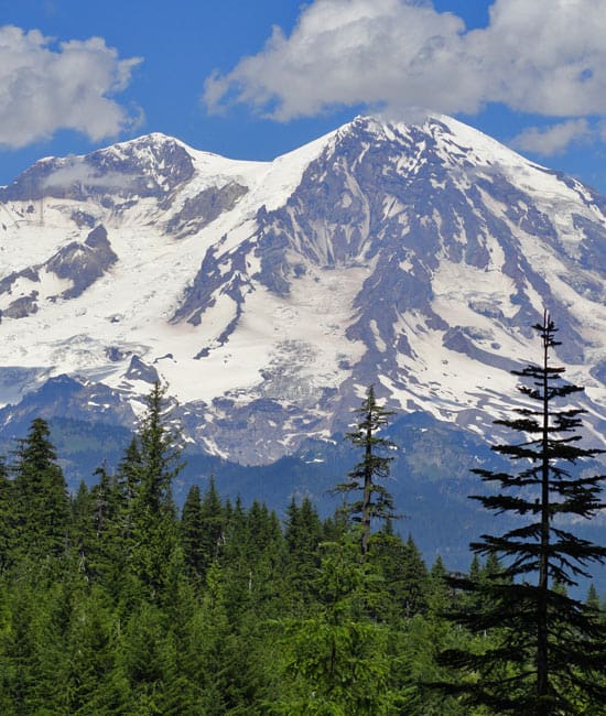
- view of Mount Rainier from Teely Creek Trailhead
-
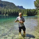
- granite Lake cooldown

-
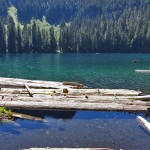
- bertha May Lake

-
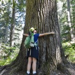
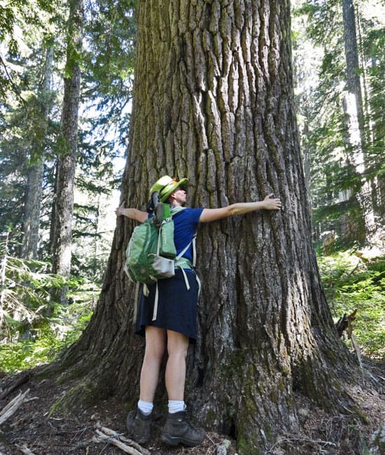
- old growth giant on the Teely Creek Trail
Via Teely Creek Trailhead from FR 8410: hiking distance is 3.6 miles round trip with 500 ft gain.
Via Big Creek Trailhead from FR 8420: hiking distance is 8.8 miles round trip with 2,150 ft gain.
Cradled within a series of deep cirques along the serrated and impressive Sawtooth Ridge are four lakes. Pothole Lake is small and is of more interest to frogs and dragonflies. Cora and Bertha May Lakes are fair sized and offer some good fishing. Granite Lake is the gem of the ridge with its sandy shores; inviting waters perfect for a swim; and serene setting surrounded by big timber and a couple of pointy pinnacles. A handful of attractive campsites can be found near its outlet along with an impressive view of Mount Rainier, especially during sunset when evening light casts a glow to the majestic mountain.
The Sawtooth Ridge is a prominent and distinct landmark rising above the Nisqually River just south of the Nisqually Entrance to Mount Rainier National Park. Its most distinguishing peak is the High Rock Lookout and many a hiker has plodded to this precariously perched fire lookout. Few hikers, however, have set out on the network of trails that tie together a string of lakes and viewpoints along the ridge. Despite a close proximity to Ashford, these trails are not heavily used. Cora Lake sees a fair amount of hikers as it is a pretty short trip (see Cora Lake description), but the other lakes usually remain quite quiet.
The quickest way to them is via the Teely Creek Trail from FR 8410. Here at the edge of an old clear-cut with a commanding view of Mount Rainer, the good trail quickly enters old-growth timber and comes to little Pothole Lake in about .2 mile. The trail then crosses the lake’s outlet creek on a bridge-then climbs a couple of hundred feet reaching a junction at .8 mile. Here the Osborne Mountain Trail veers right. Stay on the Teely Creek Trail left and continue to climb skirting a steep hillside. At 1.2 miles from the trailhead reach Bertha May Lake (el. 4,055 feet).
Set in a bowl of old-growth forest beneath a couple of serrated peaks of the Sawtooth Ridge, Bertha May is an attractive backcountry lake. However, with its muddy bottom and shoreline of floating logs, its appeal will be more for casting a lure than being lured for a swim. Proceed to Granite Lake if your intention is some wilderness wading.
Follow the Teely Creek Trail over a small rise and come to beautiful Granite Lake (el. 4,175 feet) within .6 mile. With its sandy bottom and greenish waters reflecting towering trees and jagged pinnacles, Granite Lake is the prettiest of the four lakes along Sawtooth Ridge. A wonderful wading area and inviting campsites can be found at its outlet-the source for Teely Creek. Here too you can wander a short distance to an in-your-face view of Mount Rainier.
Now, while this approach from FR 8410 is the shortest, the road leading to the trailhead is rough and not drivable for most passenger vehicles. Therefore, you may want to hike to Granite Lake from the Big Creek Trailhead on a longer and more difficult route-but one with scenic rewards and solitude.
Follow the Big Creek Trail .7 mile along Big Creek (and crossing it twice which may be difficult in high water) to Cora Lake. Saunter here for a moment or two savoring the beauty of Cora surrounded by towering old-growth conifers and situated at the base of cliffy and imposing High Rock. Then continue hiking another .6 mile to the junction (el. 4,170 feet) with the Teely Creek Trail. Continue straight cresting a ridge (el. 4,300-feet)-dropping slightly-and cresting another 4,300-foot ridge.
Now in old growth mountain hemlock forest, drop into a high basin (el. 3,950-feet) to cross several tributaries of Mesatchee Creek. Meaning evil or wicked in the Chinook jargon, Mesatchee poses no problems here other than perhaps getting your shoes a tad damp. Continue past a big boulder and a brushy avalanche chute and then climb to yet another ridge (el. 4,400 feet) before descending to Granite Lake reaching its outlet 4.4 miles from the trailhead. Enjoy the setting and perhaps an afternoon dip.
Notes: Big Creek Trail and Teely Creek Trail are also open to mountain bikes and motorcycles. Motorized use is light. Mountain bike use is moderate. Both trails are in good shape, but the roads leading to the trailheads vary. FR 84 was graded in the summer of 2012 and is in excellent shape. FR 8410 to Teely Creek Trailhead is rough and only recommended for four-wheel drive vehicles. FR 8420 to Big Creek Trailhead is in good shape and drivable for passenger cars. Creek crossings on trails may be difficult and dangerous in the early season and after heavy rainfall. Green Trails Map Randle, WA no. 301 shows all trails in the area. Contact Cowlitz Valley Ranger Station (Randle), Gifford Pinchot National Forest for updated information on this trail and access roads; (360) 497-1100; http://www.fs.usda.gov/giffordpinchot
Getting to Big Creek Trailhead (Trail No 252):
From Elbe, follow SR 706 east (passing through Ashford) for 10.1 miles. Turn right (south) onto Skate Creek Road (FR 52) and follow for 4.7 miles. Turn right (south) onto graveled FR 84 and follow for 4.2 miles tuning right onto FR 8420. Continue 1.5 miles to tthe railhead.
Getting to Teely Creek Trailhead (Trail No. 252):
From Elbe, follow SR 706 east (passing through Ashford) for 10.1 miles. Turn right (south) onto Skate Creek Road (FR 52) and follow for 4.7 miles. Turn right (south) onto graveled FR 84 and follow for 1.5 miles tuning right onto FR 8410. Continue on this rough and not suitable for passenger cars road 3.7 miles to the trailhead.
– Craig Romano, Hiking guidebook author of nine books
Waypoints
| Starting Point: 46.70491,-121.93185 | |
| Notable Waypoints:
Big Creek Trailhead: N 46° 41.713′, W 121° 53.192′ |
|