| Area: Ashford |
Hike Type: Off the Beaten Track | Pass: No Pass Req |
| Distance: 4.2 mi RT | Duration: 3 hrs | High Point: 5,450 ft. |
| Elevation Gain: 1,000 ft. | Snow-Free: July – October |
-
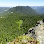
- Glacier View viewed from Mount Beljica

-
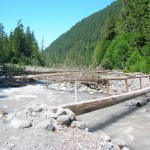
- North Mowich River Crossing

-
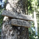
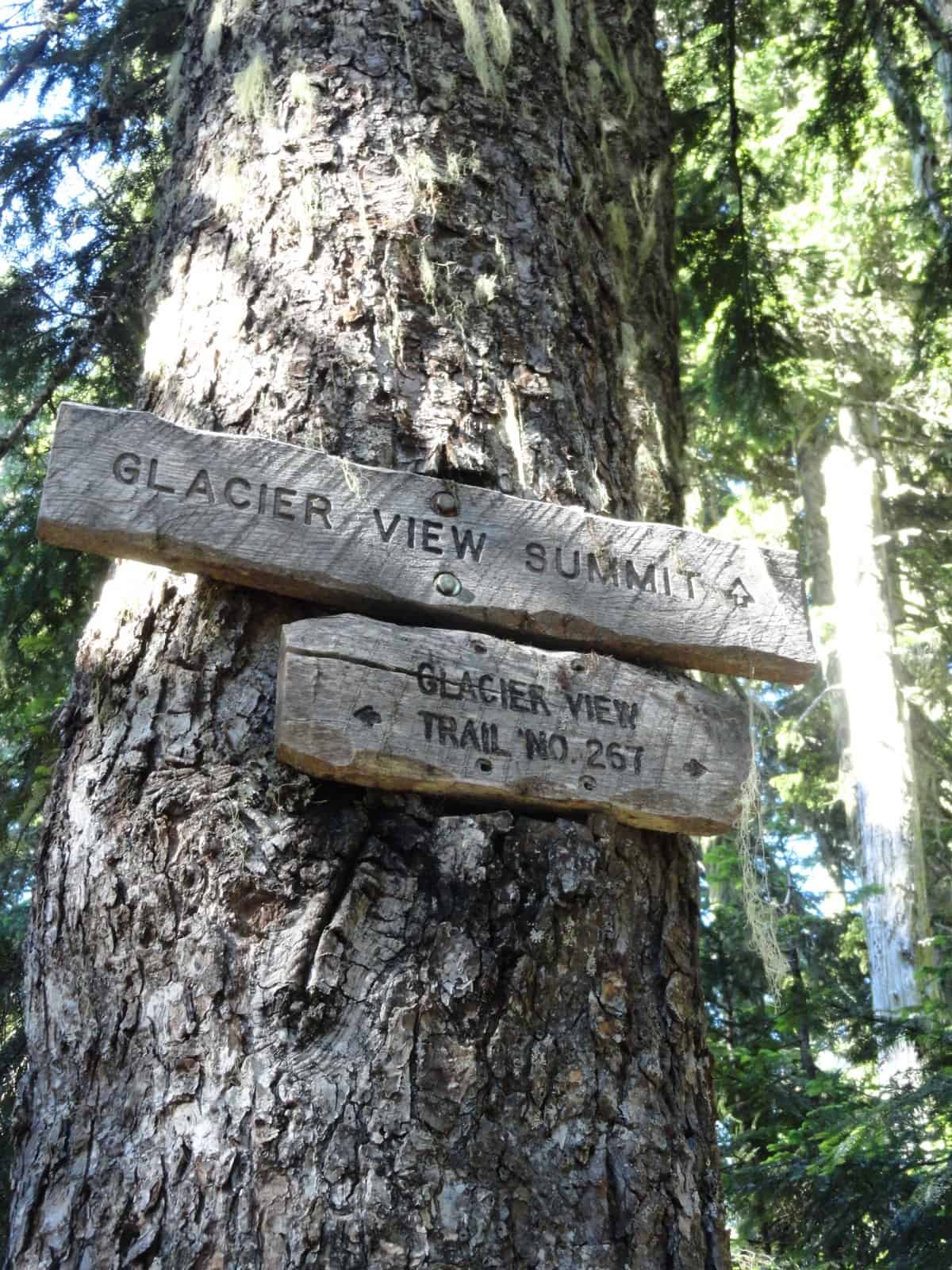
- Important junction sign
-
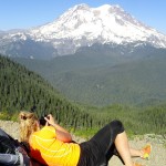
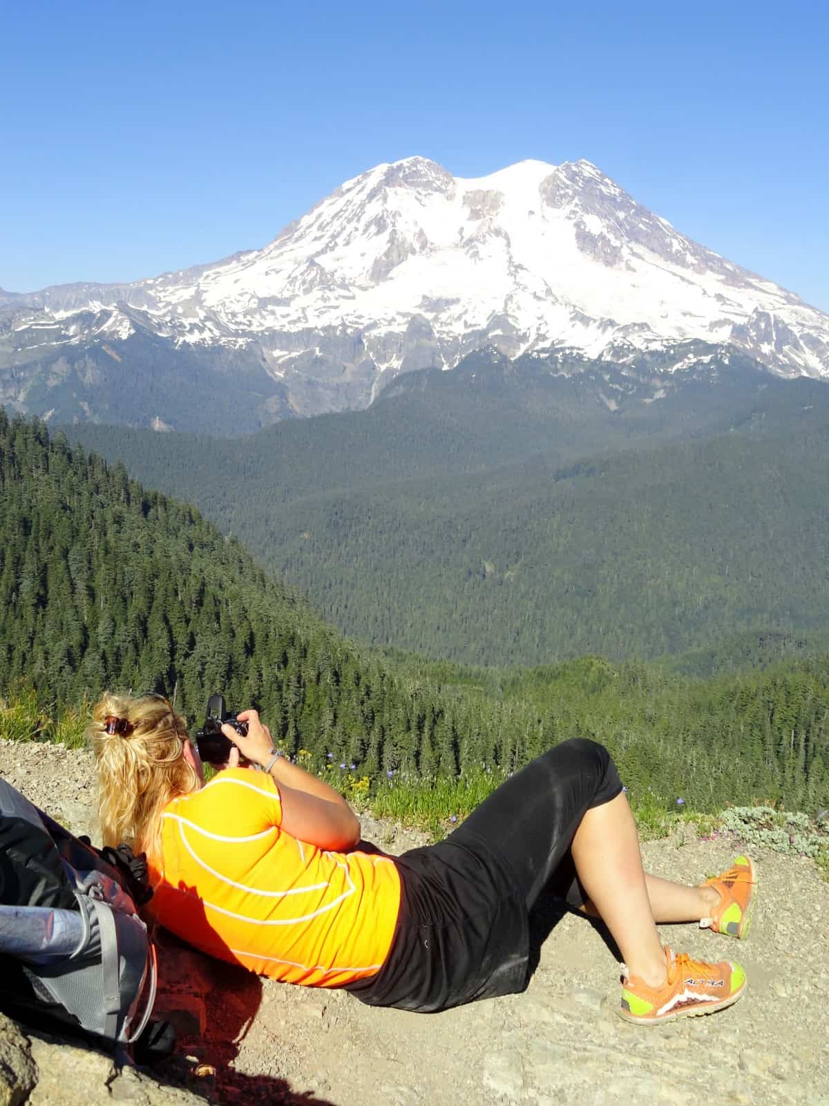
- A hiker focuses for the perfect shot
-
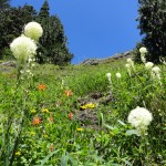
- Bear grass and wildflowers along the Glacier View Trail

-
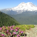
- Showy penstemon add color to the view

-
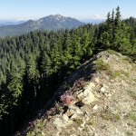
- Looking south to Mount Wow and Mount Adams

Appropriately named, Glacier View affords exceptional glacial views. A former fire lookout site on a jagged peak on the periphery of Mount Rainier National Park, Glacier View offers sweeping views of the ice fields adorning Rainier’s western face.
Located within the tiny and relatively unknown 3,080-acre Glacier View Wilderness Area, hiker traffic is light on the trails leading to this quiet peak. That’s surprising as the hike is fairly easy and views are grand for such little effort. Aside from Mount Rainier being in-your-face, Glacier View also grants some unique viewing perspectives.
Sitting on a demarcation between protected and working lands, you can compare the contrasting landscapes surrounding you. To the east, it’s a wilderness of ancient trees, alpine meadows and peaks of rock and ice. And to the west, industrial tree farms and state forestlands reveal a rolling patchwork of clear-cuts and regenerating forest. Glacier View’s position on a lofty wedge between two great glacial troughs, allows you to stare down into the deep U-shaped Puyallup River and Nisqually River valleys.
From the trailhead located high on a ridge at the edge of an old clear-cut, sign in at the kiosk and start hiking. Immediately pass a small wetland and enter the Glacier View Wilderness coming to a junction. The trail right descends to lovely Beljica Meadows and provides access to trails leading to Mount Beljica, Goat Lake and Gobblers Knob within Mount Rainier National park. They are all worthy destinations warranting a couple of return trips to this trailhead. But for now, head left to Glacier View.
The way travels north steadily climbing along the saw-tooth-like ridge making up the western boundary of the Glacier View Wilderness. Once threatened by logging, this small wedge of high elevation forest, meadows and lakes bordering Mount Rainier National became a wilderness area in 1984. This not only created a wild buffer between the park and the heavily logged forests to the west but also permanently protected several small wildlife-rich bodies of water and guaranteed several miles of trails world remain non-motorized.
Soon skirt a pointy knoll, one of many along the ridge crest. Then descend slightly before steadily climbing again. Skirting steep forested slopes reach a small gap. Here the trail bends left to dart under the rocky summit of a 5507-foot unnamed summit, the highest peak in the wilderness area. Traverse more steep slopes before reaching at 1.8 miles the ridge crest and a junction (el. 5200 feet).
The trail right steeply drops off of the ridge making its way to Lake West and Lake Helen. You want to go left to the old Glacier View Fire Lookout site. After a short and steep climb, break out of the forest and reach the rocky 5,450-foot summit at 2.1 miles. Your eyes will instantly be drawn to Mount Rainier crowding the eastern horizon. Its icy breath practically blows down upon you. The view is awesome and mesmerizing and you will have a hard time concentrating on anything but the long ribbons of glacial ice streaking down from Rainier’s frosty summit. Try to locate the Tokaloo Spire beneath the massive Puyallup Glacier.
Once you can break Rainier’s spell, cast your eyes elsewhere admiring the emerald forests cloaked upon the Glacier View high country. Look south along the ridge you are on to Mount Beljica rising above lush meadows and old clear cuts. Look north and west over miles of industrial forests to the population centers of the Puget Sound lowlands. On clear days you can see out to the Olympic Mountains across the sound. It is obvious why a fire lookout once graced this rocky outpost.
While the 1930s built lookout was removed in 1960 and nothing now remains of it—from this point, you can see two lookouts that still stand. Look west to the Puyallup Ridge Lookout best reached in winter by snowshoeing or skiing the maintained trails of the Mount Tahoma Trails Association system. Look west to Gobblers Knob located within the national park on a small promontory north of Mount Wow’s big blocky summit. This restored lookout can be reached by trail either from hiking past Goat Lake within the Glacier View Wilderness—or from the east in the park via a trail from the West Side Road.
While the sweeping views will keep you satisfied, try to cast your glances downward too to admire the bear grass and array of wildflowers adorning the summit. Glacier View invites you to spend some time basking in glorious scenery and sunshine. Not a bad payoff for a relatively short and easy hike. And it’s pretty amazing too that you just may have all of this beauty and wilderness to yourself.
Notes: Wilderness regulations apply. Free day permit required—sign in at the trailhead.
FR 59 is rough in spots but is passable for passenger cars with good clearance. Dog and kid-friendly but exercise caution on the summit.
Green Trails Map Mount Rainier West, WA no. 269 shows all Glacier View trails.
Contact Cowlitz Valley Ranger Station (Randle), Gifford Pinchot National Forest for updated information on this trail and access roads; (360) 497-1100; http://www.fs.usda.gov/giffordpinchot
Getting to Glacier View
From Elbe, follow SR 706 east (passing through Ashford) for 11 miles. Turn left (north) onto graveled Copper Creek Road (FR 59) and follow for 8.6 miles to road’s end and trailhead.
– Craig Romano, Hiking guidebook author of nine books
Waypoints
| Starting Point: N46 47.772 W121 56.855 | |
| Notable Waypoints:
Summit trail junction: N46 48.955 W121 56.996 |
|
Please note that Copper Creek/Glacier View road is a former logging road that is no longer maintained. Visitors travel to this area at their own risk.