| Area: Chinook Pass / Ohanapecosh |
Hike Type: Family friendly | Pass: Natl. Park Pass |
| Distance: 5.36 mi, one-way | Duration: 3 hrs | Difficulty Level: Moderate |
| Elevation Start: 4,900 | Elevation End: 5,350 | Elevation Gain: (+) 440, (-) 2,530 |
| Snow-Free: Late-June – Early-Nov |
-
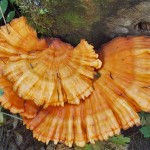
- chicken Of The Woods mushrooms
-
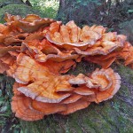
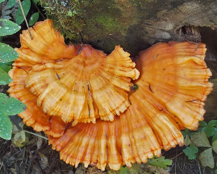
- more chickenofthewoods

-
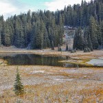
- a tipsoo Lake dusted snow

-
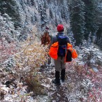
- b on the trail

One Way From Tipsoo Lake Trailhead to Deer Creek Falls
Any hike that begins from Tipsoo Lake at Chinook Pass is guaranteed to be beautiful, especially with a light dusting of snow. Late fall is an intriguing time of year to bear witness to the changing of the seasons. The fall foliage was a mix of candy-apple reds and Halloween candy colors with oranges and yellows.
The Eastside Trail begins on the south side of State Route 410 across from the Tipsoo Lake parking area just below Chinook Pass. The 16.6-mile round trip hike to Ohanapecosh Falls is too long for many day hikers; we suggest a shorter hike (5.36 miles one-way) by starting at Tipsoo Lake and turning around at Deer Creek Falls. A car shuttle will be necessary – drive to Tipsoo Lake and leave a car – then drive to the Deer Creek trailhead on Highway 123.
While the Eastside trail can be hiked either direction (from top to bottom, or vice versa) most hikers will opt to hike from Tipsoo Lake to the Deer Creek trailhead given the choice of a 2,330-foot uphill trudge or elevation loss. Strong hikers can continue to the new bridge overlooking Ohanapecosh Falls.
The first section of the trail climbs gently to a splendid view of Mount Rainier and Governors Ridge on a clear day. On our hike, it was hard to distinguish Mount Rainier from the white sky though we could make out most of Governors Ridge.
A short, steep descent leads to a tarn (5,185 feet) between the Tipsoo Lake trailhead and Highway 123 (where the Eastside Trail crosses the highway before continuing to Deer Creek). On this autumn day, the tarn had not yet frozen over though paper-thin ice bordered the shore. The contrast of new snow and vibrant vegetation compelled us to reach for our cameras more times than we could count. Here, ancient hellebores lie on the ground with pale, tattered leaves though vanilla leaf and oak ferns still had a spring in their steps, adding a perky dash to the monotone forest.
After crossing Highway 123 we found the marked trail (the trail sign is not obvious from the highway) and continued our descent. From this point the trail lies mainly in the forest with a more subdued beauty than the flashy colors at higher elevations. Overall, the trail is steep and in good condition, though we were grateful for a few level stretches that were kind to our knees.
We watched for mushrooms but saw only a few and shelf fungus clinging to stumps and old-growth trees. Pale green chunks of lichen had fallen to the forest floor, mingling with yellow pine needles and pine-cones nibbled on by squirrels and chipmunks. There were also signs of wildlife along the trail – including elk tracks and a tree, its bark freshly shredded by a bear.
This time of year, don’t forget to carry or wear raingear – in places the trail was narrow and we got a thorough soaking hiking through the wet vegetation. The moisture-laden foliage was a good reminder that it’s time to weather-proof your boots.
As we squeezed through the dripping vegetation we stopped to marvel at an enormous display of Chicken Of The Woods (Polyporus Sulphureus), fastened to a fallen Douglas fir (the red-orange fungus was growing all along the top of the tree). This fungus resembles ruffled square dance skirts and is so brightly colored its hard to miss. nAt five miles we came to a bridge at Chinook Creek (there are several bridges along the trail). We were glad (you will be too) the bridges are robust and not scary-high above the creeks.
Three miles past Deer Creek Falls we turned around at the new bridge over Ohanapecosh Falls; there we could not help but notice the low-water levels (that will change soon). We retraced our route, most of it uphill. The last .4 miles of the Eastside Trail is steep before coming out at the trailhead at Highway 123.
Note: From Tipsoo Lake to the new bridge at Ohanapecosh Falls it is 8.3 miles one-way, (round trip back to Tipsoo Lake its 16.6 miles). From the Deer Creek trailhead on Highway 123 it is 3.3 miles to Ohanapecosh Falls.
To get to the Deer Creek trailhead: From Enumclaw drive east on State Route 410 (approximately 47 miles) to Cayuse Pass (the junction with highway 123); turn right onto Highway 123. The trailhead is on the right side of Highway 123 about 4.5 miles from Cayuse Pass. To get to the Tipsoo Lake trailhead on State Route 410: Instead of turning onto Highway 123 at Cayuse Pass continue straight to the first trailhead parking for Tipsoo Lake (left). Cross State Route 410 and find the marked trail a few feet above the highway.
Additional information: The recommended map is Green Trails No. 269S (Mount Rainier Wonderland). For road closure, weather and trail conditions call the park at 360-569-2211 or visit their website: www.nps.gov/mora/index.htm.
– Karen Sykes, Visit Rainier Hiking Expert
Waypoints
| Starting Point: 46.86695, -121.51752999999997 | |
| Notable Waypoints:
Tipsoo Lake Trailhead: N 46° 52′ 01, W 121° 31′ 03 |
|