| Area: Longmire | Starting Point: Longmire | |
| Distance: 4.0 miles, RT | Duration: 3-4 hrs | Difficulty Level: Easy |
| Elevation Start: 3,223 ft | Elevation End: 4,443 ft | Elevation Gain: 1,220 ft |
-
- eaglePeak 1

-
- eaglePeak 2
The Eagle Peak trail at Longmire is a worthy year-round destination and a top-notch alternative for snowshoers when the road to Paradise is closed at Longmire. The Eagle Peak trail starts at Longmire, climbs through old-growth forest and in summer skirts Eagle Peak and ends at a saddle between Eagle Peak and Chutla Peak. The peak was originally called Sim-layshe, Native American for eagle.
In winter, Eagle Peak saddle should only be tackled by snowshoers with winter-travel skills including assessing avalanche danger; the saddle is no place for beginners.
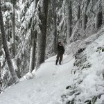
However, snowshoers of all persuasions (abilities) can snowshoe the first couple miles of the trail without worrying about avalanches. It’s always a good idea to check trail/weather conditions with the park rangers at Longmire before setting out. Depending on your experience and conditions, they may suggest you only snowshoe the first couple miles of the trail. Even experienced snowshoers may be advised to turn around at the open area below the saddle. With few trees to anchor the steep snow in place below Eagle Peak, avalanche danger is considerable.
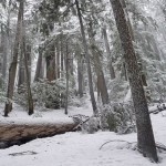
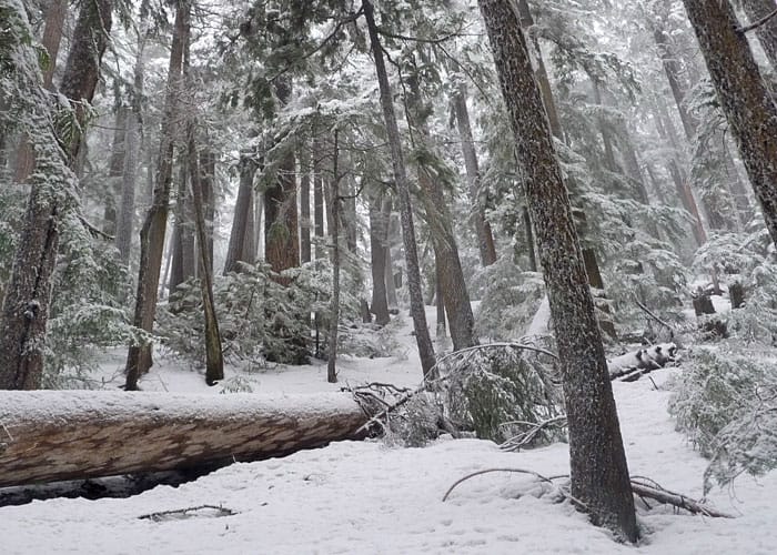
The forest walk through the snow is splendid and you may have the trail to yourself (many snowshoers head to Paradise, especially on a sunny day). The Eagle Peak trail is also a good alternative for a cloudy day when there is little chance of panoramic views at higher elevations. On days when the big views are denied, allow time enjoying close-up views of lichen, moss and ferns. Look closely into that astonishing world at your feet; there is much to see and ponder. These close-up views are just as mesmerizing as the views from the high country. Also in winter your chances of spotting wildlife increase; the mammals are year-round residents. Look for bobcats, red foxes, black-tailed deer, weasels, ptarmigan, and snowshoe hares – while you may not see them you may spot their tracks.
From the day-use area behind the National Park Inn walk up the service road behind the ranger station and employee housing, cross the Nisqually River on a historical bridge (originally built in the early 1920s) and find the signed trailhead about 50 feet past the bridge on the left side of the road. Incidentally, the bridge is the oldest road bridge in Mount Rainier National Park and one of the few road-bearing suspension bridges in the entire National Park system.
In a few steps, you’ll come to a T-junction – stay straight. The spurs lead to the park’s water supply and is off-limits to the public. After a short interval of level tread, the trail begins a steep climb through a green corridor of evergreens, salal, Oregon grape, ferns, lichen, and mosses. The trail is in good condition and easy to follow, even when snow-covered. Spurs at the end of switchbacks lead to views of a stream and small waterfalls that flow into the Nisqually River.
Beginning snowshoers should turn around at about two miles (you will see and hear the stream at the end of a switchback).
If you venture beyond that point an ice axe is advised and the ability to use one becomes necessary as the trail grows narrow and steep. When avalanche danger is nil or low, properly-equipped snowshoers can continue to the edge of an open area (at about 2-1/2 to 3miles) where the trail breaks out of the trees.
When avalanche danger is low, strong, experienced snowshoers can proceed to Eagle Peak Saddle.
In summer the trail switchbacks through steep meadows but in winter these meadows are snow-covered and subject to avalanches. Following the summer trail might not be possible or safe; experienced snowshoers generally snowshoe at or just below the ridge-line to Eagle Peak Saddle to avoid traversing across the open slopes. On a clear day enjoy views from the saddle – Mount Rainier, the tip of Mount Adams, Mount St. Helens, Tumtum Peak and peaks of the Tatoosh Range including Chutla (6,000 feet).
If in doubt, turn back. Always heed the golden rule of mountaineering especially in winter – don’t let summit fever tempt you beyond your experience and comfort level.
For additional information on fees, rules and regulations, current conditions, weather, reserving campsites call Mount Rainier National Park (360-569-2211) or visit their website at www.nps.gov/mora/. The recommended map for Mount Rainier National Park is Green Trails (Mount Rainier Wonderland Map 269S).
– Karen Sykes, VisitRainier Hiking Expert
| Waypoints: Trail head: N 46° 44′ 53, W 121° 48′ 30 Footbridge: N 46° 44′ 58, W 121° 47′ 38 Eagle Peak Saddle: N 46° 45′ 25, W 121° 46′ 44 |