| Area: Stevens Canyon |
Hike Type: Kid & Dog-Friendly | Pass: none |
| Distance: 6.2-mile loop | Duration: 4-5 hours | Difficulty Level: moderate |
| Snow-Free: Mar-Nov | High Point: 2,950 feet | Elevation Gain: 1,250 feet |
-
- IMG 1187

-
- IMG 1169
-

- IMG 1152

-
- IMG 1183

-
- IMG 1223
-
- IMG 1200
-
- IMG 1225
Features: kid-friendly, dog-friendly, exceptional wildflowers, exceptional views, wildlife watching
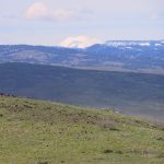
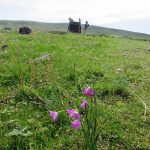
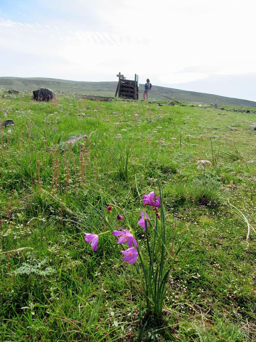
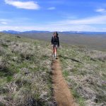
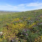
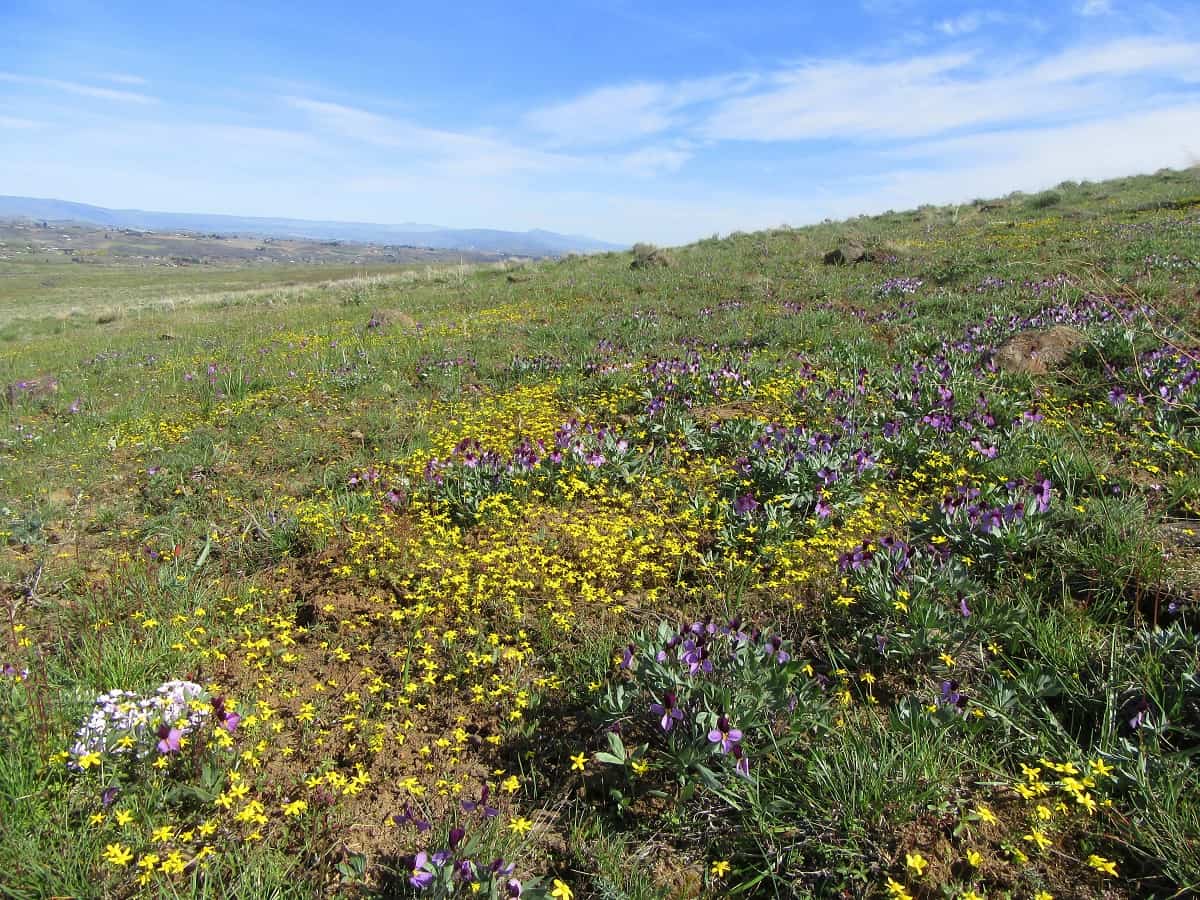
Hike to the top of a broad windswept ridge savoring sunshine and sweeping views. Centerpiece to an old cattle ranch transformed into a nature preserve, wildlife and wildflowers are prolific on Cowiche Mountain. Especially the latter come spring when the surrounding shrub-steppe is shrouded with brilliant golds and purples. And the views? From the gateway peaks of the Yakima River Canyon to Washington’s two highest summits—snowy volcanic twins Rainier and Adams—they’re extensive and breathtaking.
Hit the Trail:
Welcome to the Snow Mountain Ranch, a historic cattle ranch now part of the Cowiche Canyon Conservancy’s more than 5,000 acres of protected lands west of Yakima. Founded in 1985, the conservancy is a nonprofit land trust whose mission is to protect natural areas of the surrounding shrub-steppe and to help connect people to the outdoors. The Conservancy maintains more than 30 miles of trails on its two largest parcels—Snow Mountain Ranch and Cowiche Canyon.
Study the map at the kiosk (you can download one on the Conservancy’s website) and head down the Entry Trail. Immediately pass the Garry Oak Trail, which makes a short loop right through a stand of oaks. This important tree for wildlife—particularly the threatened western gray squirrel, grows here at its northern limits on the Cascades’ eastern slopes.
Now descending slightly, pass remnants of the ranch’s old irrigation system. Then come to the South Fork Cowiche Creek flowing nicely through a grove of towering cottonwoods. Cross the creek on a wide bridge and reach a major trail junction. There are lots of hiking options here including several loops. For the grand loop up Cowiche Mountain head right on the Cowiche Mountain West Trail. Pass the Riparian Trail West Loop and some old ranch remnants. Then pass the Ditch Trail and come to another trail junction.
Here the Wildflower Trail branches left. That’s your route as the next section of the Cowiche Mountain West Trail is currently closed due to recent flood damage. Now start climbing out of a small sage-filled draw. Pass the Balanced Rock Trail and continue up a broad gentle slope. Look back—views of the valley and surrounding hills are emerging. They only get better with each new footstep.
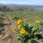
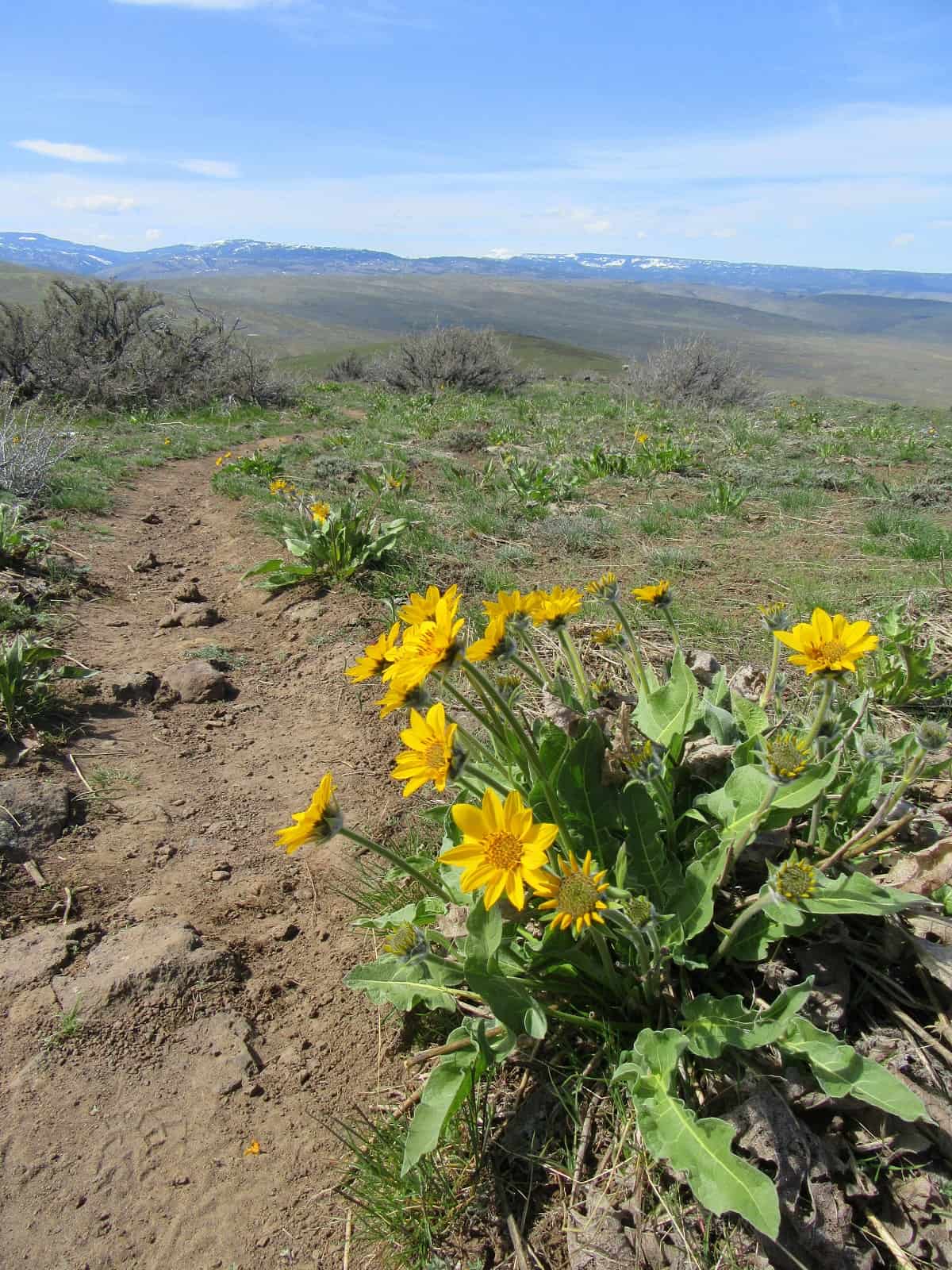
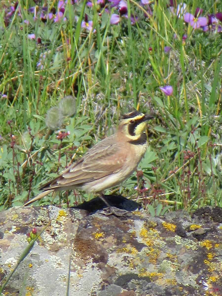
Look down—from late March through early summer the trail is lined with showy blossoms. Grass widows, desert parsley, arrowleaf balsamroot, biscuitroots, clovers violets, lupine, phlox and more. From late summer through winter these sage-steppe hills are quite drab—but in spring they burst with color—and provide enough purple and gold to satisfy a UW student or alum. Scan the blossoms and grasses for rustling. Perhaps you’ll be lucky to spot a rare Townsend’s ground squirrel. You should have no problem catching glimpses of horned larks—they nest all over these hills. Their melodious calls fill the sage-scented air in spring.
Continue hiking across open country passing old fence posts in varying degrees of decay and the first of a couple of old bath tubs once used by thirsty cattle. At about 1.2 miles come to the Bench Trail. You can make a shorter loop and avoid more climbing by following this trail left for .9 mile to the Cowiche Mountain Trail East. Otherwise continue forward climbing more steadily up Cowiche Mountain. Soon once again reach the Cowiche Mountain Trail West. Head left on it. The trail eventually bends left to approach the long ridge crest of Cowiche Mountain. Be sure to look over your shoulder. What a view! Adams to the southwest. Goat Rocks directly west—and to the northwest rising above everything is Rainier.
The trail now follows the crest of the ridge paralleling a large elk fence demarcating the property line between the Snow Mountain Ranch and Washington Department of Fish and Wildlife property. At about 3.4 miles come to a junction. Here a path continues a short distance east to near the 2,968-foot east summit of Cowiche Mountain. The highest point on this nearly 12-mile long mountain is much higher and much farther west. A radio tower sits on the east summit, but that won’t detract from the views. They are sweeping—particularly to the east where you can see the city of Yakima, the southern opening of the Yakima River Canyon, the dramatic I-82 bridges over Selah Creek and the desolate peaks of the Yakima Firing Center.
Now follow the Cowiche Mountain East Trail descending off of the flowered and windswept mountain crest. Pass the eastern end of the Bench Trail and dip and climb out of a small draw that houses a creek during the cooler months. At about 5.5 miles come to a junction. Now either follow the Ditch Bank Trail or Riparian Trail back to the Entry Trail. The Ditch Bank Trail is slightly shorter and a little easier following alongside an old irrigation ditch. The Riparian Trail East hugs the banks of the South Fork Cowiche Creek beneath a canopy of cottonwoods. The bird watching along both trails is excellent. Then retrace your steps on the Entry Trail back to the trailhead. Be sure to check yourself, kids and dogs for ticks before reflecting on what an incredible wildflower hike you just completed.
Notes: Dogs permitted on leash.
Contact: Cowiche Canyon Conservancy: www.cowichecanyon.org
Trailhead directions: From US 12 in Yakima follow N 40th Ave south for 1.6 miles. Turn right onto Summitview Road and drive for 8.8 miles. Bear left onto Cowiche Mill Road and continue for 2.5 miles to trailhead on your left.
– Craig Romano, is an author of more than a dozen hiking guidebooks including 100 Classic Hikes Washington (Mountaineers Books)
Waypoints
| Starting Point: N46 39.572 W120 45.417 | |
| Notable Waypoints:
Wildflower Trail Junction: N46 39.320 W120 45.464 Cowiche Mountain East and West trails Junction: N46 37.695 W120 44.370 |
|