-
- corralPass 2

-
- corralPass 5
-
- corralPass 1
| Area: Crystal Mountain Area | Starting Point: Corral Pass Road | |
| Distance: 11.5 miles, RT | Duration: 8 hrs | Difficulty Level: Moderate |
| Elevation Start: 2,900 ft | Elevation End: 5,700 ft | Elevation Gain: 2,800 ft |
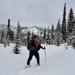
Challenging and exhilarating, the trip to Corral Pass is not for novice snowshoers. You climb 2,800 vertical feet to this high pass set in subalpine meadows on the Cascade Crest. But you’ll reap some visual just rewards for your toil. Enjoy glimpses of Rainier, and a nice all-out panoramic view of the surrounding Norse Peak Wilderness high-country.
While the climb is long and steady, the grade is moderate. Following a Forest Service Road up a thickly timbered shoulder of Castle Mountain, the way crosses no avalanche chutes making it a fairly safe route into the high country. It makes for a good ski route too and an excellent destination for backcountry winter camping.
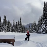
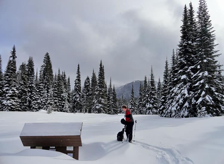
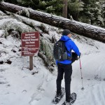
Follow the frozen roadway and after .2 mile come to a gate. In spring, it’s possible to park here saving yourself a few more steps and a little elevation. Two trails diverge from this spot also making for good snowshoeing options. The White River Trail (signed) takes off directly north for its nearly 6 mile journey down the White River Valley. The Forest Trail Loop (unsigned) heads northwest to the Alta Crystal Resort.
Pass the gate and start winding upward. Notice all of the hoof prints in the snow. During the winter and spring months, elk are prolific here and throughout the White River Valley. Once the high country snow melts, most of these majestic members of the deer family will return to the sprawling meadows at Corral Pass and surrounding open ridges and basins.
At .6 mile you may want to divert north off of the road a couple of hundred feet and climb to a nice viewpoint (el. 3,160 feet) of the heavily timbered White River Valley. It may be easier to take your snowshoes off to visit; as it is a steep little jaunt and the viewpoint’s southeastern exposure (hence the manzanitas growing here) often leave it free of snow. Pick out Slide Peak across the valley. You can see too, the Crystal Mountain Highway winding up to the ski area base. In the distance to the right is the easily recognizable Sun Top; another excellent snowshoeing destination.
Now resume climbing winding up a steep thickly forested ridge. At about 3.9 miles the canopy thins providing teaser views to the north. Keep going and soon round a ridge providing unobstructed views of Deep Creek Valley, Mutton Mountain and Dalles Ridge. With opening views and an easing grade, you can begin now to more fully enjoy your snowshoe trip. At 4.3 miles, come to a high basin (el. 5,400 feet) tucked beneath open and craggy Castle Mountain. Sporting flowering meadows in the summer, this basin now rolls out a white carpet inviting you to explore it with your snowshoes. This is also a good turning around spot if you’re too spent to continue. However, you’ve gotten the brunt of climbing over with it, so if you still have some energy, keep plodding along.
The way makes a final climb over a small ridge, then skirts beneath a crag to traverse a beautiful grove of old growth subalpine fir. At 5.6 miles reach 5,700-foot Corral Pass. Try to locate the Noble Knob Trail. Depending on the snowpack, its signpost may or may not be visible. Now walk another .15 mile to a large opening in the forest-site of the Corral Pass campground. The kiosk and privy can be located sticking out of the thick winter blanket of snow. This is a great spot to break out the thermos and refuel. Enjoy views east down into the Greenwater River Valley and south to Castle Mountain and Fifes Peak.
If you have more energy and time is on your side, consider snowshoeing a short way up the open slopes of Castle Mountain. Views are excellent from this long craggy peak that was denuded of its forest cover from a fire back around 1900. The view of Mount Rainier and Norse Peak is wonderful from this peak. Another excellent option for strong snowshoers or those planning on spending the night camped at Corral Pass is to walk a mile north to the open slopes of Mutton Mountain. From this peak along the Cascade Crest savor sweeping views to the Olympic Mountains, Mount Stuart and the Snoqualmie Pass peaks and Mount Rainier hovering over the emerald ridges of the Sourdough Mountains. If you packed up skis, enjoy the quick and exhilarating trip back to your vehicle. If snowshoes are your only mode of travel, enjoy the much easier return descending 2,800 well-earned vertical feet.
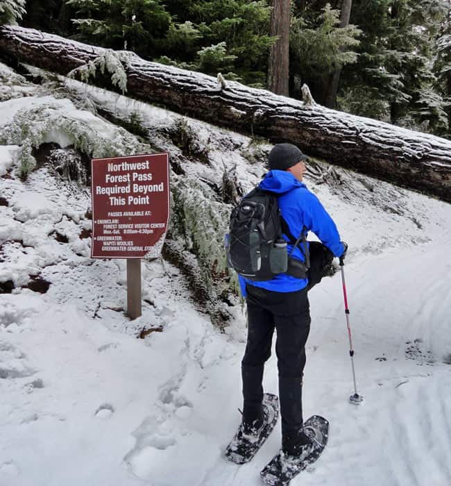
Permits: None
Contact: Mount Baker-Snoqualmie National Forest
Map: Green Trails Maps – Greenwater no. 238, Lester no. 239, and on Mount Rainier Wonderland no. 269S
Trailhead directions: From Enumclaw follow SR 410 for 32 miles turning left (just past Milepost 56) onto FR 7174. Park at (but do not block gate) power substation if snow level is below 3,000 feet; or continue .5 mile on FR 7174 to where road turns north away from cabins. Park here, being sure not to block road or cabins.
Notes: When snow level is low, parking here can be a challenge. Do not block access to any of the cabins. Best to park at power substation and walk additional .5 mile up road to hike start. Route is open to snowmobiles but their use is light.
– Craig Romano
| Waypoints:
Trailhead: N 46° 59.995′, W 121° 31.029′ |