| Area: Carbon River |
Hike Type: Woodland Rain Forest | Pass: Natl. Park Pass |
| Distance: 10.8-15 mi RT* | Duration: 3-7 hrs** | Difficulty Level: Easy |
| Elevation Start: 1,770 | Elevation End: 2,900 | Elevation Gain: 700-1,300 |
| Snow-Free: Jan – Dec |
Please check with Mount Rainier National Park on current conditions in this area.
* It is 10.8 miles round-trip to Ipsut Falls, 15 miles round-trip to the Northern Loop (trail detour to the Carbon River suspension bridge).
** Hiking time is 3-5 hours round-trip to Ipsut Falls, 6-7 hours round-trip to Northern Loop (trail detour).
-
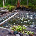
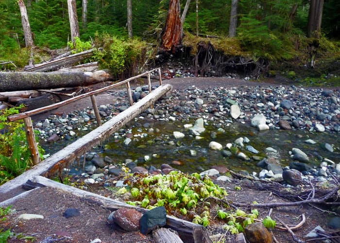
- one of several foot bridges
-
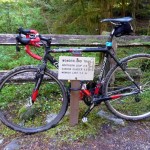
- bike

-
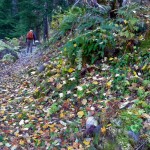
- hiker heads for the suspension bridge

The first time we hiked the Carbon River Road a few days after the historic floods of 2006, we didn’t even recognize the terrain. That storm and subsequent floods caused the Carbon River to change its course and destroyed most of the five-mile road that led to the Ipsut Creek Campground. Yet despite the damage, park rangers had already flagged a route through the chaos. Today the scars of this event remain, but only add to the character and intrigue of this beautiful and remote area of Mt. Rainier National Park. The glacier-fed Carbon River is ever present in the area as you make the trek through lush forests to Ipsut Falls at the road – turned trail’s – end.
Though the Carbon River Road was never as busy as roads in the Paradise and Sunrise areas, it was a great loss for hikers and backpackers, especially for hikers taking on The Wonderland Trail. The campground at Ipsut Creek was also the ideal spot for day-hikers to reach such destinations as Ipsut Pass, the Carbon Glacier; even Mystic Lake was accessible to strong hikers. That rain began to fall on November 5th, 2006 and continued falling through mid-day on November 7th. Nearly 18 inches of rain was recorded at Paradise. Rivers jumped their banks, and flowed over roads, uprooting old-growth trees, trails and bridges.
The flooding from the Carbon River destroyed two miles of road between the Carbon River park entrance and Ipsut Creek Campground. Plus, a windstorm that December toppled dozens of trees across the already-damaged road. The floods exceeded anything the park had experienced in its 108-year history. Fast forward to present: the road has been repaired and is in great condition for hikers and bicyclists. It is not open to vehicles; the decision was made by MRNP to leave the road in its present condition open for hikers and bicyclists, especially since it is only a matter of time before more flooding occurs. Today it’s now a five-mile hike (one-way) to Ipsut Creek campground.
Some hikers consider the road walk a trudge; others have given up hiking there altogether. Others – including us – hike the road on a regular basis enjoying the seasonal changes as well as witnessing the recovery of the region over time.
Not only does the Carbon River offer a lush and beautiful, temperate rain-forest ambience akin to what you might find in the Hoh River in the Olympics, it also provides an outdoor classroom for visitors to ponder the ever-changing topography and effects of climate change.
Rain was not an issue on our mid-November hike to Ipsut Falls – it was a sunny, cold day; frost glittered on the road and roadside vegetation. The first couple miles of the road were a relaxed walk through a boulevard of old-growth trees hung with Jacobs ladders when the sun broke through the thick forested canopy.
Along the road you’ll pass the trail to Ranger Falls and Green Lake (3.3 miles from the entrance; N 46° 59′ 34″, W 121° 51′ 03″) shortly before the Chenius Falls trailhead (N 46° 59′ 25″, W 121° 50′ 38″). As you hike the road look back from time to time for views of Old Baldy, Cayada Mountain and Bearhead Mountain – these peaks are in the Clearwater Wilderness. Tirzah Peak, Wallace Peak and Tyee Peak are all a part of Chenius Mountain which is inside the park and comes into view about the time you reach the Chenius Falls trailhead (3.5 miles from the entrance of the park).
We hiked at a brisk pace the next couple of miles, relieved to find good bridges in place en route to Ipsut Creek campground (five miles from the park entrance). The deserted campground felt surreal with its empty parking spots; at the far end of the campground a sign designates the Wonderland Trail system. Before the flood, here is where you would turn left if Ipsut Pass and Mowich Lake were your destination. Stay right for the Carbon glacier suspension bridge, the Carbon Glacier view and beyond.
Just past the campground a 200-foot spur leads to Ipsut Falls, our original destination but we had to look twice – where was the magnificent waterfall we remembered not so long ago? Memory tricks again – we’d forgotten Ipsut Creek was also heavily damaged by the 2006 floods. Today the waterfall is mostly obscured by debris and downed trees lying every which way and you can no longer hike to its base. The waterfall was so inaccessible we didn’t even attempt to take photographs. We thought it fitting that to Native Americans “Ipsut” translates to “hidden.” Such changes are a wake-up call to always check road/trail conditions before setting out on any hike.
Since the road walk had gone quickly we opted to continue our hike, our next destination the suspension bridge over the Carbon River en route to the Carbon Glacier, one of our favorite hikes over the years.
Before the 2006 flood, the suspension bridge was only about three miles from the campground, an easy hike on an old roadbed when the campground was still accessible by car. Today there is no roadbed past the campground – most of it washed away and the topography looked completely alien to what we remembered.
From the campground the trail crosses small tributaries on a series of footbridges. Here and there we could see where the floods gouged out huge chunks of land, creating new channels in its stead. After crossing several small streams we were back on good trail through the forest, at times with views of more flood-related chaos. From time to time there are views of the Mother Mountain massif (right) from clearings in the forest.
It being the first day of Daylight Saving Time we stopped at the junction to the Northern Loop trail. Here we could see where the Carbon River trail (roadbed) washed away entirely; there is a cliff where the road-trail used to be. Hikers now have to detour onto the Northern Loop trail to reach the suspension bridge and the Carbon Glacier. The reroute is well-signed; from the detour it is another mile or so to the suspension bridge.
It’s important to keep in mind that what used to be a six-mile round trip hike is now a 17-mile hike round trip. If you have a mountain bike, you can to the Ipsut Creek Campground as bicycles are allowed on the Carbon River Road. They are not, however, allowed beyond the campground.
To get there: From Wilkeson drive to the Carbon River entrance of Mount Rainier National Park and continue to the end of the road, facilities, campground and trailhead parking. Park entry fee (or pass) required. The map is Green Trails No. 269S Mount Rainier Wonderland. Hikers that want to camp at Ipsut Creek campground still will need to obtain a backcountry camping permit.
For additional information on trails accessed from the Carbon River (and a more detailed account of the 2006 floods) see http://www.nps.gov/mora/planyourvisit/carbon-and-mowich.htm.
For weather, road and trail conditions call Mount Rainier National Park (360-569-2211) or visit their website: http://www.nps.gov/mora/.
– Karen Sykes
Waypoints
| Starting Point: 46.99448, -121.91579999999999 | |
| Notable Waypoints:
Carbon River Entrance: N 46° 59′ 40, W 121° 54′ 57 |
|