| Area: Carbon River |
Hike Type: Dog-friendly | Pass: Northwest Forest Pass |
| Distance: 5.8 mi RT | Duration: 3 – 4 hrs | Difficulty Level: Moderate |
| Elevation Start: 4,283 | Elevation End: 6,072 | Elevation Gain: 1,789 |
| Snow-Free: July – Late-Oct |
-
- c looking toward East Bearhead

-
- z IMG 2900 closeup
-

- wildflowers
-
- b leaving Bearhead Mountain

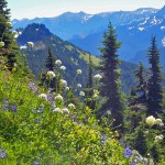
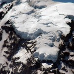
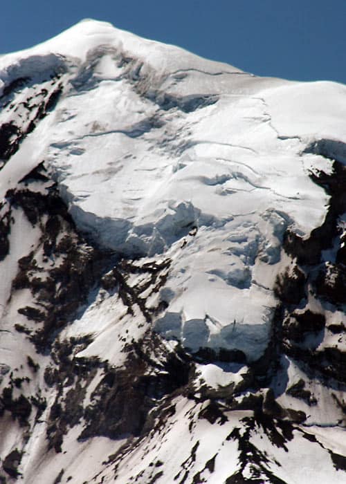
If you’re looking for a good workout and spectacular Mt. Rainier views, this trail is the one for you. Trek under the shelter of old-growth forest that slowly transitions to smaller, sub-alpine trees and finally to alpine meadows, alive with color during the summer months. Gaze at the massive Great North (Willis) Wall of Mt. Rainier. If you’re lucky, like we were, you’ll find yourself there on a clear day where you can see forever in every direction. At this peak, it seems as though you truly are above it all, with only one exception, of course.
This peak was at one time the sight of a fire look-out tower. You would be able to spot smoke easily a few hundred miles away from this vantage point. With binoculars, you may be able to pick out three other existing fire towers… Tolmie Peak, Fremont Lookout and Suntop.
On the day we hiked, even with a hazy horizon, we could see Mt. Baker, Mt. Stuart and the impressive mountain range to the north. Although many ridges of the surrounding mountains have been logged, much of the landscape is still rugged and untouched. Summit Lake sits to the west, on the next hill over and slightly below. This is the other, more popular hike from the same trailhead.
The hike begins on a trail that during winter and spring is part of a meandering stream. At the time we hiked this section of trail, we encountered jagged, sometimes large rock along with a lot of loose rock. Come summer, the stream returns to its banks. It may be muddy and slick in the late spring, but dry in the summer. Soon you’re on an easy, well worn trail to the first Twin Lake. Here (N 47° 01.889′, W 121° 49.196′) the trail splits… Summit Lake to the left (1.5 mi.) or Bearhead Mountain to the right (2.4 mi.).
It should be noted here that horses are not allowed from this point to Summit Lake. They are allowed on the Bearhead Mountain trail, but we had to climb over at least six large trees lying across the trail with no way around. Check with the forest service for conditions of this trail.
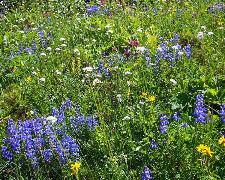
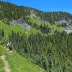
The trail climbs and crosses the west side of the mountain. Here the old growth forest is spectacular and comforting. As you near 5,000 ft., the scenery begins to change. The views start to open up and eventually you get your first site of Mt. Rainier through a break in the trees. The big Douglas Firs and cedars slowly disappear and are replaced with the stocky, sturdy sub-alpine evergreens. Large meadows and huge rocky slopes are covered in waist-high bushes and many varieties of wildflowers, so abundant that the trail narrows down considerably as it passes through. Keep in mind, the fall colors along this trail are just as spectacular as the summer flowers. The last 0.7-mile turns north and consists of five seemingly long switchbacks, gaining the last stretch of altitude needed to reach the rocky top of Bearhead Mountain. While your legs will appreciate resting on a boulder, you may soon forget them as the realization of where you are soaks in. Then your stomach growls…
To get to this trailhead, follow Hwy 165 from Buckley, through Wilkeson and Carbonado. After crossing the one-lane historic Fairfax Bridge, take a left at the “Y” toward the Carbon River Entrance to Mt. Rainier National Park. At 7.7 miles, there is another one-lane bridge crossing the river on the left, just short of the Park Entrance. It is not marked so if you miss it, and you may the first time, just turn around in the parking lot and catch it on the way back. Be aware that the road is rough and a 4 wheel drive/high clearance vehicle is advised. Follow this road 6.7 miles to the trailhead, keeping to the left whenever there is a turn. Bear in mind that a late-melting snow pack or early snowfall can limit the accessibility of this last stretch of road. However, if you can drive it to the trailhead, you should be able to hike the trail, although you may run into a lot of snow at the top.
Parking at the trailhead requires a National Forest Pass and in summer, bug spray is a MUST on this trail. And make sure you carry plenty of water because there is none above 4500 ft. We got an early start and that allowed us to have the entire top of the mountain to ourselves for over an hour, something that doesn’t happen very often. We passed five groups of people on our way out.
– Mary Janosik, VisitRainier Hiking Expert
Waypoints
| Starting Point: 47.031367, -121.8267 | |
| Notable Waypoints:
Trailhead: N 47° 01.879′, W 121° 49.607′ |
|